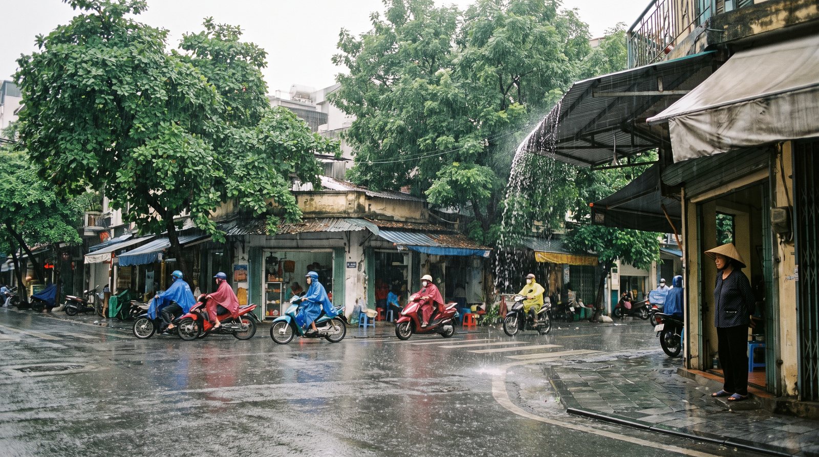
When to go: weather by regionThời điểm nên đi
Because Vietnam runs almost the length of the Indochinese peninsula, its climate divides into at least three distinct zones — northern, central and southern — each governed by different monsoon systems. A month that brings clear skies in Hanoi can bring flooding to Hoi An, and the same month that soaks Ho Chi Minh City may be perfectly dry in Sapa. Any trip that crosses all three regions requires some compromise.
The three climate zones
The north — broadly the area around Hanoi and the mountains beyond — has four recognisable seasons. Winters (roughly November to March) are cool and can be genuinely cold at altitude, with mist and drizzle common. Summers are hot and humid, with the bulk of rainfall falling between May and September.
The central coast, stretching from roughly Danang southward to Nha Trang, sits between two monsoon systems and catches heavy rain and typhoons in the autumn months — October and November in particular — while the rest of the year is generally drier and sunnier.
The south, including Ho Chi Minh City and the Mekong Delta, has two seasons rather than four: a dry season running approximately from November to April, and a wet season for the rest of the year. Temperatures remain high year-round; the variation is almost entirely in rainfall.
Month-by-month outline by region
- January–February: South is at its driest and most reliably sunny. North is cold, often misty; highland areas can see frost. Central coast generally dry and pleasant. Tet falls in late January or February (see below).
- March–April: South remains dry before the rains arrive. North begins to warm; spring humidity brings drizzle. Central coast increasingly sunny.
- May–June: South enters wet season — heavy afternoon downpours, mornings often clear. North is hot and humid with rising rainfall. Central coast largely dry and hot.
- July–August: South is firmly wet. North is at its hottest and wettest. Central coast remains comparatively dry — this is its peak-sun window.
- September–October: South wet season continues. North rainfall eases slightly. Central coast enters its most dangerous period: typhoons, heavy rain and flooding are a real risk, particularly in October.
- November–December: South transitions into dry season — the most popular time for the south. North cools sharply; highlands become cold. Central coast flood risk persists into November then eases.
Typhoon season
Typhoons affect Vietnam's eastern coastline, typically between July and November, though the peak and location shift as the season progresses. Early in the season, storms tend to track toward the northern coast; by October and November they more frequently affect the central coast, particularly the stretch between Danang and Hoi An.
The south and the far north see fewer direct typhoon strikes, though associated heavy rainfall can cause flooding well inland. Typhoon tracks are unpredictable and can shift at short notice. Anyone travelling along the central coast in autumn should monitor official weather services and accept that itineraries may need to change. There is no month in which the risk is zero, but it is substantially lower outside the July–November window.
Tet and public holiday closures
Tet Nguyen Dan — the Lunar New Year — is the most significant event in the Vietnamese calendar. The exact dates shift each year because the holiday follows the lunar calendar, but it generally falls somewhere between late January and mid-February. The official public holiday lasts several days, though in practice many businesses, restaurants, transport services and tourist sites either close or run reduced services for a week or more around the core dates.
For travellers, the period immediately before Tet sees heavy domestic travel — trains and buses book up well in advance — while the days immediately after see a second surge as people return to cities. Those wanting to witness Tet celebrations in cities like Hanoi or Ho Chi Minh City will find festivities and street decoration, but should plan carefully for food and transport. Those wanting normal touring conditions are generally better served by arriving at least two weeks before or one week after Tet.
Other public holidays (National Day in September, Liberation Day in April, International Workers' Day in May) cause shorter disruption but can still affect availability in popular destinations.
Shoulder months for a whole-country trip
No month is uniformly good across all three regions, but some periods offer the best overall balance for travellers attempting to move through north, central and south in a single trip.
November to early December is widely considered a reasonable compromise: the south is entering its dry season, the central coast's flood risk is easing, and the north is cool and clear before becoming cold. February to March (avoiding Tet itself) is another window: the south is still dry, the north is warming, and the central coast is generally pleasant. July and August suit the central coast well but coincide with the north's wettest and hottest period and the south's rain.
The honest position is that a long north-to-south trip will encounter at least one region in imperfect conditions regardless of timing. Most travellers prioritise the region they care most about and accept the trade-offs elsewhere.
Altitude and regional exceptions
Altitude creates significant local variation that the three-zone model does not fully capture. Sapa and the northern highlands can be cold enough for frost and occasional snow in January, even while Hanoi is merely chilly. Dalat, in the southern highlands, is considerably cooler than Ho Chi Minh City at any time of year and has its own rainfall pattern.
Phu Quoc island, off the southwest coast, follows a broadly southern pattern but is more exposed to the southwest monsoon, which can make its western beaches rough from May to October. The Con Dao islands similarly have a wet-season swell that makes some months better suited to diving than others.
For any specific destination — particularly islands, highland areas and the central coast — it is worth checking conditions particular to that place rather than relying on the general regional pattern.
Also known as / see also
참조 페이지
출처 목록
- Vietnam travel advice — UK Foreign, Commonwealth & Development Office 접근됨 29 August 2026
Supports: carried over from the first build - Vietnam National Authority of Tourism — VNAT 접근됨 29 August 2026
Supports: carried over from the first build
마지막 확인: 29 August 2026. Rules, fares and prices change — check the official source before acting on anything here. Report a mistake.