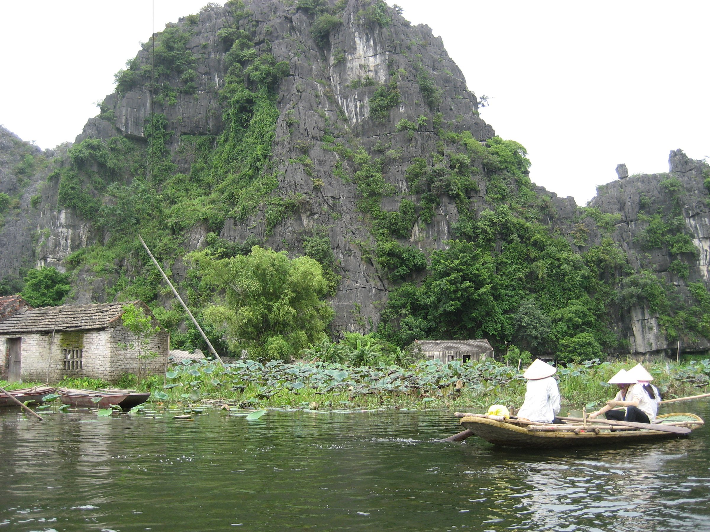
Tam CocTam Cốc
What Tam Coc Is
The name Tam Cốc means 'three caves' in Vietnamese and refers specifically to the stretch of the Ngo Dong river where the water passes through three successive cave tunnels cut through limestone karst hills: Hang Ca, Hang Hai and Hang Ba — First, Second and Third Cave respectively. The tunnels are natural formations, low-ceilinged and narrow, passable only by flat-bottomed rowing boats. The full return journey on the water covers roughly four kilometres each way, passing between flooded fields and the steep, forested karst peaks that characterise this part of Ninh Binh. The sight is sometimes loosely used to refer to the wider Tam Coc–Bich Dong tourism zone, which also includes the pagoda complex of Bich Dong carved into a nearby hillside, but the boat trip on the Ngo Dong is the central draw.
The Rowing Route and Foot-Rowing Technique
Boats depart from a jetty at Van Lam village and carry up to two passengers plus the rower. The vessels are narrow aluminium sampans, and the journey to the third cave and back typically takes around two hours at a leisurely pace. What draws particular attention is the technique used by many rowers: rather than using their hands, they propel the oars with their feet, lying back or sitting with legs extended. This foot-rowing method is practical given the low overhead clearance inside the caves, where rowers must lie almost flat, and it leaves the hands free. The technique is most associated with the women of the local farming communities who have taken up rowing as seasonal income. Inside the caves, light filters through gaps in the rock, and the river narrows considerably; torches are not generally needed but visibility drops significantly in the deeper tunnels.
Timing: Rice Season and Crowds
Tam Coc is worth timing around the rice harvest cycle. The paddies lining the Ngo Dong are planted and flooded in spring, and the rice ripens to a vivid yellow-gold in late May and the first half of June, coinciding with a second harvest window around October. During these periods the contrast between the water, the pale limestone and the coloured fields is at its most marked. Outside these windows the paddies are either bare or green, which changes the character of the journey considerably. The sight draws large numbers of visitors year-round, with peak domestic tourism over Vietnamese public holidays — particularly around Tết (late January or February) and the April–May holiday cluster — when the jetty queue can be substantial and wait times long. International visitor numbers are highest from November to April, when temperatures in the north are cooler.
The Hard Sell on the Water
Tam Coc is consistently noted by visitors for commercial pressure during the boat trip. At the halfway point, and sometimes at the cave entrances, small vendor boats draw alongside and rowers may encourage passengers to buy drinks, embroidered goods or woven items. The goods are often stored on the rowing boat itself, with the sale forming part of the rower's income beyond the ticket. Some rowers pause mid-river or slow significantly until a purchase is made. This is well documented and openly discussed, and visitors who are aware of it in advance generally report finding it less disruptive. Tipping at the end of the trip is conventional but the amount is not fixed. The dynamic is different from Trang An (see below), where commercial pressure of this kind is less frequently reported.
Tam Coc and Trang An Compared
Trang An and Tam Coc are both rowing-boat experiences through limestone karst in Ninh Binh, and travellers often choose between them or combine both. The differences are meaningful. Trang An is a larger UNESCO-inscribed complex with multiple route options covering different distances and visiting different cave systems, some of which include temple stops on raised ground. Its management is more centralised, ticket pricing is structured differently, and the experience is generally considered calmer and less commercially pressured on the water. Tam Coc is a single, shorter route with a more agricultural character — the rice fields are its defining feature — and the foot-rowing technique is more prominently on display there. Tam Coc is older as a tourist destination and more deeply embedded in the surrounding village economy. The two sites are a short distance apart and serve as complementary rather than interchangeable experiences.
Practical Notes
Boats depart from the ticket area at Van Lam, a short distance from the town of Ninh Binh. The site is accessible by bicycle or motorbike from Ninh Binh town, and many visitors base themselves in Tam Coc village nearby. Prices vary by season and are set separately from this page. Sun exposure on the water is significant; the caves provide brief shade but the open stretches are exposed, and the middle of the day in summer can be very hot. The boats are low and narrow; passengers sit on a low bench with limited legroom. Photography inside the caves is possible but challenging given the low light and movement of the boat. The surrounding area includes cycling routes through the karst landscape that are popular as a complement to the river trip.
Where it is
Also known as / see also
被以下页面引用
来源
- Vietnam National Authority of Tourism — VNAT 访问于 29 August 2026
Supports: the rules and definitions on this page - Tam Cốc – Bích Động — Wikipedia (CC BY-SA 4.0) 访问于 3 September 2026
Supports: background - Tam Cốc – Bích Động — Wikipedia (Vietnamese) (CC BY-SA 4.0) 访问于 3 September 2026
Supports: background, Vietnamese edition
Current 最后核实: 3 September 2026. Rules, fares and prices change — check the official source before acting on anything here. Report a mistake.
Picture credits (1)
TamCoc-BichDong, Minh Phượng ( Neweco ), CC BY-SA 3.0, Wikimedia Commons