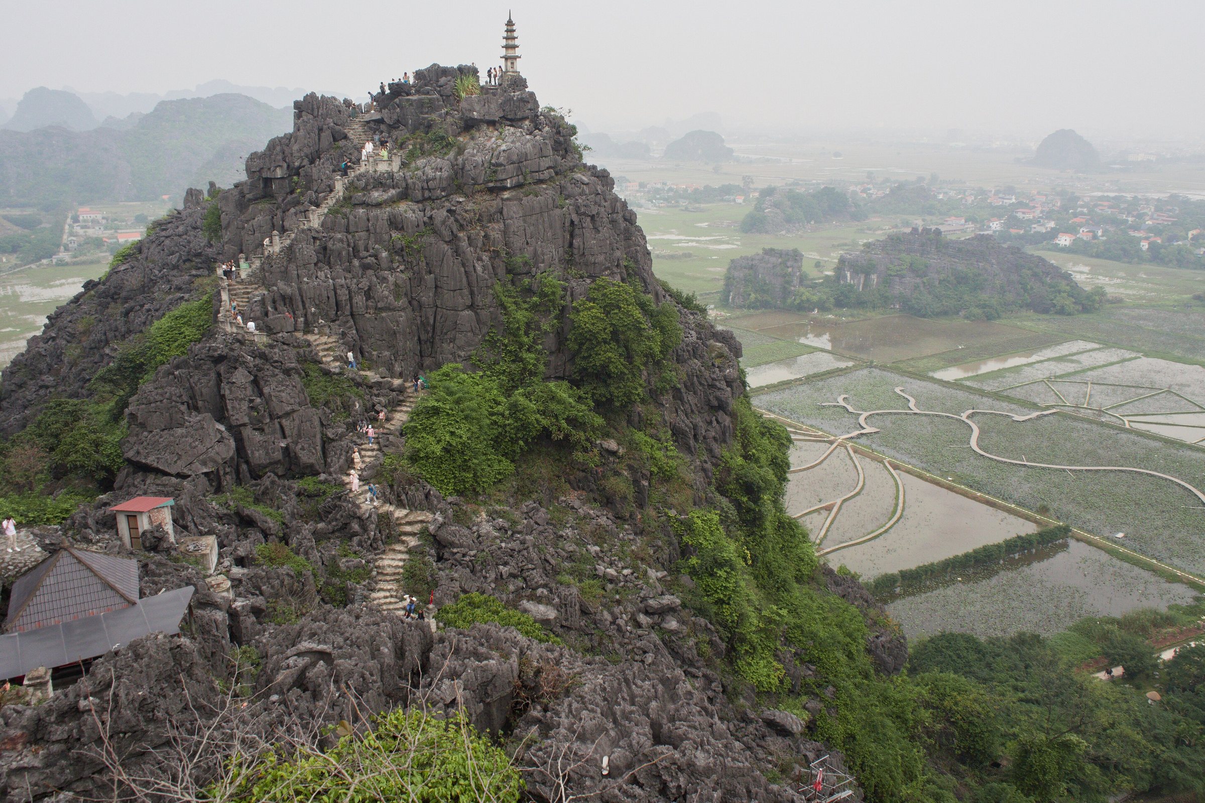
Mua Cave viewpointHang Múa
What Mua Cave viewpoint is
Hang Múa — literally Dancing Cave — is a site on the western edge of Ninh Binh and Tam Coc comprising a small cave complex at ground level and a steep stone staircase that ascends a karst ridge to a large dragon statue at the summit. The statue and the ridge below it form the foreground of the panoramic photograph that appears on most depictions of Ninh Binh: a wide arc of flooded rice paddies interrupted by isolated limestone peaks, with the Ngô Đồng river threading through the valley below. The site is on privately managed grounds; entry requires a ticket purchased at the gate.
The climb
The staircase consists of approximately 500 steps cut into and laid upon the limestone. The route is a single ridge path — narrow in places — with a handrail running most of the length. The gradient is consistent rather than extreme, but the surface becomes slick when wet, and loose gravel accumulates on some sections after rain. Footwear with grip is strongly advisable; sandals and flip-flops make the ascent and particularly the descent noticeably harder. The climb takes most visitors between fifteen and thirty minutes depending on pace and fitness. There is no shade on the staircase itself.
At the summit the dragon statue stands on a small platform. A second, lower peak is reachable via a short connecting path and offers a slightly different angle across the valley. Descent uses the same staircase.
Light and timing
The ridge faces broadly north-west, which means the rice fields below are lit most evenly in the morning. Early morning visits — before around 08:00 — also tend to see less foot traffic on the staircase and more mist in the valley, particularly in cooler months between October and February. Midday sun flattens the landscape and, combined with the absence of shade on the climb, makes the heat considerable. Late afternoon produces warm directional light across the paddies but the sun itself may be behind the ridge before it sets, limiting the golden-hour effect at the summit.
The rice fields change character through the agricultural calendar. The most photographed scenes involve bright green seedlings (roughly April to May) or the golden harvest period (roughly September to October), though exact timing shifts with planting decisions and rainfall. Neither date is guaranteed.
The cave at the base
At ground level, before the staircase begins, the site includes a small cave passage with Buddhist shrines inside. The cave itself is modest in size compared with major cave systems elsewhere in the region — it is a shallow grotto rather than an extensive cavern — but the shrines are actively used and the interior is cool. Visitors typically pass through it as part of moving between the ticketed grounds and the foot of the staircase rather than as a destination in its own right.
Heat and physical conditions
Between April and September, Ninh Binh experiences high humidity and temperatures that regularly exceed 35 °C. The staircase at Mua Cave has no canopy cover at any point, and reflected heat from the pale limestone adds to the ambient temperature. Visitors who underestimate the conditions — arriving at midday without water, in inadequate footwear — account for a disproportionate share of difficulties at the site. Water is available for purchase at the base; carrying enough for the ascent and descent before starting is the straightforward approach. The site has basic rest facilities at the bottom.
People with significant mobility limitations or a strong aversion to uneven, steep surfaces may find the upper sections of the staircase difficult. The cave and lower grounds are accessible without completing the climb.
Getting there
Mua Cave viewpoint is located a short distance south of the main Tam Coc boat-launch area, reachable by road from Ninh Binh city. Most visitors arrive by hired motorbike, bicycle hired locally, or car. The site has a car park. Combining the viewpoint with a Tam Coc boat trip on the same day is common, as the two sites are close; the order is worth considering, given the physical demands of the climb and the heat later in the day. Prices vary by season.
Where it is
Also known as / see also
مُشار إليه من
المصادر
- Vietnam National Authority of Tourism — VNAT تم الوصول إليه 29 August 2026
Supports: the rules and definitions on this page - Hang Múa — Wikipedia (Vietnamese) (CC BY-SA 4.0) تم الوصول إليه 3 September 2026
Supports: background, Vietnamese edition
Current آخر تحقق: 3 September 2026. Rules, fares and prices change — check the official source before acting on anything here. Report a mistake.
Picture credits (1)
Ninh Binh - NinhBinh1648, lumoplank, CC0, Wikimedia Commons