Quang Ninh province occupies Vietnam's northeastern corner, sharing a land border with China's Guangxi region and a long coastline along the Gulf of Tonkin. Its capital is Ha Long city, which serves as the gateway to Ha Long Bay. Beyond the bay, the province encompasses coal-mining towns, border crossings, forested hills and a string of islands that see far fewer visitors than the bay itself.
What Quang Ninh is known for
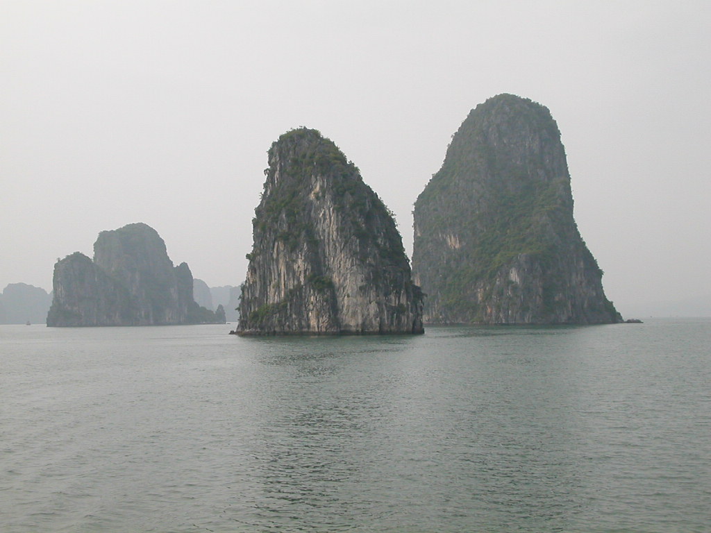
Ha Long Bay is the province's defining feature — roughly 1,600 limestone islands and islets scattered across emerald water, recognised as a UNESCO World Heritage Site and one of the most visited natural landscapes in Southeast Asia. The bay draws the overwhelming majority of tourists who come to Quang Ninh.
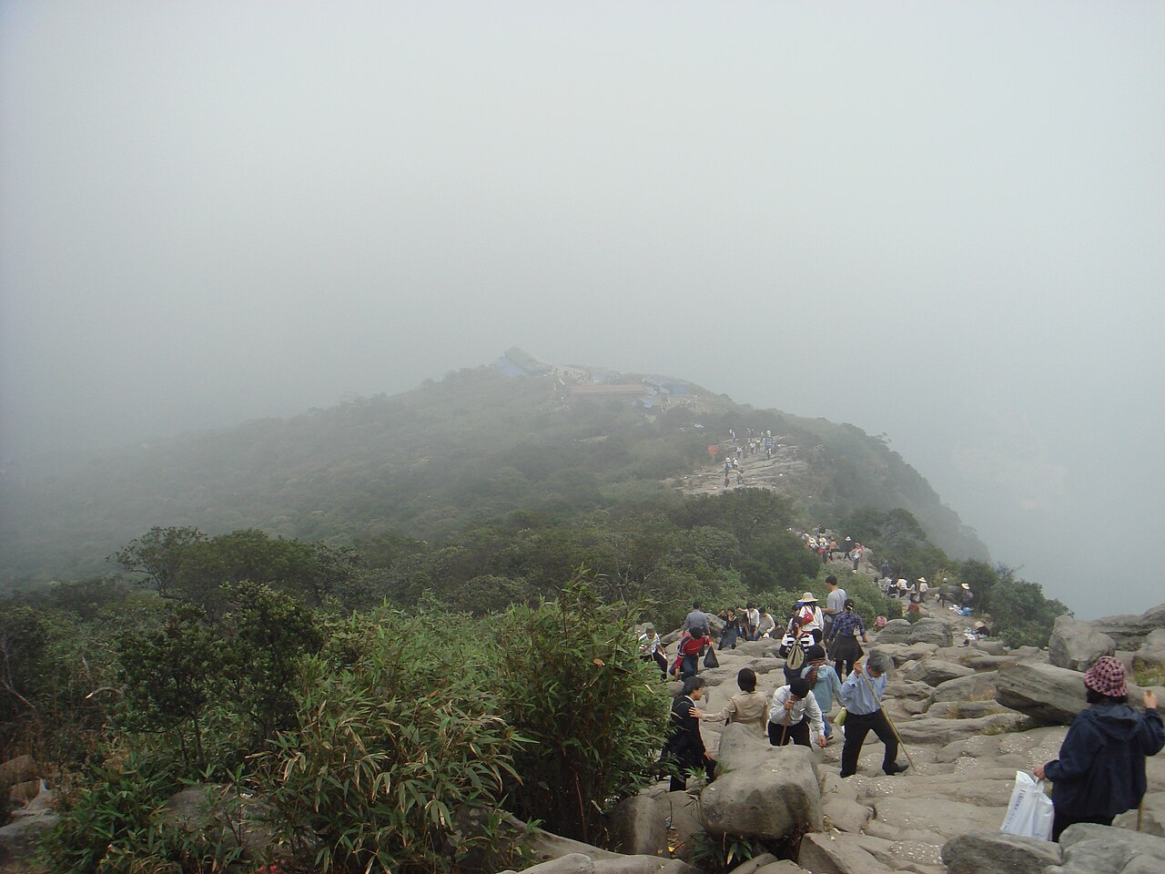
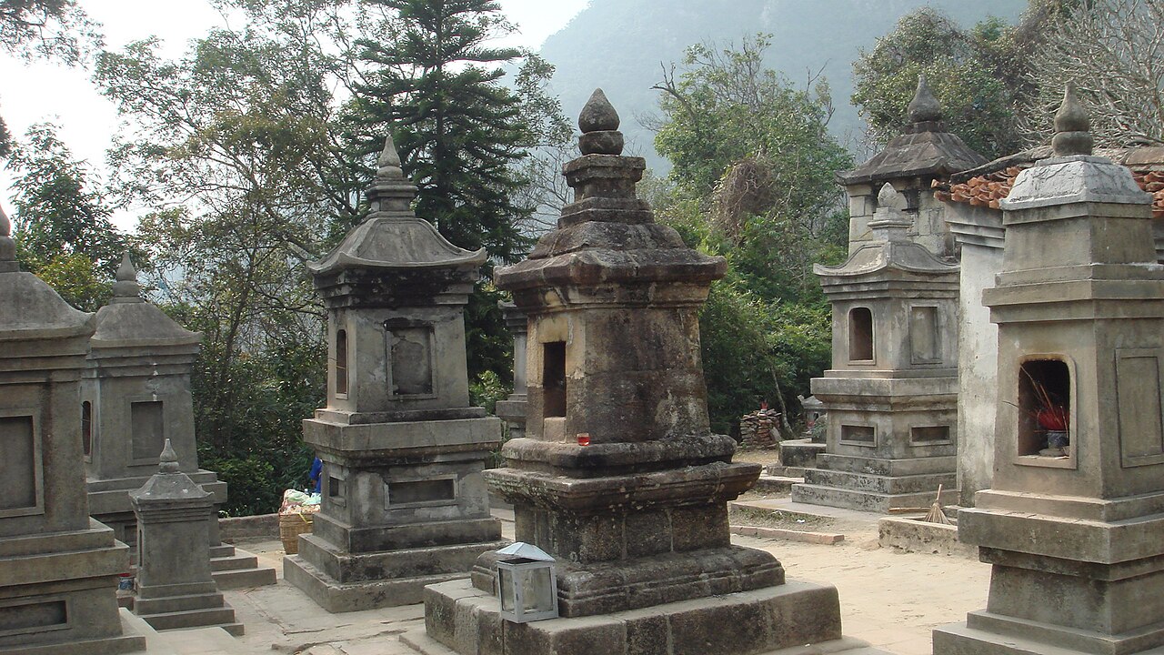
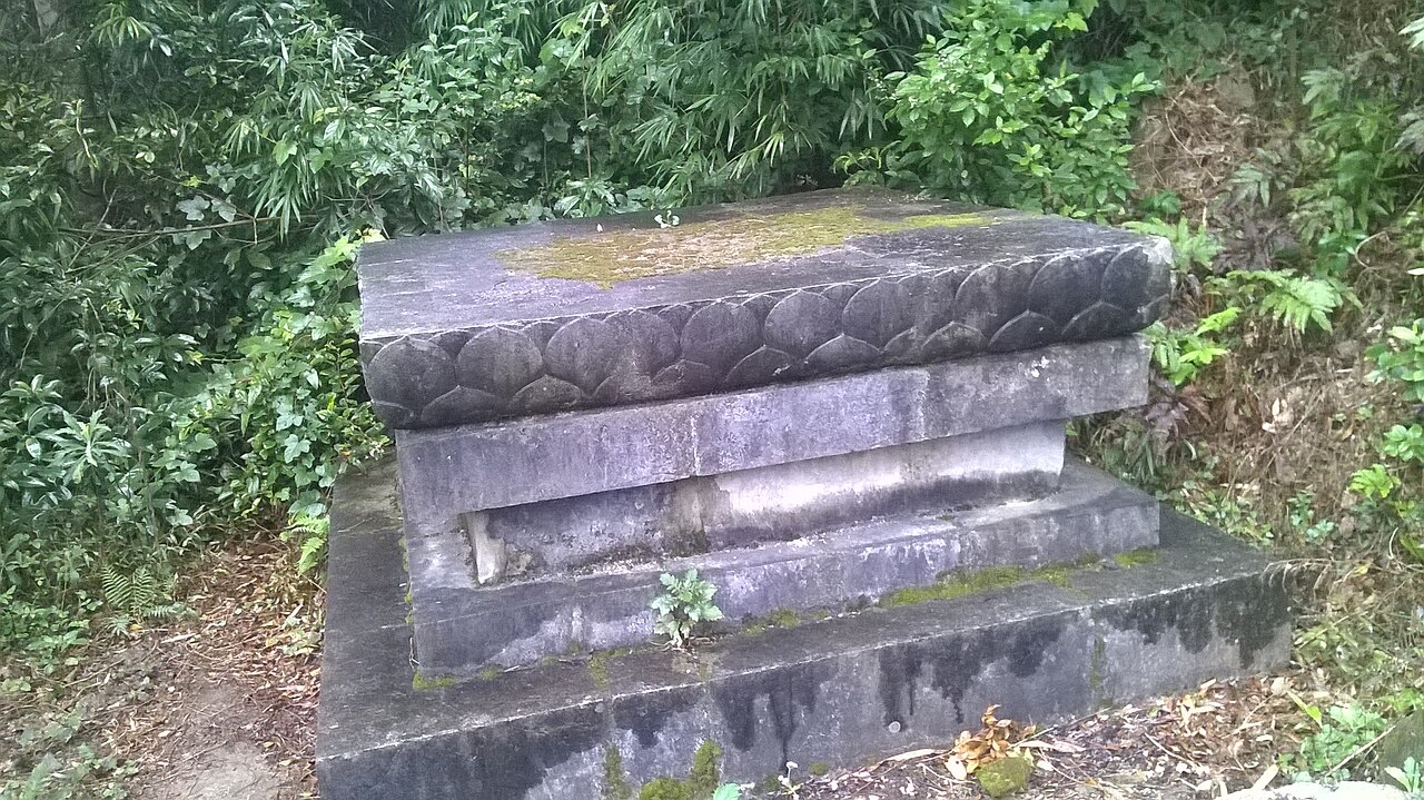
Beyond the bay, the province has a significant coal-mining heritage centred on Cam Pha and Uong Bi. The Yen Tu mountain complex near Uong Bi is a major Buddhist pilgrimage site, associated with the founding of the Truc Lam Zen school under King Tran Nhan Tong in the 13th century. The town of Mong Cai, on the Chinese border, functions as a busy commercial crossing point with Guangxi.
The island of Van Don, linked to the mainland by a long bridge, is being developed as a special economic and tourism zone, though much of that development remains a work in progress.
Getting there and away
By air: Van Don International Airport, on Cai Bau Island near Van Don town, receives domestic flights from Ho Chi Minh City, Da Nang and a number of other Vietnamese cities. Some international charter services operate seasonally. The airport is roughly 50 km from Ha Long city.
By road: Ha Long city is connected to Hanoi by the Hanoi–Hai Phong–Ha Long expressway system. Journey times from Hanoi's western districts vary with traffic but the expressway has reduced them considerably compared with the old coastal road. Limousine vans and bus services on this route are frequent. Hai Phong is reachable via expressway and serves as an additional transport hub for visitors combining the two destinations.
By sea: High-speed ferry services connect Ha Long and the island of Cat Ba, making it possible to arrive by one route and leave by another. Cat Ba Island itself falls within Hai Phong's administrative boundary, but the ferry crossing is a practical way to move between the two provinces.
Border crossing: The Mong Cai crossing links Quang Ninh to Dongxing in China. Entry requirements and operating conditions can change; the official Vietnamese immigration authority is the authoritative source.
When to go
Quang Ninh has a subtropical monsoon climate with a distinct cool-dry season and a hot-wet season. The period from October to April brings lower humidity, cooler temperatures and calmer seas — generally considered the most comfortable time for bay cruises, though winter days (December–February) can be overcast and chilly, with mist sitting low over the karsts.
The summer months from May to September are hotter and wetter, with occasional typhoons capable of disrupting boat departures entirely. The tourism peak falls over the Vietnamese and Chinese New Year holidays and during July and August, when domestic tourism surges. Midweek visits outside of Vietnamese public holidays tend to mean fewer boats on the water.
See the when to go guide for a fuller comparison of Vietnam's regional climates.
Ha Long Bay and the water
The bay is experienced almost entirely from the water. Overnight cruises aboard wooden junk-style vessels are the standard format — boats range from budget two-deck vessels to small-group luxury ships with private cabins and on-board kayaking or cooking classes. The duration, itinerary and quality of the vessel vary enormously, and the difference between a crowded boat on a busy section of the bay and a smaller craft on a quieter route is significant.
The bay is divided informally into zones. The area around Bai Tu Long, to the northeast, receives fewer vessels than the central tourist corridor and gives a less crowded experience. Lan Ha Bay, to the south and straddling the boundary with Cat Ba Island, is increasingly popular as an alternative.
Day trips from Ha Long city exist but cover less ground and return before sunset. For detail on the bay itself, the Ha Long Bay page covers itineraries, zones and boat categories.
Other places to see
Yen Tu: A mountain pilgrimage route about 40 km west of Ha Long city. Pagodas and shrines are distributed along paths that climb through pine forest to the summit pagoda at roughly 1,000 metres. A cable car covers part of the ascent. The site is crowded during the Yen Tu festival season in spring.
Dong Phong Nha — Bai Tho Mountain: This limestone massif rises directly behind Ha Long city and can be climbed via a trail of steps, giving elevated views over the bay from an accessible half-day excursion.
Quang Ninh Museum: Located in Ha Long city, the building has attracted attention for its modern architecture. Inside, exhibits cover the province's geology, ecology, coal industry and cultural history.
Mong Cai and the border area: The town has a market culture shaped by cross-border trade with China, and the Tra Co peninsula to its south has a long sandy beach and an old communal house that predates the modern town.
Where to stay
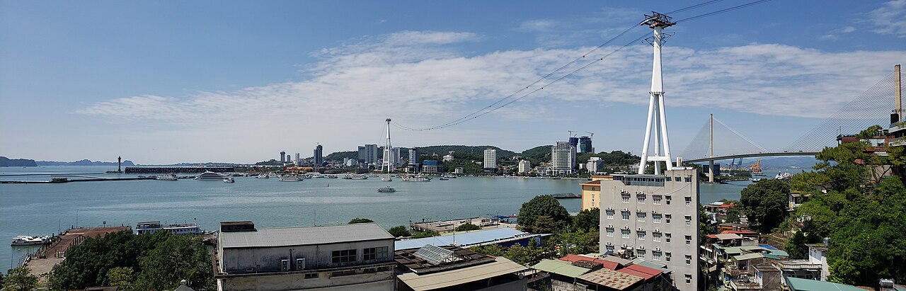
Most visitors base themselves in Ha Long city, which has accommodation spread across Bai Chay (the main tourist strip facing the water) and Hon Gai (the older commercial centre across the harbour). Bai Chay has the highest concentration of hotels aimed at tourists; Hon Gai is more functional and less oriented to visitors but is well connected by a cable-car bridge.
A growing number of travellers skip land-based hotels entirely and treat the overnight cruise as their accommodation. This is practical for short visits but leaves little time to explore the province beyond the bay.
Van Don island has a smaller selection of resort properties aimed at those who want a quieter, less commercial base, though services and onward transport options are more limited than in Ha Long city.
Common misunderstandings
Ha Long Bay and Cat Ba are not interchangeable: Cat Ba Island is administratively part of Hai Phong, not Quang Ninh. Cruises marketed as "Ha Long and Cat Ba" often cross this boundary; the geography makes it seamless but the province is different.
Cruise quality varies widely: The bay is a competitive market and descriptions of boats are sometimes misleading. Reading independent accounts of specific operators — not just categories — matters more here than in most contexts.
The weather can close the bay: Typhoon season is real. Departures are cancelled when conditions are unsafe, and there is no guarantee of a refund from all operators. Travel insurance is relevant.
Visa requirements are not fixed: Vietnam's visa and e-visa rules have changed several times in recent years and can change again by government decree. Check the current position at the official source or see the e-visa page for the current framework. Chinese nationals and travellers crossing overland face different requirements from those arriving by air.
See also: safety and common scams, money and ATMs.
Clima por mês
Médias de longo prazo, não uma previsão. Período de referência: 2015–2024. Fonte: ERA5 reanalysis (Copernicus) via the Open-Meteo archive API.
Show the numbers
| Mês | Máx. °C | Mín. °C | Chuva em mm | Dias de chuva | Humidity % |
|---|---|---|---|---|---|
| January | 19.2 | 13.0 | 61 | 11 | 82 |
| February | 20.4 | 14.0 | 55 | 10 | 82 |
| March | 23.9 | 17.6 | 63 | 14 | 87 |
| April | 27.2 | 20.5 | 94 | 14 | 85 |
| May | 29.6 | 23.7 | 207 | 19 | 87 |
| June | 31.2 | 25.6 | 259 | 23 | 87 |
| July | 31.0 | 25.3 | 306 | 24 | 87 |
| August | 30.6 | 24.8 | 456 | 26 | 90 |
| September | 29.9 | 24.0 | 288 | 21 | 87 |
| October | 27.7 | 20.8 | 147 | 12 | 78 |
| November | 25.2 | 18.2 | 40 | 9 | 78 |
| December | 20.5 | 13.4 | 30 | 7 | 72 |
Places within Quang Ninh
Where it is
Also known as / see also
Nas proximidades
Referenciado por
Fontes
- ERA5 climate normals — Copernicus / Open-Meteo (CC BY 4.0) truy cập 30 August 2026
Supports: monthly temperature and rainfall normals, and elevation - Map data from OpenStreetMap contributors, ODbL 1.0 — OpenStreetMap (ODbL 1.0) truy cập 29 August 2026
Supports: carried over from the first build - Quang Ninh (Q33396) — Wikidata (CC0 1.0) truy cập 30 August 2026
Supports: coordinates, area, population - Quang Ninh — Wikipedia (CC BY-SA 4.0) truy cập 30 August 2026
Supports: background
Current Última verificação: 29 August 2026. Rules, fares and prices change — check the official source before acting on anything here. Report a mistake.
Picture credits (7)
Núi Yên Tử, Thang Nguyen from Nottingham, United Kingdom, CC BY-SA 2.0, Wikimedia Commons · Vườn tháp Huệ Quang, chùa Đồng, Yên Tử, Thang Nguyen from Nottingham, United Kingdom, CC BY-SA 2.0, Wikimedia Commons · asinhthang, CC BY-SA 3.0, Wikimedia Commons · Am Hàm Rồng, Gió vô ưu, CC BY-SA 4.0, Wikimedia Commons · Bệ tháp hoa sen, Gió vô ưu, CC BY-SA 4.0, Wikimedia Commons · Ha Long bay tourism 11, Syced, CC0, Wikimedia Commons · Bai Chay Pano 10-2023, Pdhadam, CC BY-SA 4.0, Wikimedia Commons