The place itself has not changed, and this page continues to cover it.
2025 constitutional amendment and Law on Organisation of Local Government establishing a two-tier local government
Overview
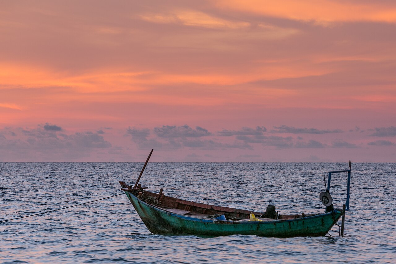
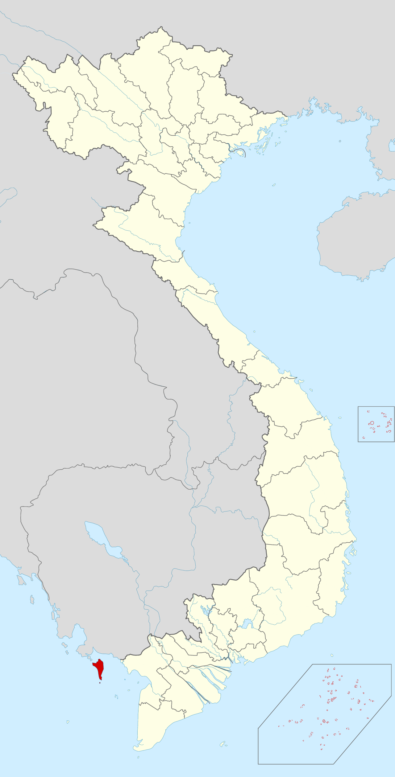
Phu Quoc lies in the Gulf of Thailand, roughly 45 kilometres off the coast of Kien Giang. At around 574 square kilometres it is the largest island in Vietnam. Since the administrative reforms of 1 July 2025, which abolished the district tier and consolidated Vietnam's provinces, Phu Quoc falls within An Giang province rather than the former Kien Giang province. The island itself — its geography, beaches, and infrastructure — is unchanged by that reorganisation.
The terrain rises to a forested ridge running north to south, with the highest point at Chua Mountain (603 m). The main town, Duong Dong, sits on the western coast and contains the airport, the majority of the island's markets, and the older fish-sauce and pepper industries. Resort development is concentrated along the west and south coasts, while the north and east remain comparatively quieter.
Beaches and coastal areas
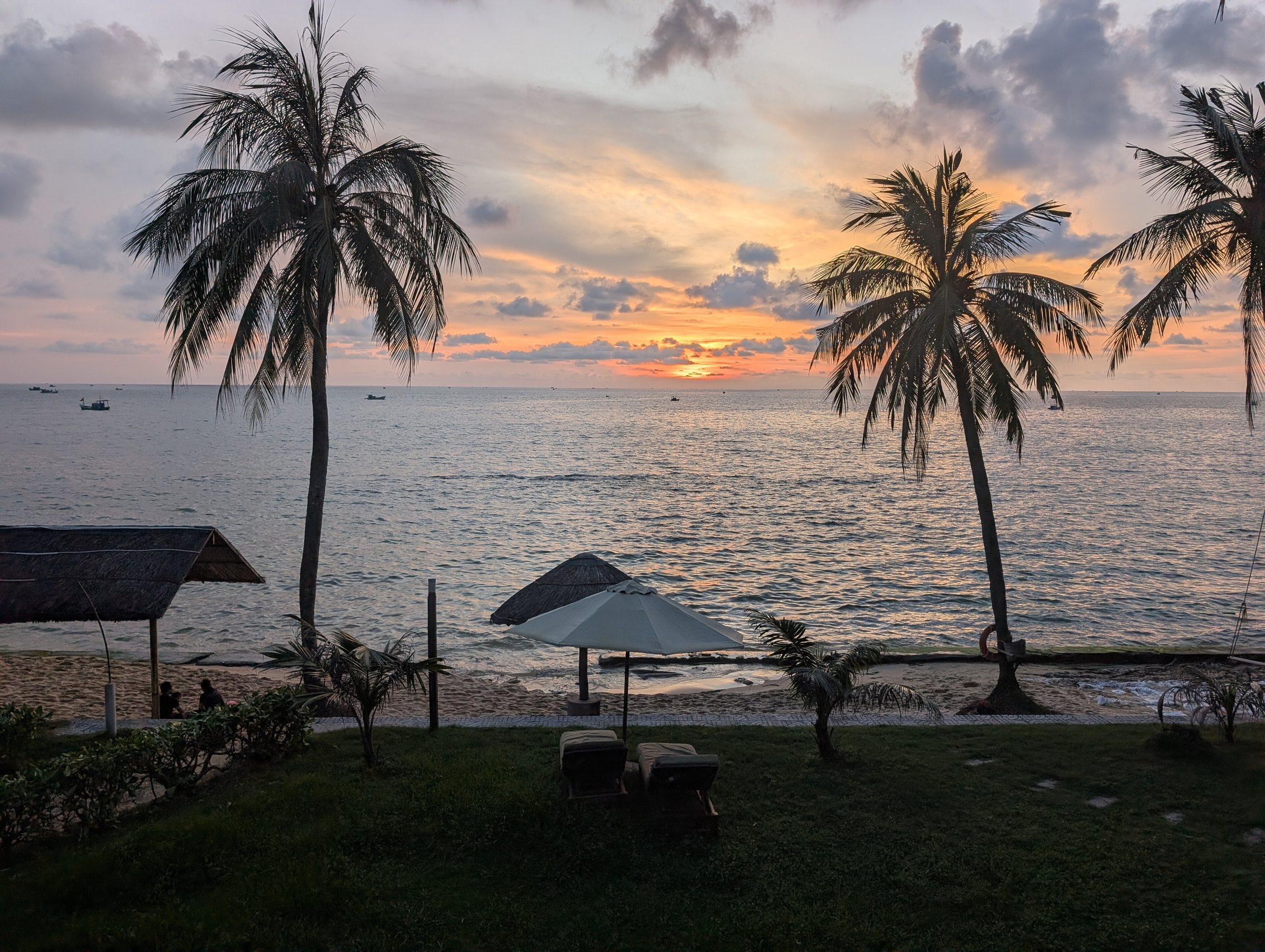
Long Beach (Bai Truong) stretches for roughly 20 kilometres along the western coast south of Duong Dong. It is the most developed shoreline on the island, lined with resorts, restaurants, and boat-hire operators. Sunsets here are unobstructed across open water.
Sao Beach (Bai Sao), on the southeastern coast, is widely regarded as having the finest sand on the island — fine, white, and compacted enough to walk on. It is more exposed to the northeast monsoon in the dry season but remains calmer in the November-to-April window.
Ong Lang, north of Long Beach, is a quieter cove with a patchier shoreline broken by rocky outcrops, preferred by travellers looking for less organised development. Further north, the coast near Ganh Dau retains largely undeveloped stretches backed by forest.
Snorkelling and dive trips depart from the An Thoi port in the south to the An Thoi archipelago, a chain of small islands including Hon Thom, Hon Roi, and Hon May Rut, where coral coverage and fish diversity are generally better than in the nearshore waters of the main island.
Hon Thom cable car and Sunset Town
The Hon Thom Cable Car, operated by Sun Group, crosses approximately 7.9 kilometres of open sea between An Thoi and Hon Thom island to the south. It holds a Guinness record for the longest non-stop three-rope cable car over water. The journey takes roughly fifteen minutes each way and passes over the southern archipelago. Hon Thom itself has an amusement park, beaches, and food outlets developed by the same operator.
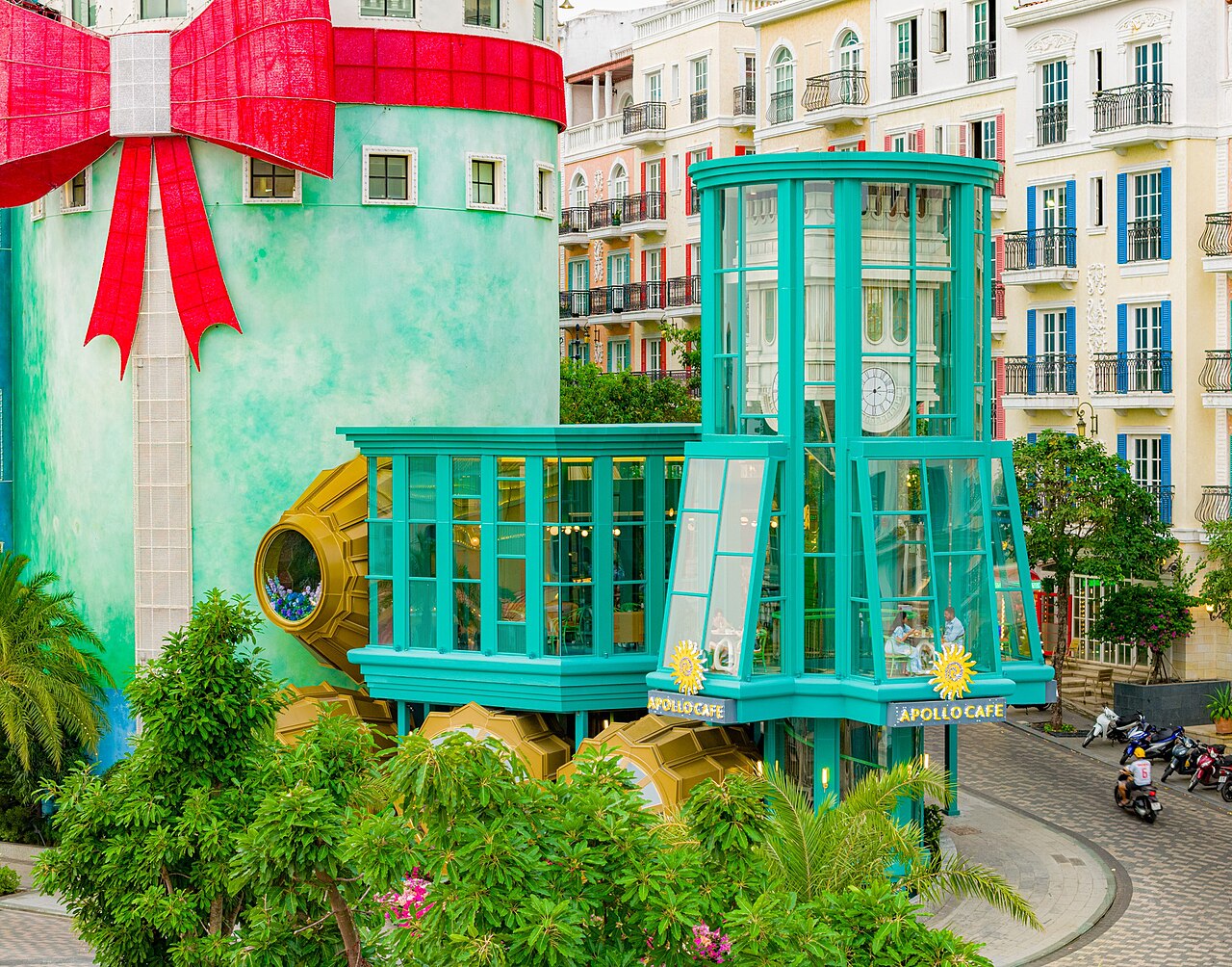
Sunset Town (also known as Phu Quoc Night Market area and the Grand World complex) occupies a purpose-built section of the southern coast near An Thoi. It is modelled loosely on a European riverside town, with coloured façades, a pedestrian street, restaurants, and performance venues. The cable car terminal is integrated into this development. Whether this aesthetic is appealing or incongruous is a matter of individual taste; both reactions are commonly reported.
Vinpearl Phu Quoc operates a large resort and safari park on the northern part of the island, the latter being one of the few open-range wildlife parks in Vietnam.
National park and northern coast
Phu Quoc National Park covers roughly 31,422 hectares — more than half the island's land area — and extends into the surrounding sea as a marine protected zone. The forested interior contains populations of slow loris, fishing cat, and various hornbill species, though wildlife sightings require patience and ideally a guide familiar with the trails. The park headquarters is near Duong Dong.
Trekking routes run through the forest to waterfalls including Suoi Tranh and Suoi Da Ban, the latter a series of granite boulders through which a stream runs — more dramatic in the wet season, reduced to a trickle in the dry months. The northern coast road past Ganh Dau to the tip of the island offers views across narrow straits toward Cambodia, which is visible on clear days.
Sea access around the northern coast is restricted in parts of the wet season when swells from the southwest make small-boat travel dangerous.

Fish sauce, pepper and local produce
Phu Quoc fish sauce (nuoc mam Phu Quoc) carries a protected geographical indication under both Vietnamese law and, since 2012, EU regulations — one of the first Vietnamese food products to receive such recognition in Europe. It is produced by fermenting whole anchovies (ca com) with salt in large wooden barrels, a process that takes at least twelve months. The resulting liquid is graded by protein content, with the first pressing commanding the highest quality rating. Several family-run factories around Duong Dong are open for informal visits; the smell is pronounced.
Phu Quoc pepper (tieu Phu Quoc) is grown on the island's red laterite soil, particularly in the Ham Ninh and Cua Duong areas. The vines are trained up wooden stakes and produce both black and white pepper. Farm visits are possible and provide context for a product sold throughout Vietnamese markets. The island also produces a locally distilled spirit, ruou sim, made from the myrtle-rose berry (sim), which grows wild in the forest and turns purple-red when ripe.
Climate and when to visit
Phu Quoc has a pronounced two-season pattern. From November to April the island is largely dry, with temperatures rising from comfortable warmth in November and December to their hottest in March and April. This window corresponds with the northeast monsoon that brings rain to northern Vietnam but bypasses the Gulf of Thailand. The sea is calm and visibility for snorkelling is at its best.
From May onward, rainfall climbs steeply. July, August and September are the wettest months, with the island receiving the bulk of its annual rainfall in sustained downpours, often in the afternoon. Seas can be rough and some ferry services are suspended on certain routes. Humidity is high throughout the wet season. October and November mark the transition back toward dry conditions, with rainfall declining month by month. A minority of visitors prefer the wet season for lower prices and reduced tourist numbers, accepting that beach and water activities will be intermittent. For broader regional context see When to go: weather by region.
Getting there and practical matters
By air: Phu Quoc International Airport (PQC) receives direct flights from Hanoi, Ho Chi Minh City, Da Nang, and a number of international destinations. The airport is near the centre of the island and most resort areas are within 30 minutes by road.
By sea: High-speed ferries connect Phu Quoc with Rach Gia and Ha Tien on the mainland. See Phu Quoc ferries for route and operator information. Ferry schedules are seasonal and some services are suspended during rough weather.
Visa: Phu Quoc operates a visa exemption scheme for international visitors arriving directly at the island and remaining there; the exemption does not automatically apply if continuing to the Vietnamese mainland. The Vietnam e-visa page covers the standard visa process. Verify current exemption conditions before travel as policy has changed previously.
On the island, motorbike hire is the most common way to get around independently. Roads in the north and east can be rough. For money matters see Money, ATMs and cards; for connectivity see SIM cards and eSIMs. Common issues for visitors are covered at Safety and common scams.
Klimaat per maand
Langjarige gemiddelden, geen voorspelling. Referentieperiode: 2015–2024. Bron: ERA5 reanalysis (Copernicus) via the Open-Meteo archive API.
Show the numbers
| Maand | Hoog °C | Laag °C | Neerslag mm | Regendagen | Humidity % |
|---|---|---|---|---|---|
| January | 29.2 | 23.3 | 55 | 11 | 76 |
| February | 30.1 | 23.3 | 37 | 11 | 76 |
| March | 31.2 | 24.3 | 54 | 14 | 77 |
| April | 31.4 | 25.2 | 125 | 20 | 80 |
| May | 30.6 | 25.5 | 246 | 27 | 85 |
| June | 29.1 | 25.0 | 306 | 27 | 88 |
| July | 28.4 | 24.5 | 410 | 29 | 89 |
| August | 28.4 | 24.5 | 351 | 30 | 89 |
| September | 28.2 | 24.2 | 430 | 28 | 90 |
| October | 28.9 | 24.1 | 358 | 28 | 89 |
| November | 29.4 | 24.2 | 177 | 20 | 83 |
| December | 29.2 | 23.7 | 69 | 12 | 76 |
Practical notes
Where it is
Also known as / see also
In de buurt
Verwezen door
Bronnen
- ERA5 climate normals — Copernicus / Open-Meteo (CC BY 4.0) geraadpleegd 30 August 2026
Supports: monthly temperature and rainfall normals, and elevation - Phú Quốc (Q21683343) — Wikidata (CC0 1.0) geraadpleegd 30 August 2026
Supports: coordinates, area, population
Current Laatst geverifieerd: 31 August 2026. Rules, fares and prices change — check the official source before acting on anything here. Report a mistake.
Picture credits (6)
1 Phu Quoc sunset, Elmschrat, CC0, Wikimedia Commons · Phu Quoc, Vietnam 2 (Unsplash), Eila Lifflander 3ilaliff, CC0, Wikimedia Commons · Phú Quốc, Phu Quoc, Vietnam (Unsplash J9Ey8Q5fXf0), Geoffrey Arduini geoffreyarduini, CC0, Wikimedia Commons · Phu Quoc in Vietnam, Vietic2, CC0, Wikimedia Commons · Apollo Cafe Sunset Town Phu Quoc daytime exterior, Vivu Vietnam, CC BY-SA 4.0, Wikimedia Commons · Phu Quoc ridgeback, Lưu Ly at Vietnamese Wikipedia, CC BY-SA 3.0, Wikimedia Commons