The place itself has not changed, and this page continues to cover it.
2025 constitutional amendment and Law on Organisation of Local Government establishing a two-tier local government
Overview and administration
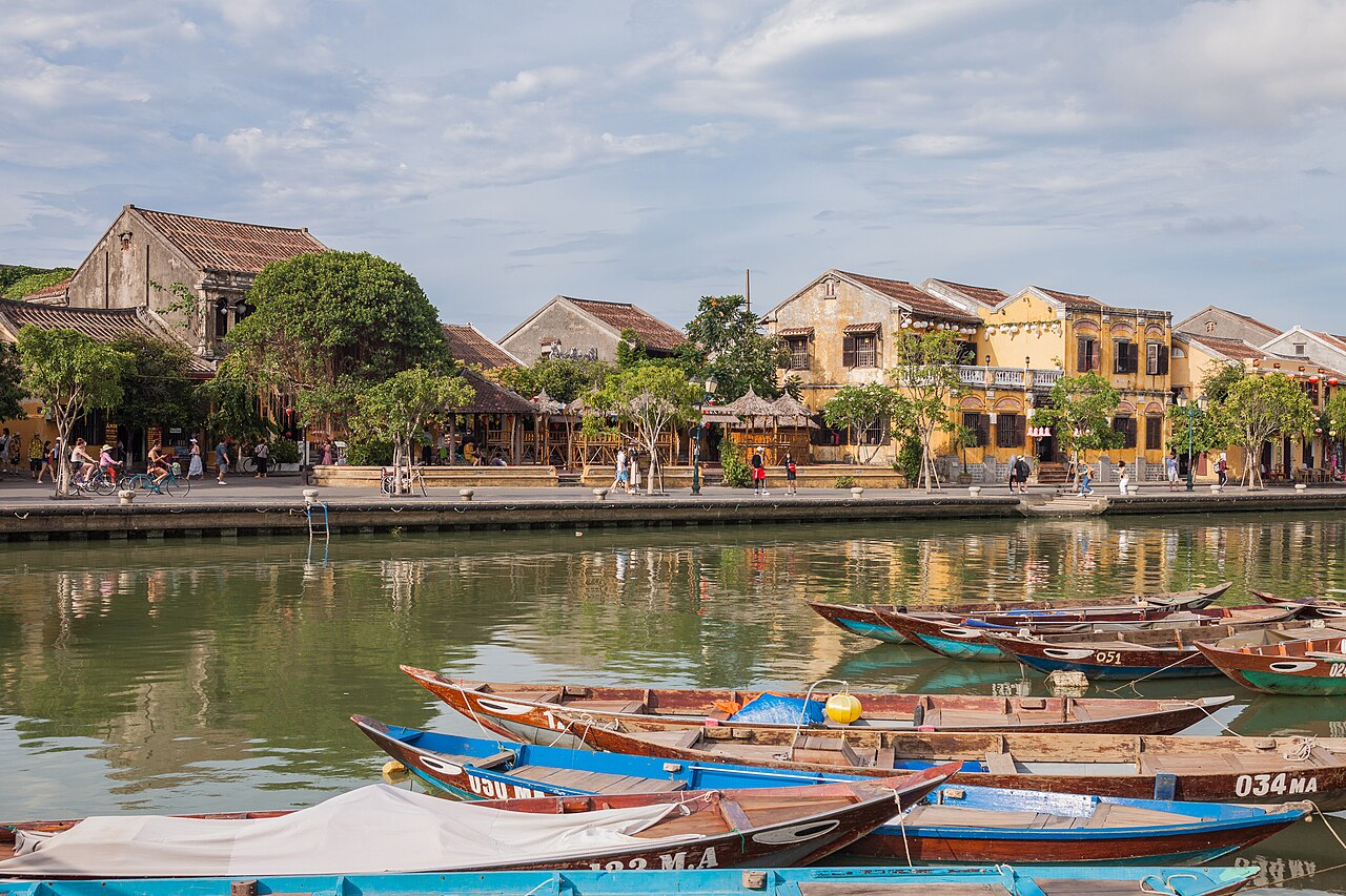
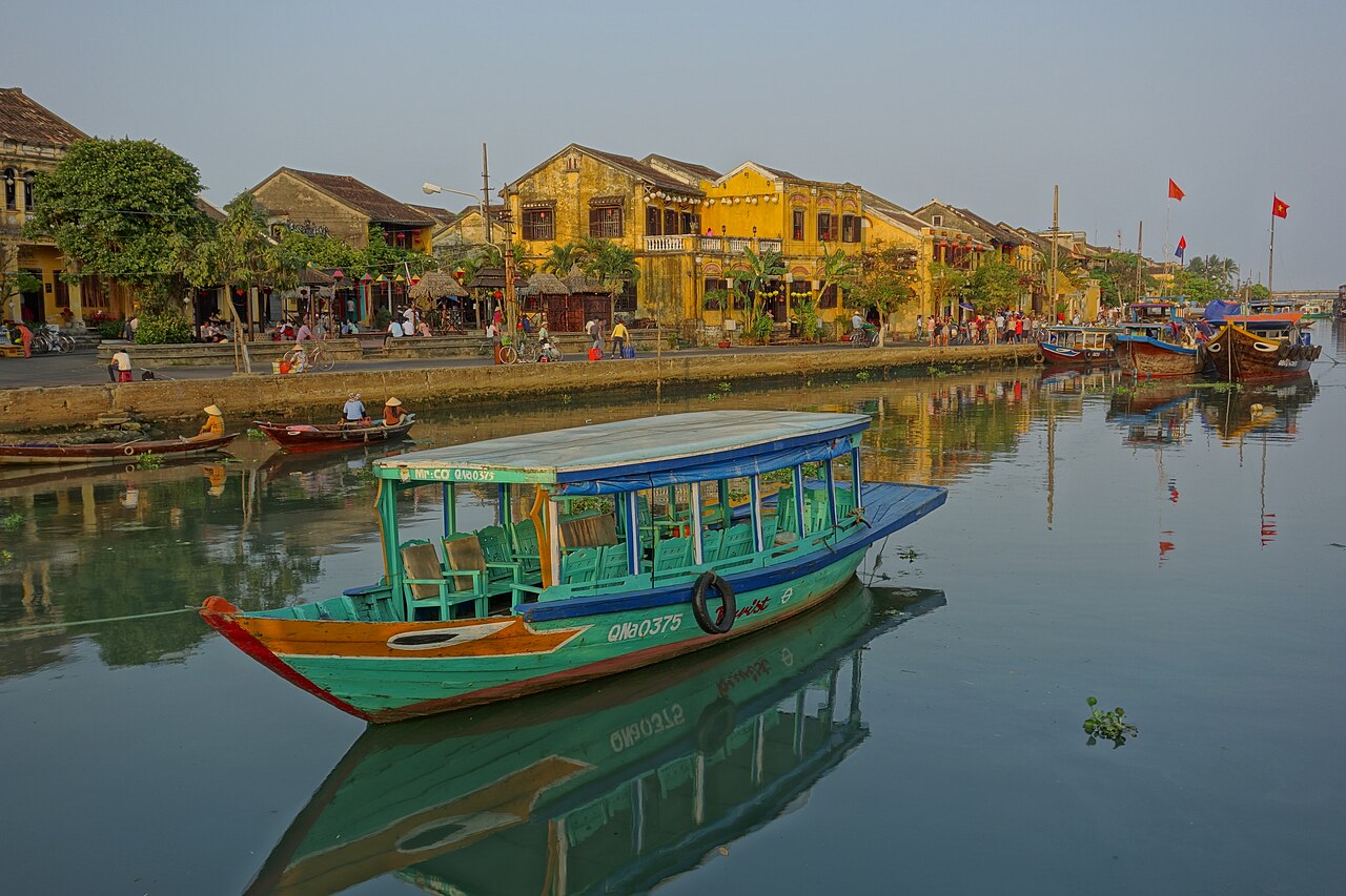
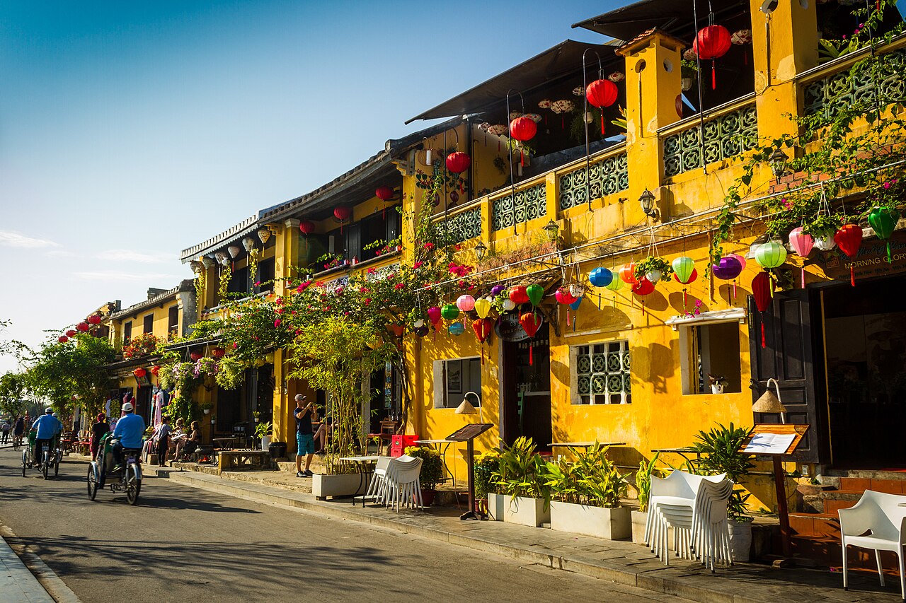
Hoi An sits on the Thu Bon River delta, roughly 30 km south of Da Nang and within the broader territory of Quang Nam province. The settlement grew into a major international trading port from the 15th century onward, hosting communities of Chinese, Japanese, Dutch and later French merchants. Its unusually intact townscape — merchant houses, assembly halls, a covered bridge — reflects that layered commercial history.
As of 1 July 2025, Vietnam's administrative restructuring abolished the district tier and merged provincial units. Hoi An is now administered under the expanded province that absorbed former Quang Nam; practical governance of the old town and surrounding communes now falls under the new provincial structure rather than a separate district authority. Day-to-day life and tourism infrastructure have continued uninterrupted.
The Ancient Town and its ticket
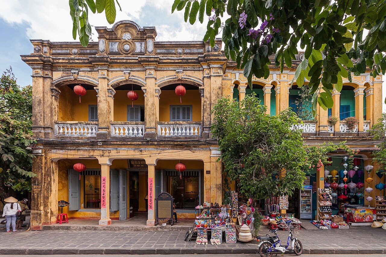
The core of the UNESCO World Heritage zone — formally inscribed in 1999 — is a compact grid of streets along the Thu Bon waterfront. Entry to the ticketed monuments requires a combined pass sold at booths on the perimeter of the old town. The pass grants admission to a set number of individual attractions from a fixed list; visitors choose which specific sites to enter from that list. Monuments not on the list, including the street itself and the riverfront, remain freely accessible.
The Japanese Covered Bridge (Chùa Cầu) at the western end of Trần Phú street is the most photographed structure. Built in the early 17th century and traditionally attributed to the Japanese merchant community, it incorporates a small temple and connects the Japanese quarter to the Chinese trading area. Restoration work has been carried out periodically and its appearance may differ slightly depending on the phase of works at the time of a visit.
The assembly halls (hội quán) were built by distinct Chinese dialect communities — Fujian (Phúc Kiến), Cantonese (Quảng Đông), Hainan (Hải Nam), Triều Châu and a combined hall — and remain active places of worship. The Fujian Assembly Hall on Trần Phú is the largest, dedicated to Thiên Hậu, the goddess of the sea.
Tailoring
Hoi An has a concentrated tailoring industry, with workshops ranging from small family operations to larger export-oriented businesses. Garments — including suits, áo dài, dresses and shoes — are made to measure, sometimes within 24 to 48 hours. The density of tailors means quality and reliability vary considerably between shops.
Common problems reported by visitors include garments delivered with fit issues when there is insufficient time for a second or third fitting, fabric substitution (a cheaper material replacing the one agreed upon), and items not matching the reference photograph or sample. Allowing several days, attending multiple fittings, and inspecting fabric before work begins reduces the likelihood of these outcomes. Collecting a finished item and then leaving Vietnam the same day leaves no time to address problems.
The busiest period for tailors runs through the cooler and drier months of February to May, and again around major holidays. Custom shoes, bags and leather goods are produced by a smaller number of specialist workshops on and around Trần Phú and Lê Lợi streets.
Beaches: An Bang and Cua Dai
An Bang beach lies approximately 4 km from the old town centre. It has a longer stretch of open sand and a more relaxed atmosphere than Cua Dai, with a collection of beach bars and sun-lounger operators. Cua Dai beach is slightly closer to town but has experienced significant erosion since the early 2010s; the shoreline has receded noticeably and some sections are heavily affected by accumulated sand-retaining structures.
Both beaches are reached by bicycle or motorbike from the old town along flat roads, or by hired vehicle. The coast faces east and is exposed to the South China Sea. During the October–November flood and storm season, beach conditions deteriorate significantly and swimming is inadvisable. The calmer, warmer months of March through August are the more reliable period for beach use, with June and July delivering the highest temperatures.
Lantern festival, cooking classes and Tra Que
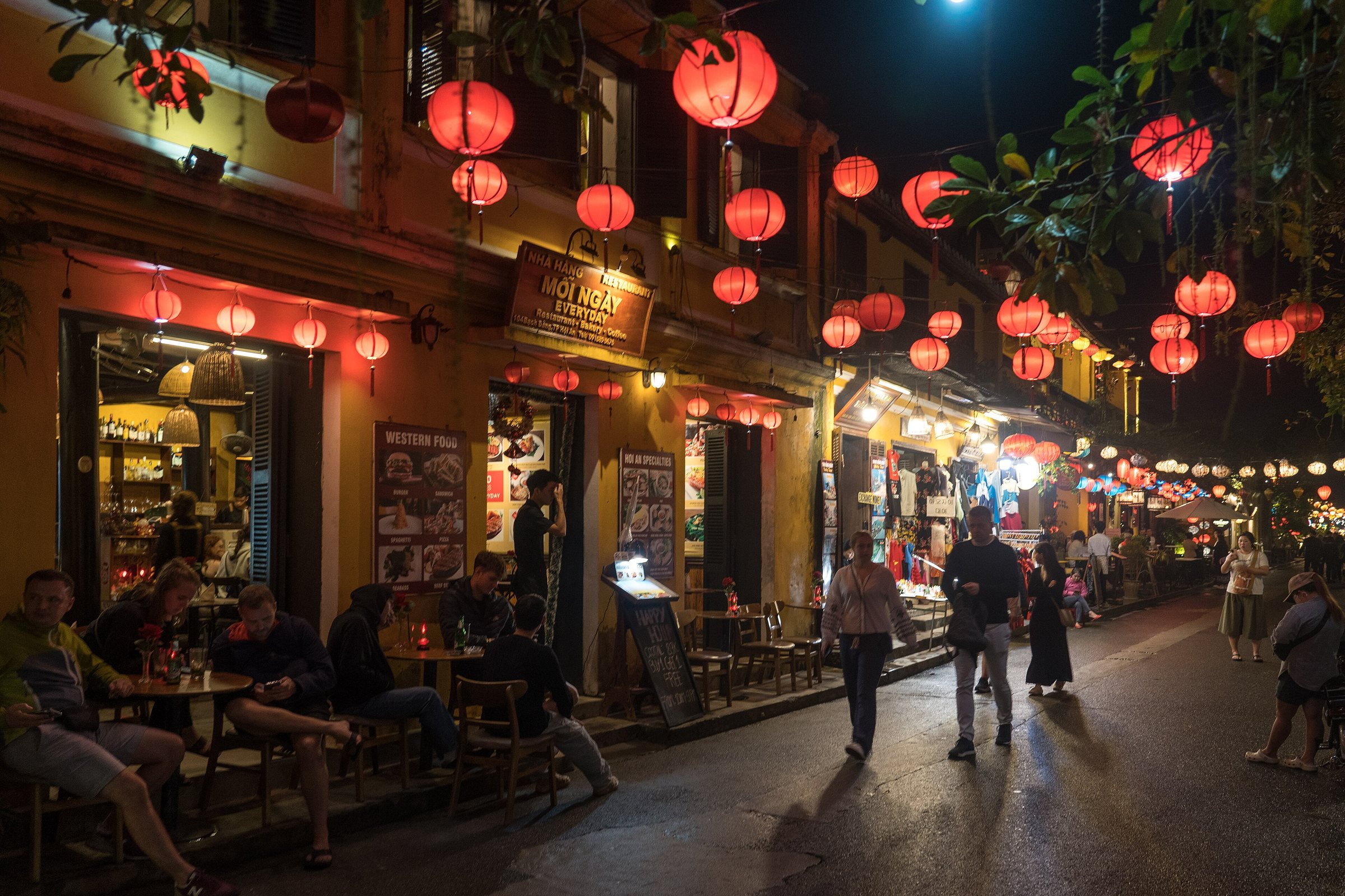
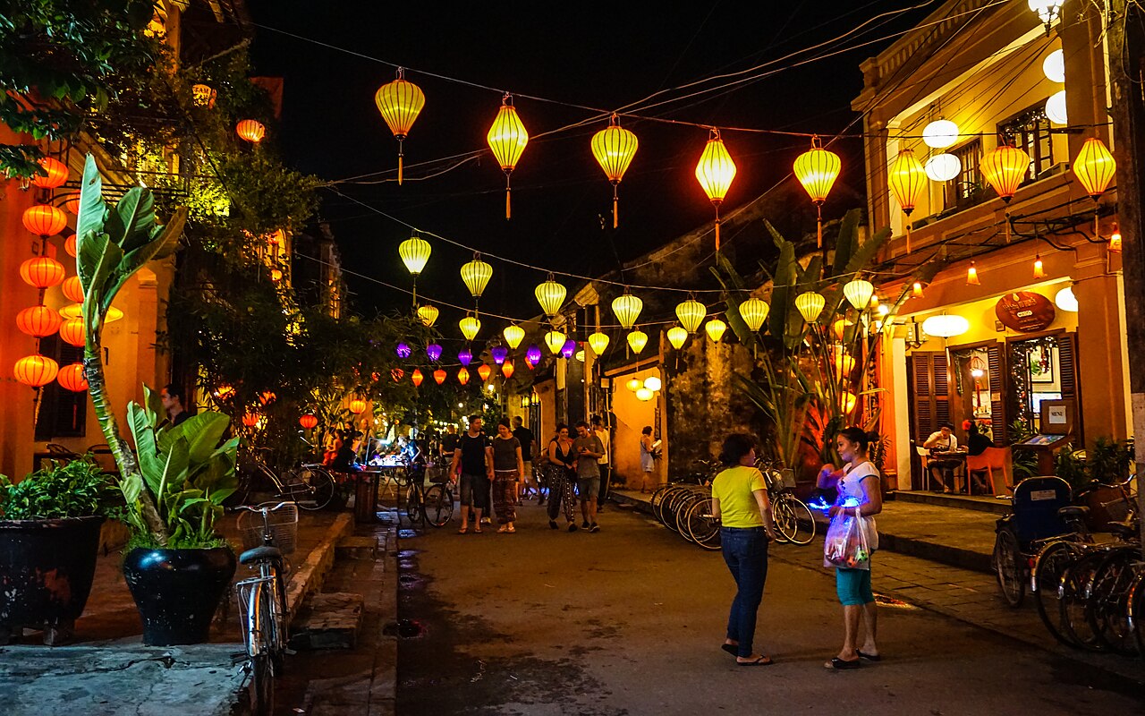
On the 14th day of each lunar month, the old town observes a full-moon lantern night: electric street lighting is dimmed, silk lanterns are lit along the riverside and streets, and motorised traffic is restricted in the heritage zone. The event draws large crowds, particularly in the peak tourism months. Floating paper lanterns (hoa đăng) are released on the Thu Bon River; their sale supports a small local industry.
Cooking classes typically begin with a visit to the covered market (Chợ Hội An) on Trần Phú, where instructors demonstrate the selection of local ingredients, before moving to a kitchen — sometimes at a riverside property or at the Tra Que vegetable village. Dishes covered usually include cao lầu, cơm gà Hội An (Hoi An chicken rice) and white rose dumplings (bánh bao vạc).
Trà Quế is a small herb-farming village roughly 3 km north of the old town, known for producing aromatic herbs — including basil, mint, coriander and laksa leaf — using traditional methods and river silt fertiliser from the Đế Võng lagoon. Many cooking-class itineraries incorporate a short visit there.
Climate and flood season
Hoi An has a distinct seasonal pattern shaped by the central Vietnamese monsoon. Temperatures rise through spring and peak in June and July. The period from roughly February to May is dry and warm, broadly considered the most comfortable for outdoor activity. From June onwards, heat intensifies further before the rains build.
The critical period is October and November, when rainfall reaches its annual peak. The Thu Bon River regularly floods the old town during this period — streets in the heritage zone can be submerged by half a metre or more during significant flood events, and this is a recurrent feature of Hoi An's geography rather than an exceptional occurrence. Some accommodation and restaurant owners in low-lying streets have flood boards and pumps, but travel plans should account for disruption. December through January remains relatively wet and noticeably cooler, with temperatures that can feel cold by Vietnamese standards at night.
See also: When to go: weather by region.
Getting there and practical information
Da Nang International Airport (DAD) is the main gateway, with domestic connections to Hanoi and Ho Chi Minh City and international routes to several Asian cities. From the airport to Hoi An, the road journey takes roughly 45 minutes to one hour depending on traffic; options include taxi, private transfer and shared shuttle. No train station serves Hoi An directly; the nearest stop on the North–South line is Da Nang.
Bicycle hire is the dominant mode of local transport within and around the old town, which is compact and largely flat. Motorbike hire is available for wider exploration. Vehicles are restricted within the heritage core during certain hours.
Nearby sites accessible as day trips include Mỹ Sơn Sanctuary, a group of Cham Hindu temples roughly 40 km southwest, and Bạch Mã National Park to the north. Lý Sơn Island is accessible via Quảng Ngãi to the south.
For entry requirements see Vietnam e-visa. For currency and payments see Money, ATMs and cards. For connectivity see SIM cards and eSIMs. For common visitor scams see Safety and common scams.
各月气候
长期平均值,非预测数据。 参考周期: 2015–2024. 来源: ERA5 reanalysis (Copernicus) via the Open-Meteo archive API.
Show the numbers
| 月份 | 最高气温 °C | 最低气温 °C | 降雨量(毫米) | 降雨天数 | Humidity % |
|---|---|---|---|---|---|
| January | 24.1 | 20.1 | 170 | 20 | 86 |
| February | 24.8 | 20.1 | 83 | 13 | 86 |
| March | 27.7 | 22.3 | 54 | 8 | 86 |
| April | 30.3 | 24.2 | 70 | 8 | 83 |
| May | 32.7 | 26.0 | 83 | 13 | 80 |
| June | 34.4 | 27.1 | 74 | 12 | 74 |
| July | 33.2 | 26.6 | 152 | 16 | 76 |
| August | 33.6 | 26.8 | 137 | 18 | 75 |
| September | 31.0 | 25.6 | 269 | 22 | 83 |
| October | 28.3 | 24.2 | 490 | 25 | 86 |
| November | 26.9 | 23.2 | 400 | 24 | 86 |
| December | 24.5 | 21.2 | 381 | 26 | 85 |
Practical notes
Where it is
Also known as / see also
附近
被以下页面引用
来源
- ERA5 climate normals — Copernicus / Open-Meteo (CC BY 4.0) 访问于 30 August 2026
Supports: monthly temperature and rainfall normals, and elevation - Hội An (Q36160) — Wikidata (CC0 1.0) 访问于 30 August 2026
Supports: coordinates, area, population - Hội An — Wikipedia (CC BY-SA 4.0) 访问于 30 August 2026
Supports: background
Current 最后核实: 31 August 2026. Rules, fares and prices change — check the official source before acting on anything here. Report a mistake.
Picture credits (7)
Alexkom000, CC BY 4.0, Wikimedia Commons · Hoi An (I), This Photo was taken by Supanut Arunoprayote . Feel free to use any of my images, but…, CC BY 4.0, Wikimedia Commons · Hoi An (III), This Photo was taken by Supanut Arunoprayote . Feel free to use any of my images, but…, CC BY 4.0, Wikimedia Commons · Dem ram Hoi An 2006, User Zimmelino on Flickr, CC BY-SA 1.0, Wikimedia Commons · Boat by the water - Hoi An (16922189291), Ryan Milani, CC BY-SA 2.0, Wikimedia Commons · Hoi An, Vietnam (25710326363), katiebordner, CC BY 2.0, Wikimedia Commons · Hoi An (42681823051), rhjpage, CC BY 2.0, Wikimedia Commons