
National Assembly Resolution 202/2025/QH15 on the rearrangement of provincial-level administrative units
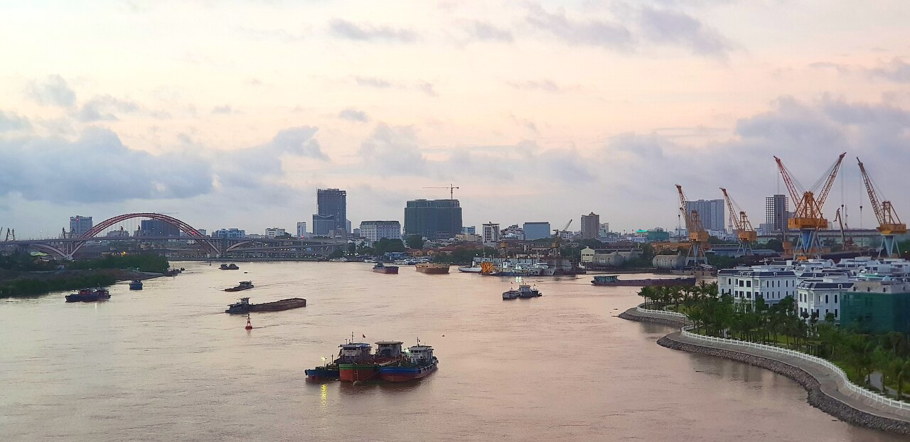
Hai Phong is one of Vietnam's six centrally-governed cities and its busiest northern port. From 1 July 2025 it absorbed the former province of Hai Duong under national administrative reforms, making it a substantially larger unit than before. The city itself is an industrial and commercial hub with a distinct French-colonial streetscape, a working harbour, and ferry connections to the islands of the Gulf of Tonkin.
What Hai Phong is known for
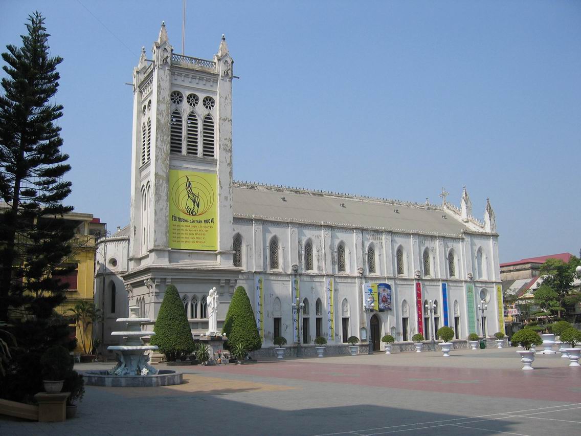
Hai Phong has been Vietnam's main northern seaport since the French colonial period, and container shipping remains the economic core of the city. Alongside that industrial identity, the city centre retains a notable stock of early-twentieth-century French colonial architecture — grand post offices, tree-lined boulevards and yellow-painted civic buildings — that gives it a character distinct from Hanoi.
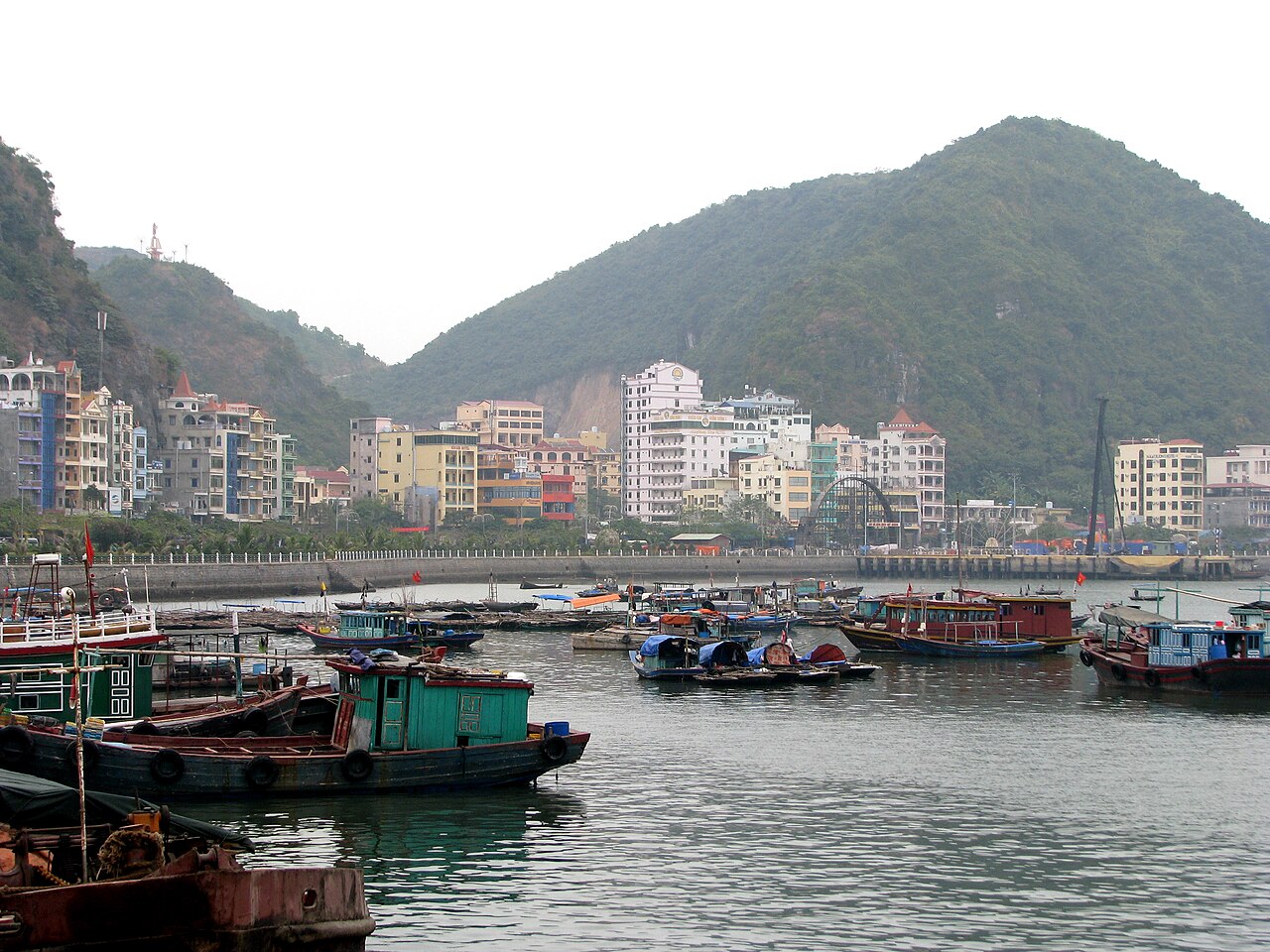
The city is also known as the practical departure point for Cat Ba Island and the southern reaches of Ha Long Bay. Travellers who cross through Hai Phong rather than routing entirely through Hanoi often find the approach to the bay less crowded. Locally, Hai Phong has a strong culinary identity; bánh đa cua — a crab noodle soup made with broad red rice noodles — is the dish most closely associated with the city.

Administrative changes since 2025
On 1 July 2025, under a National Assembly resolution reorganising Vietnam's provincial-level units, Hai Phong merged with the former province of Hai Duong. The combined entity retains the name Hai Phong and is administered as a single centrally-governed city. The district tier has been abolished nationally; administration now runs directly from city level to commune and ward level.
Population figures recorded before 1 July 2025 reflect only the pre-merger Hai Phong boundaries, so any comparison with post-merger data should be treated with caution — the question of the combined entity's current population is unsettled while new figures are compiled. Places within the former Hai Duong — including the historic sites at Con Son and Kiep Bac — now fall administratively within Hai Phong.
Getting there and away
By road from Hanoi: An expressway connects Hanoi to Hai Phong city centre, and the journey typically takes around two hours by bus or private vehicle. Several bus operators run this corridor; see Hanoi to Hai Phong and Ha Long buses for route details.
By rail: A dedicated Hanoi–Hai Phong rail line exists, with services departing from Hanoi's Gia Lam station rather than the main Long Bien or Hanoi stations. Journey time is longer than the expressway bus.
By air: Cat Bi International Airport sits close to the city and receives domestic flights from Ho Chi Minh City, Da Nang and other Vietnamese cities, as well as some international routes. It is an alternative entry point to the broader Hanoi–Ha Long corridor.
To Cat Ba Island: Ferries and high-speed boats depart from Hai Phong's Got Pier and Dinh Vu area. See Cat Ba ferries and the Hai Phong crossing for schedules and crossing options.
When to go
Hai Phong shares the northern Vietnamese climate pattern: a cool, occasionally misty winter from roughly November to March, and a hot, humid summer with typhoon risk from May through October. The peak of typhoon season — August and September — brings the highest chance of disrupted ferry services to Cat Ba and other islands.
Spring (March to May) and autumn (October to November) are generally considered the most comfortable periods, with moderate temperatures and lower rainfall. The Lunar New Year (Tết) period, usually in late January or February, sees the city quiet as residents travel to family homes, with some businesses closed for up to a week.
For a broader comparison of regional weather patterns, see When to go: weather by region.
What to see and do
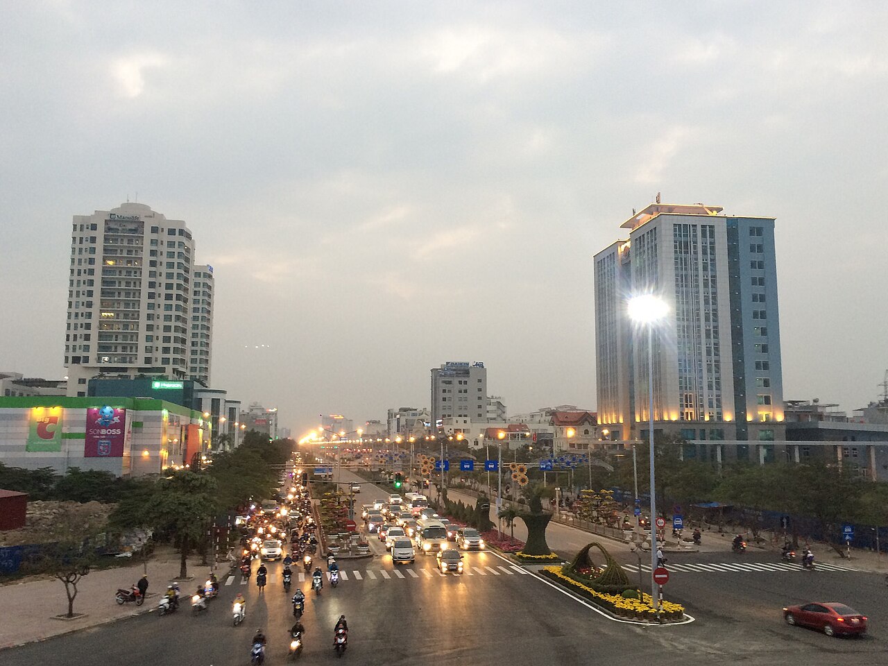
City centre: The colonial-era quarter around Dien Bien Phu Street and the main post office area rewards walking. The Hai Phong Museum and the Opera House — a smaller cousin of Hanoi's — are the most visited civic buildings. The city's covered market, Chợ Sắt, is a large working market rather than a tourist market.
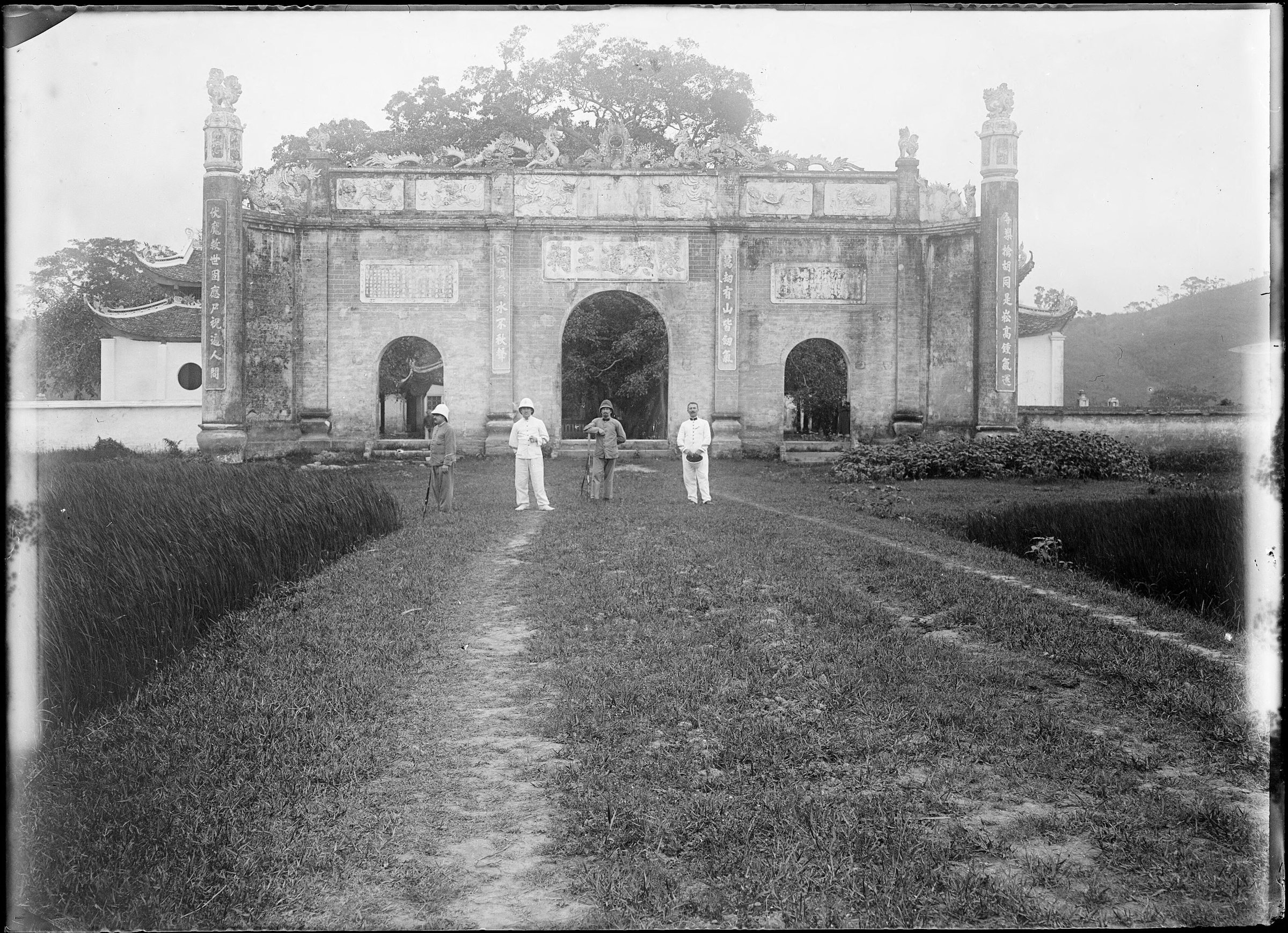
Con Son and Kiep Bac: Now within the administrative boundaries of the merged Hai Phong, the temple complexes at Con Son and Kiep Bac in the former Hai Duong area are significant sites associated with the Trần dynasty general Trần Hưng Đạo. They draw large numbers of Vietnamese pilgrims, particularly during festival periods.
Cat Ba Island: Most visitors treat Hai Phong as a transit point rather than a destination in its own right, continuing by ferry to Cat Ba Island, which offers limestone karst scenery, a national park, and access to the quieter southern section of Ha Long Bay.
Where to stay
Accommodation concentrates in two broad areas. The city-centre district around Dien Bien Phu Street and the Opera House has the greatest range of hotels, from small guesthouses to business-oriented mid-range properties; this location suits those who want to explore the colonial architecture or use the city as a stopover. A second cluster of accommodation exists near the ferry piers on the city's eastern side, convenient for early-morning departures to Cat Ba.
Hai Phong does not have a resort strip of the kind found in coastal cities further south. Visitors looking for beach-resort accommodation are generally better served by continuing to Cat Ba Island rather than staying in the city.
Common misunderstandings
Hai Phong is not a beach destination. The city is a port and industrial centre; the nearest island beaches require a ferry crossing to Cat Ba. Arriving with beach-holiday expectations and no onward plan is a frequent mistake.
The ferry situation has changed. Routes, operators and pier locations for Cat Ba ferries have shifted over the years. Check current departure points before travelling; the information at Cat Ba ferries and the Hai Phong crossing covers what is known, but pier assignments can change without much notice.
Hai Duong sites are now in Hai Phong. Since the 2025 merger, places such as Con Son and Kiep Bac that were formerly in Hai Duong province fall under Hai Phong's administration, though they are still physically located inland to the west.
For practical entry matters including visa requirements, which can change by government decree, consult the official Vietnamese immigration authority and see Vietnam e-visa.
Khí hậu theo tháng
Số liệu trung bình dài hạn, không phải dự báo. Kỳ tham chiếu: 2015–2024. Nguồn: ERA5 reanalysis (Copernicus) via the Open-Meteo archive API.
Show the numbers
| Tháng | Nhiệt độ cao °C | Thấp °C | Lượng mưa (mm) | Ngày mưa | Humidity % |
|---|---|---|---|---|---|
| January | 20.6 | 14.7 | 51 | 9 | 79 |
| February | 21.6 | 15.6 | 40 | 7 | 80 |
| March | 24.7 | 19.0 | 42 | 11 | 85 |
| April | 27.8 | 21.9 | 90 | 12 | 84 |
| May | 30.6 | 25.3 | 191 | 18 | 83 |
| June | 32.8 | 27.3 | 215 | 18 | 80 |
| July | 32.3 | 26.9 | 294 | 20 | 81 |
| August | 31.3 | 26.0 | 409 | 25 | 86 |
| September | 30.4 | 25.0 | 346 | 22 | 85 |
| October | 28.2 | 22.0 | 148 | 13 | 78 |
| November | 26.1 | 19.6 | 52 | 10 | 77 |
| December | 21.6 | 15.0 | 28 | 7 | 72 |
Places within Hai Phong
Where it is
Also known as / see also
Lân cận
Đã sáp nhập
Được tham chiếu bởi
Các nguồn
- ERA5 climate normals — Copernicus / Open-Meteo (CC BY 4.0) đã truy cập 30 August 2026
Supports: monthly temperature and rainfall normals, and elevation - Map data from OpenStreetMap contributors, ODbL 1.0 — OpenStreetMap (ODbL 1.0) đã truy cập 29 August 2026
Supports: carried over from the first build - Hai Phong (Q72818) — Wikidata (CC0 1.0) đã truy cập 30 August 2026
Supports: coordinates, area, population - Hai Phong — Wikipedia (CC BY-SA 4.0) đã truy cập 30 August 2026
Supports: background
Current Đã xác minh lần cuối: 29 August 2026. Rules, fares and prices change — check the official source before acting on anything here. Report a mistake.
Picture credits (8)
Hải Phòng City, Minhvnhp, CC BY-SA 4.0, Wikimedia Commons · Hai Phong Cathedral (2007), Qjafcc, CC BY-SA 3.0, Wikimedia Commons · Hai Phong City 2017, Minhvnhp, CC BY-SA 4.0, Wikimedia Commons · Haiphong2020, Minhvnhp, CC BY-SA 4.0, Wikimedia Commons · Duong Nguyen Binh Khiem thanh pho Hai Phong, Hoàng Linh ( thảo luận ), CC BY-SA 3.0, Wikimedia Commons · HaiPhong2017, Minhvnhp, CC BY-SA 4.0, Wikimedia Commons · Vietnam 08 - 28 - Cat Ba Island (3170461046), McKay Savage from London, UK, CC BY 2.0, Wikimedia Commons · Kiếp Bạc temple in 1904, André Salles, Public domain, Wikimedia Commons