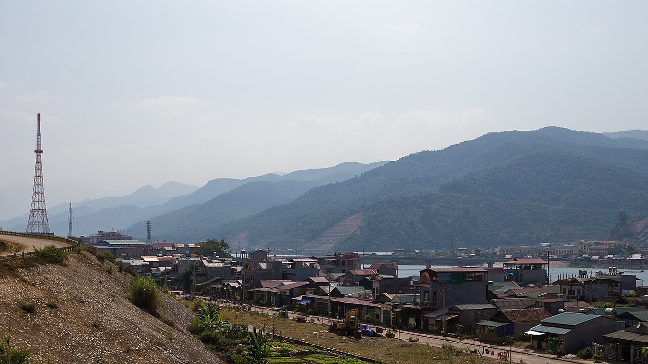
Dien Bien province occupies the far northwestern corner of Vietnam, sharing borders with Laos to the west and southwest and Lai Chau to the north and east, and Son La to the east and south. It was unchanged by the 2025 provincial merger that reshaped most of Vietnam. The provincial capital, Dien Bien Phu city, sits in the Muong Thanh valley, the largest natural valley in the northwest and the site of the battle that ended French rule in Indochina.
What Dien Bien is known for
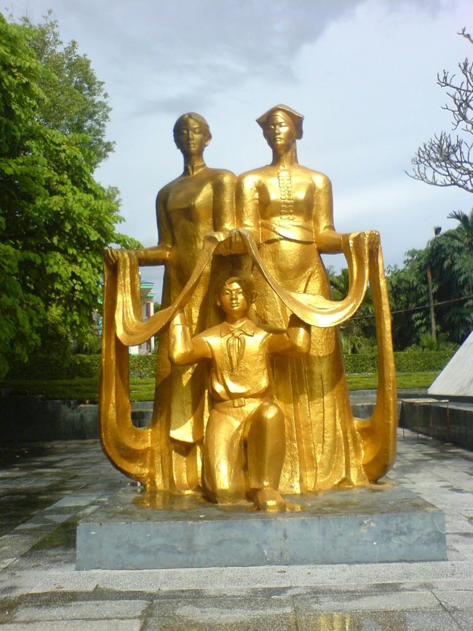
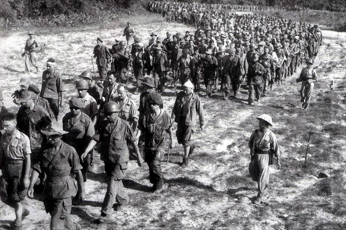
The province is defined, above all, by the Battle of Dien Bien Phu (March–May 1954), in which Viet Minh forces under General Vo Nguyen Giap surrounded and overcame a French garrison of roughly 15,000 troops. The defeat compelled France to negotiate at Geneva, leading to the partition of Vietnam and the withdrawal of French colonial administration from Indochina. Battlefield sites, bunkers, command posts and a large museum preserve this history in and around the city.
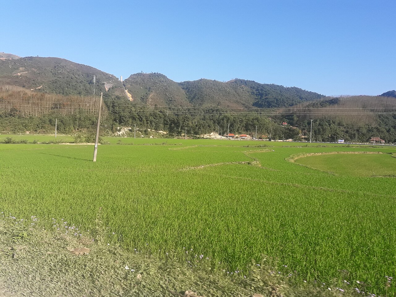
Beyond the military history, Dien Bien is home to a substantial diversity of ethnic minority peoples, including the Thai (the largest group in the valley), the Hmong, the Kho Mu and others, each with distinct textile traditions, festivals and village architecture. The Muong Thanh valley floor is wide and agricultural, planted with rice, while the surrounding mountains carry forest and small highland communities. The province is one of the least-visited parts of Vietnam, which shapes both the experience and the logistics.
Getting there and away
By air: Dien Bien Phu Airport (IATA: DIN) is the practical entry point for most visitors arriving from Hanoi. Flight times are short and the airport is close to the city centre, but services are limited and can sell out or be disrupted during poor visibility. Checking schedules in advance is essential.
By road from Hanoi: Overland travel is long — the route via Son La and over the mountain passes takes many hours even on improved roads. Sleeper buses operate from Hanoi's My Dinh terminal. The road through Son La is the most commonly used; a northern route via Lai Chau is more scenic and adds further hours. Private car and motorbike are also used, the latter predominantly by experienced riders given the gradient and road condition.
Crossing into Laos: The Tay Trang–Pang Hok border crossing, southwest of Dien Bien Phu city, connects to Phongsali province in Laos. It is open to foreign nationals, though border rules can change; the official Vietnamese and Lao immigration authorities are the definitive source. Vietnam's e-visa covers entry but not this crossing specifically — verify in advance.
When to go
Dien Bien's climate is highland subtropical, moderated by altitude. The broad patterns are important for planning. See also weather by region for a fuller picture of the northwest.
- November to April (dry season): Cooler and drier. Skies are clearer, mountain roads safer and river levels lower. This is generally the preferred period for travel. January and February can be cold in the highlands, sometimes below 10 °C at night.
- May to October (wet season): Rainfall is heavy, particularly July and August. Landslides on mountain roads are a real hazard, and some routes become impassable after sustained rain. Valleys can be misty for days. The landscape is green and rice paddies are active.
- Rice harvest (September to October): Despite the tail end of the wet season, the Muong Thanh valley is visually striking when the terraced and flat paddies are golden. Many visitors time a visit around this.
What there is to see and do
The majority of sites are concentrated in or near Dien Bien Phu city, which has a dedicated page with fuller detail. Key reference points include the Dien Bien Phu Museum, Hill A1 (Eliane 2 in French accounts), the reconstructed de Castries bunker, the French military cemetery, and the Vietnamese war memorial. The sites are spread across the valley and the surrounding hillsides; most can be reached on foot or by bicycle from the city centre, with some requiring short vehicle trips.
Outside the city, the province offers:
- Muong Thanh valley villages — Thai communities with stilt-house architecture, home weaving and periodic markets.
- Pa Thom cave — a large limestone cave system to the south of the city, with significant stalactite formations.
- Pa Khoang lake — a reservoir northeast of the city used for boating and fishing, with minority villages on its margins.
- Remote highland routes — roads toward the Lao border and north toward Lai Chau pass through terrain with limited tourist infrastructure but significant ethnic diversity.
Motorbiking the provincial roads is popular among travellers with experience of mountain riding, though distances and road conditions require genuine preparation.
Where to stay
Accommodation is concentrated in Dien Bien Phu city. Options range from simple guesthouses to mid-range hotels; there is nothing that would be classified as luxury tourism infrastructure. The city is compact enough that location within it matters less than it would in a larger urban centre.
Outside the city, homestays in Thai villages around the valley are available, offering a different character of stay — shared meals, traditional stilt-house sleeping arrangements, and closer proximity to agricultural life. Standards vary considerably between hosts and intermediaries. Booking through a Hanoi-based operator or through local guesthouses in the city is more reliable than arriving unannounced.
There is effectively no accommodation in the remote highland areas of the province. Anyone planning extended routes toward the borders needs to plan overnight stops carefully, as distances between settlements with any facilities can be large.
Common misunderstandings
"Dien Bien" and "Dien Bien Phu" are different things. Dien Bien is the province; Dien Bien Phu is the provincial capital and the specific valley and city where the 1954 battle took place. The two names are frequently conflated.
The province is much larger than the city. Many visitors fly in, see the battlefield sites over two days, and leave without realising how extensive the surrounding province is. The city is a useful base but represents a small fraction of the territory.
Road conditions vary enormously by season. A road that is straightforward in March can be closed or dangerous in August. Verify conditions locally before setting out on provincial routes.
ATM coverage is limited. Dien Bien Phu city has ATMs, but they are fewer than in larger cities and can run out of cash around holidays. See Money, ATMs and cards for broader guidance. Carry adequate cash for any travel beyond the city.
Mobile data is patchy. Coverage in the city is reasonable; coverage in highland and border areas is intermittent or absent. A local SIM (see SIM cards and eSIMs) helps in the city but does not resolve rural dead zones.
المناخ حسب الشهر
متوسطات طويلة الأمد، وليست تنبؤاً. الفترة المرجعية: 2015–2024. المصدر: ERA5 reanalysis (Copernicus) via the Open-Meteo archive API.
Show the numbers
| الشهر | أعلى درجة حرارة °م | الحد الأدنى °C | كمية الأمطار (ملم) | أيام الأمطار | Humidity % |
|---|---|---|---|---|---|
| January | 23.5 | 12.4 | 50 | 6 | 77 |
| February | 26.2 | 13.7 | 31 | 4 | 70 |
| March | 30.5 | 17.4 | 52 | 9 | 68 |
| April | 31.7 | 19.9 | 90 | 12 | 70 |
| May | 32.0 | 22.3 | 154 | 19 | 77 |
| June | 30.1 | 23.1 | 237 | 27 | 86 |
| July | 29.6 | 22.9 | 296 | 26 | 89 |
| August | 28.8 | 22.6 | 405 | 27 | 91 |
| September | 29.1 | 21.6 | 179 | 19 | 89 |
| October | 28.3 | 19.2 | 70 | 11 | 83 |
| November | 27.2 | 16.4 | 24 | 5 | 77 |
| December | 24.1 | 12.8 | 31 | 5 | 75 |
Places within Dien Bien
Where it is
Also known as / see also
قريب
مُشار إليه من
المصادر
- ERA5 climate normals — Copernicus / Open-Meteo (CC BY 4.0) تم الوصول إليه 30 August 2026
Supports: monthly temperature and rainfall normals, and elevation - Map data from OpenStreetMap contributors, ODbL 1.0 — OpenStreetMap (ODbL 1.0) تم الوصول إليه 29 August 2026
Supports: carried over from the first build - Dien Bien (Q36955) — Wikidata (CC0 1.0) تم الوصول إليه 30 August 2026
Supports: coordinates, area, population - Dien Bien — Wikipedia (CC BY-SA 4.0) تم الوصول إليه 30 August 2026
Supports: background
Current آخر تحقق: 29 August 2026. Rules, fares and prices change — check the official source before acting on anything here. Report a mistake.
Picture credits (6)
Mường Lay skyline, [Tycho] , http://shansov.net, CC BY-SA 3.0, Wikimedia Commons · Cánh đồng ở Điện Biên, Ioe2015, CC BY-SA 4.0, Wikimedia Commons · Dien Bien Phu, statue 1, Pilip from Hanoi, Vietnam, CC BY-SA 2.0, Wikimedia Commons · Welcome to Dien Bien banner, Ioe2015, CC BY-SA 4.0, Wikimedia Commons · Dien Bien Phu 1954 French prisoners, Stringer, AFP, Public domain, Wikimedia Commons · Bến xe khách thành phố Điện Biên Phủ, Ioe2015, CC BY-SA 4.0, Wikimedia Commons