Overview
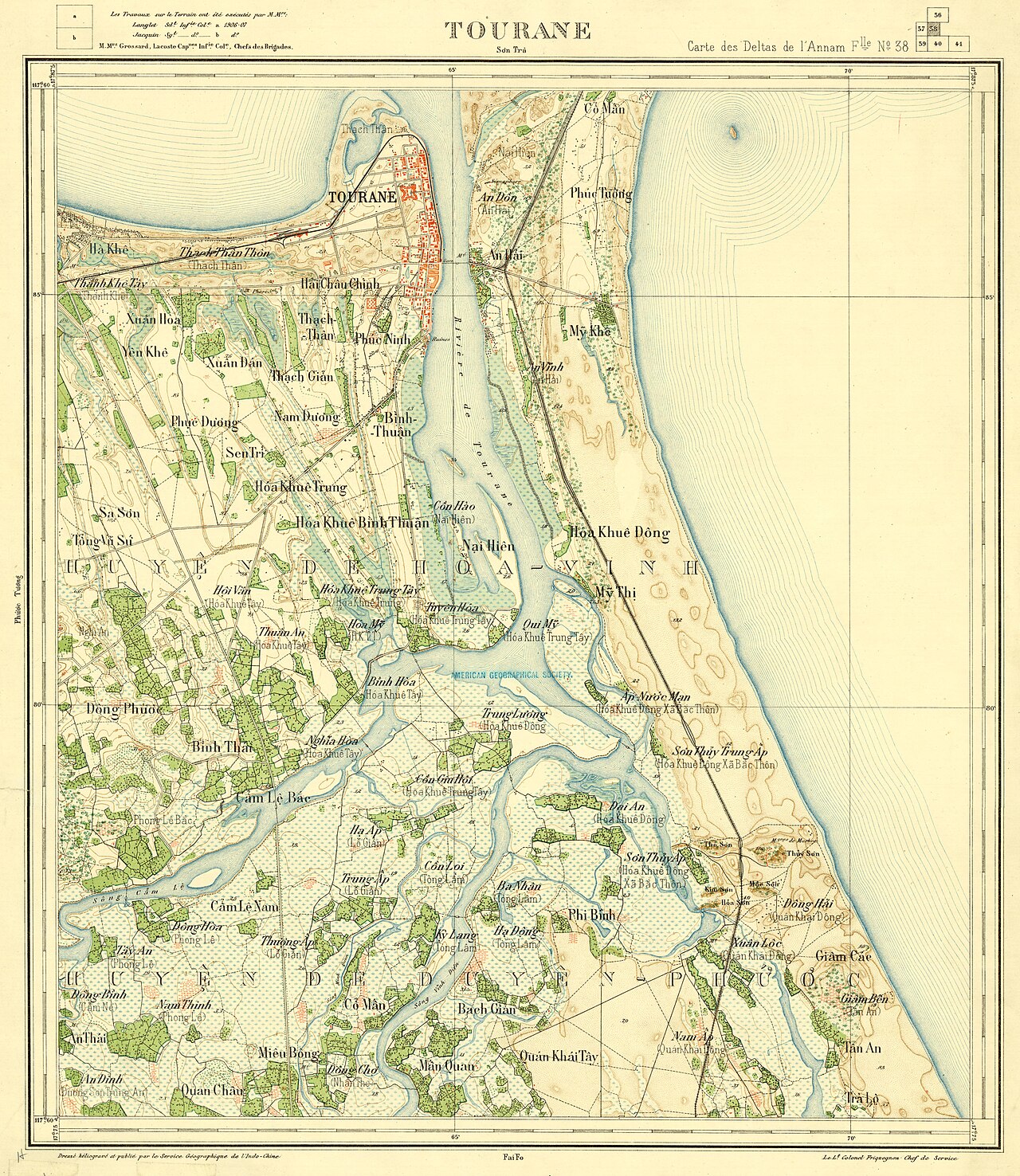
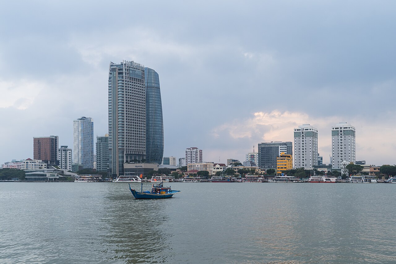
Da Nang sits at roughly the midpoint of Vietnam's coast, where the Han River meets the South China Sea. It is the largest city in central Vietnam and functions as the region's commercial and transport hub. Unlike the historic towns nearby, Da Nang is a working modern city: wide boulevards, a rebuilt waterfront, and a skyline that has changed dramatically since the early 2000s.
Its position makes it a practical base. Hoi An lies about 30 kilometres to the south, Hue roughly 100 kilometres to the north, and My Son Sanctuary is within day-trip range. Travellers often use Da Nang as a staging point for all three, taking advantage of the airport and the city's relative abundance of accommodation options at different price points. The broader province in which the city sits is covered on the Quang Nam page.
My Khe Beach and the Coastline
My Khe is a broad, gently curving stretch of sand running for several kilometres along Da Nang's eastern edge. The beach faces east, so it catches morning light and afternoon sea breezes. The water is generally calm from around February through to August; outside those months, swells increase and currents can be strong.
The beach is lined with hotels, seafood restaurants and rental stalls for sun loungers and water equipment. It is well used by locals as well as visitors, particularly in the early morning and early evening. Lifeguard posts operate during the main season, with flag systems indicating swimming conditions — the flag colours follow standard international conventions.
Further north, Non Nuoc Beach continues the same arc of sand closer to the Marble Mountains. The two beaches are effectively continuous but the areas have different characters: Non Nuoc is quieter and backed by a strip of stone-carving workshops rather than hotels.
Marble Mountains (Ngũ Hành Sơn)
The Marble Mountains are a cluster of five limestone and marble outcrops rising from flat ground about 9 kilometres south of central Da Nang, close to Non Nuoc Beach. Each peak is named after one of the five elements in Vietnamese cosmology: Kim (metal), Moc (wood), Thuy (water), Hoa (fire) and Tho (earth). Thuy Son is the largest and the one with public access via paths and staircases — or a lift, for a separate fee.
Inside and around Thuy Son are several cave pagodas, including Huyen Khong Cave, whose ceiling has a natural opening that lets in a column of light. The caves served as field hospitals and shelters during the American War. Stone carving has been practised in the villages at the base of the mountains for centuries; workshops along the road sell pieces ranging from small souvenirs to full-scale statuary, and it is possible to watch carvers at work.
The site is managed as a ticketed attraction. Wear shoes suitable for uneven stone steps, as sections are steep and can be slippery in wet weather.
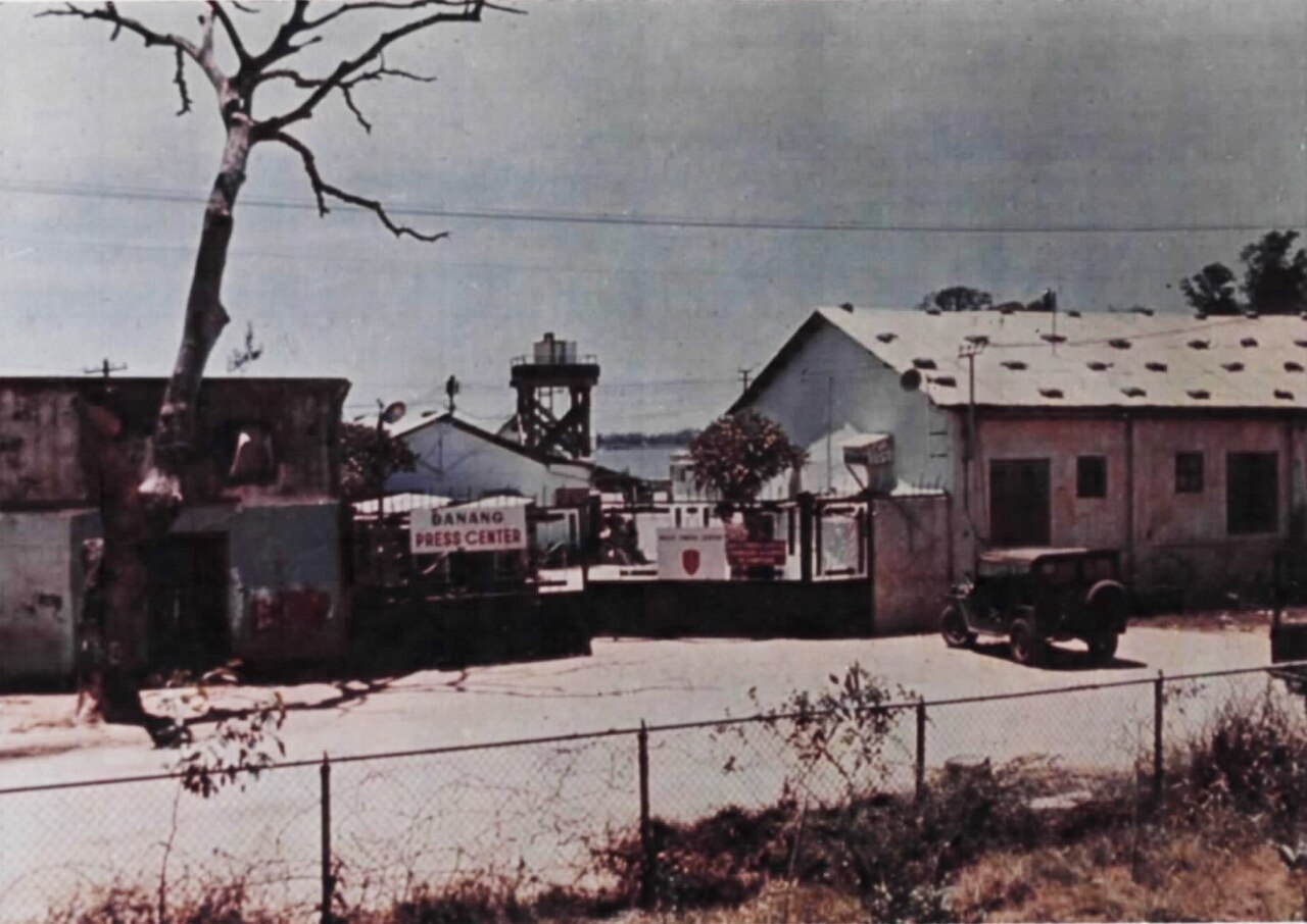
Son Tra Peninsula and the Lady Buddha
Son Tra Peninsula juts into the sea north-east of the city centre, rising to around 700 metres and covered in secondary forest. The peninsula is home to the endangered red-shanked douc langur, a brightly coloured primate; sightings are possible but not guaranteed, and wildlife disturbance is a documented problem caused by visitors and some tour operators.
At the southern tip of the peninsula, visible from much of Da Nang's coastline, stands the Lady Buddha statue (Tượng Phật Quan Thế Âm) at Linh Ung Pagoda. The figure is 67 metres tall and has become one of the city's most recognisable landmarks. The pagoda complex is an active place of worship and draws large numbers of visitors; dress covering shoulders and knees is expected.
The road up Son Tra offers sea views and is popular with cyclists and motorcyclists. A military zone occupies part of the peninsula and access to certain areas is restricted.
Ba Na Hills and the Golden Bridge
Ba Na Hills is a hill-station resort developed on a ridge at around 1,400 metres elevation, about 40 kilometres west of the city. It was originally a French colonial retreat built to escape coastal heat. The site is now operated as a large-scale theme park by the Sun Group conglomerate, reached by a cable car system that holds several length and elevation-change records.
The Golden Bridge (Cầu Vàng), opened in 2018, is the element that brought international attention: a pedestrian walkway held up by two oversized sculpted stone hands, designed to give the impression of being lifted above the cloud line. Whether the overall Ba Na Hills experience justifies the entrance fee — which covers the cable car and most attractions — is a question visitors debate openly. The resort is deliberately theatrical and themed, combining a mock-French village, gardens, amusement rides and a wax museum. It is not a nature experience in the conventional sense.
Cloud cover is frequent at this altitude, and the Golden Bridge itself is often partially obscured — a fact worth accounting for when planning a visit. Prices vary by season.
Dragon Bridge and City Landmarks
The Dragon Bridge (Cầu Rồng) spans the Han River along a route connecting the airport area to the beach. Completed in 2013, it is constructed in the form of a yellow dragon 666 metres long — the dragon is a symbol of the Ly dynasty and of Da Nang's own civic identity. On weekend evenings, the dragon's head breathes fire and water in a timed show that draws large crowds to the riverbanks. The shows run late on Saturday and Sunday nights; specific times are subject to change and worth confirming locally.
Han Market (Chợ Hàn), in the city centre near the river, is a multi-storey covered market selling fresh produce, dry goods, clothing and souvenirs. It is primarily a local market rather than a tourist construction, which means prices are set for local purchasing power — though haggling on non-food items is standard. Nearby, Con Market (Chợ Cồn) is larger, less visited by tourists, and more focused on everyday goods.
The Han River itself is flanked by a promenade popular for evening walks. Several other bridges cross the river; the older Thuan Phuoc suspension bridge carries traffic at the river mouth.
Getting There and Getting Around
Da Nang International Airport sits approximately 3 kilometres from the city centre — close enough that aircraft are visible and audible from parts of the urban beach. It is the third-busiest airport in Vietnam by passenger numbers and receives both domestic flights from Hanoi and Ho Chi Minh City and international routes from elsewhere in Asia. For travellers arriving by air into central Vietnam, it is the standard entry point. See the Vietnam e-visa page for entry requirements.
Within the city, the main options are taxis, ride-hailing apps (Grab operates here), motorbike taxis, and bicycle or motorbike rental. The city is relatively flat and the distances between the beach and the centre are manageable. For day trips to Hoi An, private car hire with a driver is common; the road follows the coast and passes through the Marble Mountains area. The route north to Hue crosses the Hai Van Pass, a mountain spur that descends directly to the sea — a significant weather divide between the climatic zones north and south of it.
Train services connect Da Nang to both Hue and Hoi An's nearest station (Tam Ky, for onward road connection). For SIM card options on arrival, see SIM cards and eSIMs, and for cash and payment, see Money, ATMs and cards.
Climate and When to Visit
Da Nang's climate divides sharply across the year. From roughly February through August, conditions are warm to hot, relatively dry, and well-suited to beach use — temperatures climb through the mid-twenties in February to the low thirties by mid-year, with June producing the highest average highs. This is the period most visitors target.
From September onwards, rainfall increases sharply. October and November are the wettest months by a significant margin, with totals that can bring flooding to low-lying parts of the city and make outdoor sightseeing difficult. December and January remain wet and cooler than the rest of the year. The Hai Van Pass to the north can be closed by low cloud and rain during this period, affecting road access to Hue.
Typhoons occasionally make landfall or pass close to Da Nang between September and November. The impact varies considerably by year. The broader regional pattern is covered on the When to go: weather by region page. Bach Ma National Park, situated on the same climatic divide in the hills above the coastal plain, receives some of the highest rainfall totals in Vietnam during the wet season.
For safety considerations in Da Nang, including common tourist-area scams, see Safety and common scams.
Iklim per bulan
Rata-rata jangka panjang, bukan prakiraan. Periode referensi: 2015–2024. Nguồn: ERA5 reanalysis (Copernicus) via the Open-Meteo archive API.
Show the numbers
| Bulan | Suhu tertinggi °C | Rendah °C | Curah hujan (mm) | Hari hujan | Humidity % |
|---|---|---|---|---|---|
| January | 23.8 | 20.2 | 170 | 20 | 86 |
| February | 24.4 | 20.2 | 78 | 13 | 86 |
| March | 27.1 | 22.5 | 52 | 10 | 87 |
| April | 29.6 | 24.5 | 75 | 8 | 85 |
| May | 31.8 | 26.4 | 73 | 13 | 81 |
| June | 33.6 | 27.3 | 66 | 10 | 76 |
| July | 32.6 | 26.8 | 118 | 16 | 77 |
| August | 33.0 | 26.8 | 116 | 17 | 76 |
| September | 30.7 | 25.7 | 242 | 22 | 83 |
| October | 28.1 | 24.4 | 467 | 26 | 85 |
| November | 26.7 | 23.3 | 346 | 24 | 86 |
| December | 24.3 | 21.4 | 346 | 25 | 85 |
Practical notes
Where it is
Also known as / see also
Di sekitar
Dirujuk oleh
Các nguồn
- ERA5 climate normals — Copernicus / Open-Meteo (CC BY 4.0) đã truy cập 30 August 2026
Supports: monthly temperature and rainfall normals, and elevation - Vietnam National Authority of Tourism — VNAT đã truy cập 29 August 2026
Supports: the rules and definitions on this page - Da Nang — Wikipedia (CC BY-SA 4.0) đã truy cập 30 August 2026
Supports: background - Đà Nẵng — Wikipedia (Vietnamese) (CC BY-SA 4.0) đã truy cập 31 August 2026
Supports: background, Vietnamese edition
Current Terakhir diverifikasi: 31 August 2026. Rules, fares and prices change — check the official source before acting on anything here. Report a mistake.
Picture credits (6)
Da nang, Vietnam 1908, French Indochina. Service géographique, Public domain, Wikimedia Commons · University of Da Nang - Da Nang, Vietnam - DSC02421, Daderot, CC0, Wikimedia Commons · Statue outside Da Nang Cathedral - Da Nang, Vietnam - DSC02465, Daderot, CC0, Wikimedia Commons · Da Nang Cathedral - Da Nang, Vietnam - DSC02464, Daderot, CC0, Wikimedia Commons · Da Nang Press Center, Unknown author Unknown author, Public domain, Wikimedia Commons · Alexkom000, CC BY 4.0, Wikimedia Commons