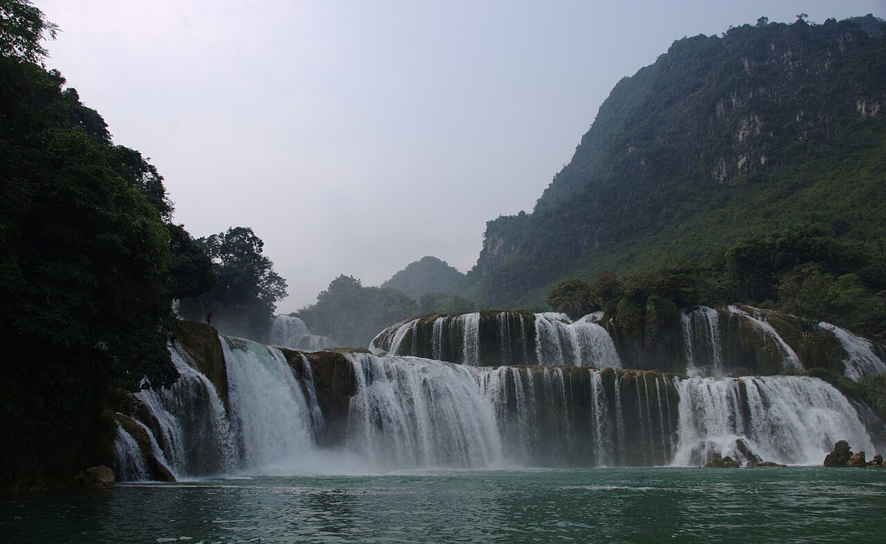
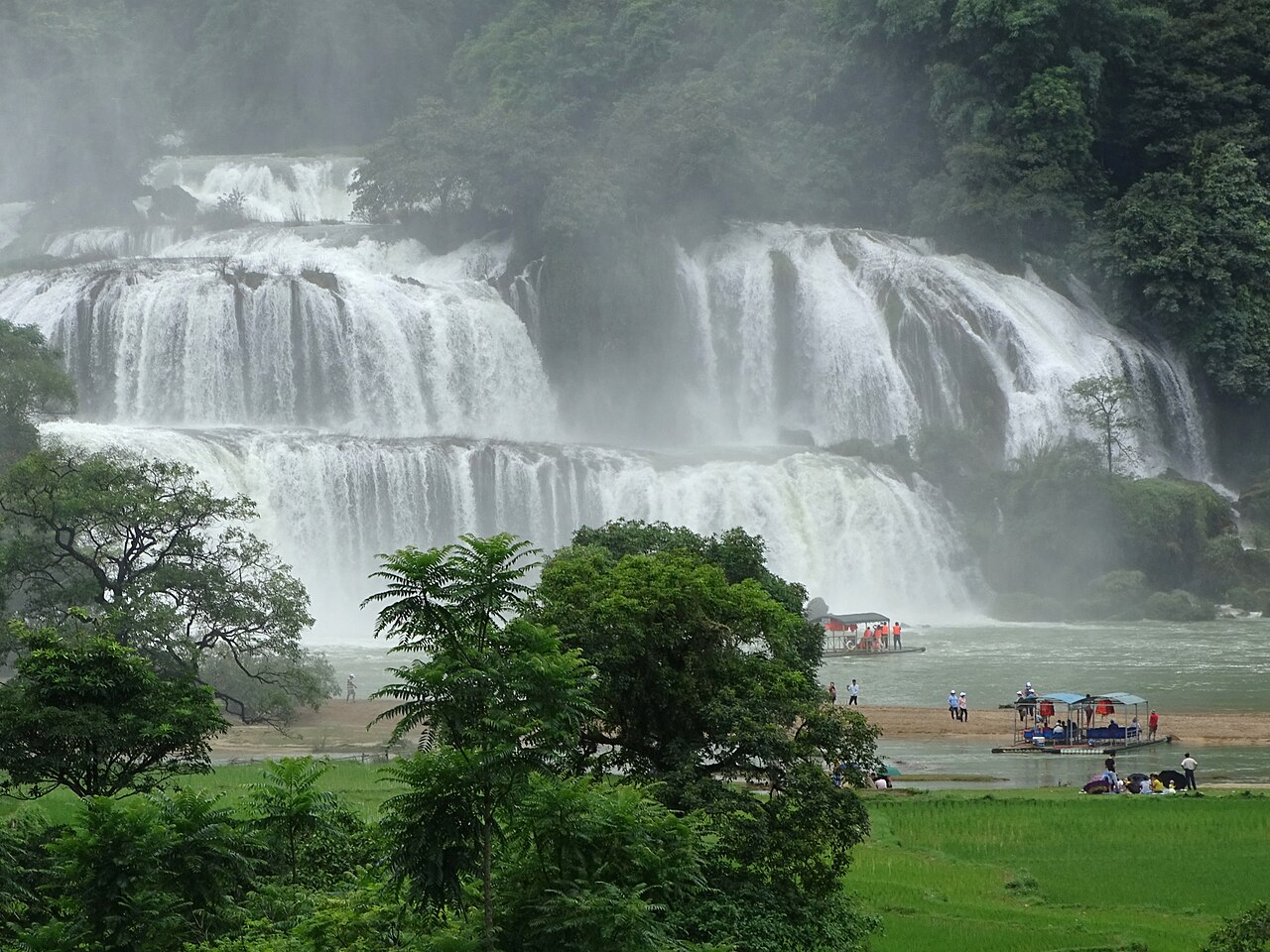
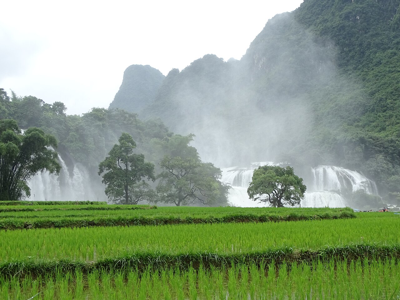
Ban Gioc Waterfall (Thác Bản Giốc) lies in Cao Bang province, roughly 90 kilometres north of Cao Bang city, where the Quay Son River marks the international boundary between Vietnam and China. At full flow it is among the largest waterfalls in Southeast Asia by width, spreading across a series of stepped limestone terraces divided into two principal cascades.
The waterfall and the border
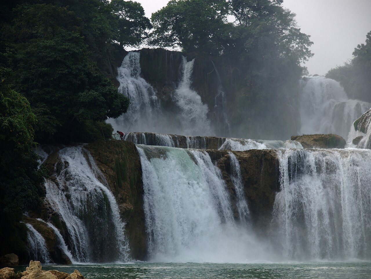
Ban Gioc falls in two distinct sections separated by a rocky island. The larger, western cascade lies partly or wholly on the Chinese side of the border, depending on the precise channel of the Quay Son River; the smaller eastern cascade is unambiguously in Vietnamese territory. The boundary runs through the river, and Chinese tourism infrastructure — including a resort and viewing platforms — is visible on the far bank. Vietnamese and Chinese visitors can be present on the water simultaneously, though on separate craft and under separate jurisdictions.
The division of sovereignty over the main cascade has been a subject of diplomatic discussion and the precise boundary at this point is not something this page will assert definitively. What is clear is that Vietnamese authorities administer access from the Vietnamese bank, and that visitors are on Vietnamese soil throughout a standard visit.
Bamboo rafts and Nguom Ngao cave
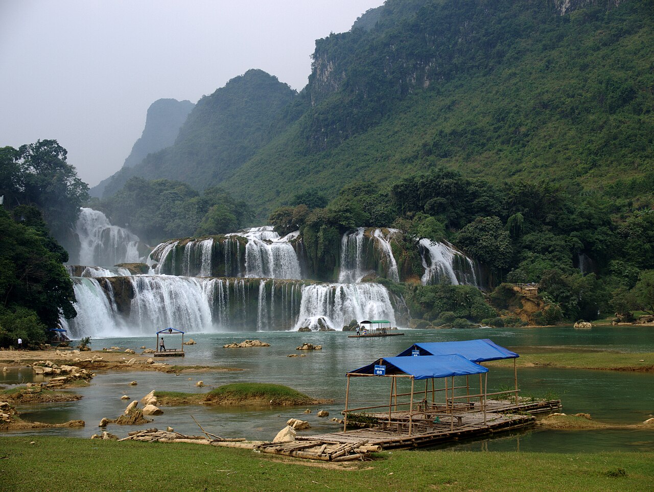
At the base of the Vietnamese cascade, operators run flat bamboo rafts that pole out across the pool toward the falling water. This is the standard way to experience the spray and noise at close range. There is an entry fee for the waterfall area and a separate fee for the raft. Demand is highest on weekends and Vietnamese public holidays, when queues for rafts can be long.
Nguom Ngao cave lies a short distance from the waterfall — roughly three kilometres by road — and is one of the more substantial karst caverns in the northeast. Its chambers extend for several kilometres into the limestone, though only a portion is open to visitors. Stalactite and stalagmite formations are the main draw. There is an entry fee. The cave is cool year-round and noticeably dark beyond the lit sections, so a torch can be useful even on a guided walk.
When to go
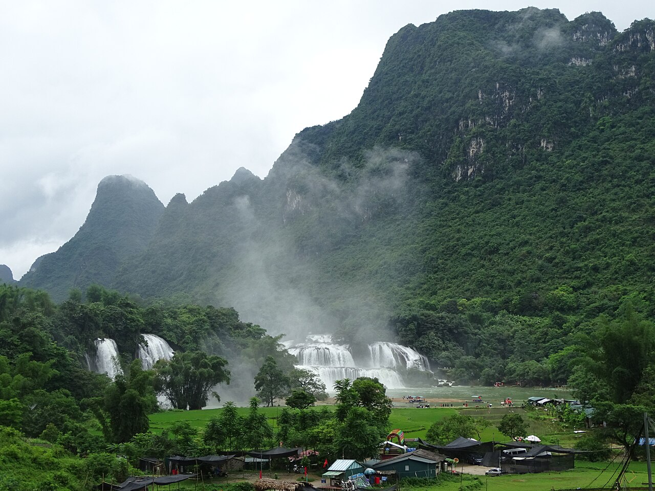
The waterfall's character changes substantially with rainfall. The peak of the rainy season (July and August) brings maximum volume but also brown, silt-heavy water and frequent overcast skies. September and October are generally considered the best months: water levels remain high after the rains, the silt has begun to clear, and sunshine is more reliable, which improves both the colour of the water and photography. By the dry months of January to March the flow is considerably reduced, and the falls lose much of their width and force. The northeast also has a cool, sometimes foggy winter, which can affect visibility and comfort. For a broader picture of regional weather patterns, see When to go: weather by region.
Getting there from Hanoi and Cao Bang
Cao Bang city is the practical base for a visit. It has hotels across several categories, restaurants, ATMs (see Money, ATMs and cards), and SIM card availability (see SIM cards and eSIMs). From Cao Bang, the road to the waterfall runs north through Trung Khanh district; the journey takes roughly two to three hours depending on road conditions and the vehicle.
From Hanoi, the most common approach is by overnight sleeper bus to Cao Bang, or by private vehicle or motorbike over two days. The roads through the northeastern limestone karst are scenic but include significant mountain sections that are narrow and winding. Motorbike riders should be experienced with mountain roads. There is no rail connection to Cao Bang.
The area immediately around the waterfall is a border zone. Vietnamese nationals and foreign visitors alike may encounter identity checks at checkpoints on the approach road. Carry your passport at all times. Foreign visitors do not require a special border-area permit beyond a standard Vietnamese visa or visa exemption, but the situation at specific checkpoints can change, so confirming current requirements locally or with your accommodation in Cao Bang before travelling is prudent.
The Cao Bang loop with Ba Be
Many visitors combine Ban Gioc with Ba Be National Park on a loop that takes in a substantial portion of the northeastern highlands. The two destinations are connected by mountain roads through minority-inhabited valleys, and the loop is typically done over four to six days from Hanoi, either by motorbike or in a hired vehicle. The route passes through varied landscape: limestone karst around Cao Bang, forested hills toward Ba Be, and river systems throughout.
Ha Giang to the west and Lang Son to the southeast are other northeastern destinations that some travellers combine into a longer itinerary, though each adds meaningful road time. Thai Nguyen lies on the main road corridor between Hanoi and the northeast and is a common overnight stop.
Visas, border proximity and practical notes
Standard Vietnamese entry documents apply. Vietnam's e-visa system covers most nationalities; see Vietnam e-visa for current details, noting that visa policy can change by government decree and the official Vietnamese immigration authority is the authoritative source. The proximity of the border with China does not grant any right of crossing: Ban Gioc is a domestic tourism destination, not an international crossing point. There is no formal border crossing for travellers here.
The area around the falls is popular with Vietnamese domestic tourists and, increasingly, Chinese visitors arriving on their own side. Weekends and public holidays on both sides of the border can make the site noticeably crowded. For general guidance on safety and avoiding scams in Vietnam, see Safety and common scams.
月別気候
長期平均値であり、予報ではありません。 参照期間: 2015–2024. 出典: ERA5 reanalysis (Copernicus) via the Open-Meteo archive API.
Show the numbers
| 月 | 最高気温 °C | 最低気温 °C | 降水量(mm) | 雨天日数 | Humidity % |
|---|---|---|---|---|---|
| January | 17.2 | 10.4 | 93 | 14 | 80 |
| February | 18.7 | 11.6 | 79 | 12 | 80 |
| March | 22.7 | 15.8 | 95 | 17 | 84 |
| April | 26.3 | 18.6 | 123 | 16 | 82 |
| May | 28.7 | 21.6 | 276 | 22 | 84 |
| June | 30.2 | 23.6 | 316 | 25 | 87 |
| July | 30.5 | 23.7 | 256 | 24 | 86 |
| August | 30.2 | 23.4 | 304 | 26 | 88 |
| September | 29.0 | 22.2 | 220 | 19 | 85 |
| October | 25.7 | 18.5 | 124 | 12 | 78 |
| November | 22.8 | 15.3 | 70 | 12 | 80 |
| December | 17.8 | 10.3 | 54 | 9 | 75 |
Practical notes
Where it is
Also known as / see also
近隣
参照元
出典
- ERA5 climate normals — Copernicus / Open-Meteo (CC BY 4.0) アクセス日 30 August 2026
Supports: monthly temperature and rainfall normals, and elevation - Ban Gioc–Detian Falls — Wikipedia (CC BY-SA 4.0) アクセス日 29 August 2026
Supports: carried over from the first build - Thác Bản Giốc — Wikipedia (Vietnamese) (CC BY-SA 4.0) アクセス日 29 August 2026
Supports: carried over from the first build
Current 最終確認: 29 August 2026. Rules, fares and prices change — check the official source before acting on anything here. Report a mistake.
Picture credits (6)
Ban Gioc waterfalls 0, Applejuice, CC BY-SA 4.0, Wikimedia Commons · Ban Gioc waterfalls 1, Applejuice, CC BY-SA 4.0, Wikimedia Commons · Ban Gioc waterfalls 2, Applejuice, CC BY-SA 4.0, Wikimedia Commons · Ban Gioc Waterfall - Trung Kanh District - Cao Bang Province - Vietnam - 01 (48119813303), Adam Jones from Kelowna, BC, Canada, CC BY-SA 2.0, Wikimedia Commons · Ban Gioc Waterfall - Trung Kanh District - Cao Bang Province - Vietnam - 02 (48119872597), Adam Jones from Kelowna, BC, Canada, CC BY-SA 2.0, Wikimedia Commons · Ban Gioc Waterfall - Trung Kanh District - Cao Bang Province - Vietnam - 03 (48119829898), Adam Jones from Kelowna, BC, Canada, CC BY-SA 2.0, Wikimedia Commons