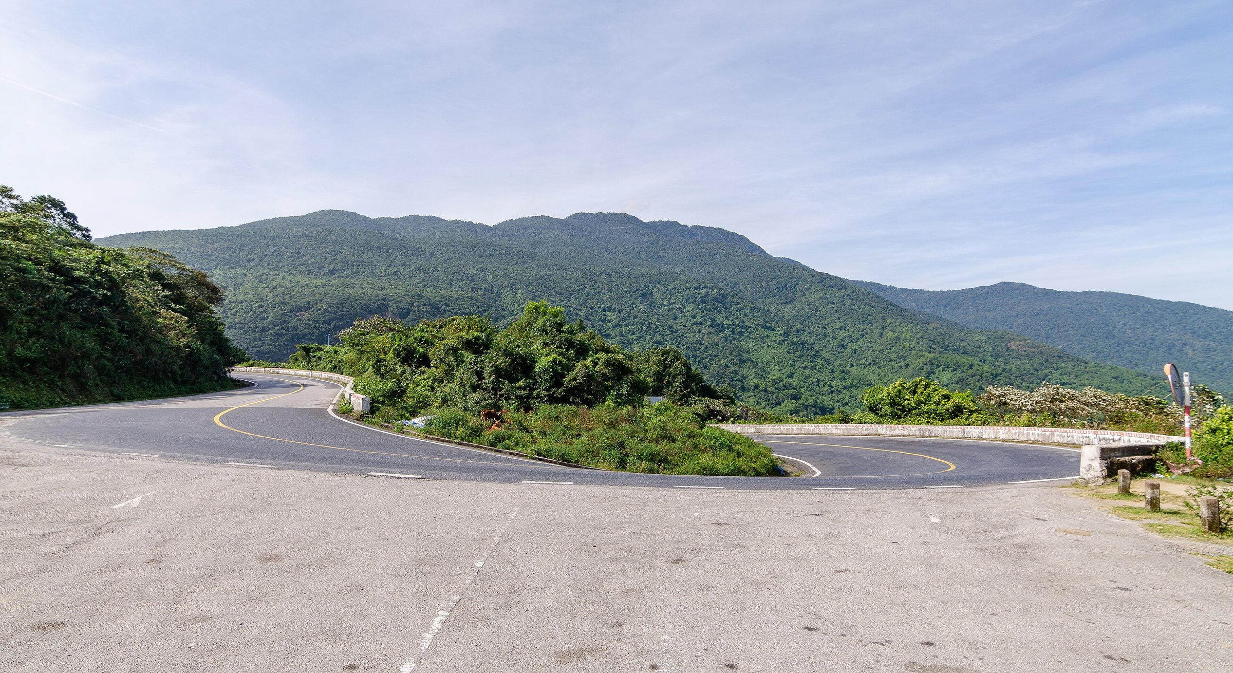
Hue to Da Nang
How to get there
100 kmThe one journey worth taking slowly: the train and the pass road both cross Hai Van, and the tunnel underneath saves time but sees nothing.
| Option | Typical time | How often | What it is like | Best for | 票价 |
|---|---|---|---|---|---|
| Train Train over the Hai Van pass | 2.5–3 hours | Several daily | Seat; sit on the sea side | The best three hours of railway in Vietnam | not verified |
| Motorbike Motorbike over the pass | 3–4 hours | On demand | Exposed; the pass is the attraction | Riders; transfer services will move your luggage | not verified |
| Car Private car through the tunnel | 1.5–2 hours | On demand | Door to door | Speed, or bad weather on the pass | not verified |
Times are typical door-to-door ranges, not a timetable, and they move with traffic, weather and season. A fare is shown only where we have checked it against a published source on the date given; everywhere else it says so rather than guessing. Confirm both with the operator before you book.
Options last reviewed: 2026-09-03
The journey in context
The 100-kilometre route between Hue and Da Nang is defined by one geographical feature: the Hai Van Pass (Đèo Hải Vân), a spur of the Trường Sơn range that meets the South China Sea and forces every traveller to choose — over it or under it. The tunnel opened in 2005 and cut road travel time sharply, but it also removed the landscape from the equation entirely. The train and the pass road remain the two routes that engage with what is actually there.
This is also a climatic boundary. The pass separates central Vietnam's weather systems: Hue's grey, rain-heavy winters from the drier conditions that typically prevail further south around Da Nang. Weather on the pass itself — cloud, rain, wind — is an independent variable that affects the motorbike option significantly and the train not at all.
Train: the coastal crossing
The Reunification Express and several regional services run between Hue station and Da Nang station, taking roughly two and a half to three hours. The section approaching and crossing the pass — from just north of Lang Co Lagoon to the southern descent above Da Nang Bay — is widely regarded as the most scenic stretch of railway in the country. The track runs along a narrow coastal shelf, sometimes tunnelling through the headland, with open sea to one side and steep forested slopes to the other.
Seating is on the east (sea) side when travelling south; this matters in the middle section of the journey. Hard seat, soft seat and sleeper-class berths all appear on longer trains passing through; on shorter regional runs the choice is narrower. Booking is through Vietnam Railways — the national operator's own ticketing, third-party agents, or hotel desks. Seats on popular morning departures sell out days ahead during holidays and peak travel months (July–August, Tết, and the April–May bridge holidays). The stations at both ends are central: Hue station is walkable from the old city, and Da Nang station sits close to the city centre, making onward transfer straightforward.
Motorbike: the pass road
The old Highway 1 alignment climbs to 496 metres over the Hai Van Pass before descending toward Da Nang. The road is in reasonable condition; the gradients are manageable on a standard semi-automatic or manual motorbike. The full run from central Hue to central Da Nang, including time on the pass, takes three to four hours at an unhurried pace.
Most people doing this without their own vehicle use a transfer service: an operator takes luggage directly to the destination hotel by car or van while the traveller rides a hired motorbike over the pass. This avoids managing bags on a mountain road. Hire shops in Hue can arrange the combination, and some operators run group transfers on this basis. The pass itself has a Cham-era gate structure at the summit — the Hải Vân Quan — and several look-out points that see heavy visitor traffic during clear weather.
The key variable is conditions. The pass collects cloud and rain independently of what is happening at sea level in either city. It can be clear and dry in Hue and heavily overcast on the summit. Checking conditions before departure is practical; reversing course once on the road is possible but the pass is exposed throughout.
Private car: the tunnel route
The Hai Van Tunnel carries national highway traffic under the pass, reducing the road distance and cutting journey time to around one and a half to two hours door to door. Private cars and minivans arranged through hotels, guesthouses or booking agencies follow this route by default, unless a scenic detour is specifically requested.
The tunnel route is the standard choice when weather on the pass is poor, when travellers have a time-sensitive connection at the far end (Da Nang International Airport is a common example), or when comfort and luggage logistics are the priority. Open-tour buses and shared shuttles also use the tunnel. Pick-up and drop-off arrangements vary by operator: some run fixed hotel circuits, others offer point-to-point service. Confirming the exact pick-up location and whether the service goes to the airport or city centre matters more on this route than on the train, where the station is a fixed point.
Seasonal and practical notes
October and November bring the heaviest rain to central Vietnam, affecting Hue more severely than Da Nang. During this period the pass road can be slick and visibility poor; the train is unaffected. Conversely, July and August bring high temperatures and dry conditions that make the train ride across the pass particularly clear. Prices vary by season on all modes.
Booking lead time differs by mode. Train seats on popular services should be secured at least several days ahead during school holidays and public holiday periods. Private car and transfer services are generally available with shorter notice but may be harder to arrange on the day of Tết itself. Open-tour bus seats between the two cities are available through most traveller-oriented guesthouses in both cities, though these services are slower because of intermediate stops.
Travellers splitting the journey for the Lang Co or Bach Ma area have the option of a train stop at Lang Co station, which sits on the lagoon north of the pass. This is a minor station and not all services stop there; checking the specific service timetable is necessary.
Choosing between the options
The structured comparison of durations, frequencies and booking channels appears in the table above. In plain terms: the train suits travellers who want the landscape without physical exposure to weather or road conditions, and who are comfortable booking a fixed seat in advance. The motorbike pass road suits those who want direct engagement with the terrain and are willing to manage weather risk; it also works well as a one-way transfer with luggage sent separately. The tunnel by private car suits anyone prioritising speed, door-to-door convenience, or travelling when the pass is not viable.
There is no fourth option that combines pass scenery with tunnel speed; the geography does not allow it. The Hai Van rail crossing and the pass road are separate routes to the same destination, and the tunnel bypass is a third. Each resolves the journey differently.
Connects
被以下页面引用
来源
- Ministry of Transport — Ministry of Transport of Vietnam 访问于 29 August 2026
Supports: the rules and definitions on this page - Vietnam National Authority of Tourism — VNAT 访问于 29 August 2026
Supports: the rules and definitions on this page
Ageing 最后核实: 3 September 2026. Rules, fares and prices change — check the official source before acting on anything here. Report a mistake.
Picture credits (1)
Lăng Cô, Hải Vân Pass, 2020-01 CN-01, Steffen Schmitz, CC BY-SA 4.0, Wikimedia Commons