Hai Van PassĐèo Hải Vân
Hai Van Pass (Đèo Hải Vân, meaning 'Ocean Cloud Pass') separates the climates of central and southern Vietnam at a ridge roughly 500 metres above sea level. For centuries it marked a significant cultural and geographical boundary. Today it sits between Da Nang to the south and Hue to the north, with a parallel tunnel, a coastal railway and the mountain road itself each offering a different experience of the crossing.
Typical journey times
| Journey | Typical time | How often | Notes |
|---|---|---|---|
| Motorbike Da Nang → Hue | 3 – 4 hours | On demand | Over the pass, allowing for stopping at the top. |
| Car Da Nang → Hue | 1h 30m – 2 hours | On demand | Through the Hai Van tunnel, which motorbikes may not use. |
| Train Da Nang → Hue | 2h 30m – 3 hours | Several daily | The railway hugs the coast below the pass road. |
Typical door-to-door ranges, not a timetable. Road times move with traffic and weather, and sea crossings are cancelled outright in rough conditions — confirm with the operator on the day. Last reviewed: 2026-09-10.
The Pass Road
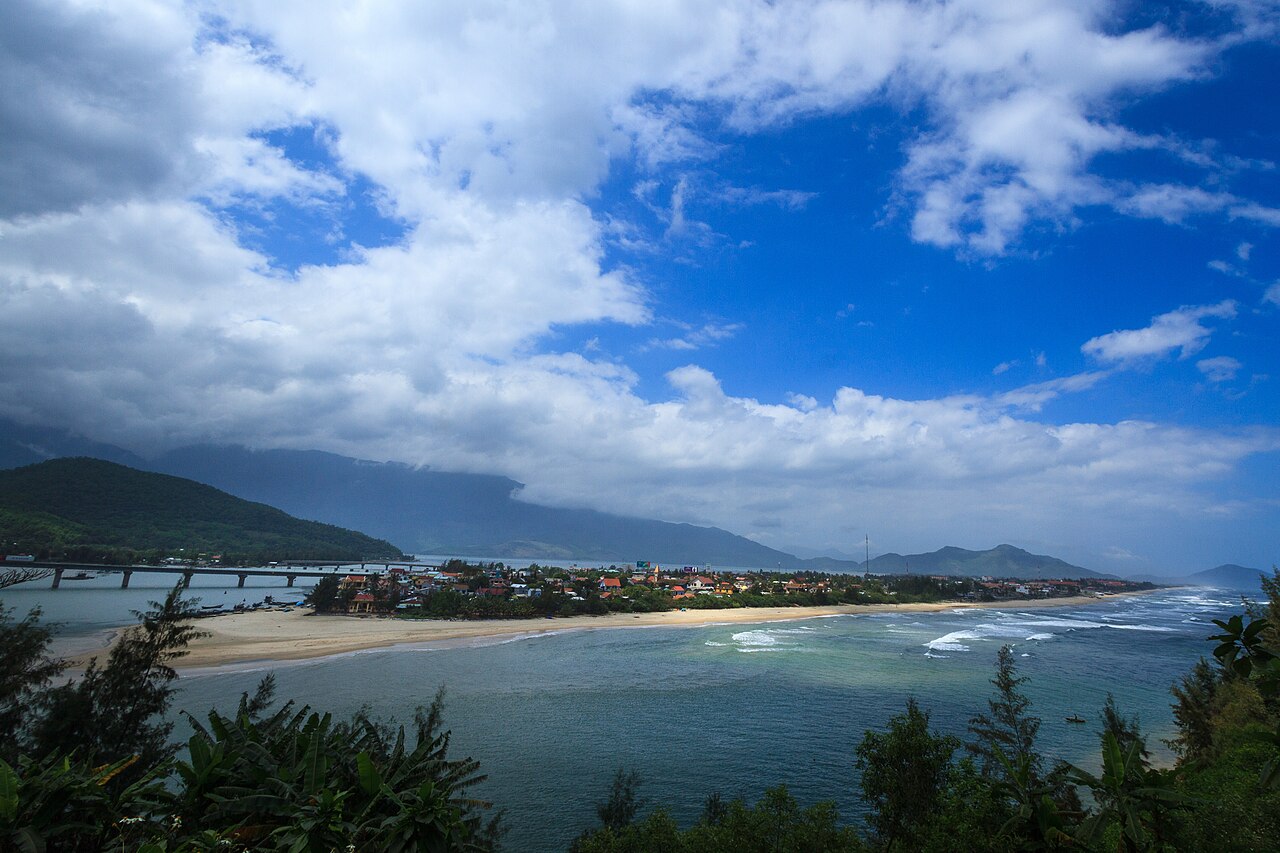
The pass road runs for 21 kilometres along the seaward face of the Truong Son range. The surface is sealed and carries a mixture of motorcycles, private cars and tourist vehicles. The road is narrow in places and includes tight hairpin bends, particularly near the summit. Gradients are manageable for most motorcycles but demand care in wet conditions. Overtaking opportunities are limited.
At the summit there is a cluster of structures: French-era fortifications and, more prominently, bunkers and gun emplacements from the American War period, still largely intact. The site is not a formal museum; access and any associated fees are a matter that visitors should verify locally, as the situation is not fully settled in available sources.
The Tunnel Alternative
The Hai Van Tunnel, opened in 2005, runs beneath the pass and cuts the road distance between Da Nang and Hue substantially compared with the mountain route. There is a toll for vehicles using the tunnel. Motorcycles are prohibited from using the tunnel; riders must take the pass road or arrange a transfer service (see below). The tunnel is the standard route for buses, trucks and most private cars.
For travellers whose primary interest is reaching the destination rather than the journey itself, the tunnel is the practical choice. The pass road adds considerable time and is not suited to poor weather or inexperienced riders.
Riding and Driving the Pass
Because motorcycles cannot use the tunnel, riders face a clear choice: ride the pass themselves or use a transfer service that loads the motorcycle onto a vehicle for the tunnel crossing while the rider travels separately. Several operators based in both Da Nang and Hue offer this service; it is worth confirming availability and logistics before committing to a schedule.
Riders who do cross the pass should account for the road's condition, traffic from commercial vehicles using the mountain route, and the time of day. Early morning crossings in dry weather are generally considered the most straightforward. The descent on the Da Nang side is steep and the road surface can be affected by runoff after rain.
Private cars and hired vehicles can use either route. Some drivers of tourist vehicles prefer the pass for clients specifically wanting the scenic crossing, but will typically use the tunnel otherwise.
Weather and Fog
The pass sits at a climatic boundary. The southern side around Da Nang tends toward a drier pattern, while the northern side toward Hue receives considerably more rainfall, particularly between September and February. The summit itself generates its own weather: cloud and fog are common and can descend quickly, reducing visibility to a few metres even when conditions at sea level appear clear.
Fog is not merely atmospheric inconvenience; it is a genuine hazard on a narrow road without barriers in many sections. Travelling in fog substantially increases risk. There is no reliable real-time information service for pass conditions available through this site; local knowledge and current reports from guesthouses or other travellers are the practical resource.
The Coastal Train
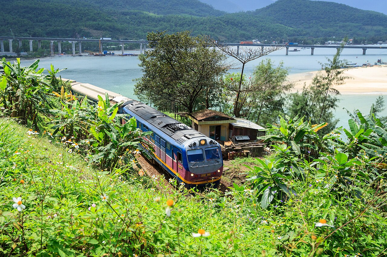
The main north–south railway line between Da Nang and Hue skirts the base of the pass along the coast, passing through a series of tunnels and across headlands. The section between Lang Co lagoon and Da Nang is widely regarded as one of the more scenic railway stretches in Vietnam. The train does not stop at the pass itself. The journey between Da Nang and Hue by rail takes roughly two to three hours depending on service; the fare depends on class and train type.
For travellers not specifically interested in the road crossing, the train provides a view of the coastal landscape without the demands of the mountain road.
Practicalities
Whether a written permit or any formal registration is required to ride the pass is a question that has not been fully resolved in current sources; this page does not assert either way, and riders should verify the current position before departure.
Fuel is available in both Da Nang and Lang Co (at the northern foot of the pass) but not at the summit. Mechanical assistance on the road itself is limited. The pass is not lit at night and is not recommended for night riding.
The transfer services for motorcycles between Da Nang and Hue are operated commercially and prices vary; no specific fare is listed here. Travellers arranging a transfer should clarify whether the fee covers the motorcycle only or includes passenger transport through the tunnel as well.
Also known as / see also
対象エリア
参照元
出典
- Ministry of Transport — Ministry of Transport of Vietnam アクセス日 29 August 2026
Supports: carried over from the first build - Vietnam National Authority of Tourism — VNAT アクセス日 29 August 2026
Supports: carried over from the first build - Hải Vân Pass — Wikipedia (CC BY-SA 4.0) アクセス日 29 August 2026
Supports: carried over from the first build
Current 最終確認: 29 August 2026. Rules, fares and prices change — check the official source before acting on anything here. Report a mistake.
Picture credits (3)
Hai Van Pass-4 (28808672428), rhjpage, CC BY 2.0, Wikimedia Commons · Hai Van Pass-5 (28808671738), rhjpage, CC BY 2.0, Wikimedia Commons · Hai Van Pass-6 (28808671188), rhjpage, CC BY 2.0, Wikimedia Commons