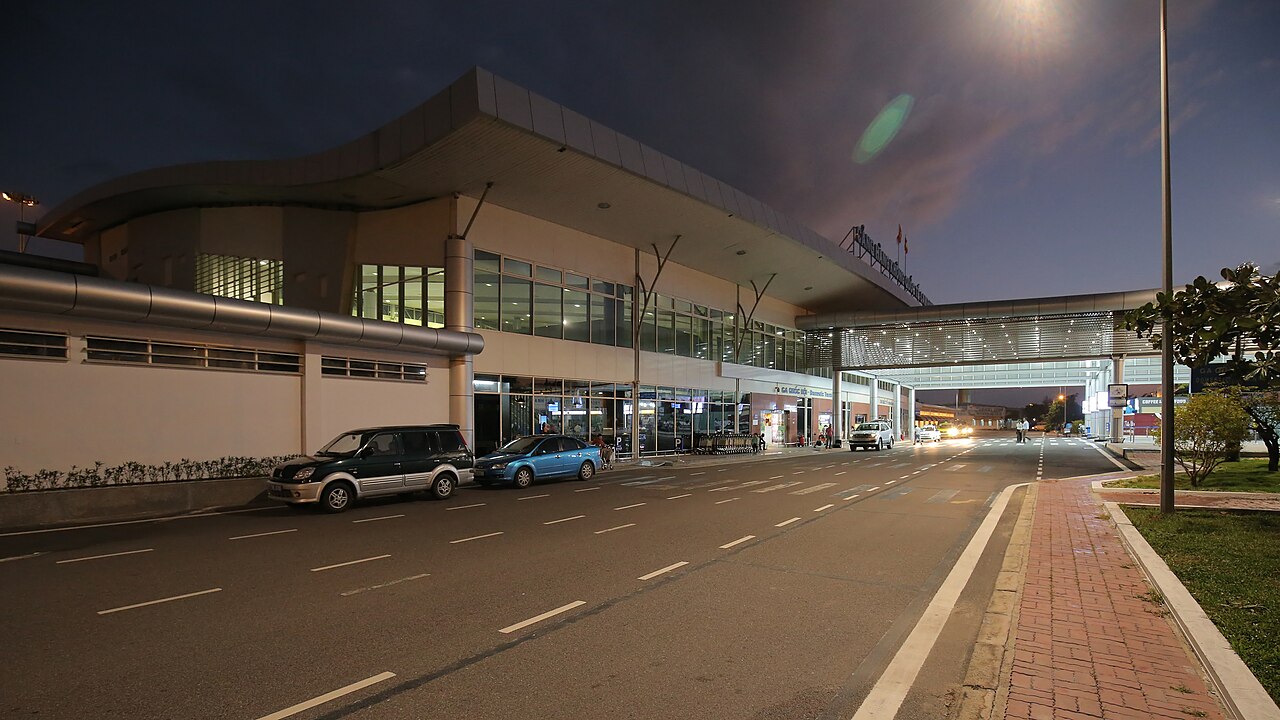
Cam Ranh International Airport (CXR)Sân bay Cam Ranh
Cam Ranh International Airport (CXR) is the principal air gateway for Nha Trang and the wider province of Khanh Hoa. It sits on the Cam Ranh Peninsula, roughly 35 km south of Nha Trang city centre, separated from it by a stretch of coastal highway that passes lagoons and beach resorts.
Typical journey times
| Journey | Typical time | How often | Notes |
|---|---|---|---|
| Car Cam Ranh → Nha Trang | 40 – 50 min | On demand | 35 km along the coast road. |
Typical door-to-door ranges, not a timetable. Road times move with traffic and weather, and sea crossings are cancelled outright in rough conditions — confirm with the operator on the day. Last reviewed: 2026-09-10.
Role and traffic
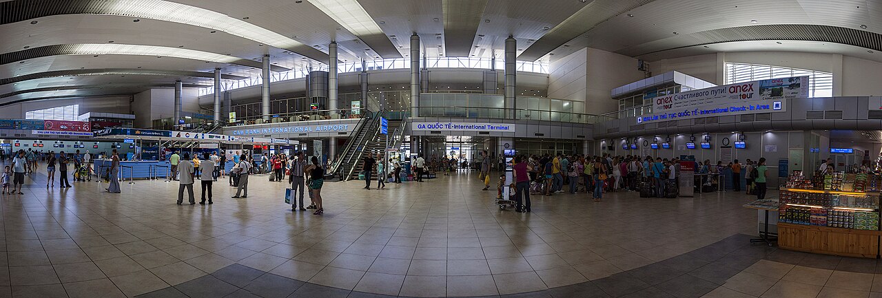
CXR handles both scheduled domestic services and a significant volume of international charter flights, the latter driven largely by resort tourism along the Khanh Hoa coastline. Charter traffic — particularly from Russia, China, South Korea and parts of Europe — has at various times accounted for a substantial share of movements, making the airport's passenger numbers sensitive to shifts in package-holiday demand and bilateral air agreements. Scheduled international routes connect the airport to several regional hubs, while domestic routes link it to Hanoi, Ho Chi Minh City and a number of secondary Vietnamese cities. The balance between charter and scheduled traffic changes with seasons and commercial negotiations, so the current route map is best confirmed through airlines or the airport directly.
The road from airport to Nha Trang
The 35 km journey between the terminal and central Nha Trang follows a coastal road — in large part the route designated as Highway 1 and its coastal variant — that skirts the bay and passes a succession of beach resorts, lagoon inlets and low hills. The scenery is one reason the transfer takes longer than the raw distance might suggest; the road is also shared with freight vehicles and local traffic. Under normal conditions the journey takes roughly 45 minutes to an hour, though this can extend during busy periods or when resort areas generate additional congestion.
Getting to and from the city
Several options exist for the airport–Nha Trang transfer.
- Airport bus: A shuttle bus service operates between the terminal and a stop in central Nha Trang. The fare depends on operator and season; tickets are sold at the terminal. Journey time varies with traffic and intermediate stops.
- Taxi and ride-hailing: Metered taxis from reputable companies queue at the arrivals exit. Ride-hailing applications also operate here, though pick-up arrangements at the kerb can be subject to airport regulations that change periodically. Agree on metered fare or confirm the app price before departure.
- Hotel and resort transfers: Many properties along the coast arrange private transfers, which can be booked in advance. This is common for resorts that lie between the airport and the city, shortening the journey considerably.
There is no rail connection to the airport. The nearest mainline railway station is in Nha Trang city.
Onward to Ninh Van Bay and Doc Let
Two destinations north of the airport require additional planning beyond the standard Nha Trang transfer.
- Ninh Van Bay: This bay, accessible only by boat, is home to a small number of high-end resort properties. Guests typically travel from the airport to a private jetty — arrangements are made through the resort concerned — and then cross by speedboat. The transfer involves both road and water legs, and timing depends on tides and resort schedules.
- Doc Let Beach: Located on a peninsula further north of Nha Trang in Khanh Hoa, Doc Let is reached by road. From the airport, the route passes through or around Nha Trang; some resort operators offer direct transfers. Public transport options are limited, and most visitors use private car hire or pre-arranged resort shuttles.
Whether to travel via Nha Trang city or take a more direct coastal route to these northern destinations depends on accommodation and available transfer services at the time of travel.
Facilities and practical notes
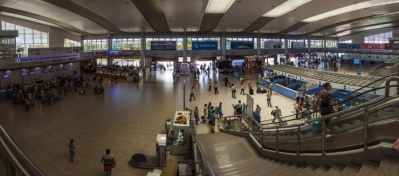
The terminal building has been expanded in phases to accommodate growing passenger numbers. International and domestic arrivals and departures are handled in the same complex, with the usual range of check-in counters, immigration and customs facilities. Currency exchange and ATMs are available in the arrivals hall, though rates and availability at exchange counters can vary. The airport has a cafe and retail area, though the range is modest compared with larger Vietnamese airports. Whether a dedicated international pier or additional terminal capacity is planned or under construction is a question that should be verified with current sources, as infrastructure works in the region have proceeded in stages.
When traffic is heaviest
The airport is busiest during the peak tourism season for Khanh Hoa, broadly from late January through to early September, when the coast benefits from dry and sunny conditions. The Tết lunar new year period — falling in late January or February — and the summer school-holiday months generate the highest domestic passenger volumes. International charter traffic follows different rhythms tied to the source markets; Russian and Chinese tourist seasons have historically peaked at different times of year. Travellers whose plans are sensitive to crowding at the terminal or on the coastal road may find shoulder periods — roughly October and the weeks immediately after Tết — somewhat quieter, though the weather in those months brings greater variability.
Also known as / see also
सेवा देता है
संदर्भित
स्रोत
- Airports Corporation of Vietnam — ACV accessed 29 August 2026
Supports: carried over from the first build - Vietnam National Authority of Tourism — VNAT accessed 29 August 2026
Supports: carried over from the first build
Ageing अंतिम सत्यापन: 29 August 2026. Rules, fares and prices change — check the official source before acting on anything here. Report a mistake.
Picture credits (3)
Sân bay quốc tế Cam Ranh, [Tycho] talk , http://shansov.net, CC BY-SA 3.0, Wikimedia Commons · Cam-Ranh-International-Airport, Castelfranco, CC BY-SA 4.0, Wikimedia Commons · Cam-Ranh-International-Airport inside, Castelfranco, CC BY-SA 4.0, Wikimedia Commons