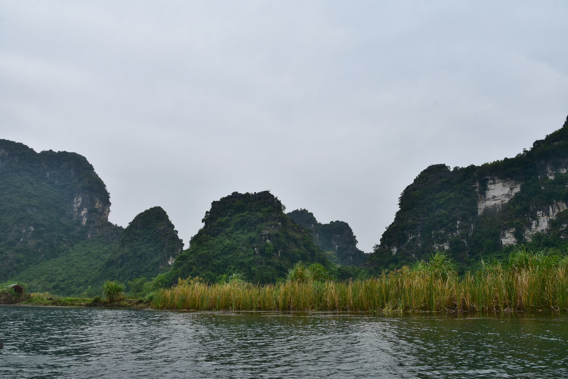
Trang AnTràng An
What Trang An is
Trang An (Tràng An) is a complex of flooded karst valleys in Ninh Binh, listed as a UNESCO Mixed Cultural and Natural World Heritage Site in 2014 — one of very few sites worldwide to hold both designations simultaneously. The listing covers roughly 6,200 hectares of limestone towers, seasonal wetlands, primary forest and archaeological sites. Excavations at cave shelters within the complex have produced evidence of human habitation stretching back at least 30,000 years, making it significant to prehistorians as well as to those interested in Vietnamese religious history. The landscape is administered as a special-use forest and scenic zone, with boat routes managed through a central ticketing system at the main wharf.
The three boat routes
Three numbered routes depart from the main embarkation point. All are covered by the same entrance ticket, and visitors choose one route per ticket; returning to take a second or third route requires purchasing again.
- Route 1 (Tràng An – Bái Đính): The longest circuit, typically taking around three hours on the water. It passes through the greatest number of caves — generally cited as nine — and ends near the approach road to Bái Đính Pagoda. The caves on this route include Tối Cave, Sáng Cave and Sinh Dược Cave, among others. The route follows narrow gorges where the rock walls close in overhead before opening into broad lake-like valleys.
- Route 2 (Tràng An – Đầm Trường): A mid-length circuit of roughly two hours. It covers fewer caves but moves through wider, more open valleys and is considered calmer water for those prone to motion sickness in enclosed spaces.
- Route 3 (Tràng An – Hang Nấu Cơm): The shortest option, approximately ninety minutes. It suits visitors with limited time and passes Hang Nấu Cơm, a cave named for its use as a field kitchen during wartime.
Conditions vary by season: water levels are higher in the wet season (roughly May to October), which can make cave ceilings feel very low but also opens some channels that are not navigable in the dry season.
The caves
The caves at Trang An are solution caves formed by water dissolving the Triassic limestone over millions of years. Unlike show caves with electric lighting, they are unlit and passed through at water level — the boat enters a dark tunnel, sometimes only a metre or so above the waterline, and emerges into the next valley. Rowers use poles and paddles to navigate the low sections.
Named caves encountered across the three routes include Hang Tối (Dark Cave), the longest and most claustrophobic; Hang Sáng (Bright Cave), which receives natural light through openings in the vault; Hang Sinh Dược; Hang Khống; Hang Nấu Cơm; and Hang Ba Giọt, notable for three steady drips from stalactites that give it its name. The total number of distinct caves a visitor passes through depends on the route chosen and water conditions on the day.
Temples and cultural sites on the water
Several temples and shrines are built into the rock faces or on small promontories along the routes, reflecting centuries of Vietnamese religious use of the landscape. The most prominent stopping point on Route 1 is Đền Trần, a temple associated with the Trần dynasty (1225–1400), where boats moor briefly and passengers can walk up stone steps to make offerings or look out across the valleys. Đền Tin and Đền Thái Vi are also accessible along various routes, the latter being a significant historical site where Trần kings are said to have held councils during the Mongol invasions of the thirteenth century. The blending of natural and sacred heritage was central to UNESCO's mixed designation.
Rowers and tipping
Each sampan is propelled by a single local rower, often a woman, who uses both oars and, through the lower cave passages, her feet — lying back and pushing against the rock overhead to move the boat. The rowing is physically demanding over a full three-hour circuit. Tipping is not included in the ticket price and is widely expected; the amount is at the visitor's discretion. Rowers do not generally speak English, and interaction during the trip is limited. Boats carry a maximum of four adults. Waiting times at the embarkation point can be long on weekends and public holidays, particularly between late September and November when domestic tourism peaks.
Trang An compared with Tam Coc
Trang An and Tam Coc are often mentioned together and are geographically close, but they differ in character. Tam Coc's boat route runs along the Ngô Đồng River through paddy fields — the surrounding landscape is agricultural rather than forested, and the famous view is of rice growing around and between the karst towers. Trang An is a closed, enclosed system of valley lakes and caves with no farmland visible; the scenery is wilder and the cave count higher.
Trang An's ticket system is more structured, with fixed routes and departure points, whereas Tam Coc's experience has historically been more informal. Trang An receives somewhat fewer visitors than Tam Coc's central river route, though both can be crowded in peak periods. The UNESCO listing applies to Trang An's complex; Tam Coc is included within the broader Tràng An Landscape Complex designation. Visitors with time for only one experience often find that their preference depends on whether they prioritise cave exploration or open river scenery with rice fields.
Where it is
Also known as / see also
Упоминается на страницах
Источники
- Vietnam National Authority of Tourism — VNAT просмотрено 29 August 2026
Supports: the rules and definitions on this page - Tràng An — Wikipedia (Vietnamese) (CC BY-SA 4.0) просмотрено 3 September 2026
Supports: background, Vietnamese edition
Current Последняя проверка: 3 September 2026. Rules, fares and prices change — check the official source before acting on anything here. Report a mistake.
Picture credits (1)
Trang An Scenic Landscape Complex, northern Vietnam (221) (37806567224), Richard Mortel from Riyadh, Saudi Arabia, CC BY 2.0, Wikimedia Commons