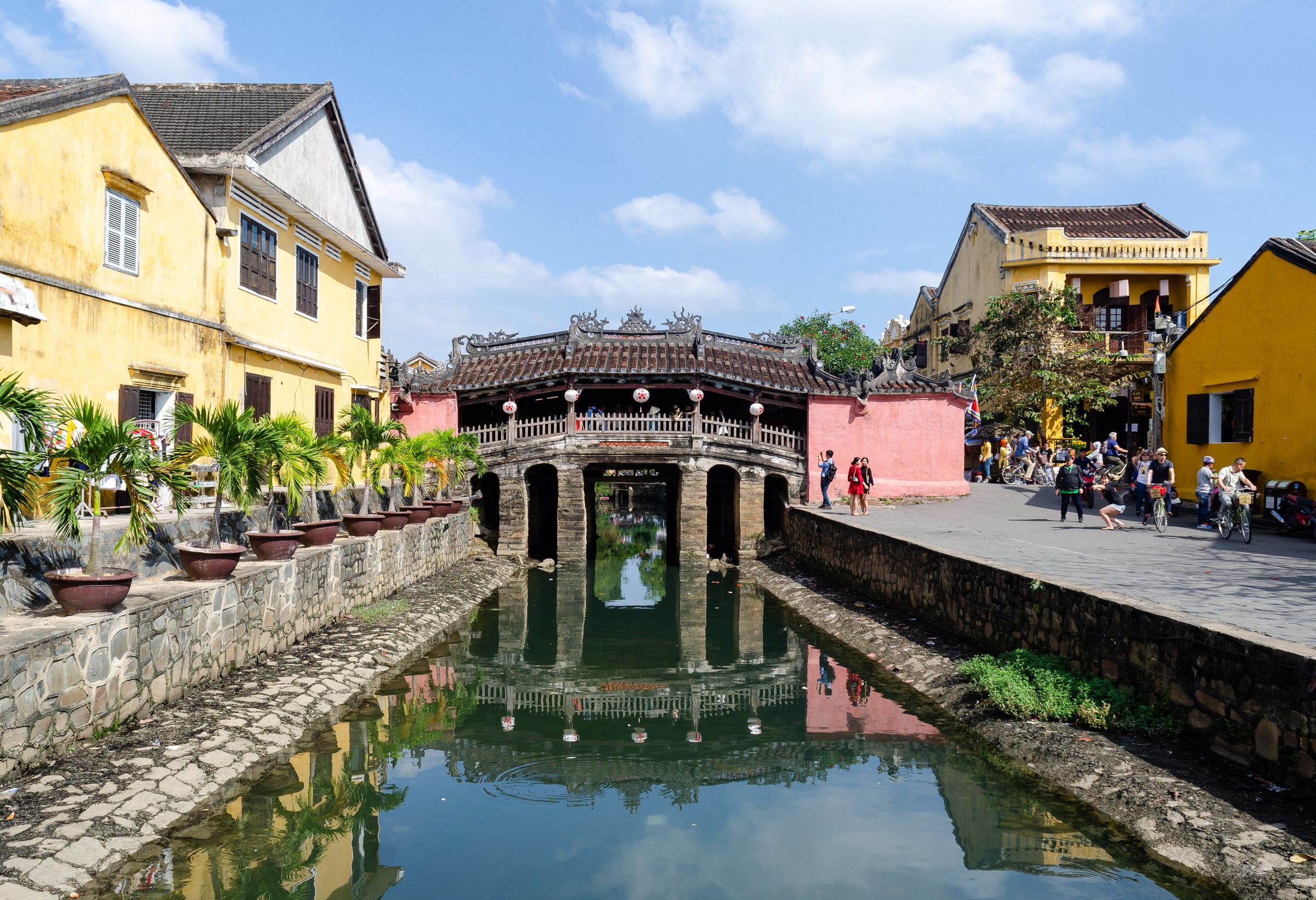
Japanese Covered BridgeChùa Cầu
What it is
Chùa Cầu — literally Pagoda Bridge — is a covered pedestrian bridge spanning a small tributary of the Thu Bon River on the western edge of Hoi An's ancient town. Though popularly called the Japanese Covered Bridge in English, it functions simultaneously as a bridge and a place of worship, with a modest temple chamber set into the northern side of the structure. The bridge is depicted on the Vietnamese 20,000-dong banknote, making it one of the most widely reproduced images in the country.
Origins and history
Construction is attributed to the Japanese merchant community that settled in Hoi An during the late sixteenth and early seventeenth centuries, when the port was one of the busiest trading stops in Southeast Asia. Documentary evidence is incomplete, but the bridge is generally dated to around 1593–1595, with significant reconstructions recorded in 1653, 1719, 1763, 1817, 1875, and 1917. Each rebuild followed the broad form of the original while incorporating Vietnamese and Chinese stylistic elements, so the structure seen today is a layered product of several centuries rather than a single Japanese design frozen in time.
The bridge connected the Japanese quarter to the west with the Chinese quarter to the east. After Japan's Tokugawa shogunate restricted overseas trade in the 1630s, the Japanese community in Hoi An dwindled, but the bridge remained in use and care passed to the town's Chinese and Vietnamese residents.
The temple inside
A small sanctuary occupies a room built into the northern railing of the bridge, perpendicular to the direction of travel. It is dedicated to Bắc Đế Trấn Võ, a Taoist deity associated with weather, water and the protection of mariners — an appropriate dedication for a trading port dependent on sea routes. The shrine contains a statue of the deity flanked by two animal guardians: a dog to the east and a monkey to the west. Local tradition holds that construction began in the year of the monkey and was completed in the year of the dog, though this explanation may be retrospective folk etymology rather than documented fact.
The 2022–2024 restoration and its reception
The bridge was closed for a major structural restoration that concluded in 2024. Decades of humidity, flooding, tourist foot traffic and earlier piecemeal repairs had compromised the foundations and timber frame. The restoration was carried out with involvement from Japanese conservation specialists, reflecting the structure's significance to Japan-Vietnam cultural relations.
When the bridge reopened, its appearance provoked public debate inside Vietnam and among heritage professionals internationally. Critics argued the new paintwork — particularly the bright ochre and red tones applied to the exterior — looked too fresh and departed from the weathered patina that had accumulated over centuries. Supporters of the restoration countered that the colours were historically documented and that the previous dark appearance was itself a product of grime and repeated informal touching-up. The controversy had not fully settled as of mid-2025, and the bridge's appearance continues to be discussed in Vietnamese media and conservation circles. UNESCO, which includes the Hoi An Ancient Town on its World Heritage List, has been watching the outcome.
Access and the old-town ticket
The Japanese Covered Bridge is one of the sites included in the Hoi An Ancient Town entrance ticket, a combined pass sold at booths around the old town perimeter. The ticket system allows a set number of site entries; visitors who wish to cross the bridge as a through route rather than enter the temple may do so without a ticket, but entering the shrine chamber requires one. Ticket arrangements and the list of included sites have changed over the years and may change again; prices vary by season and are subject to revision by local authorities.
The bridge is a short walk from the central market and the main concentration of old-town merchant houses. It is busiest in the mid-morning and late afternoon when guided groups are active; early morning visits see considerably fewer people.
Practical details
The bridge is roughly 18 metres long and covered by a curved, tiled roof supported by timber columns. The walkway is narrow — two people can pass side by side, but the structure was not designed for large crowds. Signage at each end asks visitors to cross in single file during busy periods.
Photography is unrestricted on the bridge itself. Flash photography and tripods inside the shrine chamber are generally discouraged by attendants, though enforcement is inconsistent. The bridge is illuminated at night and appears in the lantern-lit streetscape that characterises the old town after dark.
Where it is
Also known as / see also
Citato da
Fonti
- Vietnam National Authority of Tourism — VNAT consultato 29 August 2026
Supports: the rules and definitions on this page - Chùa Cầu — Wikipedia (Vietnamese) (CC BY-SA 4.0) consultato 3 September 2026
Supports: background, Vietnamese edition
Current Ultima verifica: 3 September 2026. Rules, fares and prices change — check the official source before acting on anything here. Report a mistake.
Picture credits (1)
Hội An, Chùa Cầu, 2020-01 CN-01, Steffen Schmitz ( more photos ), CC BY-SA 4.0, Wikimedia Commons