FansipanPhan Xi Păng
The mountain
Fansipan — written Phan Xi Păng in Vietnamese — stands at 3,147 metres in the Hoàng Liên Son range, part of the southeastern extension of the Himalayas. It lies roughly nine kilometres southwest of Sapa as the crow flies. The mountain falls within Hoàng Liên National Park, a protected area covering over 29,000 hectares of montane forest. The range acts as a climatic divide: the eastern slopes receive heavy rainfall from the Gulf of Tonkin, while the western slopes are drier. The Hoàng Liên Son range was historically traversed by Hmong, Dao and Tày communities whose villages still occupy the valleys below.
The peak sits within what was formerly Lào Cai province; following Vietnam's July 2025 administrative merger, the area is administered under the consolidated province that absorbed the former Lào Cai unit.
Cable car and funicular
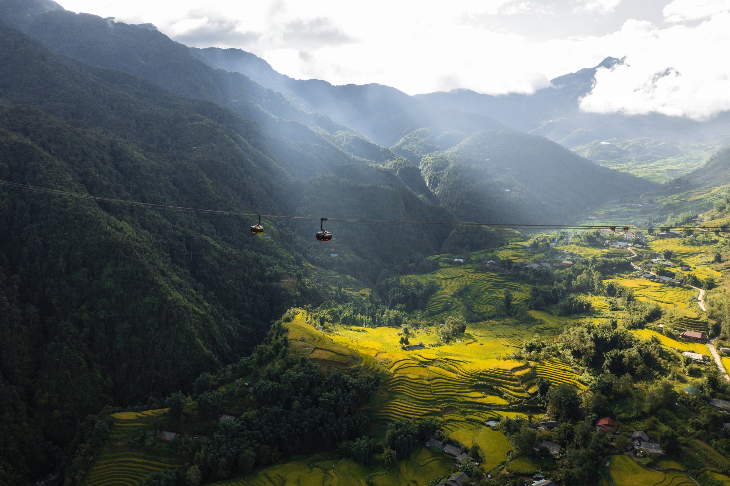
Sun Group opened the Fansipan Legend cable car system in 2016. The three-rope gondola system covers approximately 6,300 metres of horizontal distance and claims to hold several engineering records for its length and elevation gain. The journey from the valley station at Mường Hoa to the mountain station near the summit takes roughly 15 to 20 minutes. From Sapa town, a separate rack-and-pinion funicular connects the town centre to the cable car's valley station, descending the escarpment in around ten minutes.
Tickets are sold for the funicular and cable car as a combined package; prices vary by season, age category and promotional period. Queues can be long during public holidays, particularly the Tết period in late January or February and national holidays in April and September. Arriving early in the morning reduces waiting time. The complex operates daily but closes periodically for maintenance; checking current schedules before travelling is advisable.
The summit complex
The area immediately around the summit has been developed into a religious and tourist complex. A large bronze statue of Amitabha Buddha dominates the upper terraces, installed in 2016. A series of Vietnamese Buddhist temples and shrines step up the ridge below the summit marker, connected by staircases. The summit itself is marked by a stone pillar engraved with the elevation of 3,147 metres.
Souvenir stalls, food kiosks and a restaurant operate at the mountain station level. The development is substantial and the experience at the top resembles a busy hilltop temple complex rather than a remote mountain environment. Visitors who arrive by cable car spend most of their time on constructed paths and staircases rather than open ridge terrain.
Weather and visibility
Fansipan is cloud-covered for a significant portion of the year, and a clear view from the summit is not guaranteed on any given day. The mountain generates its own weather, and conditions can change within hours. The clearest periods are generally October to December and February to March, after the monsoon has retreated and before the spring haze and cloud build up again. January can bring cold fog, occasional frost and, at higher elevations, ice.
The summer monsoon, roughly May to September, brings heavy rain, thick cloud and leeches on the trekking routes. Visibility from the cable car during monsoon months is frequently limited to a few hundred metres. Spring, from around late February to April, is warm at lower elevations but often hazy at altitude due to agricultural burning across the wider region. There is no season that reliably guarantees summit views; the mountain is clear perhaps 30–40 days per year at the summit level, though this figure is not officially tracked.
Trekking the route
Before the cable car opened, Fansipan was primarily a trekking destination. The standard route begins at Trạm Tôn pass, roughly 15 kilometres by road from Sapa, at an elevation of around 1,900 metres. From the trailhead the climb gains approximately 1,200 metres over a distance of roughly nine kilometres to the summit. The trail passes through primary forest, bamboo zones, rhododendron groves and, near the top, subalpine scrub.
Most trekking groups take two days up and one day down, camping or staying in basic shelters on the mountain. A one-day ascent is physically possible but demanding and requires an early start. Trekking requires a licensed local guide under national park regulations; independent ascent is not permitted. The trail is well-defined in dry conditions but can be slippery and muddy during and after rain. Leeches are present from approximately April through October. Gear requirements include warm layers — temperatures at the summit can drop below freezing at night even in summer — waterproofs and sturdy boots.
Several trekking operators based in Sapa organise guided ascents. Group sizes, itineraries and included equipment vary between operators. Prices vary by season and group size.
Cable car versus trek: practical comparison
The cable car reduces the summit visit to a half-day excursion from Sapa and requires no physical preparation beyond walking staircases at altitude, which some visitors find causes mild breathlessness. The trek takes a minimum of two days and involves sustained physical effort, cold nights and uncertain trail conditions.
The two experiences are substantively different. The cable car delivers visitors to a built environment of temples and kiosks; the trek passes through protected forest with biodiversity — including over 2,000 plant species recorded in Hoàng Liên National Park — and the ridge terrain that the cable car bypasses entirely. Some trekkers descend by cable car after reaching the summit via the trail, combining both. The decision turns on time, fitness, budget and what kind of experience is sought, rather than one option being objectively preferable.
Where it is
Also known as / see also
참조 페이지
출처 목록
- Vietnam National Authority of Tourism — VNAT 접근됨 29 August 2026
Supports: the rules and definitions on this page - Fansipan — Wikipedia (CC BY-SA 4.0) 접근됨 3 September 2026
Supports: background - Fansipan — Wikipedia (Vietnamese) (CC BY-SA 4.0) 접근됨 3 September 2026
Supports: background, Vietnamese edition
Current 마지막 확인: 3 September 2026. Rules, fares and prices change — check the official source before acting on anything here. Report a mistake.
Picture credits (1)
Fansipan cable car misty mountain valley Sa Pa Vietnam, Vivu Vietnam, CC BY-SA 4.0, Wikimedia Commons