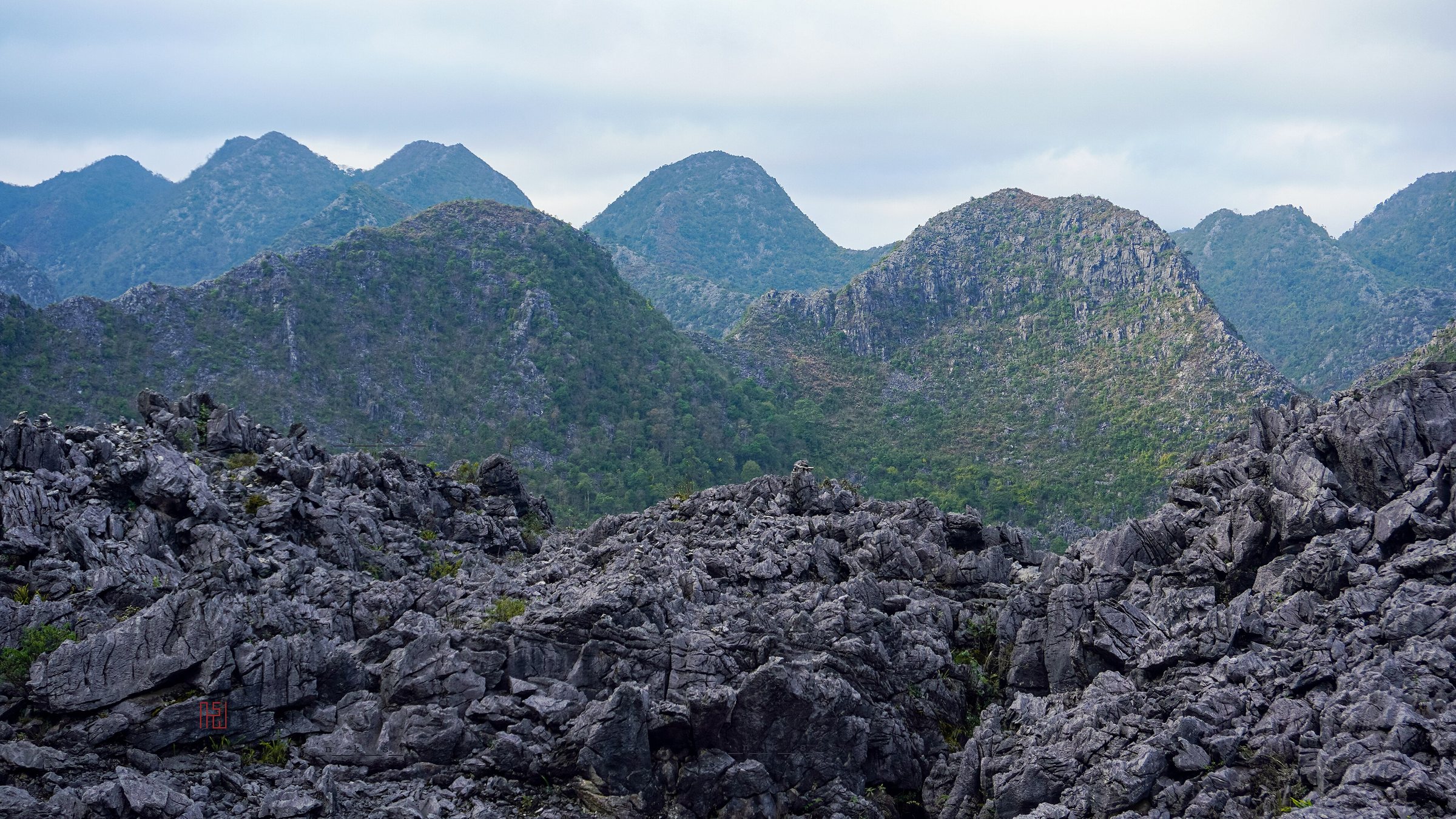
Dong Van Karst PlateauCao nguyên đá Đồng Văn
What the Geopark is
The Dong Van Karst Plateau covers roughly 2,356 square kilometres across the northernmost part of Ha Giang province. UNESCO designated it a Global Geopark in 2010 — the first in Southeast Asia to receive that status — recognising rock formations that range from approximately 540 million to 400 million years old. The landscape is dominated by grey and dark limestone karst: serrated peaks, vertical cliff faces, narrow valleys and sinkholes carved by water over geological time. The plateau sits at elevations generally between 1,000 and 1,600 metres, with some ridges higher. Four communes anchor the visitor circuit: Quan Ba, Yen Minh, Dong Van and Meo Vac, each connected by mountain roads that form the core of the Ha Giang Loop.
Geology in plain terms
The limestone of the plateau formed from ancient marine sediments — shells, coral and organic matter — compressed over hundreds of millions of years while the region lay beneath a shallow sea. Tectonic uplift brought these seabed deposits to high altitude, and subsequent erosion by rain and rivers carved the present karst topography. Fossils of trilobites and brachiopods appear in exposed rock faces throughout the area. The Ma Pi Leng Pass, a steep section of road above the Nho Que River gorge between Dong Van town and Meo Vac, exposes some of the most dramatic cross-sections of this geology: the gorge drops several hundred metres to a river running an intense turquoise-green, coloured by calcium carbonate in suspension. The plateau is seismically stable but subject to landslides during the July–August rainy season, when sections of road can close temporarily.
Dong Van and Meo Vac Sunday markets
Both Dong Van town and Meo Vac town hold weekly markets on Sundays, though the Meo Vac market is sometimes referred to as a Sunday market even when smaller gatherings occur on other days — the main event remains Sunday morning. These are functional trading markets, not markets staged for visitors. Hmong, Tay, Giay, Lo Lo and Nung people descend from surrounding villages to trade livestock, agricultural tools, medicinal herbs, indigo-dyed fabric and food. At Meo Vac the livestock section — where buffalo, pigs and dogs are sold — occupies a separate yard from the dry-goods stalls. Thắng cố, a broth made from horse or buffalo offal simmered with spices in large iron cauldrons, is a characteristic market food of the plateau. Corn liquor distilled locally is traded in unlabelled bottles. Markets begin before dawn and wind down by midday.
The Hmong King's Palace at Sa Phin
At Sa Phin, roughly 14 kilometres west of Dong Van town, stands the residence built for Vuong Chi Sinh (also written Vương Chí Sình), the leader of the Vuong clan who held de facto authority over the Hmong population of the plateau during the late French colonial period. Construction began around 1919 and took eight years; the design combines Chinese southern architectural elements with local Hmong spatial conventions. The compound consists of multiple courtyards and wooden pavilions built from hardwood and stone, set against a limestone hillside chosen for its feng shui alignment. The Vuong family's power derived partly from control of opium cultivation, which dominated the plateau economy into the mid-twentieth century. The site is now a protected heritage building and is open to visitors; a member of the Vuong family has at various times served as an on-site guide, though this arrangement has changed over the years.
Lung Cu Flag Tower
Lung Cu is a commune at the northernmost tip of Vietnam, on a ridge of the plateau adjacent to the Chinese border. A flag tower on the summit of Lung Cu Mountain — Dragon Mountain, Núi Rồng — marks the point, and the large Vietnamese flag flying there is visible for considerable distance. The current reinforced concrete tower, rebuilt and enlarged in 2010, stands approximately 33 metres tall and is reached by a staircase of several hundred steps from the car park below. The surrounding landscape is open limestone grassland with views into Yunnan province, China, on clear days. Ethnic Lo Lo villages occupy the valley beneath the tower; the Lo Lo are a small Sino-Tibetan-speaking group with a distinct embroidered textile tradition. Lung Cu falls within a border zone and requires documentation — see the permit note below.
Border-zone permits
The Dong Van Karst Plateau sits immediately along the land border with China, and parts of it — including Lung Cu and some villages near the boundary — are designated a border protection zone under Vietnamese law. Foreign nationals are required to carry a border-zone permit (giấy phép khu vực biên giới) to enter these areas. The practical position has shifted over time: at certain periods, tourist checkpoints have waved through travellers holding a standard Vietnamese tourist visa without requesting a separate permit; at other periods enforcement has been stricter. As of the time of writing the requirement is technically in force for non-Vietnamese nationals. Permits have historically been arranged through licensed tour operators in Ha Giang city or, less reliably, through guesthouses on the loop route. Independent travellers should verify the current enforcement position before departure, as it is subject to change without public notice. Vietnamese nationals do not require a permit.
Visiting the plateau
The plateau is traversed as part of the Ha Giang Loop, the mountain circuit that begins and ends in Ha Giang city. Most visitors spend two to four nights on the loop, with at least one night in Dong Van town and one in or near Meo Vac. The road from Ha Giang city to Dong Van covers approximately 150 kilometres with significant elevation change; travel times vary considerably depending on road conditions, season and vehicle type. The plateau is accessible year-round, but the dry season from October to April offers clearer views and safer road surfaces. Buckwheat flowers, planted by Hmong farmers, bloom in pink and white across the limestone fields from roughly late October into November, which draws peak visitor numbers. The rainy season from June to September brings lush green colour but also landslide risk on the steeper sections of road.
Where it is
Also known as / see also
参照元
出典
- Vietnam National Authority of Tourism — VNAT アクセス日 29 August 2026
Supports: the rules and definitions on this page - Dong Van Karst Plateau Geopark — Wikipedia (CC BY-SA 4.0) アクセス日 3 September 2026
Supports: background - Cao nguyên đá Đồng Văn — Wikipedia (Vietnamese) (CC BY-SA 4.0) アクセス日 3 September 2026
Supports: background, Vietnamese edition
Current 最終確認: 3 September 2026. Rules, fares and prices change — check the official source before acting on anything here. Report a mistake.
Picture credits (1)
Bãi đá mặt trăng Đồng Văn - NKS, NKSTTSSHNVN, CC BY-SA 4.0, Wikimedia Commons