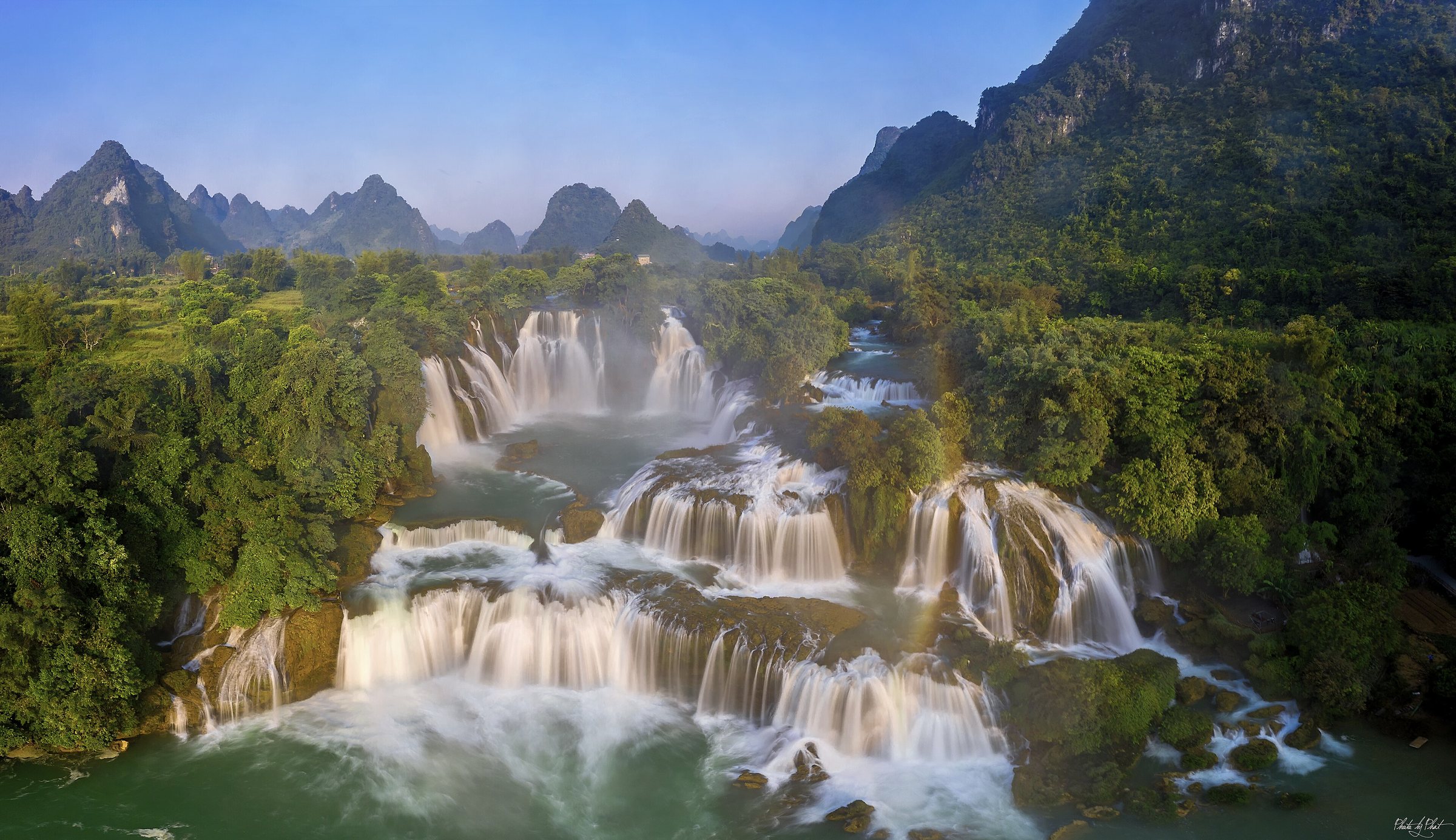
Ban Gioc WaterfallThác Bản Giốc
What Ban Gioc is
Ban Gioc (Vietnamese: Thác Bản Giốc) is the largest waterfall located on any national border with China and is ranked among the four largest border waterfalls in the world, alongside Niagara, Victoria and Iguazú. It sits on the Quay Son River in the limestone karst country of what is now Cao Bang province, following Vietnam's July 2025 provincial consolidation.
The waterfall is not a single drop. A central limestone island divides the Quay Son into two main channels before the water descends in two distinct tiers. The upper tier is narrower and falls into a churning intermediate ledge; the lower, wider tier is the one visible from the Vietnamese riverbank and from bamboo rafts on the pool below. At peak flow the combined curtain extends roughly 300 metres across.
The international border and access rules
The mid-line of the Quay Son River marks the Vietnam–China boundary at this point, meaning the western portion of the waterfall falls under Chinese administration (known on the Chinese side as Detian Falls) and the eastern portion under Vietnamese administration. Both countries have developed visitor facilities on their respective banks, and on busy days visitors from both sides can be seen on the water simultaneously.
Because Ban Gioc lies within a designated border zone, Vietnamese authorities require visitors to hold a border-area permit (giấy phép khu vực biên giới) in addition to a standard Vietnamese visa or visa-exempt entry. The permit is not obtained at the falls themselves; guesthouses in Trung Khanh and tour operators running trips from Cao Bang city handle the paperwork, typically requiring passport details a day or more in advance. Regulations around border permits are subject to periodic revision, so confirming current requirements before travel is advisable.
Bamboo rafts and the viewing pool
The most direct view of the lower cascade is from the broad turquoise pool at its base. Local operators run bamboo-platform rafts — flat, motorised vessels with low bamboo railings — that carry visitors from a floating dock on the Vietnamese bank out across the pool and into the mist at the foot of the falls. The experience is wet; the raft approaches close enough that spray is unavoidable.
A paved riverside path along the Vietnamese bank provides a drier, elevated perspective. From here the full width of the lower tier is visible, along with the cultivated rice fields of the valley on both sides of the river. Prices for raft trips vary by season and operator and are not listed here.
When the flow is strongest
The Quay Son River is fed by monsoon rains that arrive in the uplands of northern Vietnam and southern China between May and October. Flow at Ban Gioc peaks in August and September, when the waterfall is fullest and the colour of the water deepest. During these months the lower pool can rise considerably and the boundary between the two curtains of water becomes less distinct as the volume overwhelms the central island.
The dry season, roughly November to April, reduces the flow substantially. The falls remain active and visually striking, but the individual channels are more separated and the pool is calmer. Dry-season conditions make raft operation easier and the surrounding paths less slippery. The valley mist that often sits over the river in early morning is present year-round but is most photogenic in the cooler months.
Nguom Ngao Cave
Approximately three kilometres from the waterfall along a paved road lies Nguom Ngao ('Tiger Cave' in the Tay language), a limestone cavern that extends for around three kilometres in mapped passages, of which roughly one kilometre is open to visitors. The cave was documented by French geologists in the colonial period and formally surveyed in the 1990s.
Inside, the passages widen into chambers containing stalactite and stalagmite formations, some of considerable scale. Lighting has been installed along the visitor route. The cave and the waterfall are almost always combined in a single day visit from Trung Khanh, as the road between them is short and direct. Separate admission applies to each site.
Practical orientation
The nearest town with reliable accommodation, restaurants and motorbike hire is Trung Khanh, formerly the seat of Trung Khanh district (a tier now abolished under Vietnam's 2025 restructuring). Cao Bang city, the provincial centre, is roughly 90 kilometres to the south and is the main transport hub for the region, with bus connections to Hanoi.
Most independent visitors arrive on hired motorbikes or in rented cars. The road from Cao Bang city to the falls passes through steep karst terrain with several sections that are narrow and winding. A small car park and a cluster of food stalls have been developed near the Vietnamese riverbank entrance. Opening hours for the raft service and the ticket gate are subject to change; checking with accommodation in Trung Khanh on the day is standard practice.
Where it is
Also known as / see also
Referenziert von
Quellen
- Vietnam National Authority of Tourism — VNAT abgerufen 29 August 2026
Supports: the rules and definitions on this page - Thác Bản Giốc — Wikipedia (Vietnamese) (CC BY-SA 4.0) abgerufen 29 August 2026
Supports: background, Vietnamese edition
Current Zuletzt geprüft: 3 September 2026. Rules, fares and prices change — check the official source before acting on anything here. Report a mistake.
Picture credits (1)
Bangioc9tam, Lê Minh Phát, CC BY 2.0, Wikimedia Commons