The place itself has not changed, and this page continues to cover it.
2025 constitutional amendment and Law on Organisation of Local Government establishing a two-tier local government
Overview and administrative status
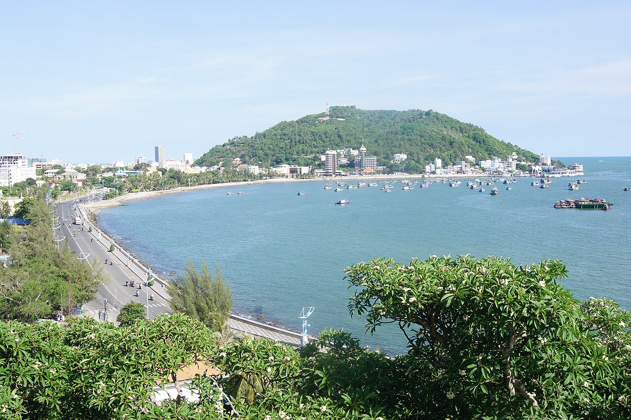
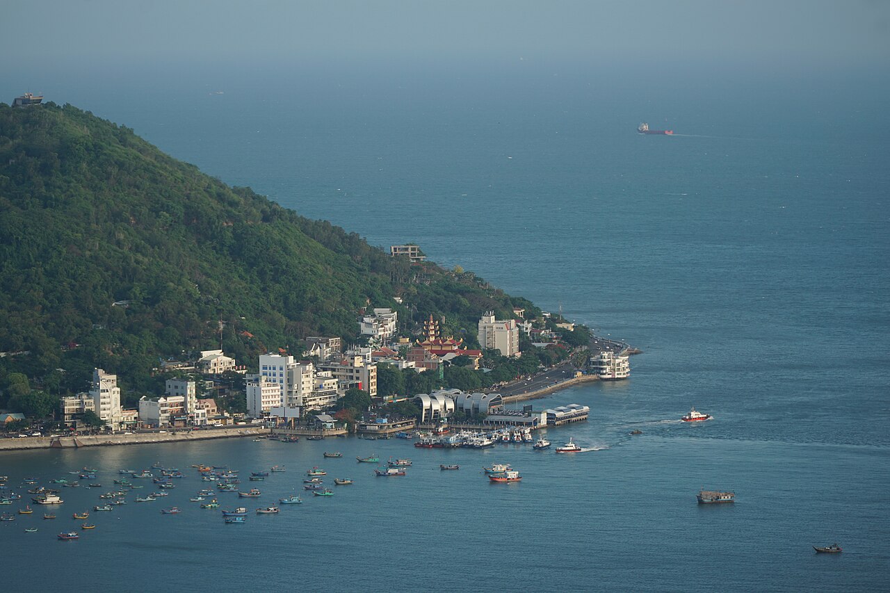
Vung Tau occupies a compact peninsula on the southeastern coast of Vietnam, roughly 125 km by road from central Ho Chi Minh City. The peninsula is flanked to the west by Bãi Trước (Front Beach) and to the east by Bãi Sau (Back Beach), with Núi Lớn (Big Mountain) and Núi Nhỏ (Small Mountain) forming its hilly spine.
Until 30 June 2025, Vung Tau was a provincial city within Bà Rịa–Vũng Tàu province. Under Vietnam's nationwide administrative reorganisation that took effect on 1 July 2025, provincial and district tiers were restructured across the country. Vung Tau now falls within the expanded administrative boundaries of Ho Chi Minh City. The city itself has not moved or changed its character; the change is one of administrative jurisdiction.
Vung Tau also functions as a base for Vietnam's offshore oil and gas industry, giving it a noticeable international and industrial dimension alongside its role as a leisure destination.
The beaches
Bãi Trước (Front Beach) curves along the calmer western shore of the peninsula, facing the bay rather than the open South China Sea. The water is generally sheltered but can appear murky, particularly near the ferry terminals. The esplanade here is lined with seafood restaurants and hotels, and the beach itself tends to attract a more sedate crowd. A large statue of Trần Hưng Đạo, the 13th-century Vietnamese general, stands at the northern end.
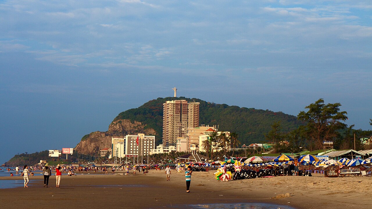
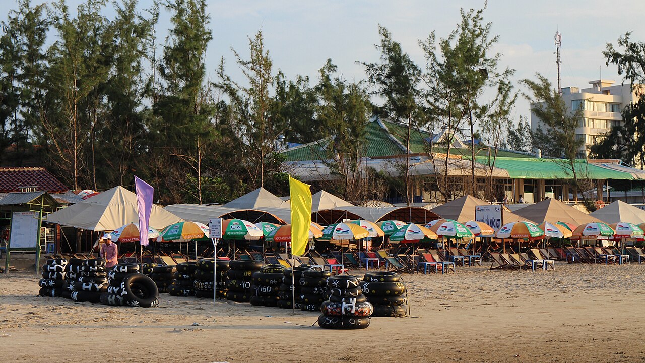
Bãi Sau (Back Beach) is a significantly longer stretch — around 8 km — facing the South China Sea. Waves are more pronounced, and the beach is considerably wider. This is where the bulk of weekend activity concentrates, with sun-lounger and umbrella hire available along much of its length. The southern end, near the Bãi Dứa area, is quieter.
A third beach, Bãi Dâu, sits on the northwestern tip of the peninsula and is popular with local residents. Several smaller coves are accessible on foot or by motorbike around the headlands.
Prices vary by season. Weekend crowds from Ho Chi Minh City arrive in volume on Friday evenings and clear by Sunday night; visiting mid-week produces a noticeably quieter experience.
Christ of Vung Tau and the lighthouse
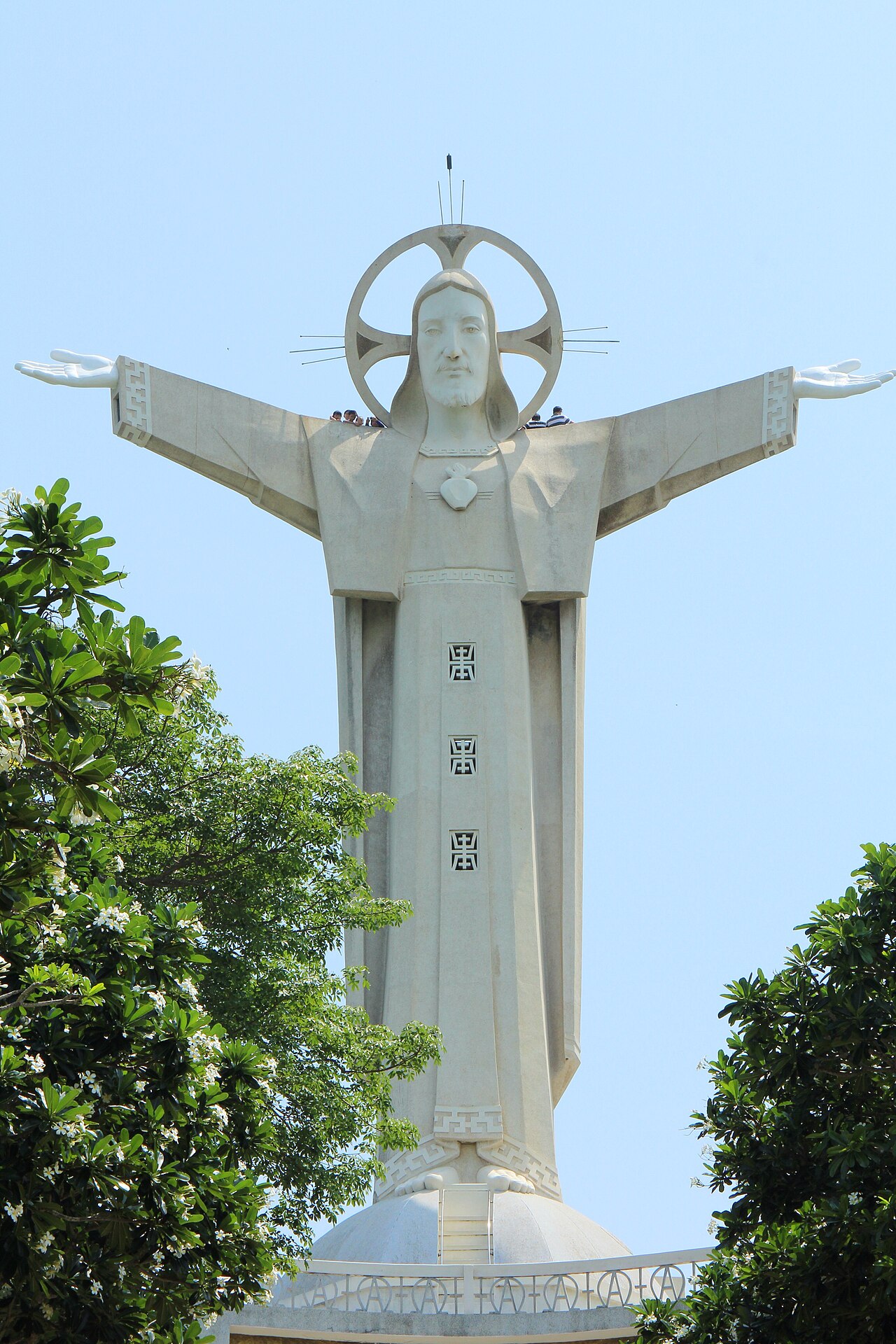
The Christ of Vung Tau (Tượng Chúa Kitô Vua) stands on Núi Nhỏ and is one of the largest Christ statues in Asia, at 32 metres in height with an arm span of 18.4 metres. Construction was completed in 1994, though an earlier statue existed on the same site from the 1970s. Visitors climb a staircase inside the statue itself and can emerge at shoulder level for views across the peninsula and out to sea. A further set of steps leads up through the hillside grounds. Modest dress is expected.
The Vung Tau Lighthouse (Hải Đăng Vũng Tàu) occupies the peak of Núi Nhỏ and dates to the French colonial period, with the current structure completed in 1910. It remains operational. The climb to the lighthouse — a steep path from the road below — rewards visitors with a panoramic view taking in both beaches simultaneously. Opening arrangements and access conditions are subject to change; confirm locally before making the ascent a firm plan.
Both sites are reachable by motorbike taxi from either beach, or on foot for those comfortable with steep gradients in tropical heat.
Getting there from Ho Chi Minh City
Two practical options connect Ho Chi Minh City to Vung Tau: the hydrofoil and the expressway bus.
Hydrofoil services depart from the Bach Dang terminal near the city centre and from Cần Giờ, arriving at the Vung Tau ferry terminal adjacent to Front Beach. The journey takes approximately 75–90 minutes on the water. Services run several times daily but schedules are adjusted seasonally and during public holidays, when advance booking is advisable. Note that the hydrofoil does not run in rough sea conditions, which can affect departures without much warning.
Expressway bus services use the Bến Tre–Vũng Tàu or Ho Chi Minh City–Vũng Tàu expressways, with journey times typically in the range of two to two-and-a-half hours depending on traffic. Departure points in Ho Chi Minh City vary by operator; most terminate near Back Beach in Vung Tau. Weekend traffic on Sunday afternoons returning toward the city can add considerably to travel time.
Private car hire and ride-hailing services also cover the route. Cần Giờ district lies along the water route and is sometimes combined into a longer trip.
Food
Vung Tau's culinary identity is built around seafood and a handful of locally distinct dishes. The city's position on the coast means that crab, clams, squid, and various fin fish are prominent on menus across all price levels, from beachside plastic-stool eateries to indoor restaurants catering to weekend visitors from the city.
Bánh khọt is the dish most closely associated with Vung Tau. These are small, thick rice-flour pancakes, cooked in individual cast-iron moulds and typically topped with shrimp, then wrapped in lettuce and fresh herbs. The version made here is considered by many Vietnamese to be the original and definitive form of the dish. Vendors and restaurants specialising in bánh khọt are found throughout the city.
Other local specialities include bánh canh chả cá (a thick noodle soup with fish cake), various preparations of ốc (sea snails), and gỏi cá mai (a salad of raw young herring cured in citrus). The seafood market near Front Beach is a reference point for fresh produce, though the restaurants immediately adjacent to any market should be assessed individually for value.
Prices vary by season and by whether the visit falls on a weekend, when demand-driven pricing is common at popular spots.
When to go and practical notes
The driest and most reliably calm period runs from approximately November to April, when seas are settled and the risk of heavy rain is low. The southwest monsoon brings wetter and more overcast conditions from May through October; seas at Back Beach can become rough enough to make swimming inadvisable, and the hydrofoil may be suspended on individual days. See When to go: weather by region for a broader picture of southeastern Vietnam's seasons.
Vung Tau is an extremely popular weekend destination and Vietnamese public holidays — particularly the Reunification Day and Labour Day cluster in late April and early May, and Tết — see the city very heavily booked. Accommodation and transport should be arranged in advance for those periods.
Mobile connectivity is generally good throughout the peninsula. For SIM and data options, see SIM cards and eSIMs. For payment and cash access, see Money, ATMs and cards. Visitors requiring a visa should consult the Vietnam e-visa page. Standard awareness of common tourist-area situations is relevant here as elsewhere; Safety and common scams covers the national picture.
महीने के अनुसार जलवायु
दीर्घकालिक औसत, पूर्वानुमान नहीं। संदर्भ अवधि: 2015–2024. स्रोत: ERA5 reanalysis (Copernicus) via the Open-Meteo archive API.
Show the numbers
| महीना | उच्च °C | न्यूनतम °C | वर्षा मिमी | वर्षा दिवस | Humidity % |
|---|---|---|---|---|---|
| January | 29.0 | 24.0 | 18 | 3 | 73 |
| February | 29.4 | 24.2 | 3 | 0 | 72 |
| March | 30.2 | 25.4 | 9 | 2 | 74 |
| April | 31.2 | 26.9 | 41 | 7 | 74 |
| May | 31.1 | 27.2 | 146 | 22 | 78 |
| June | 30.3 | 26.6 | 167 | 25 | 82 |
| July | 29.5 | 26.2 | 215 | 29 | 84 |
| August | 29.7 | 26.2 | 197 | 28 | 83 |
| September | 29.3 | 25.8 | 255 | 28 | 85 |
| October | 29.2 | 25.5 | 232 | 25 | 84 |
| November | 29.5 | 25.3 | 113 | 14 | 80 |
| December | 29.1 | 24.4 | 56 | 8 | 77 |
Practical notes
Where it is
Also known as / see also
आस-पास
संदर्भित
स्रोत
- ERA5 climate normals — Copernicus / Open-Meteo (CC BY 4.0) accessed 30 August 2026
Supports: monthly temperature and rainfall normals, and elevation - Vũng Tàu (Q21194) — Wikidata (CC0 1.0) accessed 30 August 2026
Supports: coordinates, area, population - Vũng Tàu — Wikipedia (CC BY-SA 4.0) accessed 30 August 2026
Supports: background
Current अंतिम सत्यापन: 31 August 2026. Rules, fares and prices change — check the official source before acting on anything here. Report a mistake.
Picture credits (6)
Bờ biển Vũng Tàu, Hoangvantoanajc, CC BY-SA 3.0, Wikimedia Commons · trungydang, CC BY 3.0, Wikimedia Commons · Bai Truoc Vung Tau, NDTK08, CC BY 4.0, Wikimedia Commons · trungydang, CC BY 3.0, Wikimedia Commons · trungydang, CC BY 3.0, Wikimedia Commons · trungydang, CC BY 3.0, Wikimedia Commons