Overview and character
Thanh Hoa province occupies a broad wedge of territory running from the Gulf of Tonkin westward into the Truong Son uplands, bordered by Ninh Binh to the north, Nghe An to the south, and Laos to the west. The Ma River and its tributaries divide a productive coastal plain from a highland interior that reaches significant elevations near the Lao frontier.
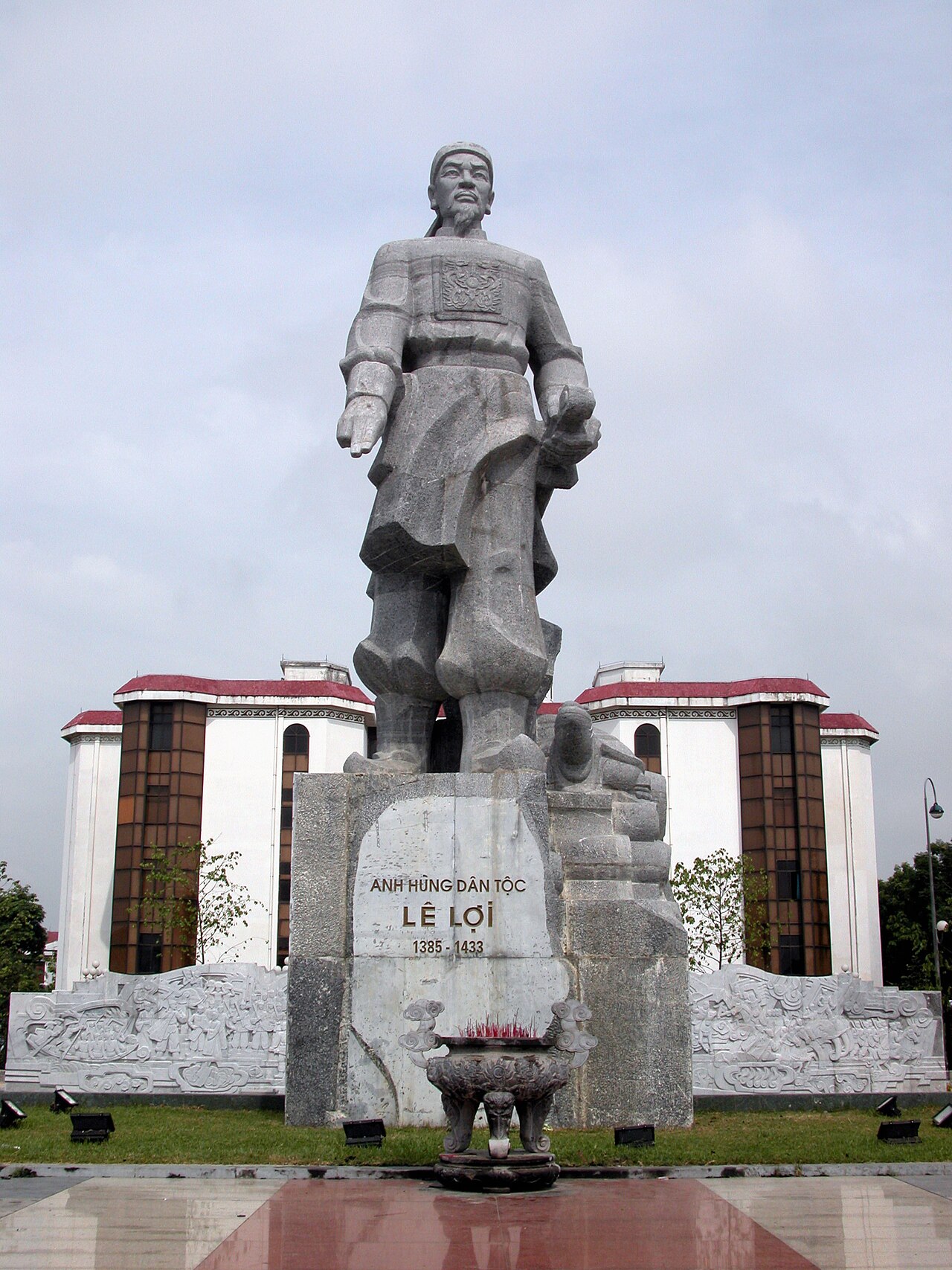
The province is one of Vietnam's most populous and has historically been a major source of soldiers, administrators and scholars. The Le dynasty, which ruled Vietnam for most of the fifteenth to eighteenth centuries, originated here; the ancestral home of Le Loi, who expelled the Ming Chinese occupiers in 1428, is at Lam Kinh, west of the provincial capital. This depth of political history distinguishes Thanh Hoa from many other north-central provinces.
Thanh Hoa sits within the broader North Central Coast region and shares its transitional character — climatically, culturally and linguistically — between the Red River Delta to the north and the old imperial heartland further south.
Climate and when to go
Thanh Hoa's climate follows a pattern common to the north-central coast but with some local particulars. Winters are cool and relatively dry, with temperatures in January and February noticeably lower than in provinces further south. Spring brings warming temperatures alongside a modest increase in rainfall. By May the heat intensifies sharply, and the province enters its wet season proper.
The heaviest rainfall falls between July and September, with August and September typically the wettest months of the year by a considerable margin. This period also carries the highest risk of typhoons making landfall or bringing heavy indirect rain. October remains very wet before a rapid drying in November and December.
The coastal area around Sam Son is busiest with domestic tourists from around April to August, coinciding with warmer sea temperatures. The upland areas, including Pu Luong Nature Reserve, are generally most accessible in the dry cooler months of October through March, though the terraced rice fields are most visually striking when water-filled in spring or golden at harvest in September and October. For further regional climate context, see When to go: weather by region.
Historical and cultural sites
The Lam Kinh historical site, roughly 50 km west of the city, preserves the ancestral capital of the Le dynasty. Stone stelae recording the reigns of successive Le emperors, reconstructed royal halls, and the tomb complexes of early dynastic figures remain on site. The largest stele, erected in 1433 and describing Le Loi's life and campaigns, is among the oldest surviving carved inscriptions of this scale in Vietnam.
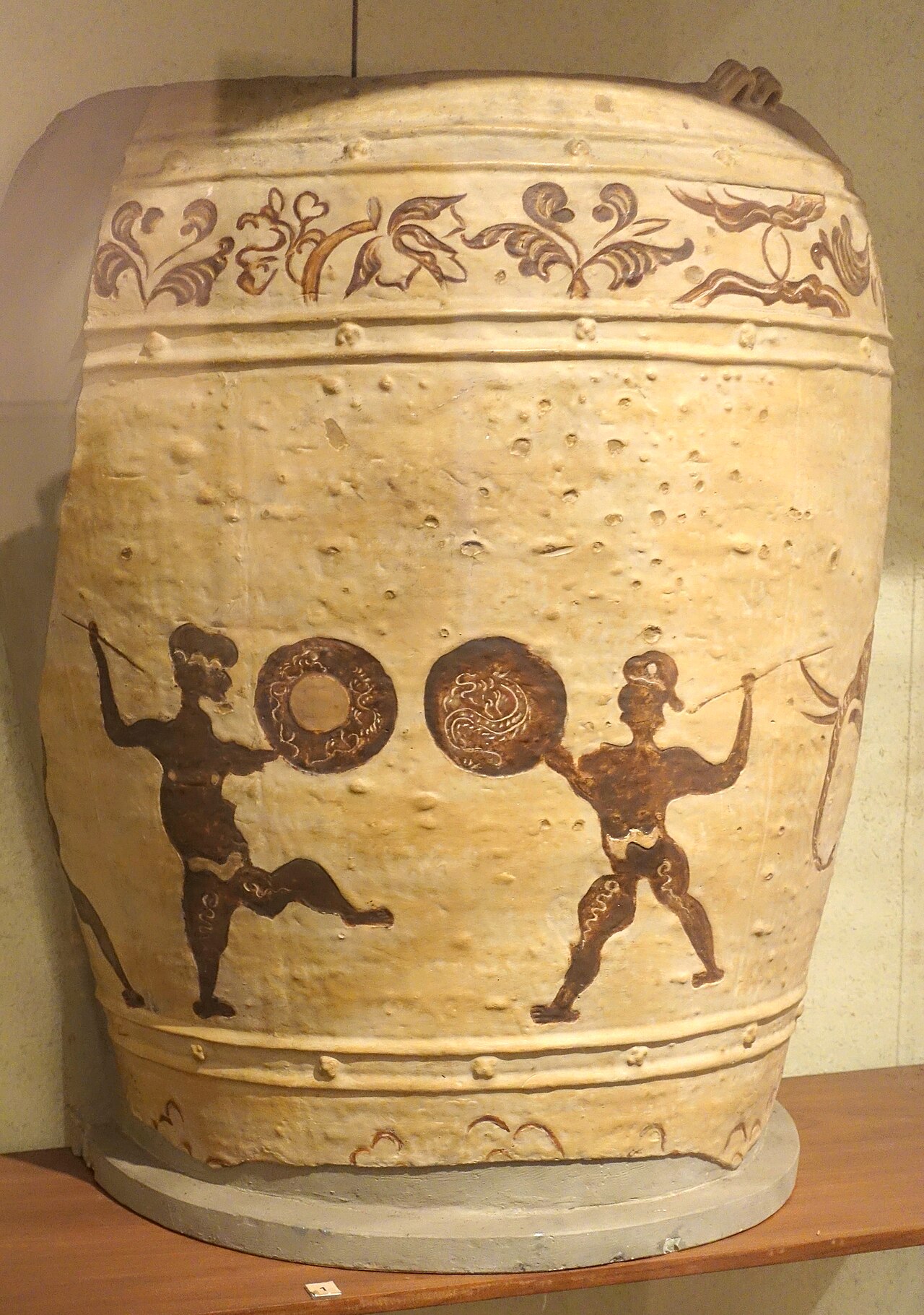
The Thanh Hoa Museum in the provincial capital holds artefacts spanning the Dong Son bronze culture through the French colonial period. Dong Son itself — the site that gave its name to the entire late Bronze Age culture of mainland Southeast Asia — is a village within the province on the Ma River, excavated from the 1920s onwards by Vietnamese and French archaeologists.
The Ho dynasty citadel at Tay Do, built entirely from large sandstone blocks in 1397 and now a UNESCO World Heritage Site, stands in the western part of the province. Its four gates and significant stretches of wall survive. The citadel was the capital of the short-lived Ho dynasty and later served the Ming occupation; its construction in dressed stone rather than rammed earth distinguishes it from most Vietnamese fortifications of the era.
Natural areas and outdoor destinations
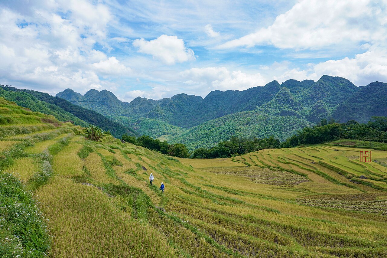
Pu Luong Nature Reserve covers forested limestone hills in the province's northwest. It contains old-growth forest, terraced paddy fields worked by Thai and Muong communities, and a series of narrow valleys accessible on foot or by motorbike. Pu Luong has grown in popularity with travellers looking for an alternative to more visited highland areas, and overnight homestay accommodation is available in several villages.
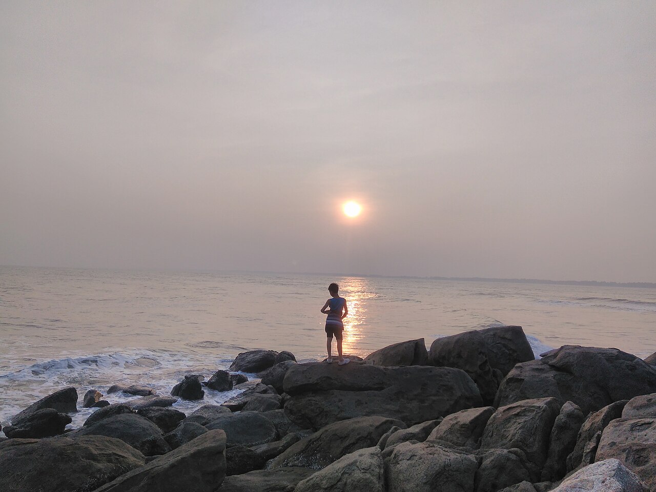
The coastal strip centres on Sam Son, a beach town that draws large numbers of domestic visitors, particularly from Hanoi, during the warmer months. The beach is long and backed by a busy resort strip. Ben En National Park, in the south of the province, protects a lake and forested hills and is known for birdwatching, though it receives far fewer international visitors than comparable parks further north such as Cuc Phuong National Park.
Getting there and around
Thanh Hoa city lies on the main north–south railway line and all express trains between Hanoi and Da Nang or Ho Chi Minh City stop here, making it one of the more accessible provincial capitals by rail. Journey times to Hanoi are several hours depending on the service; the city is also well connected by road via National Highway 1 and the parallel North–South Expressway.
Tho Xuan Airport, located west of the city, handles domestic flights linking Thanh Hoa to Ho Chi Minh City and a small number of other destinations; schedules and operators change periodically. Travellers arriving from abroad will generally transit Hanoi or Da Nang first; the Vietnam e-visa covers all entry points.
Within the province, distances are significant. Pu Luong is a two-hour drive or more from the city over mountain roads. Lam Kinh and the Ho citadel require separate day trips in different directions. Motorbike rental is practical for confident riders; car hire with a driver is common for those covering multiple sites. Local buses connect the city to major towns but are slow on upland routes. A local SIM card or eSIM is useful for navigation in areas with limited signage in Roman script.
Food and practical notes
Thanh Hoa's cuisine shares characteristics with the broader central Vietnamese food tradition while retaining regional dishes. Nem cuon (fresh spring rolls) and grilled meats are common street foods. The province produces a fermented shrimp paste, mam tom, used widely in dipping sauces. River fish from the Ma River system and seafood from the coast feature prominently in local restaurants. The upland communities of the interior, particularly Thai groups in the Pu Luong area, prepare distinct dishes including sticky rice cooked in bamboo and grilled meats seasoned with local herbs.
ATMs are available in the provincial capital and in larger towns; coverage thins in rural and highland areas. See Money, ATMs and cards for general guidance. First-time visitors sometimes underestimate the province's east–west scale: the coast, the capital, the Lam Kinh area, the Ho citadel, and Pu Luong all sit in different parts of a large territory and cannot be combined in a single day. Standard safety considerations apply, particularly regarding motorbike hire and road conditions on highland routes after heavy rain.
Neighbouring provinces worth considering in combination include Ninh Binh to the north, with its karst scenery at Tam Coc, and the upland routes that connect broadly to the Perfume Pagoda area southwest of Hanoi.
Klimaat per maand
Langjarige gemiddelden, geen voorspelling. Referentieperiode: 2015–2024. Bron: ERA5 reanalysis (Copernicus) via the Open-Meteo archive API.
Show the numbers
| Maand | Hoog °C | Laag °C | Neerslag mm | Regendagen | Humidity % |
|---|---|---|---|---|---|
| January | 21.3 | 14.7 | 69 | 11 | 81 |
| February | 22.9 | 15.6 | 43 | 8 | 81 |
| March | 26.4 | 19.2 | 73 | 12 | 85 |
| April | 29.9 | 21.6 | 122 | 11 | 83 |
| May | 32.4 | 24.4 | 221 | 18 | 83 |
| June | 34.1 | 26.1 | 180 | 15 | 80 |
| July | 32.9 | 25.8 | 336 | 20 | 83 |
| August | 32.0 | 25.4 | 359 | 24 | 86 |
| September | 30.5 | 24.4 | 361 | 23 | 87 |
| October | 27.9 | 21.7 | 277 | 16 | 82 |
| November | 25.9 | 19.2 | 93 | 11 | 81 |
| December | 21.7 | 14.8 | 49 | 8 | 76 |
Places within Thanh Hoa
 National Park
Pu Luong Nature Reserve
A quiet mountain reserve in Thanh Hoa with terraced rice valleys, Thai villages and low-key…
 Destination
Sam Son
North-central Vietnamese beach resort popular with domestic tourists, known for summer…
 City
City
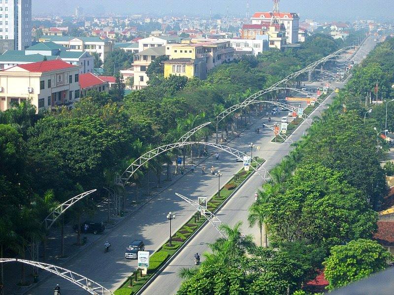
Thanh Hóa
Former provincial city at the heart of north-central Vietnam, absorbed into Thanh Hóa…
Where it is
Also known as / see also
In de buurt
Verwezen door
Bronnen
- ERA5 climate normals — Copernicus / Open-Meteo (CC BY 4.0) geraadpleegd 30 August 2026
Supports: monthly temperature and rainfall normals, and elevation - Thanh Hoa (Q36512) — Wikidata (CC0 1.0) geraadpleegd 30 August 2026
Supports: coordinates, area, population - Thanh Hoa — Wikipedia (CC BY-SA 4.0) geraadpleegd 30 August 2026
Supports: background
Current Laatst geverifieerd: 31 August 2026. Rules, fares and prices change — check the official source before acting on anything here. Report a mistake.
Picture credits (8)
Dam in Thanh Hoa DDXVN p41, Unknown, but published in 1926, Public domain, Wikimedia Commons · Storage jars for domestic use, Thanh Hoa and Ha Tay provinces, Early Le or Mac dynasty, 15th-16th century AD, blue and white glazed ceramic…, Daderot, CC0, Wikimedia Commons · Ceramic, Thanh Hoa, 13th-14th century - Vietnam National Museum of Fine Arts - Hanoi, Vietnam - DSC04815, Daderot, CC0, Wikimedia Commons · Le Loi statue, Nguyễn Thanh Quang, CC BY-SA 3.0, Wikimedia Commons · Inspectiong the new latrine, Thanh Hoa, Vietnam 2010. Photo- AusAID (10705409726), Department of Foreign Affairs and Trade, CC BY 2.0, Wikimedia Commons · Ruộng bậc thang Pù Luông 1 - NKS, NKSTTSSHNVN, CC BY-SA 4.0, Wikimedia Commons · Sunset in Truong Le Mountain, bkt92, CC BY-SA 4.0, Wikimedia Commons · Le Loi avenue, Nguyenbadong, CC BY-SA 3.0, Wikimedia Commons