The place itself has not changed, and this page continues to cover it.
National Assembly Resolution 202/2025/QH15 on the rearrangement of provincial-level administrative units
Thai Binh (Thái Bình) sat at the southeastern edge of the Red River Delta, bordered by the Gulf of Tonkin and threaded by distributaries of the Red and Thai Binh rivers. Historically one of Vietnam's most densely farmed provinces, it was known for rice cultivation, traditional weaving crafts, and a coastline of tidal mudflats rather than sandy beaches. On 1 July 2025 it was dissolved and absorbed into the newly formed province of Hung Yen.
Administrative status after 2025
Thai Binh province ceased to exist as a separate administrative entity on 1 July 2025, when the National Assembly's resolution on provincial reorganisation came into force. Its territory, along with that of the former Hung Yen province, was merged into the new province of Hung Yen. The district tier was abolished at the same time across all of Vietnam, so references to Thai Binh's former districts are no longer current administrative descriptions.
Pages and documents written before mid-2025 — including maps, guidebooks and official Vietnamese-government materials issued under the old structure — will refer to Thai Binh as an independent province with its own People's Committee. That framing is now out of date. For current administrative purposes, the area is governed as part of Hung Yen.
What Thai Binh was known for
The territory is defined by its flatness. The Red River Delta here is almost entirely at or near sea level, criss-crossed by irrigation channels and dikes that have shaped farming and settlement for centuries. Rice was, and remains, the dominant crop, and the province was historically associated with Vietnam's inland agricultural heartland rather than its tourist circuits.
- Traditional textiles: The town of Nam Dinh Road and notably the village of Nam Cao were associated with silk and cotton weaving, though the centre of this craft is now more commonly visited through the broader delta region.
- Cheo theatre: Thai Binh has a strong association with cheo, a form of Vietnamese folk opera that originated in the Red River Delta. Several performance troupes were based here.
- Coastal mudflats: The province's coastline along the Gulf of Tonkin consists mainly of tidal flats and mangrove-fringed estuaries rather than resort beaches, making it significant for migratory birds and aquaculture rather than leisure swimming.
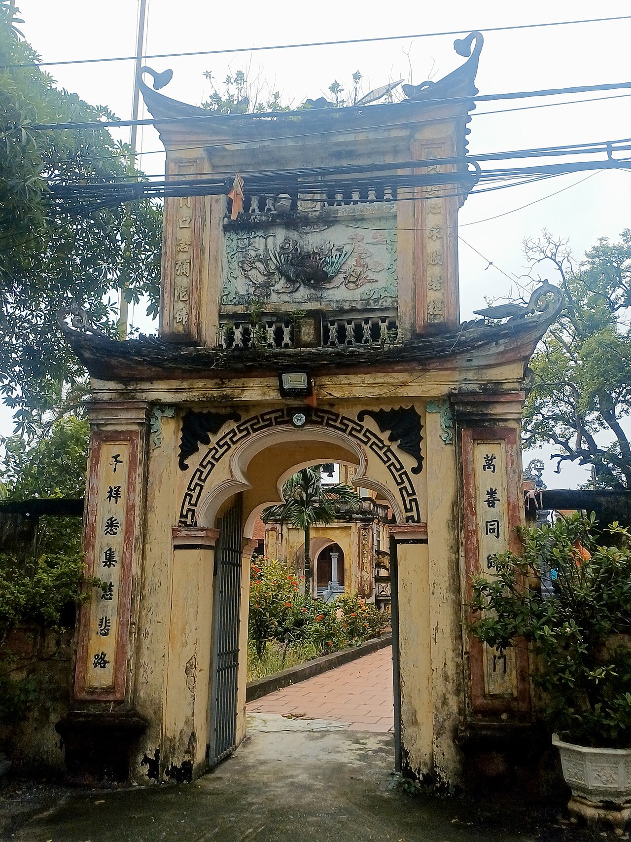
- Pagodas and communal houses: Numerous dinh (communal houses) and Buddhist pagodas dot the rural communes, reflecting the dense settlement history of the delta.
Getting there and around
Thai Binh town, the former provincial capital, lies roughly 110 kilometres south-east of Hanoi by road. The most common approach from Hanoi was via National Route 10, which connects the delta coast from Hai Phong southward through Thai Binh toward Nam Dinh. Buses linking Hanoi's southern terminals with Thai Binh town ran frequently; the journey typically took two to three hours depending on traffic through the delta.
There is no commercial airport in the former province. The nearest airports are Noi Bai International Airport in Hanoi and Cat Bi Airport in Hai Phong, both requiring onward road travel.
Within the former province, motorbike and car hire were the practical options for reaching rural pagodas and coastal areas, as public transport thinned considerably outside the main town. The flat terrain made cycling feasible for those who arranged a bicycle in town.
Under the 2025 reorganisation, transport and ticketing infrastructure nominally falls under Hung Yen provincial administration, though the physical roads and terminals are unchanged.
When to go
The Red River Delta has four seasons, but the contrasts are less dramatic than in the mountains. Winters (November to March) are cool and often overcast, with temperatures that can drop noticeably, particularly at night. Summers (May to September) are hot and humid, with the heaviest rainfall concentrated between June and August. Typhoons occasionally affect the coast in late summer and early autumn.
Spring (February to April), after the Tet new year period, brought the driest and most comfortable conditions for travel through the delta countryside, when rice paddies between planting cycles showed a particular character. Autumn (October and November) was also considered favourable. Visiting during Tet itself meant encountering very busy roads and many businesses closed.
The tidal mudflat coastline is most visited by birdwatchers during migratory seasons in spring and autumn, when shorebird diversity peaks.
Places to see
The former province is not a major destination for international travellers, but several sites drew Vietnamese visitors and those interested in delta culture.
- Keo Pagoda (Chùa Keo): One of the best-preserved examples of 17th-century Vietnamese wooden architecture in the delta. The pagoda complex sits in a village setting and includes a bell tower considered exceptional in the region.
- Thai Binh town centre: The former provincial capital is a mid-sized delta town with markets, riverside areas, and the infrastructure of a regional hub. It is functional rather than scenic.
- Coastal communes: The estuarine and mangrove zone along the Gulf of Tonkin is used for shrimp and seafood aquaculture. Access required local guidance and a tolerance for rough tracks.
- Rural communal houses: Scattered across the flat countryside, many dinh retain carved woodwork and records of local deities, though they receive little formal tourist infrastructure.
Common misunderstandings
The coastline is not a beach destination. Visitors expecting sandy shores similar to Ha Long or Da Nang will find instead mudflats, estuaries and aquaculture ponds. The coast has ecological value but not the character of a leisure beach.
The province no longer exists independently. Since 1 July 2025, Thai Binh is part of Hung Yen province. Any administrative contact, provincial-level services or official documentation now falls under the new entity. The geography, towns and villages are unchanged, but the governing structure is not.
Distances across the delta are deceptive. The flat terrain can suggest short, easy journeys, but narrow dike roads, ferry crossings over distributary channels and agricultural traffic can make travel slower than maps imply.
Keo Pagoda is sometimes confused with another pagoda of the same name in the neighbouring area of Nam Dinh. The Thai Binh Keo Pagoda and the Nam Dinh Keo Pagoda are distinct sites with related but separate histories.
Iklim per bulan
Rata-rata jangka panjang, bukan prakiraan. Periode referensi: 2015–2024. Nguồn: ERA5 reanalysis (Copernicus) via the Open-Meteo archive API.
Show the numbers
| Bulan | Suhu tertinggi °C | Rendah °C | Curah hujan (mm) | Hari hujan | Humidity % |
|---|---|---|---|---|---|
| January | 21.1 | 14.9 | 55 | 10 | 79 |
| February | 22.2 | 15.8 | 36 | 7 | 80 |
| March | 25.3 | 19.2 | 48 | 10 | 84 |
| April | 28.3 | 22.1 | 88 | 10 | 83 |
| May | 31.2 | 25.4 | 169 | 16 | 82 |
| June | 33.5 | 27.4 | 185 | 15 | 77 |
| July | 32.8 | 26.9 | 315 | 20 | 79 |
| August | 31.5 | 26.2 | 373 | 24 | 85 |
| September | 30.4 | 25.0 | 378 | 23 | 86 |
| October | 28.2 | 22.2 | 184 | 14 | 78 |
| November | 26.1 | 19.8 | 67 | 10 | 78 |
| December | 21.7 | 15.2 | 35 | 6 | 72 |
Places within Thai Binh
Kini bagian dari
Dirujuk oleh
Các nguồn
- ERA5 climate normals — Copernicus / Open-Meteo (CC BY 4.0) đã truy cập 30 August 2026
Supports: monthly temperature and rainfall normals, and elevation - Thai Binh (Q36681) — Wikidata (CC0 1.0) đã truy cập 30 August 2026
Supports: coordinates, area, population - Thai Binh — Wikipedia (CC BY-SA 4.0) đã truy cập 30 August 2026
Supports: background
Current Terakhir diverifikasi: 29 August 2026. Rules, fares and prices change — check the official source before acting on anything here. Report a mistake.
Picture credits (5)
Nha Van Hoa Lao Dong Thai Binh, Daaé, Public domain, Wikimedia Commons · Bao tang Thai Binh, Daaé, Public domain, Wikimedia Commons · Các hương chức làng Niêm Hạ, Thái Bình (1928), Không rõ (Unknown), Public domain, Wikimedia Commons · Cảnh phơi chiếu tại một xưởng làm chiếu ở làng nghề Hải Triều, Thái Bình thập niên 1920, Không rõ (Unknown), Public domain, Wikimedia Commons · Chùa Tống Vũ, Bánhmỳchảo, CC0, Wikimedia Commons