National Assembly Resolution 202/2025/QH15 on the rearrangement of provincial-level administrative units
Overview and administrative status
Tay Ninh is a province in Southeast Vietnam, sharing an international border with Cambodia to the north and west. As of 1 July 2025, Vietnam restructured its provincial-level units from 63 to 34, and the current province of Tay Ninh was formed by merging the former provinces of Tay Ninh and Long An. The district tier was abolished at the same time; administration now operates on a two-tier province/commune basis. Which settlement serves as the administrative centre is contested — sources disagree and no confirmed capital has been established at the time of writing. The physical landscape, towns, temples and roads of the area are unchanged by this administrative reorganisation.
The province lies at a low average elevation and borders Ho Chi Minh City and Dong Nai to the east and south.
Key sights and points of interest
The most visited site in Tay Ninh is the Cao Dai Holy See at Tay Ninh town, the spiritual and administrative headquarters of Caodaism, a syncretic religion founded in the 1920s that draws on Buddhism, Taoism, Confucianism and Christianity. The main cathedral, completed in 1955, is among the most visually distinctive religious buildings in Southeast Asia. Prayers are conducted four times daily, and visitors are generally permitted to observe from an upper gallery.
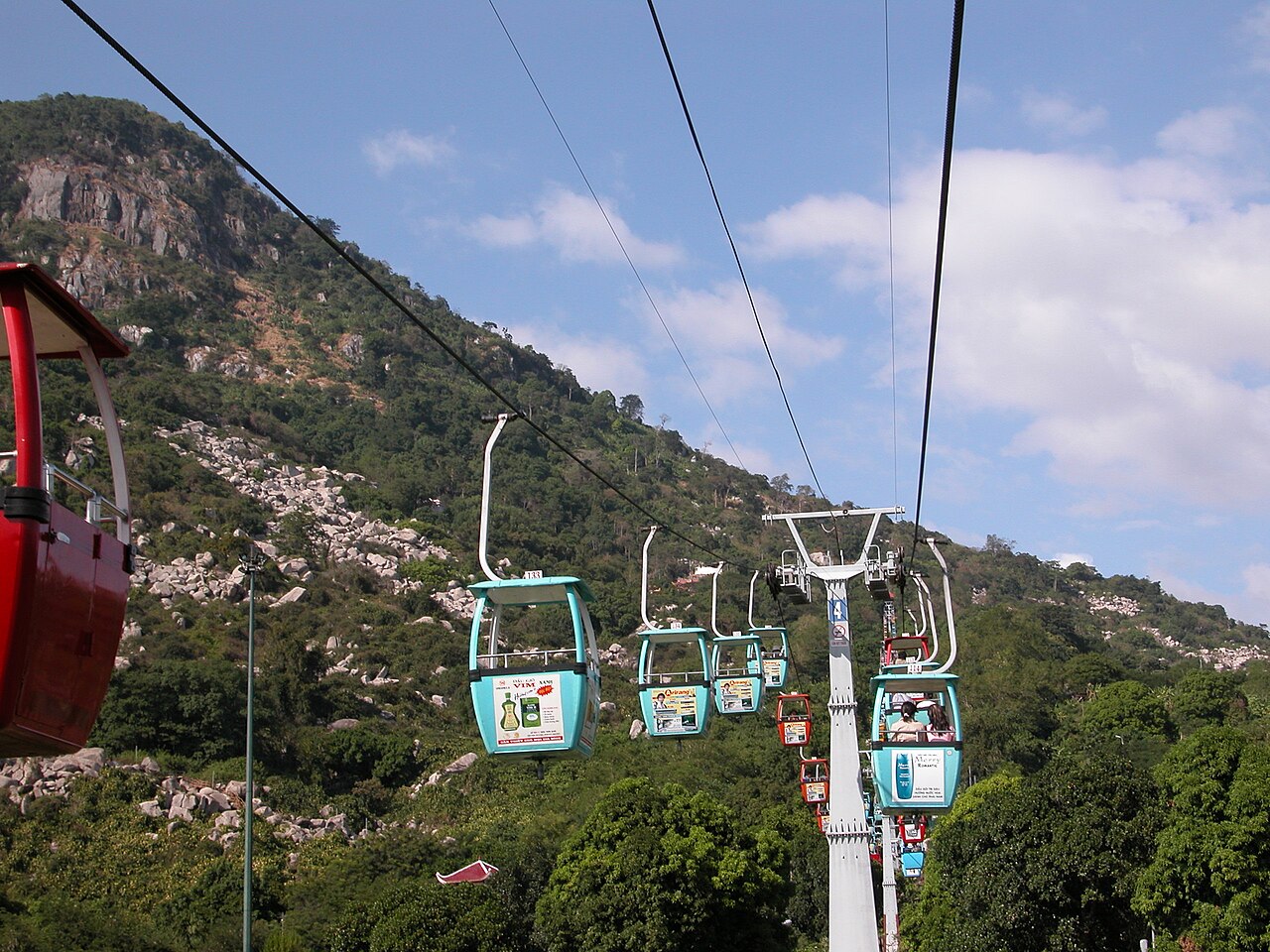
Ba Den Mountain (Núi Bà Đen), rising sharply from the flat surrounding plain to roughly 986 metres, is the highest point in southern Vietnam. A cable-car system runs to near the summit, and several Buddhist pagodas are built into the mountain's slopes. The site is an important pilgrimage destination, particularly busy around the lunar new year and major Buddhist festivals.
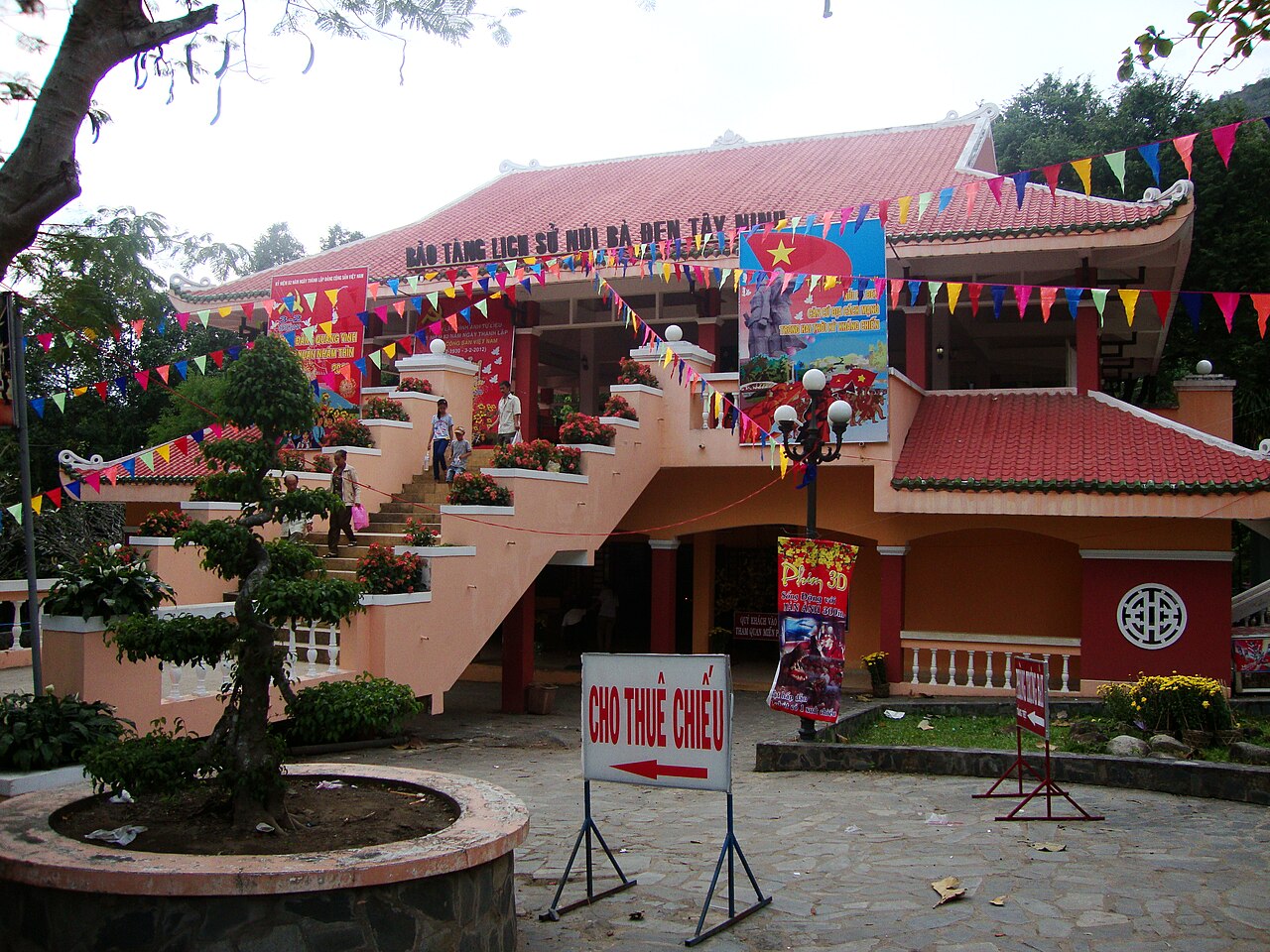
The province's western border runs through the Vam Co Dong river system and patches of protected forest. The area was heavily contested during the American War, and remnants of that period remain in the landscape and in local museums.
Climate and when to visit
Tay Ninh has a pronounced tropical wet-dry pattern. Temperatures are warmest and rainfall lightest from January through March, with peak daytime highs in March and April before the rains arrive. The dry season makes travel straightforward and roads predictable.
The wet season runs from May through November. Rainfall climbs steeply from May, peaks in September, and produces heavy daily downpours that can temporarily flood low-lying roads. July, August, September and October are the wettest months. Despite the rain, temperatures remain warm throughout the year and minimums do not drop below the low twenties even in the coolest months.
December and January represent a mid-ground: rainfall has largely ceased and the heat has moderated slightly from its April–May peak, making this period comfortable for outdoor activity. For further detail on how these patterns compare with the rest of the country, see When to go: weather by region.

Getting there and getting around
Tay Ninh town is approximately 90 to 100 kilometres northwest of central Ho Chi Minh City, connected by Highway 22, which also serves as one of the main overland routes into Cambodia. Bus services run regularly between Ho Chi Minh City and Tay Ninh town, and the journey typically takes two to three hours depending on traffic near the city. Motorbike taxis and hired cars are the primary means of moving between sites once in the province.
The Cu Chi Tunnels lie along the same highway corridor and are commonly visited on the same day or as a stop en route. There is no rail connection to Tay Ninh. The Moc Bai border crossing connects the province to Bavet in Cambodia and is one of the busier road crossings between the two countries; travellers should confirm current visa requirements before attempting this route. See Vietnam e-visa for entry requirements into Vietnam.
Accommodation and staying in the province
Most accommodation is concentrated in and around Tay Ninh town. Options range from simple guesthouses serving domestic pilgrimage traffic to mid-range hotels oriented towards business travellers and tourists making day trips from Ho Chi Minh City. Extended stays are uncommon among international visitors, and the range of internationally oriented facilities is limited compared with the larger cities of the south.
A smaller number of guesthouses operate near the Ba Den Mountain cable-car base, catering primarily to pilgrims and visitors who wish to be on the mountain early in the morning. Prices across the province vary by season and by proximity to major festivals, particularly the Cao Dai-related and Buddhist calendar events that draw large domestic crowds. See Money, ATMs and cards for practical payment information.
Common misunderstandings for first-time visitors
The Cao Dai prayer ceremonies are religious events, not performances. Visitors who enter the cathedral during prayers are expected to dress modestly, remain in designated areas, and behave accordingly. Photography is generally tolerated but should not disrupt worshippers. Arriving without appropriate clothing — bare shoulders, short skirts or shorts — may result in being turned away.
Ba Den Mountain is steeper than its cable-car access suggests. The pilgrim trails to the pagodas partway up involve uneven stone steps and can be slippery after rain. The summit area is considerably cooler and windier than the plain below.
Tay Ninh borders Cambodia but the Moc Bai crossing requires valid documentation for both countries. Assuming the crossing is straightforward without checking current visa rules is a recurring error. See Safety and common scams for general awareness, and SIM cards and eSIMs for connectivity across the border region.
Klima nach Monat
Langzeitdurchschnitte, keine Vorhersage. Referenzzeitraum: 2015–2024. Quelle: ERA5 reanalysis (Copernicus) via the Open-Meteo archive API.
Show the numbers
| Monat | Höchsttemperatur °C | Tief °C | Regen mm | Regentage | Humidity % |
|---|---|---|---|---|---|
| January | 31.9 | 22.8 | 18 | 3 | 66 |
| February | 33.2 | 22.9 | 8 | 2 | 62 |
| March | 34.2 | 24.2 | 28 | 5 | 64 |
| April | 34.2 | 25.4 | 90 | 11 | 70 |
| May | 32.9 | 25.7 | 228 | 25 | 80 |
| June | 31.4 | 24.9 | 258 | 27 | 85 |
| July | 30.8 | 24.6 | 357 | 29 | 86 |
| August | 30.9 | 24.6 | 321 | 29 | 86 |
| September | 30.4 | 24.2 | 389 | 29 | 88 |
| October | 30.2 | 23.9 | 330 | 26 | 87 |
| November | 30.5 | 23.7 | 160 | 17 | 81 |
| December | 30.8 | 23.1 | 46 | 7 | 71 |
Where it is
Also known as / see also
In der Nähe
Aufgegangen
Referenziert von
Quellen
- ERA5 climate normals — Copernicus / Open-Meteo (CC BY 4.0) abgerufen 30 August 2026
Supports: monthly temperature and rainfall normals, and elevation - Tay Ninh (Q36608) — Wikidata (CC0 1.0) abgerufen 30 August 2026
Supports: coordinates, area, population - Tay Ninh — Wikipedia (CC BY-SA 4.0) abgerufen 30 August 2026
Supports: background
Current Zuletzt geprüft: 31 August 2026. Rules, fares and prices change — check the official source before acting on anything here. Report a mistake.
Picture credits (5)
Cáp treo núi Bà Đen, Nguyễn Thanh Quang 18:18, 16 December 2007 (UTC), Public domain, Wikimedia Commons · Bảo tàng Lịch sử Núi Bà Đen Tây Ninh, KDL Núi Bà Đen, Prenn, CC BY-SA 3.0, Wikimedia Commons · trungydang, CC BY 3.0, Wikimedia Commons · Tây Ninh 2022 (biển hiệu cửa hàng) (5), Phương Huy, CC BY-SA 4.0, Wikimedia Commons · Tây Ninh 2022 (biển hiệu cửa hàng) (6), Phương Huy, CC BY-SA 4.0, Wikimedia Commons