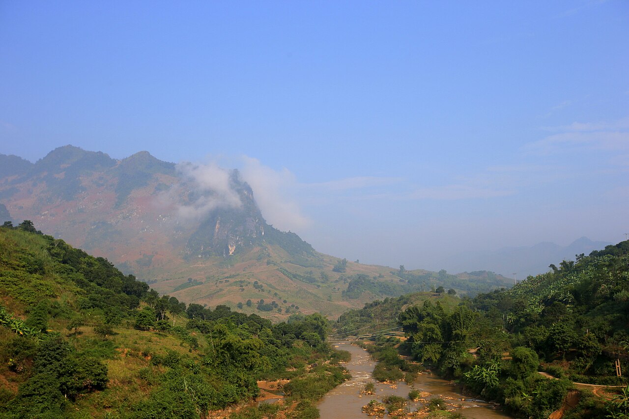
Son La province occupies a broad stretch of the northwest highlands, wedged between the Red River basin to the east and the border with Laos to the west. The terrain is dominated by limestone ridges, river valleys and high plateaus. Several dozen ethnic groups live here, including Thai, Mong, Muong and Dao communities, each with distinct weaving traditions, festivals and agricultural practices. The province was unchanged by Vietnam's July 2025 provincial merger, retaining its boundaries and its capital, also called Son La.
What Son La is known for
Son La's most visited area is the Moc Chau plateau, a high grassland region in the east of the province that produces tea, dairy products and stone fruit. The plateau is covered in tea bushes and plum and peach orchards that flower in late winter, drawing visitors from Hanoi on weekend trips.
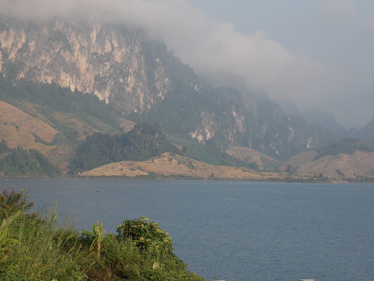
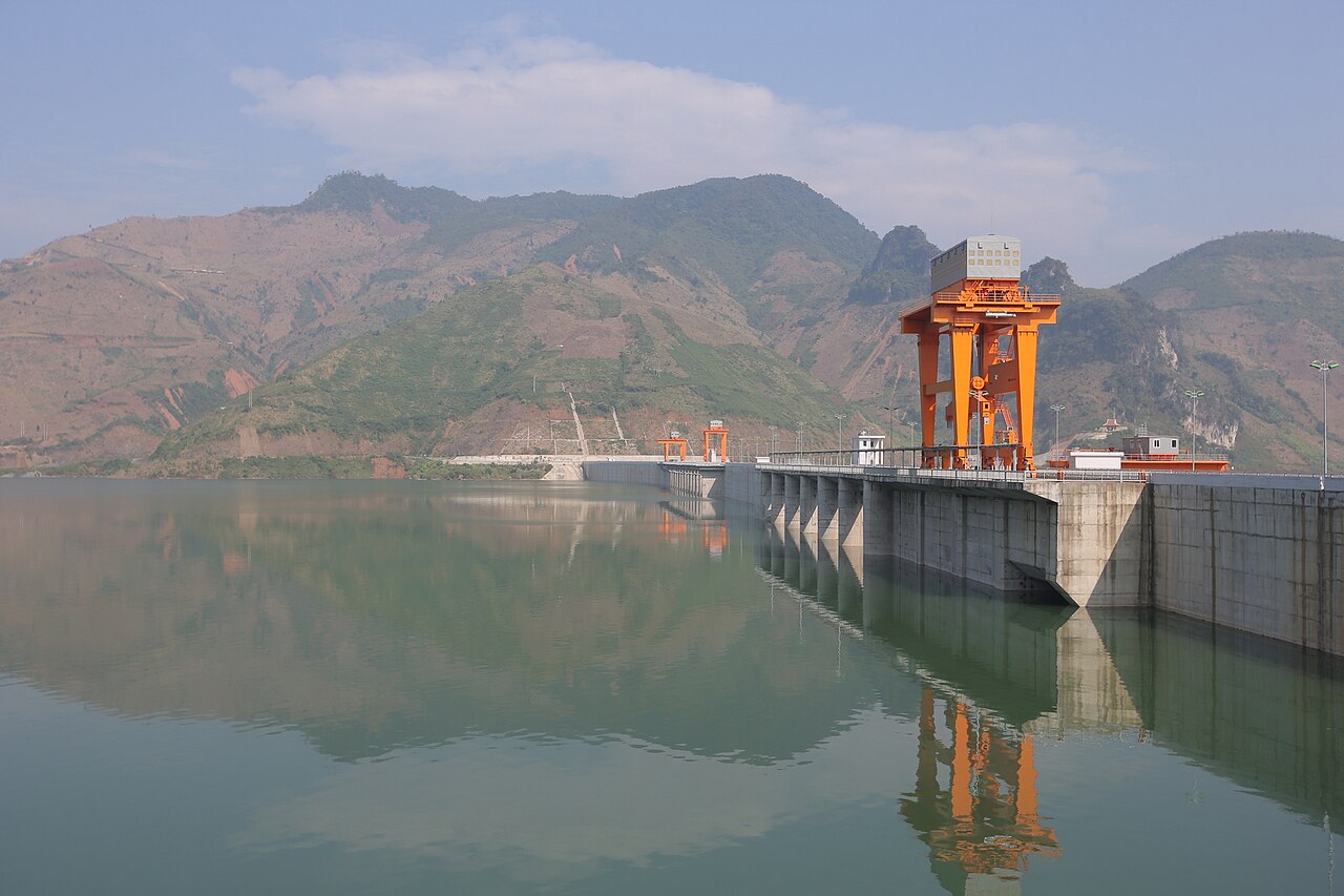
Beyond Moc Chau, the province is characterised by steep river valleys — particularly along the Da River and its reservoir, created by the Son La hydropower dam, one of the largest in Southeast Asia. The reservoir has altered the landscape significantly since its completion in the early 2010s, flooding former valleys and relocating tens of thousands of residents.
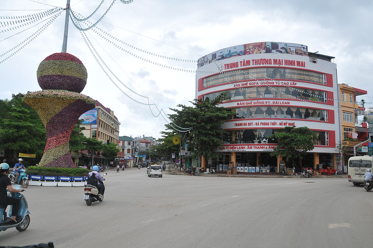
Ethnic Thai stilt-house villages, traditional brocade weaving and local rice wine are consistent features of the rural areas. The provincial capital, Son La city, retains a small French colonial-era prison that is now a museum, and serves mainly as a staging point for travel further west into Dien Bien.
Getting there and away
Son La city sits on National Highway 6, the main overland route connecting Hanoi with the northwest. Road travel from Hanoi to Son La city takes roughly five to six hours depending on traffic and road conditions; the route passes through Hoa Binh province before climbing into the mountains.
Open-tour sleeper buses and standard coaches operate daily between Hanoi's My Dinh bus station and Son La city. Minivans and shared vehicles connect Son La city with Moc Chau to the east and with Dien Bien Phu to the west, though the western leg is a long mountain drive.
Son La does not have a commercial airport. The nearest airports with regular domestic services are at Dien Bien Phu to the west and at Hanoi (Noi Bai) to the east. Travellers using Lao Cai and Sapa as a base for the northwest will find Son La requires a separate westward journey, as there is no direct road of reasonable quality linking the two corridors without returning to the valley floor.
Self-drive motorbike travel is common among experienced riders; the roads are scenic but include long stretches of steep gradient and limited roadside services. Fuel stops should be planned in advance outside of town centres.
When to go
Son La has a subtropical highland climate with distinct wet and dry seasons. The dry season runs roughly from October to April, with cooler temperatures from November through February, particularly at higher elevations. This period offers the most reliable road conditions and the clearest skies.
The wet season, from May to September, brings heavy rainfall that can cause landslides and road closures, particularly on the steeper mountain passes. Travel during this period is possible but requires flexibility and local advice on road conditions.
Moc Chau attracts visitors in late January and February when plum and peach trees flower, and again in October when the tea harvest and buckwheat fields provide colour. The plateau is cooler than the lowlands year-round, which can be welcome in summer but requires warmer clothing in winter evenings.
See weather by region for a broader comparison of seasonal patterns across Vietnam.
What there is to see and do
The Son La Prison and Museum in the provincial capital is the most visited historical site in the city. Built by the French colonial administration in 1908 and expanded in the 1930s, it held Vietnamese political prisoners including several figures who later became prominent in the Democratic Republic of Vietnam. The ruins and surviving cells are open to visitors.
Moc Chau is the province's most developed tourist destination, with tea plantations, dairy farms open to visitors, and access to several Mong and Thai villages. Pha Luong mountain near the Laos border offers trekking, though this area requires more logistical preparation and is less frequently visited.
The Da River reservoir, stretching across a large part of the province, can be explored by boat from several points along its shore. Former valley communities that were relocated above the waterline have, in some cases, developed small homestay operations.
Ethnic minority markets — particularly those held on specific days of the lunar calendar in villages across the province — are genuine trade events rather than tourist productions, though they attract visitors as well as local buyers and sellers. Confirming schedules locally is advisable as market days follow the lunar calendar and vary.
Where to stay
Accommodation in Son La province divides broadly between Son La city, Moc Chau and a scattering of homestays in rural villages.
Son La city has a range of mid-range hotels and guesthouses serving travellers on the Hanoi–Dien Bien corridor. It is functional rather than a destination in itself, and most visitors spend only one night here.
Moc Chau has the widest range of accommodation in the province, including resort-style hotels on the plateau and village homestays in the surrounding area. Weekends and holiday periods, particularly around the plum blossom season, see high occupancy and advance booking is advisable.
Village homestays in the Thai and Mong communities elsewhere in the province vary considerably in comfort and facilities. Some are well-established with basic private rooms and meals included; others are more rudimentary. Local tour operators in Son La city can assist with arranging verified homestays in more remote areas.
Common misunderstandings
Distance versus time. On a map, Son La appears relatively close to Hanoi or Sapa, but mountain roads mean that distances translate into considerably longer travel times than the same kilometres would in the lowlands. Budget generously for road travel and expect variations due to weather or road works.
Moc Chau is not the whole province. Many visitors treat Moc Chau as synonymous with Son La, but it represents only the eastern edge. The provincial capital, the Da River reservoir and the areas towards the Laos border are distinct destinations requiring separate planning.
Connectivity and cash. Mobile signal is inconsistent outside town centres and the main highway. ATMs are available in Son La city and Moc Chau town but are scarce in rural areas. See money, ATMs and cards and SIM cards and eSIMs for practical detail.
Visa rules change. Entry requirements for Vietnam, including e-visa eligibility and exemptions, are set by decree and can be updated with little notice. The Vietnam e-visa page summarises current arrangements, but the official immigration authority is the definitive source.
महीने के अनुसार जलवायु
दीर्घकालिक औसत, पूर्वानुमान नहीं। संदर्भ अवधि: 2015–2024. स्रोत: ERA5 reanalysis (Copernicus) via the Open-Meteo archive API.
Show the numbers
| महीना | उच्च °C | न्यूनतम °C | वर्षा मिमी | वर्षा दिवस | Humidity % |
|---|---|---|---|---|---|
| January | 19.3 | 10.7 | 53 | 7 | 81 |
| February | 21.6 | 11.9 | 42 | 6 | 77 |
| March | 25.8 | 15.7 | 76 | 12 | 77 |
| April | 28.0 | 18.0 | 113 | 15 | 74 |
| May | 28.9 | 20.3 | 200 | 21 | 78 |
| June | 28.0 | 21.1 | 250 | 26 | 85 |
| July | 27.5 | 21.0 | 295 | 26 | 87 |
| August | 26.8 | 20.7 | 426 | 28 | 90 |
| September | 26.4 | 19.9 | 176 | 21 | 86 |
| October | 24.5 | 17.5 | 91 | 12 | 82 |
| November | 23.0 | 15.2 | 30 | 7 | 79 |
| December | 19.4 | 11.1 | 27 | 5 | 78 |
Places within Son La
Where it is
Also known as / see also
आस-पास
संदर्भित
स्रोत
- ERA5 climate normals — Copernicus / Open-Meteo (CC BY 4.0) accessed 30 August 2026
Supports: monthly temperature and rainfall normals, and elevation - Map data from OpenStreetMap contributors, ODbL 1.0 — OpenStreetMap (ODbL 1.0) accessed 29 August 2026
Supports: carried over from the first build - Son La (Q33379) — Wikidata (CC0 1.0) accessed 30 August 2026
Supports: coordinates, area, population - Son La — Wikipedia (CC BY-SA 4.0) accessed 30 August 2026
Supports: background
Current अंतिम सत्यापन: 29 August 2026. Rules, fares and prices change — check the official source before acting on anything here. Report a mistake.
Picture credits (6)
Sơn La Province, [Tycho] , http://shansov.net, CC BY-SA 3.0, Wikimedia Commons · Nhật nguyệt, CC BY-SA 3.0, Wikimedia Commons · ChieuTimViet, CC BY 3.0, Wikimedia Commons · Sơn La Dam reservoir, [Tycho] , http://shansov.net, CC BY-SA 3.0, Wikimedia Commons · Rubus niveus 01, Gió Đông ( thảo luận ), CC BY 3.0, Wikimedia Commons · November 2024, Binh Chau - Phuoc Buu nature reserve, along South of central road 14, Syced, CC0, Wikimedia Commons