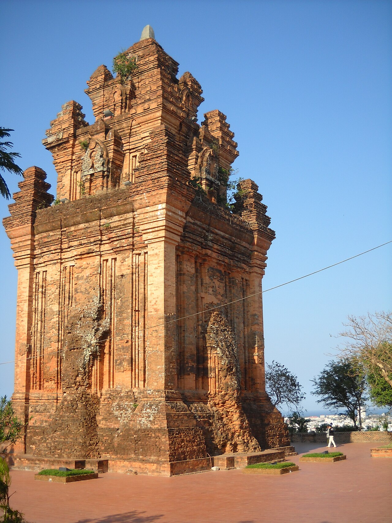
The place itself has not changed, and this page continues to cover it.
National Assembly Resolution 202/2025/QH15 on the rearrangement of provincial-level administrative units
Administrative status
Phu Yen functioned as a provincial-level administrative unit until 30 June 2025. On 1 July 2025, as part of Vietnam's nationwide consolidation from 63 provinces to 34, Phu Yen merged into Dak Lak, which now governs the area. The district tier was abolished at the same time, and the territory moved to a two-tier province/commune system.
The merger is a change of administration, not of geography or culture. Tuy Hoa, the former provincial capital, remains the main city of the area. The Ghenh Da Dia rock formations, Long Beach, and Vung Ro Bay are all where they have always been. Maps and signage may reflect the old province name for some time after the merger.

What Phu Yen is known for
The area occupies a narrow coastal strip between the Truong Son mountain range to the west and the South China Sea to the east. It is best known for:
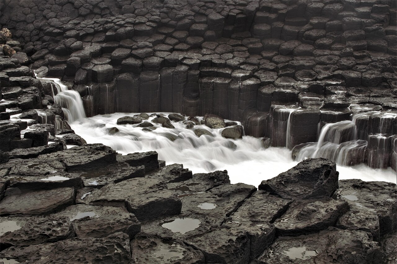
- Ghenh Da Dia (Đá Đĩa): a beach of tightly packed basalt columns formed by ancient volcanic activity, sometimes compared in structure to the Giant's Causeway in Northern Ireland. The columns interlock in near-perfect hexagons and meet the sea directly.
- Yellowfin tuna: Phu Yen's offshore waters support one of Vietnam's most productive tuna fisheries. The catch is significant enough that the former province was sometimes called the "tuna capital" of the country.
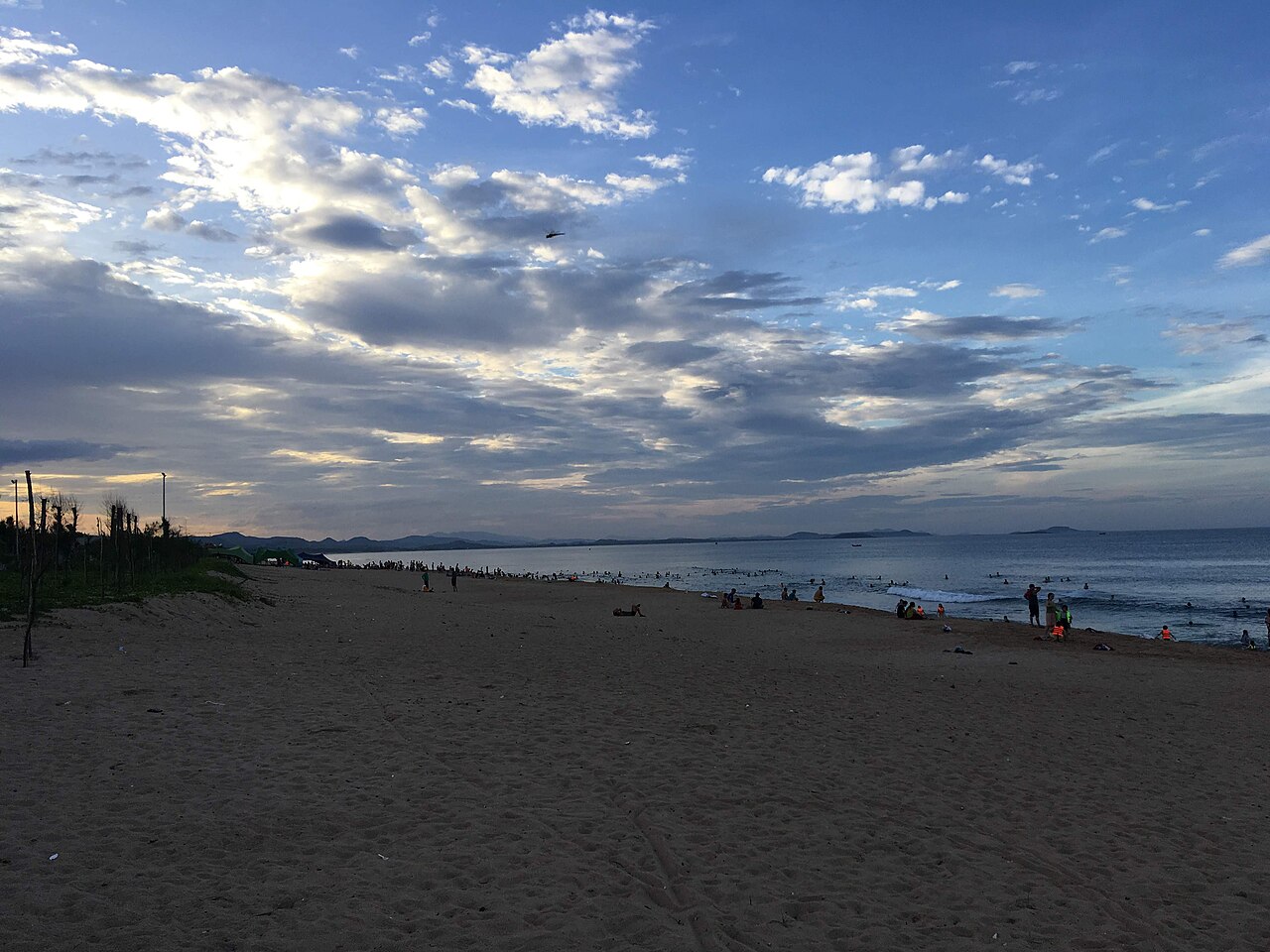
- Long Beach (Bãi Dài): a largely undeveloped sandy beach north of Tuy Hoa city, stretching for several kilometres without the commercial density found further south.
- Vung Ro Bay: a sheltered deepwater bay associated with the Ho Chi Minh Trail's maritime branch, through which supplies were shipped to southern forces during the war. Rusting hulks remain visible underwater.
- O Loan Lagoon: a brackish coastal lagoon farmed for shellfish, particularly ark clams and oysters.
Seasons and when to visit
Phu Yen sits in a climatic transition zone. The rainy season runs roughly from September through December, driven by the north-east monsoon, and this period brings the heaviest rainfall and occasional typhoon risk. October and November are typically the wettest months. Flooding can affect low-lying coastal areas and mountain roads during peak rainfall.
The dry season from January through August offers calmer seas and clearer skies. February through May tends to be the driest and most settled period. Sea conditions are generally best for swimming and boat trips during this window. Prices vary by season, with domestic tourism peaking around national holidays including Tết in late January or February and the April reunification period.
Travellers researching diving or snorkelling at Vung Ro should note that visibility is strongly affected by seasonal swell and river runoff following heavy rain.
Getting there and around
By air: Dong Tac Airport serves Tuy Hoa, with scheduled connections to Hanoi and Ho Chi Minh City. Flight frequency varies by carrier and season; the airport is small and does not handle international routes directly.
By rail: The North–South Railway (Đường sắt Thống Nhất) passes through Tuy Hoa station, making rail a practical option from both Hanoi and Ho Chi Minh City. The coastal stretch through this section of the route is considered scenically notable. Journey times vary considerably by train class and stopping pattern.
By road: National Highway 1 (Quốc lộ 1) runs the length of the former province. Bus services connect Tuy Hoa to Da Nang, Nha Trang, and other coastal cities. The mountain passes at the northern and southern boundaries of the area can be slow in poor weather.
Getting around locally: Motorbike hire is available in Tuy Hoa and is the most practical way to reach Ghenh Da Dia, O Loan Lagoon, and the northern beaches independently. Distances are manageable but roads to some coastal sites are narrow.
Towns and areas
Tuy Hoa city: The former provincial capital and the area's main urban centre. It sits at the mouth of the Ba River and is a working city rather than a resort town. The main market, central bus station, and most accommodation options are concentrated here.
Song Cau: A smaller coastal town to the north, known for its aquaculture lagoons, particularly lobster farming in floating cages. The approach road along the coast between Song Cau and the Ghenh Da Dia area passes several fishing villages.
Dong Hoa and the southern coast: The southern part of the former province borders Khanh Hoa (now also part of a merged entity) and includes access to Vung Ro Bay. This area is less visited and road access to the bay itself requires descending a mountain pass.
Common misunderstandings
The province no longer exists as an administrative unit. As of 1 July 2025, official correspondence, business registration, and governance all fall under Dak Lak. However, Phu Yen remains a meaningful geographic and cultural reference, and the name continues to appear in tourism, food labelling (particularly for tuna products), and local identity.
Ghenh Da Dia is not in Quy Nhon. Visitors sometimes confuse the two because Quy Nhon in Binh Dinh to the north is a more widely marketed destination. The basalt formations are in the area of An Ninh Dong commune, north of Tuy Hoa, not in Binh Dinh.
Tuy Hoa is not a beach resort. Unlike Nha Trang or Da Nang, the city itself is not built around tourism infrastructure. Travellers expecting a resort-style experience in the city centre are likely to be surprised by its everyday commercial character.
Tuna at the source does not mean cheap. The area's tuna reputation leads some visitors to expect unusually low prices. Seafood pricing varies by season and supply; no specific price expectations are reliable.
各月气候
长期平均值,非预测数据。 参考周期: 2015–2024. 来源: ERA5 reanalysis (Copernicus) via the Open-Meteo archive API.
Show the numbers
| 月份 | 最高气温 °C | 最低气温 °C | 降雨量(毫米) | 降雨天数 | Humidity % |
|---|---|---|---|---|---|
| January | 23.6 | 18.4 | 103 | 17 | 86 |
| February | 24.5 | 18.4 | 56 | 12 | 85 |
| March | 27.6 | 20.0 | 51 | 11 | 84 |
| April | 30.0 | 21.8 | 56 | 11 | 81 |
| May | 31.4 | 23.4 | 130 | 19 | 79 |
| June | 32.0 | 23.8 | 95 | 18 | 73 |
| July | 31.3 | 23.5 | 130 | 19 | 74 |
| August | 31.9 | 23.7 | 105 | 19 | 72 |
| September | 29.9 | 22.6 | 238 | 25 | 81 |
| October | 27.2 | 21.6 | 340 | 26 | 87 |
| November | 25.3 | 20.8 | 395 | 26 | 90 |
| December | 23.6 | 19.3 | 266 | 25 | 88 |
现为……的一部分
被以下页面引用
来源
- ERA5 climate normals — Copernicus / Open-Meteo (CC BY 4.0) 访问于 30 August 2026
Supports: monthly temperature and rainfall normals, and elevation - Phu Yen (Q36725) — Wikidata (CC0 1.0) 访问于 30 August 2026
Supports: coordinates, area, population - Phu Yen — Wikipedia (CC BY-SA 4.0) 访问于 30 August 2026
Supports: background
Current 最后核实: 31 August 2026. Rules, fares and prices change — check the official source before acting on anything here. Report a mistake.
Picture credits (4)
Tháp Nhạn, Tuy Hòa, Phú Yên, Original uploader was Dongson*vmvn at vi.wikipedia, CC BY-SA 3.0, Wikimedia Commons · Beach in Tuy Hoa 3, Christophe95, CC BY-SA 4.0, Wikimedia Commons · Mui Dai Lanh PhuYen, Nh.Nguyen ( thảo luận ), CC BY 3.0, Wikimedia Commons · Ghềnh đá đĩa phú yên, Việt Nguyễn, CC0, Wikimedia Commons