2025 constitutional amendment and Law on Organisation of Local Government establishing a two-tier local government
Administrative status
Phan Thiết was formerly a provincial city — the capital of Bình Thuận province. On 1 July 2025, Vietnam's nationwide administrative reorganisation abolished the district tier and consolidated provincial-level units from 63 down to 34. As part of this reform, Phan Thiết's status as a distinct provincial-city unit ceased; the area is now governed directly under the two-tier province/commune system within Bình Thuận province.
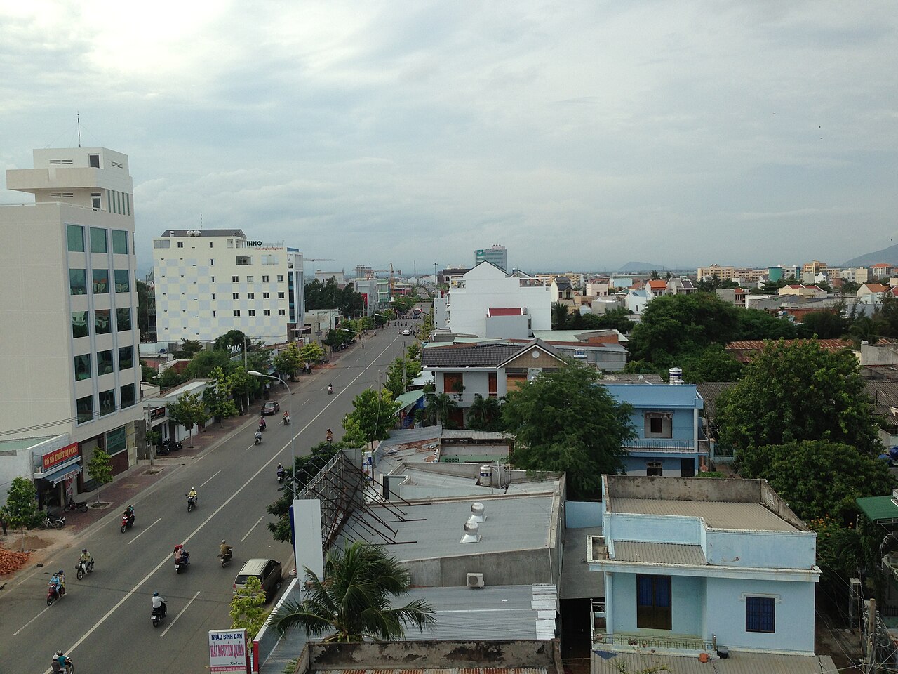
The city as a place — its streets, coastline, port and communities — has not changed. Phan Thiết remains the name of the urban centre, and it continues to function as the main city of Bình Thuận. Travellers and residents will notice no difference on the ground.
What Phan Thiết is known for
Phan Thiết's most enduring association is with nước mắm — fish sauce. The town has produced it for centuries using anchovy catches from the South China Sea, and the smell of fermenting barrels is still present in older parts of the city near the river mouth. Several family operations and larger producers remain active.
The city is also the gateway to Mũi Né, a narrow coastal strip roughly 20 kilometres to the northeast that developed rapidly from the 1990s into a concentration of resorts, restaurants and watersports facilities. Mũi Né and the surrounding red and white sand dunes have become the primary draw for visitors, though they are administratively and spatially distinct from Phan Thiết's urban core.
Kite surfing and windsurfing have a strong presence here owing to reliable seasonal winds, particularly between October and April, when the northeast monsoon funnels along this stretch of coast.
Seasons and when to visit
Phan Thiết sits in one of Vietnam's drier corridors. The coastal location and the sheltering effect of surrounding terrain means the area receives significantly less rainfall than regions to the north or the Mekong Delta to the south.
The dry season runs approximately from November through April. This period coincides with the northeast monsoon winds that make the area popular for kite surfing and windsurfing. Conditions are generally clear and hot.
The wet season runs from May through October, with the heaviest rainfall typically in September and October. Even during this period, prolonged rain is less common here than in many other parts of Vietnam, though tropical depressions and occasional typhoons can affect the coast. Prices vary by season, and the resort strip in particular sees markedly different crowd levels between peak and off-peak months.
Getting there and around
Phan Thiết does not currently have a commercial airport in regular passenger operation, though a new airport for Bình Thuận province has been in planning and intermittent development for a number of years — its status remains uncertain and subject to change.
The primary intercity connections are by road and rail. The North–South railway passes through Phan Thiết station, linking the city to Hồ Chí Minh City to the south and to Đà Nẵng and Hà Nội to the north. Journey times vary considerably by train type. Sleeper and express services operate on this route.
By road, Phan Thiết lies on or near National Highway 1 and is accessible by open-tour buses and private coaches from Hồ Chí Minh City, a journey of roughly four hours depending on traffic and departure point. Limousine vans serving the Mũi Né strip directly from Hồ Chí Minh City are common and can be booked through accommodation providers.
Within the city and along the coastal strip, motorbike taxis, app-based ride services and bicycle rental are the most practical options for short distances.
Places and things to see
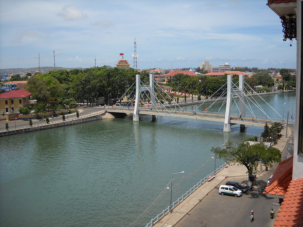
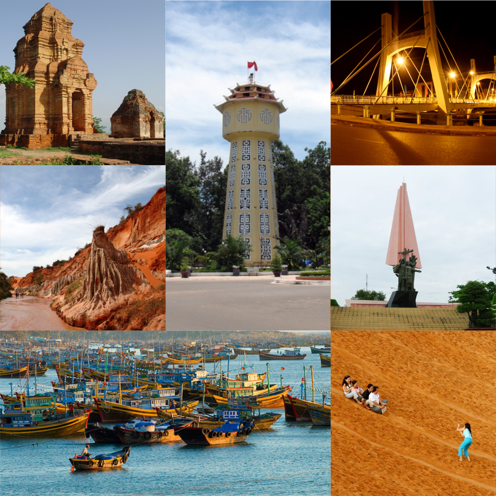
The Cà Ty River runs through the city centre and the fishing harbour along its banks remains active. Early mornings see catch being landed and sorted at the port area near the river mouth.
The Phan Thiết Water Tower, a French colonial-era structure built in 1928, stands in the city centre and is one of the more photographed landmarks in the urban area itself.
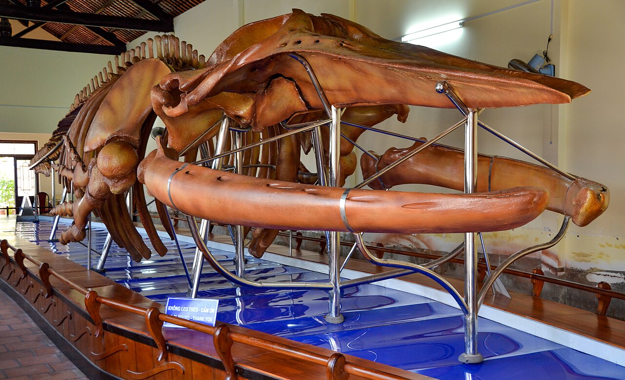
The Vạn Thủy Tú Temple (Đình Vạn Thủy Tú) is a Cham-influenced whale temple dating to the early 18th century, housing one of the largest whale skeletons in Vietnam — a feature of the local seafaring and whale-veneration tradition that persists along this coast.
The sand dunes of the Mũi Né area include both the Red Sand Dunes (Đồi Hồng) closer to the town and the White Sand Dunes (Bàu Trắng) further northeast, the latter situated next to a freshwater lake. Both are active tourism sites.
The Fairy Stream (Suối Tiên), a shallow red-and-white sandstone gully with a stream running through it, is a popular walking site near the resort strip.
Where people stay
Accommodation divides broadly between the Mũi Né resort strip and the Phan Thiết city centre. These two zones have very different characters.
The resort strip along the coastal road northeast of the city — historically referred to as Mũi Né — is where the bulk of international-standard hotels, resorts, and guesthouses are concentrated. Properties range from budget guesthouses to large beachfront resorts. The strip is linear, stretching several kilometres, and transport between properties requires vehicles.
The city centre is a working Vietnamese town with a different pace. Accommodation here tends toward Vietnamese-run guesthouses and mid-range hotels catering to domestic travellers and those with business in the city. Proximity to the railway station is a practical advantage for this zone.
Lâm Đồng province, which borders Bình Thuận to the north, sees some visitors combining the coast with a trip to the highland city of Đà Lạt, a route that passes through varied terrain.
Common misunderstandings
Mũi Né and Phan Thiết are not the same place. Many booking platforms and travel writers use the names interchangeably, or label accommodation spread across 20 kilometres of coastline as simply "Mũi Né". Mũi Né is technically a specific cape and village at the far northeastern end of the resort strip. Travellers who book a beachside resort expecting to walk to the city centre will find the distances impractical on foot.
The fish sauce smell is real and localised. Parts of the city near production facilities have a strong fermented fish aroma, particularly in warm weather. This is a feature of the place, not a sanitation issue.
The wind and waves serve specific sports. The conditions that make Phan Thiết attractive to kite surfers — strong offshore winds, choppy water — make the same stretch of coast less suitable for casual swimming than travellers sometimes expect. Calmer swimming spots exist but require knowing where to look.
Administrative changes do not affect travel logistics. The 2025 reorganisation that ended Phan Thiết's status as a provincial city does not change addresses, transport links, or any practical aspect of visiting. The city is still called Phan Thiết and is still the main urban centre of Bình Thuận.
Where it is
Fontes
- Phan Thiết (Q25315) — Wikidata (CC0 1.0) truy cập 30 August 2026
Supports: coordinates, area, population - Phan Thiết — Wikipedia (CC BY-SA 4.0) truy cập 30 August 2026
Supports: background
Current Última verificação: 31 August 2026. Rules, fares and prices change — check the official source before acting on anything here. Report a mistake.
Picture credits (4)
Sông Cà Ty trong TP.Phan Thiết, Original uploader was Nguyễn Đông Sơn at vi.wikipedia, CC BY-SA 3.0, Wikimedia Commons · Phan Thiết - street, 1700-talet, CC BY 3.0, Wikimedia Commons · Phanthiet, Tran The Vinh, CC BY-SA 3.0, Wikimedia Commons · Balaenoptera physalus skeleton in the Van Thuy Tu Temple, Photographer: Mosbatho, CC BY 4.0, Wikimedia Commons