The place itself has not changed, and this page continues to cover it.
2025 constitutional amendment and Law on Organisation of Local Government establishing a two-tier local government
Overview
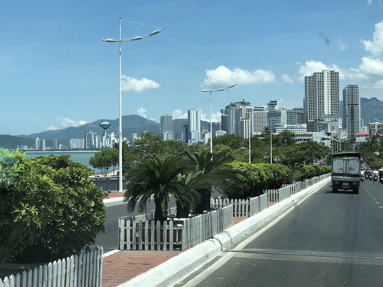
Nha Trang sits on a sheltered bay in Khanh Hoa province, backed by low mountains and facing a chain of islands to the south and east. The city occupies a narrow coastal plain at close to sea level, which makes it warmer and sunnier than nearby highland destinations such as Da Lat. The seafront promenade, Tran Phu Boulevard, runs for several kilometres along the main beach and anchors the commercial core of the city. Nha Trang functions simultaneously as a domestic resort for Vietnamese holidaymakers, a beach destination for Russian and Korean tourists who form two of its largest international visitor groups, and a base for divers exploring the reefs around Hon Mun and neighbouring islands. The city has a distinctly layered character: Soviet-era hotel blocks, Korean-language signage, Vietnamese family guesthouses, and international dive shops occupy the same few streets.
The beach and seafront
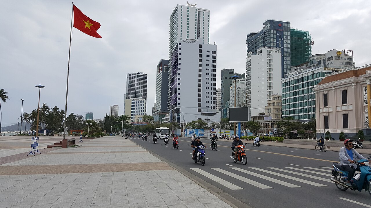
The main beach stretches roughly six kilometres along Tran Phu Boulevard. The sand is reasonably clean by urban Vietnamese standards, and the bay is calm enough for swimming during the dry season. The northern end of the beach near the mouth of the Cai River tends to be quieter; the central and southern sections, flanked by large hotels, are more crowded. Sun loungers and umbrellas are available from operators along the beach; prices vary by season and location.
The seafront is backed by a narrow strip of casuarina trees planted as windbreaks. Vendors, juice stalls, and seafood restaurants occupy the streets immediately behind the promenade. At the southern end of the bay, Hon Chong headland offers elevated views across the water toward the Hon Do islet and its small pagoda. The headland's granite boulders are a popular vantage point at dusk.
Islands, boat trips and snorkelling
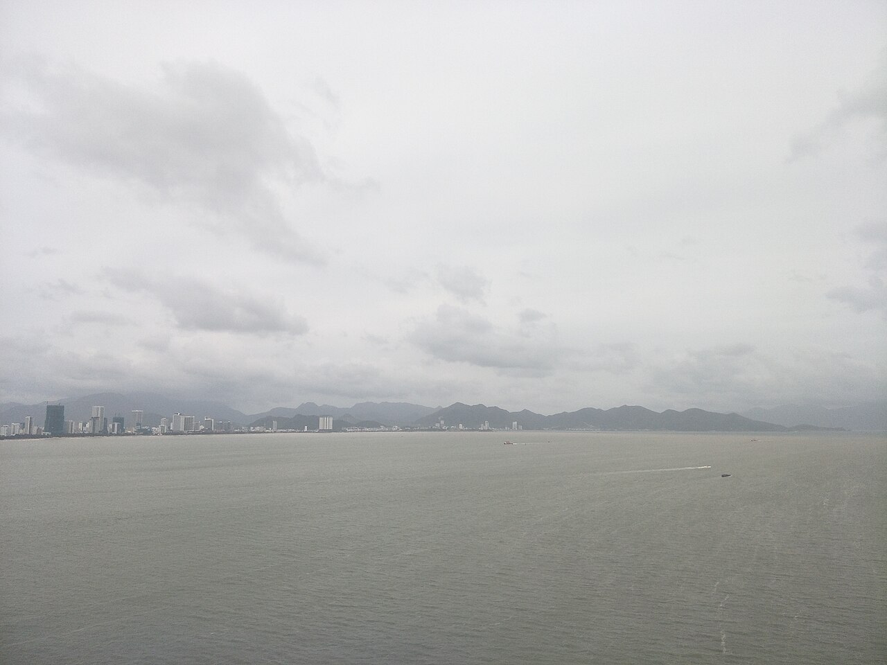
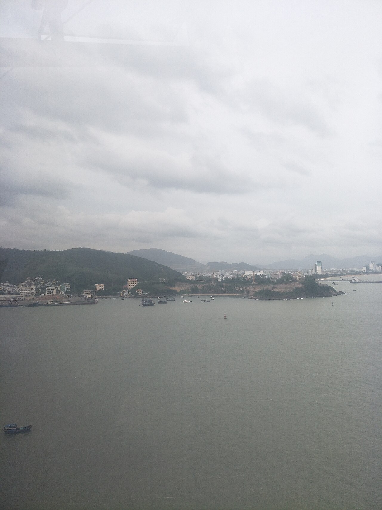
The cluster of islands south of Nha Trang — including Hon Mun, Hon Tam, Hon Mot, Hon Tre, and Hon Mieu — is the focus of most organised boat excursions. Group boat trips typically follow a circuit visiting three or four islands, combining snorkelling stops with a floating seafood lunch. The quality of coral around Hon Mun is the highest of the group and the area carries marine protected status, though enforcement has been inconsistent and coral condition has declined over successive decades of intensive tourism.
Hon Tre, the largest island, is dominated by the Vinpearl resort and amusement complex, accessible by cable car from the mainland — the cable car crossing over the bay is a recognisable feature of the Nha Trang skyline. Ninh Van Bay, to the north of the city, is accessible only by boat and is home to several upmarket bungalow resorts set among granite boulders; it offers a quieter alternative to the main island circuit. Doc Let beach, roughly an hour's drive north along the coast, is a long, shallow-water beach used mainly by domestic visitors and day-trippers.
Diving
Nha Trang is one of the longest-established diving destinations in Vietnam. PADI-certified dive centres are concentrated along Biet Thu Street and the surrounding blocks. Hon Mun marine protected area is the primary dive site, with depths ranging from shallow reef gardens suitable for beginners to walls and drop-offs used for more experienced dives. Visibility is generally best between January and August; the wet season from October to December brings reduced visibility and occasionally rough sea conditions that lead operators to cancel trips.
Standards among dive operators vary. Some centres maintain well-serviced equipment and employ internationally certified instructors; others operate at lower standards. Prospective divers are advised to inspect equipment and ask about instructor qualifications before booking. Night dives and day trips to more remote sites are offered by a smaller number of operators.
Po Nagar Cham towers
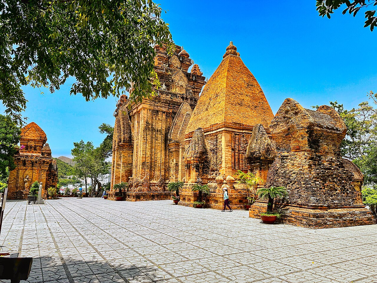
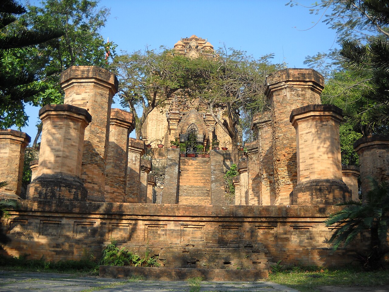
The Po Nagar tower complex stands on a small granite hill at the north of the city, above the mouth of the Cai River. It is one of the best-preserved Cham religious sites in Vietnam, with construction phases dating from the 7th to the 12th centuries. The towers were dedicated to the goddess Po Ino Nagar, the Cham mother goddess of the kingdom, and the site remains an active place of worship for both ethnic Cham communities and Vietnamese Buddhists.
Four towers survive in varying states of preservation. The tallest, the North Tower (Tháp Chính), stands approximately 23 metres and retains much of its original brick and sandstone decorative carving. A mukhalinga — a Shiva linga carved with a face — occupies the sanctuary. Visitors are expected to cover their shoulders and knees; cloths are available at the entrance. The site is busiest during the annual Po Nagar Festival, held on the 23rd day of the third lunar month, when Cham and Vietnamese pilgrims gather for ceremonies and traditional music performances.
Mud baths and hot springs
Several mud bath facilities operate on the outskirts of the city, drawing on geothermal springs in the Nha Trang area. The best known are Thap Ba Hot Spring Centre, to the northwest, and I-Resort, a larger complex further inland. Both offer individual and group mud tubs, mineral water pools at varying temperatures, and waterslide areas aimed at families. The mud is naturally occurring mineral clay, and the facilities market the experience around its purported benefits for skin and circulation — claims that are not independently verified. Visits are typically a half-day activity. Prices vary by season and package type.
Getting there and practical notes
Cam Ranh International Airport (CXR) is located approximately 35 kilometres south of the city centre and handles both domestic routes and direct international flights from Russia, South Korea, and several other countries. The road transfer from the airport takes 30–50 minutes depending on traffic. Open-tour buses connect Nha Trang with Ho Chi Minh City to the south and with Quy Nhon and Da Nang to the north; the city is also on the main north–south railway line. Da Lat and Buon Ma Thuot are accessible by road for day trips or overnight excursions into the Central Highlands.
The driest and calmest months run from January through August, with temperatures climbing from the mid-twenties in January to the low thirties by mid-year. October and November are the wettest months and bring the heaviest rainfall; some island boat trips are cancelled during sustained swells. See When to go: weather by region for broader regional context. Visitors requiring a visa should consult the Vietnam e-visa page. For currency and payment, see Money, ATMs and cards. As in any busy tourist city, common scams including inflated taxi fares and unsolicited tour offers occur; see Safety and common scams for details. Mobile connectivity is reliable in the city centre; options are outlined at SIM cards and eSIMs.
المناخ حسب الشهر
متوسطات طويلة الأمد، وليست تنبؤاً. الفترة المرجعية: 2015–2024. المصدر: ERA5 reanalysis (Copernicus) via the Open-Meteo archive API.
Show the numbers
| الشهر | أعلى درجة حرارة °م | الحد الأدنى °C | كمية الأمطار (ملم) | أيام الأمطار | Humidity % |
|---|---|---|---|---|---|
| January | 26.3 | 21.7 | 85 | 14 | 80 |
| February | 26.9 | 21.6 | 50 | 9 | 78 |
| March | 28.9 | 22.9 | 40 | 9 | 79 |
| April | 30.7 | 24.6 | 54 | 10 | 79 |
| May | 32.1 | 26.2 | 89 | 15 | 78 |
| June | 32.8 | 26.5 | 76 | 12 | 75 |
| July | 32.2 | 26.1 | 102 | 17 | 77 |
| August | 32.6 | 26.1 | 112 | 16 | 76 |
| September | 31.1 | 25.4 | 173 | 21 | 81 |
| October | 29.1 | 24.4 | 260 | 26 | 85 |
| November | 27.8 | 23.6 | 370 | 23 | 86 |
| December | 26.5 | 22.6 | 232 | 19 | 82 |
Practical notes
Where it is
Also known as / see also
قريب
مُشار إليه من
المصادر
- ERA5 climate normals — Copernicus / Open-Meteo (CC BY 4.0) تم الوصول إليه 30 August 2026
Supports: monthly temperature and rainfall normals, and elevation - Nha Trang (Q19491) — Wikidata (CC0 1.0) تم الوصول إليه 30 August 2026
Supports: coordinates, area, population - Nha Trang — Wikipedia (CC BY-SA 4.0) تم الوصول إليه 30 August 2026
Supports: background
Current آخر تحقق: 31 August 2026. Rules, fares and prices change — check the official source before acting on anything here. Report a mistake.
Picture credits (6)
04052023 Ponagar Hindu temples complex, Nha Trang Vietnam - 27, Ms Sarah Welch, CC0, Wikimedia Commons · Nha Trang Khánh Hoà, Victor311, CC BY-SA 4.0, Wikimedia Commons · 20180409 143358Nha Trang, choi kwangmo, CC0, Wikimedia Commons · Coastline of Nha Trang in November 2017, picture2, Huangdan2060, CC0, Wikimedia Commons · Coastline of Nha Trang in December 2017, picture1, Huangdan2060, CC0, Wikimedia Commons · Bình đài ở tháp Ponagar, Nha Trang, Dongson*vmvn at Vietnamese Wikipedia, CC BY-SA 3.0, Wikimedia Commons