Overview and administrative note
Mui Ne (Mũi Né) is a coastal settlement on Vietnam's southern coast, historically part of Binh Thuan province. Following Vietnam's provincial consolidation on 1 July 2025, the area now falls within Lam Dong province, which absorbed former Binh Thuan. The destination itself — the dunes, the resort strip, the fishing harbour — is unchanged by this administrative reorganisation.
The name Mui Ne refers both to a specific headland and, loosely, to the long beach road (Nguyen Dinh Chieu street) lined with resorts, restaurants and kitesurf schools. Phan Thiet, the larger urban centre a few kilometres to the west, is the provincial city and transport hub. Travellers often use the two names interchangeably, though the character of each differs considerably.
Sand dunes
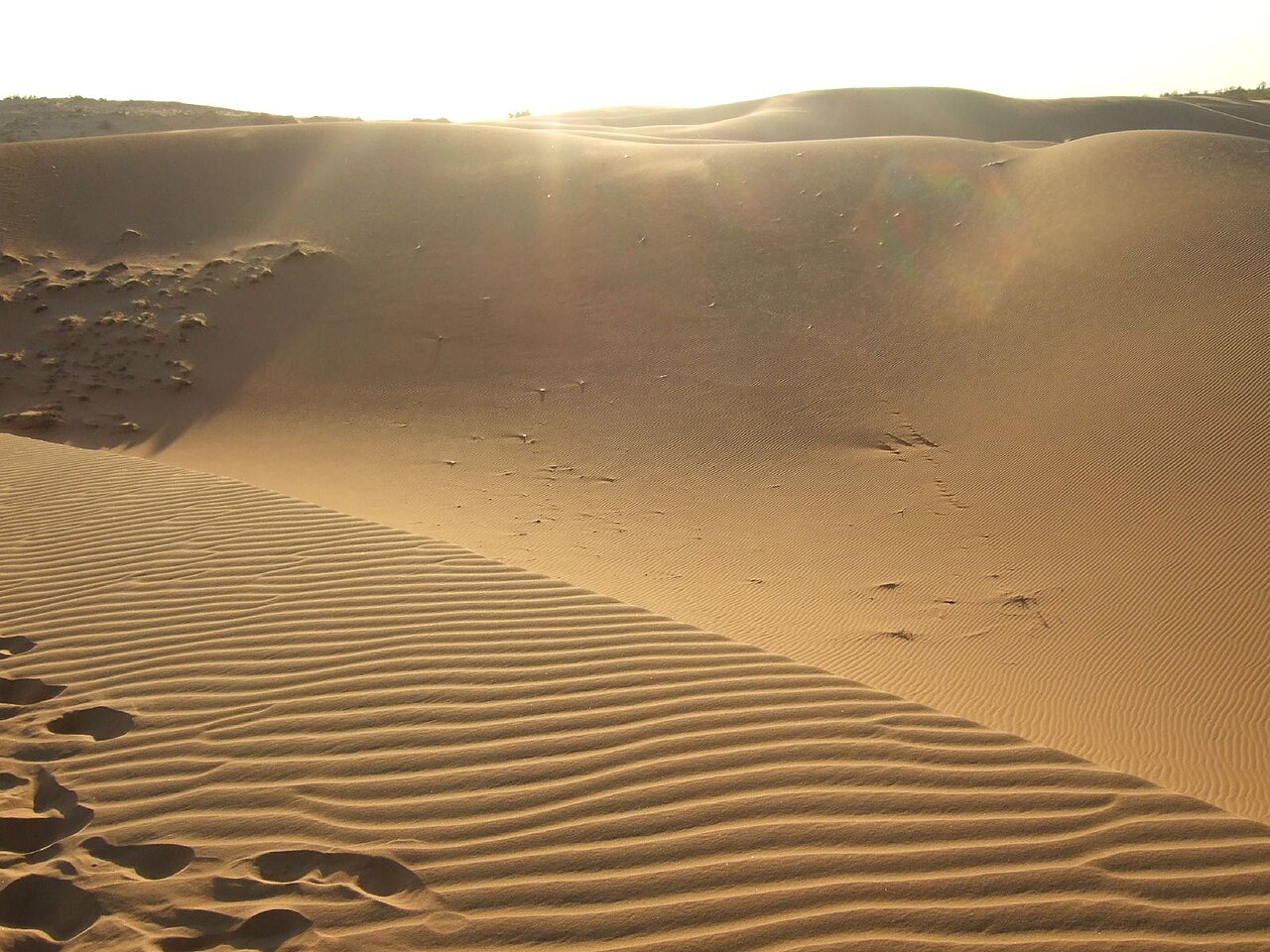
Mui Ne's most photographed features are two distinct dune systems. The red dunes (đồi cát đỏ), closer to the resort strip, are coloured by iron oxide in the sand and rise to modest heights suitable for walking or sliding. The white dunes (đồi cát trắng, also called Bàu Trắng), located further northeast near the village of Bắc Bình, are larger and more dramatic, surrounding a freshwater lake fringed with casuarina trees.
Both sites attract quad bikes and sand sledges for hire. The quad-bike operations at the white dunes in particular have been a point of ongoing debate: environmental groups have raised concerns about erosion and disturbance to the dune ecosystem, and the situation regarding permitted access and vehicle types has changed periodically. Visitors should expect the commercial activity but should also be aware that regulations are contested and may shift.
Early morning visits avoid the midday heat and, at the white dunes, offer the clearest light for the lake reflections.
Fairy Stream and the fishing village
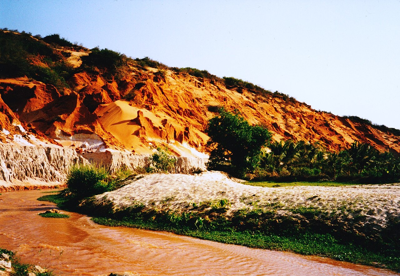
Fairy Stream (Suối Tiên) is a shallow watercourse that winds through low sandstone formations and red dunes before reaching the sea. Visitors wade along the streambed — removing footwear is the norm — passing eroded canyon walls tinted in shades of ochre and rust. The walk is short, roughly two kilometres return, and is accessible to most visitors.
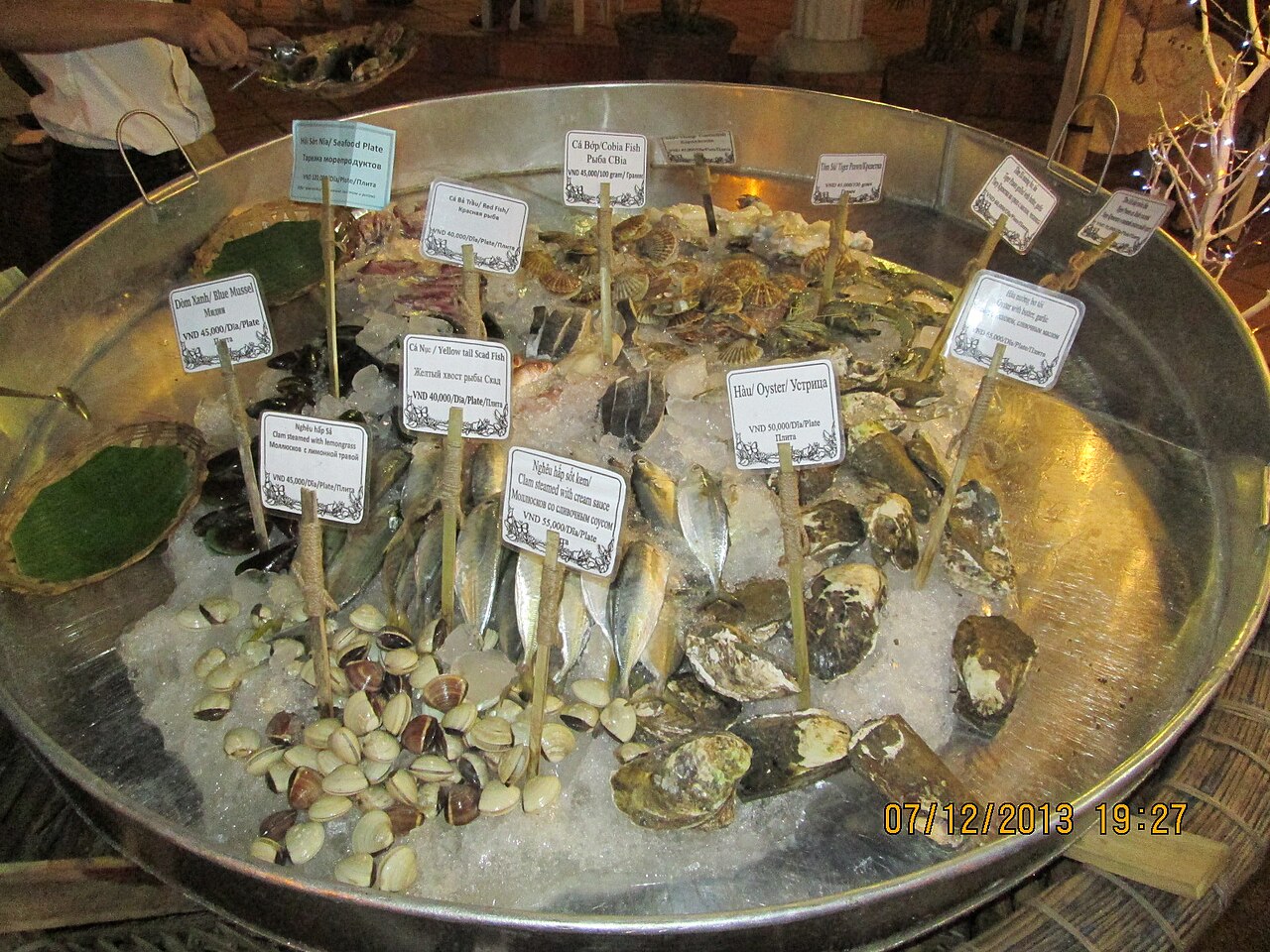
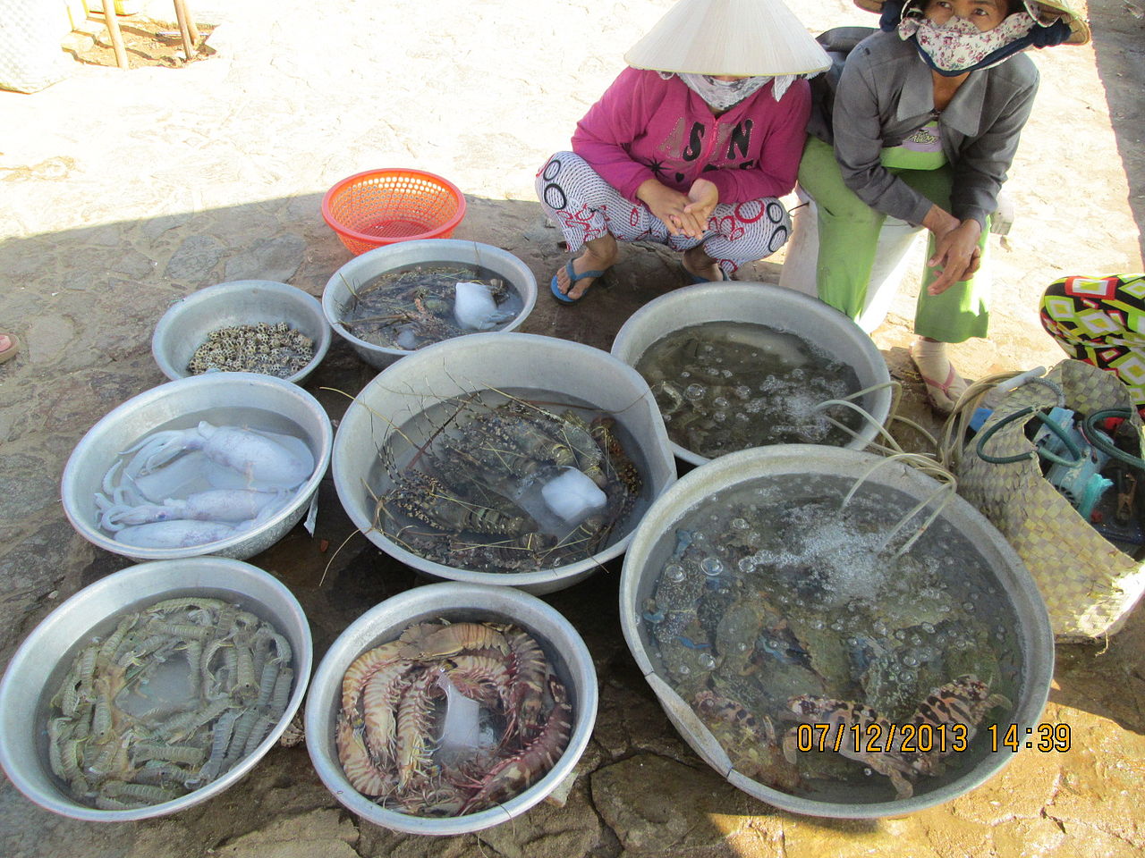
The Mui Ne fishing village occupies the bay around the headland and has operated for generations. Colourful round basket boats (thuyền thúng) are the most visible element, used for transferring catch between larger vessels and the shore. The harbour is most active in the early morning, when the night's catch arrives. The village supplies much of the region's seafood and is also associated with fish sauce (nước mắm) and dried seafood production, industries long established in the Phan Thiet area.
Kitesurfing
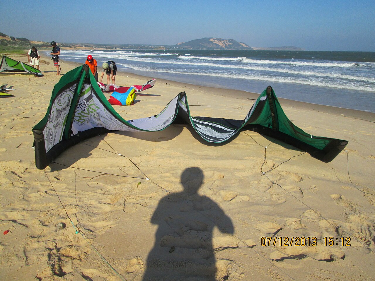
Mui Ne is one of Southeast Asia's most consistent kitesurfing locations, a reputation built on the reliable seasonal winds that blow from the northeast between approximately November and April. December to February is considered peak season, when wind strength and frequency are at their highest.
Several kitesurf schools operate along the beach road, offering instruction from beginner to advanced level. The International Kiteboarding Organisation (IKO) certification is the most commonly referenced accreditation among local schools, though visitors should verify current instructor credentials independently. Wind conditions during the wet season (roughly May to October) are less predictable, and many dedicated kitesurf operations reduce activity or close during this period.
Windsurfing also has a presence at Mui Ne, predating the kitesurfing boom by some years. Stand-up paddleboarding and other water sports are available along the main beach strip, though the beach itself is narrow in places and subject to seasonal erosion.
Climate and when to go
Mui Ne's climate is notably drier than much of southern Vietnam, sheltered from the heaviest monsoon rainfall by the geography of the coast. The year divides broadly into two periods. The dry season, from approximately November through April, brings low rainfall, warm temperatures and the northeast winds that drive the kitesurf season. February and March are particularly dry. The wet season, peaking in September and October, brings the heaviest monthly rainfall totals, though temperatures remain warm throughout the year with little seasonal variation in daytime highs.
For beach activities and dune visits, the dry season is the conventional choice. For those primarily interested in the fishing village or the landscape rather than water sports, the shoulder months of November and April offer reasonable conditions with somewhat fewer visitors than the December–February peak. See When to go: weather by region for broader context.
Getting there and getting around
The main approach from Ho Chi Minh City is by road, a journey of roughly 200 kilometres that can take four to six hours depending on traffic and the route taken. Open-tour buses, private transfers and self-drive motorbike are all used. Train services run to Phan Thiet station, which opened in 2023 on the main north–south rail corridor, reducing journey times from Ho Chi Minh City significantly compared to road.
Within Mui Ne, the resort strip stretches several kilometres along a single coast road. Motorbike hire and xe ôm (motorbike taxi) are the standard local options. The distance between the white dunes and the main resort area is substantial enough that a vehicle is necessary rather than optional.
Da Lat in the highlands is a common combined itinerary partner, accessible by road through the mountains of what is now Lam Dong province.
Practical information
Accommodation ranges from budget guesthouses to large resort properties, concentrated along Nguyen Dinh Chieu street. Phan Thiet town, a short distance west, has a wider range of everyday services, markets and less tourist-oriented dining.
The resort strip has ATMs, though availability and reliability vary; see Money, ATMs and cards. SIM cards are widely available; see SIM cards and eSIMs. Most foreign visitors enter Vietnam on an e-visa; details are at Vietnam e-visa. As with any tourist-heavy coastal destination, awareness of common approaches by touts and overcharging is advisable; see Safety and common scams.
Prices vary by season, with the December to February peak commanding higher rates across accommodation and activity operators.
Klima nach Monat
Langzeitdurchschnitte, keine Vorhersage. Referenzzeitraum: 2015–2024. Quelle: ERA5 reanalysis (Copernicus) via the Open-Meteo archive API.
Show the numbers
| Monat | Höchsttemperatur °C | Tief °C | Regen mm | Regentage | Humidity % |
|---|---|---|---|---|---|
| January | 30.3 | 22.4 | 19 | 2 | 70 |
| February | 30.8 | 22.5 | 4 | 1 | 67 |
| March | 31.3 | 23.5 | 6 | 2 | 72 |
| April | 32.2 | 24.9 | 30 | 6 | 75 |
| May | 32.2 | 25.8 | 127 | 21 | 79 |
| June | 31.7 | 25.4 | 142 | 21 | 81 |
| July | 30.9 | 25.1 | 157 | 25 | 83 |
| August | 31.3 | 25.1 | 143 | 23 | 82 |
| September | 30.6 | 24.7 | 185 | 23 | 84 |
| October | 30.1 | 24.2 | 195 | 20 | 84 |
| November | 30.4 | 24.1 | 118 | 8 | 78 |
| December | 30.2 | 23.0 | 57 | 6 | 73 |
Where it is
Also known as / see also
In der Nähe
Referenziert von
Quellen
- ERA5 climate normals — Copernicus / Open-Meteo (CC BY 4.0) abgerufen 30 August 2026
Supports: monthly temperature and rainfall normals, and elevation - Vietnam National Authority of Tourism — VNAT abgerufen 29 August 2026
Supports: the rules and definitions on this page - Mũi Né — Wikipedia (CC BY-SA 4.0) abgerufen 31 August 2026
Supports: background - Mũi Né — Wikipedia (Vietnamese) (CC BY-SA 4.0) abgerufen 31 August 2026
Supports: background, Vietnamese edition
Current Zuletzt geprüft: 31 August 2026. Rules, fares and prices change — check the official source before acting on anything here. Report a mistake.
Picture credits (6)
Đồi cát Mũi Né, Martin Fisch, CC BY-SA 2.0, Wikimedia Commons · Fairy Stream at Mui Ne - 2003, Benoît Prieur, CC0, Wikimedia Commons · 'KITE-SURFING' in Mui Ne, Rudolph.A.Furtado, CC0, Wikimedia Commons · Exotic seafood in 'Mui Ne' restaurants., Rudolph.A.Furtado, CC0, Wikimedia Commons · Fresh live sea-food sold in Mui Ne, Rudolph.A.Furtado, CC0, Wikimedia Commons · Ostrich riding in Mui Ne, Rudolph.A.Furtado, CC0, Wikimedia Commons