The place itself has not changed, and this page continues to cover it.
2025 constitutional amendment and Law on Organisation of Local Government establishing a two-tier local government
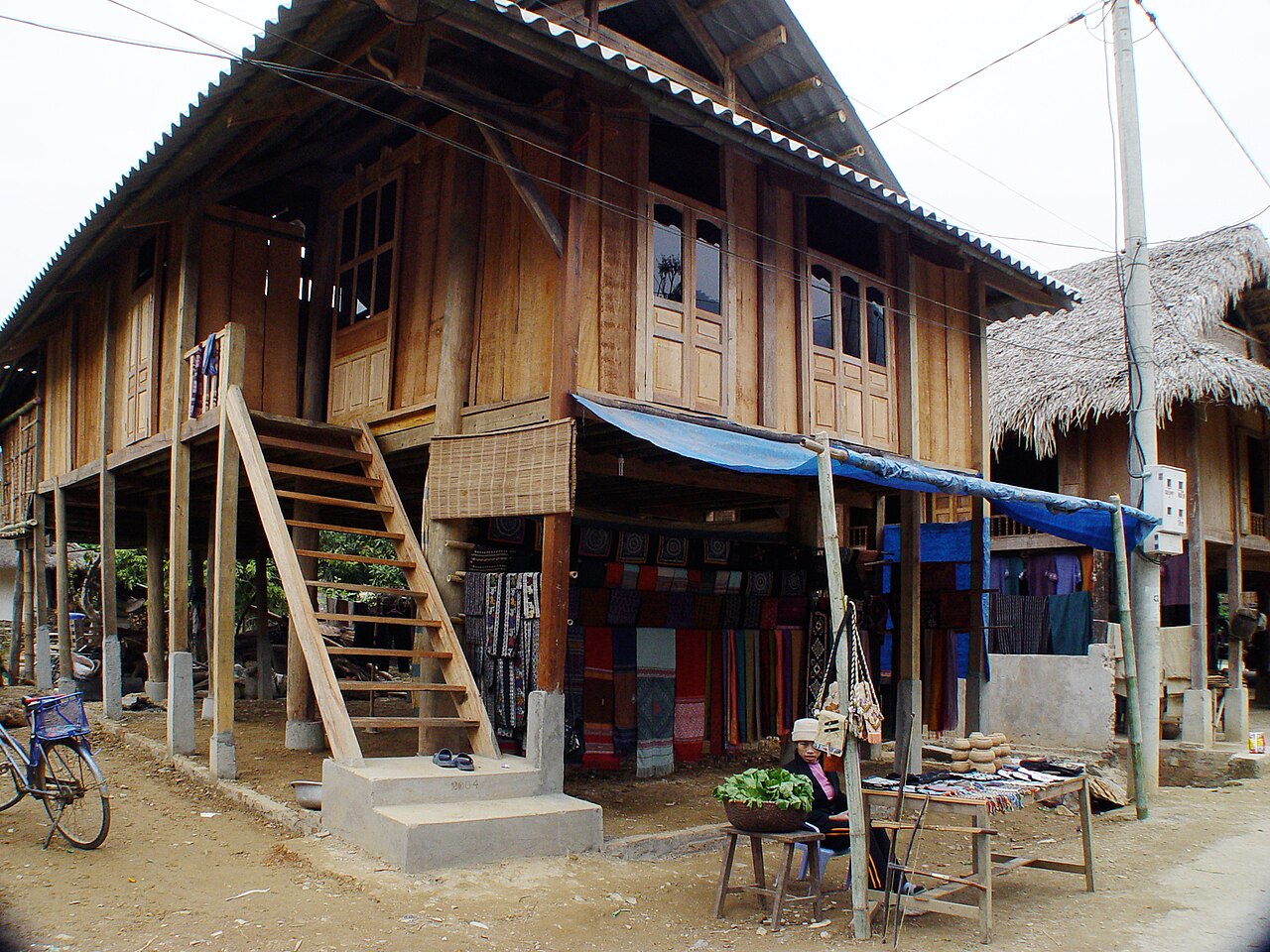
Mai Chau valley lies within Phu Tho province, which was formed in mid-2025 when the former province of Hoa Binh was merged into a larger administrative unit. The valley is best known for its White Thai communities, terraced rice fields and a well-established tradition of village homestays.
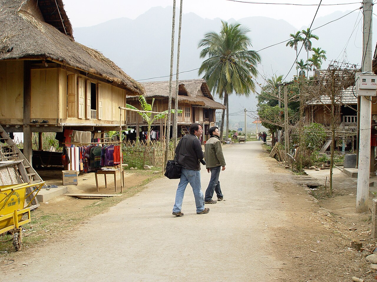
Lac and Pom Coong villages
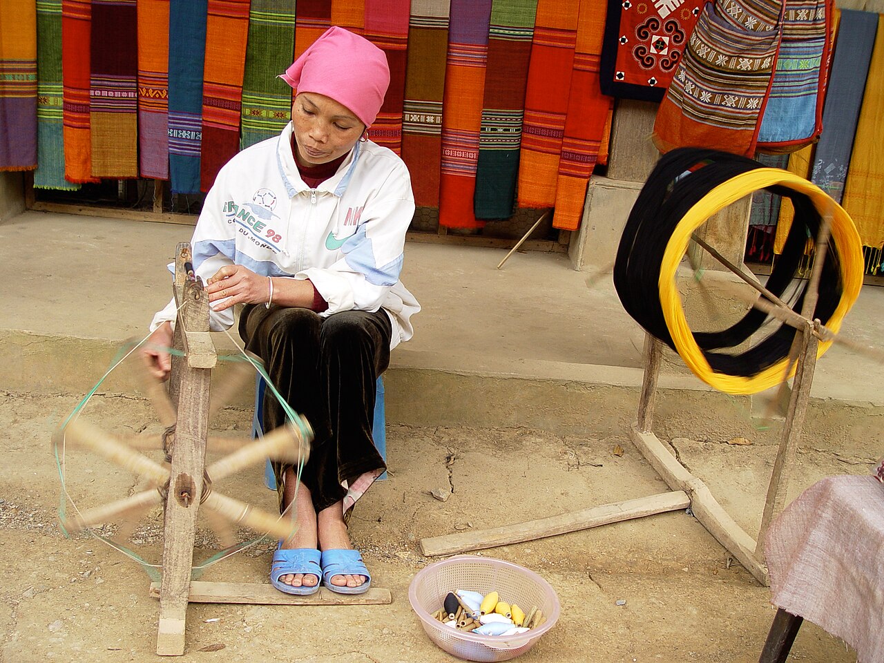
The two villages most visited in the valley are Ban Lac and Ban Pom Coong, which face each other across a paved track on the valley floor. Both are White Thai settlements whose residents have maintained a tradition of weaving, and lengths of hand-woven fabric in indigo, black and bright cotton colours are sold from stalls at the village edges.
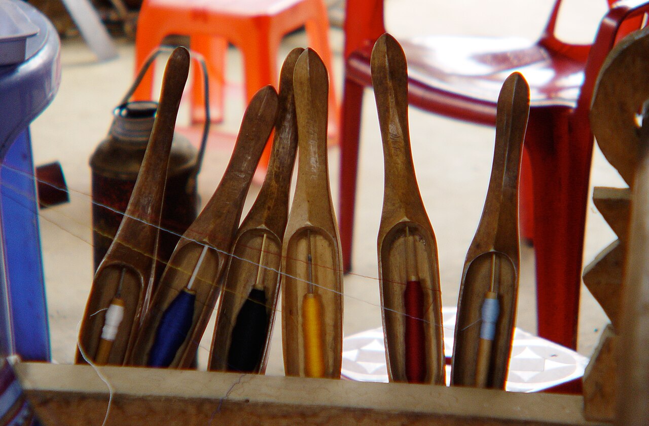
The villages have been receiving visitors for several decades and tourism is woven into daily life in a practical rather than ceremonial way. Weavers work on looms beneath stilt houses; water buffalo move through the paddies. Visitors who expect complete seclusion will find something more pragmatic — a functional rural economy that has absorbed tourism as one of its income streams.
Smaller hamlets further up the valley sides see fewer visitors and involve more walking to reach. The question of which villages retain the most authentic character is, frankly, unsettled and depends heavily on timing and individual expectation.
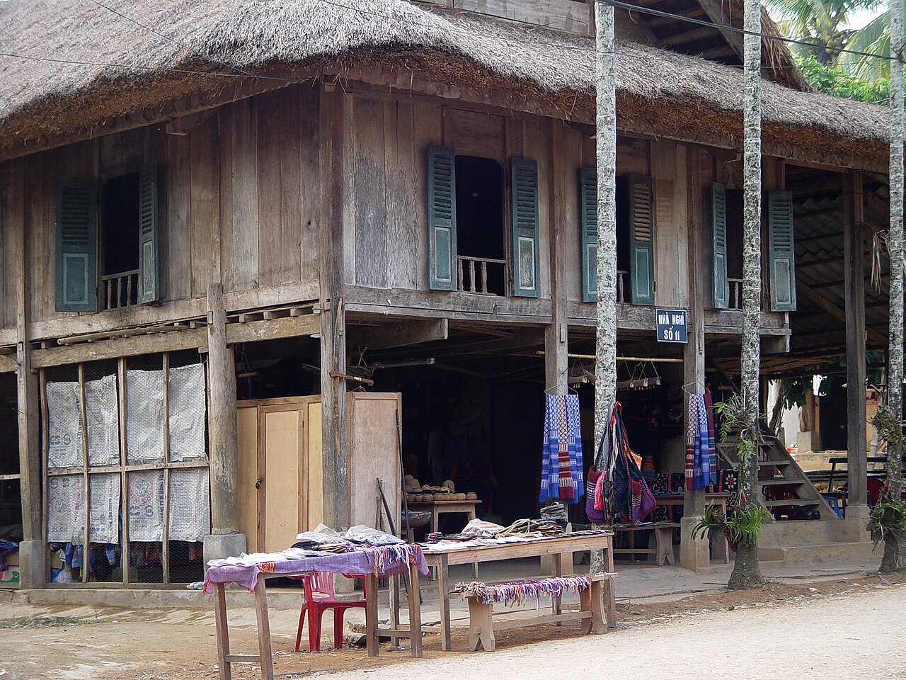
Stilt-house homestays
Staying in a White Thai stilt house is the defining experience of a visit to Mai Chau. Accommodation is typically on a communal sleeping platform raised on timber posts above the ground, with bedding, mosquito nets and basic washing facilities provided. Some homestays have added separate rooms or partitioned areas as visitor numbers have grown, so the degree of communal living varies.
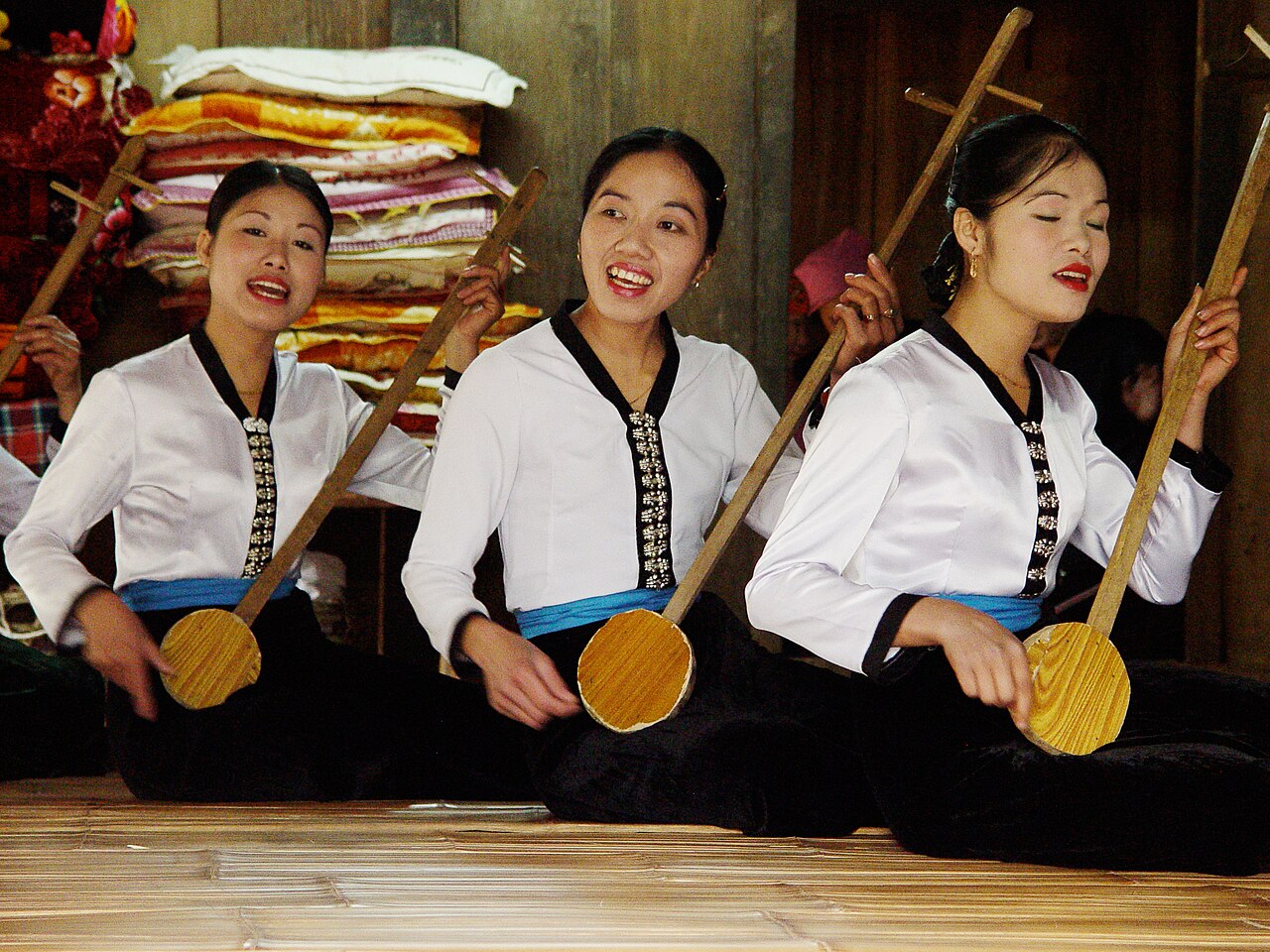
A standard overnight stay usually includes an evening meal and breakfast prepared by the host family, often featuring sticky rice, river fish, bamboo shoots and locally distilled rice wine. Evenings sometimes include a performance of Thai folk music and dance, though the frequency and character of these performances varies by operator and season.
Comfort levels range from very basic to mid-range depending on the house and how much it has been modified for tourism. There is no luxury accommodation in the valley in the international-hotel sense. Electricity and mobile data are available, though connectivity can be intermittent.
Cycling the valley
The floor of Mai Chau valley is almost entirely flat, making it well suited to cycling. Bicycles are available to hire from homestay operators and a few small outlets near the villages. The main loop around the valley paddies is short enough to complete in a morning, with options to extend toward satellite hamlets and the lower slopes of the surrounding hills.
The paddies change character through the year. In June and July the fields are intensely green as the rice grows; after the September to November harvest the cut stalks and remaining water give the landscape a different, quieter quality. Cycling in the heat of midday in summer is uncomfortable; early morning or late afternoon are preferable.
The roads connecting the villages are paved but narrow, and motorbikes and agricultural vehicles share them. The valley is not traffic-free, though traffic volumes are low by Vietnamese standards.
Thung Khe pass
Thung Khe pass (also called White Cloud pass) sits on the road between Mai Chau and the lowlands to the north-east. It rises steeply from the valley and the road surface can be demanding, particularly after rain. On clear days the pass offers wide views back across the valley and, in the other direction, toward the limestone hills of the former Hoa Binh province.
A small cluster of roadside stalls at the summit sells local produce, including honey and preserved fruit. Fog and low cloud are common, especially between October and February, and the view is not reliable. The pass is a reference point for drivers and cyclists, but it is not a managed attraction with facilities.
The road over Thung Khe connects to the wider network toward Hoa Binh and Hanoi, and is part of the route used by most visitors arriving overland from the capital.
Getting there from Hanoi
Mai Chau is roughly 135 km from Hanoi by road. The most common approach is by private car, motorbike or organised minibus, taking the route through Hoa Binh city and over Thung Khe pass. Journey time depends on traffic leaving Hanoi and road conditions on the pass; allow several hours.
Public bus services connect Hanoi's My Dinh bus station to Mai Chau town, from which local transport is needed to reach the valley villages. This option is slower and less convenient than private transport, but is used regularly by budget travellers. There is no rail connection to Mai Chau.
Organised day trips from Hanoi exist, but the valley is most usefully visited with at least one overnight stay; a same-day return leaves little time after accounting for travel. Mai Chau can also be combined with nearby destinations: Pu Luong Nature Reserve lies to the south-west, Moc Chau further along the same highland road, and Cuc Phuong National Park is reachable as a detour on the way back toward the lowlands.
When to go
The generally recommended months are September to November, when the harvest is recent or underway and the air is clearer and cooler. Rice is cut from late September onward; the window when ripe golden paddies fill the valley is brief and timing cannot be guaranteed in advance.
June and July bring the most vivid green colour to the terraces as the rice is growing, though this period falls within the wetter months and rain can be heavy and persistent. Humidity is high.
December to February is cool and sometimes cold at night, with fog frequent on the pass. March to May is increasingly warm and drier. The valley can become crowded on Vietnamese public holidays and at weekends regardless of season, as it is within easy reach of Hanoi.
For a broader picture of northern Vietnamese weather patterns, see When to go: weather by region.
Practical notes
Mai Chau is administratively part of Phu Tho province following the July 2025 merger that abolished the former province of Hoa Binh. Travel information and some signage may still reference Hoa Binh province; this reflects the pre-merger situation.
ATM coverage in the valley itself is limited. Carrying sufficient cash before arrival is advisable. For guidance on currency and payment, see Money, ATMs and cards. Mobile data is available but patchy; a Vietnamese SIM generally performs better than roaming — see SIM cards and eSIMs.
Visitors from most Western countries can enter Vietnam on an e-visa; check the current rules at Vietnam e-visa, as visa policy can change by government decree. General advice on staying safe and avoiding common tourist scams is at Safety and common scams.
월별 기후
장기 평균값이며 예보가 아닙니다. 기준 기간: 2015–2024. 출처: ERA5 reanalysis (Copernicus) via the Open-Meteo archive API.
Show the numbers
| 월 | 최고 기온 °C | 최저 기온(°C) | 강수량(mm) | 강수일수 | Humidity % |
|---|---|---|---|---|---|
| January | 20.3 | 14.4 | 61 | 11 | 84 |
| February | 22.0 | 15.4 | 42 | 9 | 82 |
| March | 26.0 | 19.2 | 70 | 13 | 85 |
| April | 29.4 | 21.8 | 109 | 14 | 83 |
| May | 31.5 | 24.4 | 226 | 21 | 83 |
| June | 32.8 | 25.8 | 186 | 19 | 82 |
| July | 31.8 | 25.5 | 332 | 22 | 84 |
| August | 30.9 | 25.1 | 395 | 25 | 87 |
| September | 29.5 | 24.2 | 300 | 22 | 87 |
| October | 26.7 | 21.5 | 193 | 16 | 83 |
| November | 24.8 | 18.9 | 63 | 10 | 82 |
| December | 20.2 | 14.4 | 41 | 8 | 80 |
Where it is
Also known as / see also
주변
참조 페이지
출처 목록
- ERA5 climate normals — Copernicus / Open-Meteo (CC BY 4.0) 접근됨 30 August 2026
Supports: monthly temperature and rainfall normals, and elevation - Mai Châu (Q6735119) — Wikidata (CC0 1.0) 접근됨 30 August 2026
Supports: coordinates, area, population - Mai Châu — Wikipedia (CC BY-SA 4.0) 접근됨 30 August 2026
Supports: background - Mai Châu — Wikipedia (CC BY-SA 4.0) 접근됨 29 August 2026
Supports: carried over from the first build
Current 마지막 확인: 29 August 2026. Rules, fares and prices change — check the official source before acting on anything here. Report a mistake.
Picture credits (6)
Stick-house-contstruction,-Mai-Chau,-Vietnam, Steven C. Price, CC BY-SA 4.0, Wikimedia Commons · Stilt-House-construction-Mai-Chau,-Vietnam, Steven C. Price, CC BY-SA 4.0, Wikimedia Commons · Stilt-House-construction-Mai-Chau-Vietnam, Steven C. Price, CC BY-SA 4.0, Wikimedia Commons · Traditional-Crafts,-Mai-Chau,-Vietnam, Steven C. Price, CC BY-SA 4.0, Wikimedia Commons · Traditional-Music,-Mai-Chau,-Vietnam, Steven C. Price, CC BY-SA 4.0, Wikimedia Commons · Traditional-craft,-Mai-Chau,-Vietnam, Steven C. Price, CC BY-SA 4.0, Wikimedia Commons