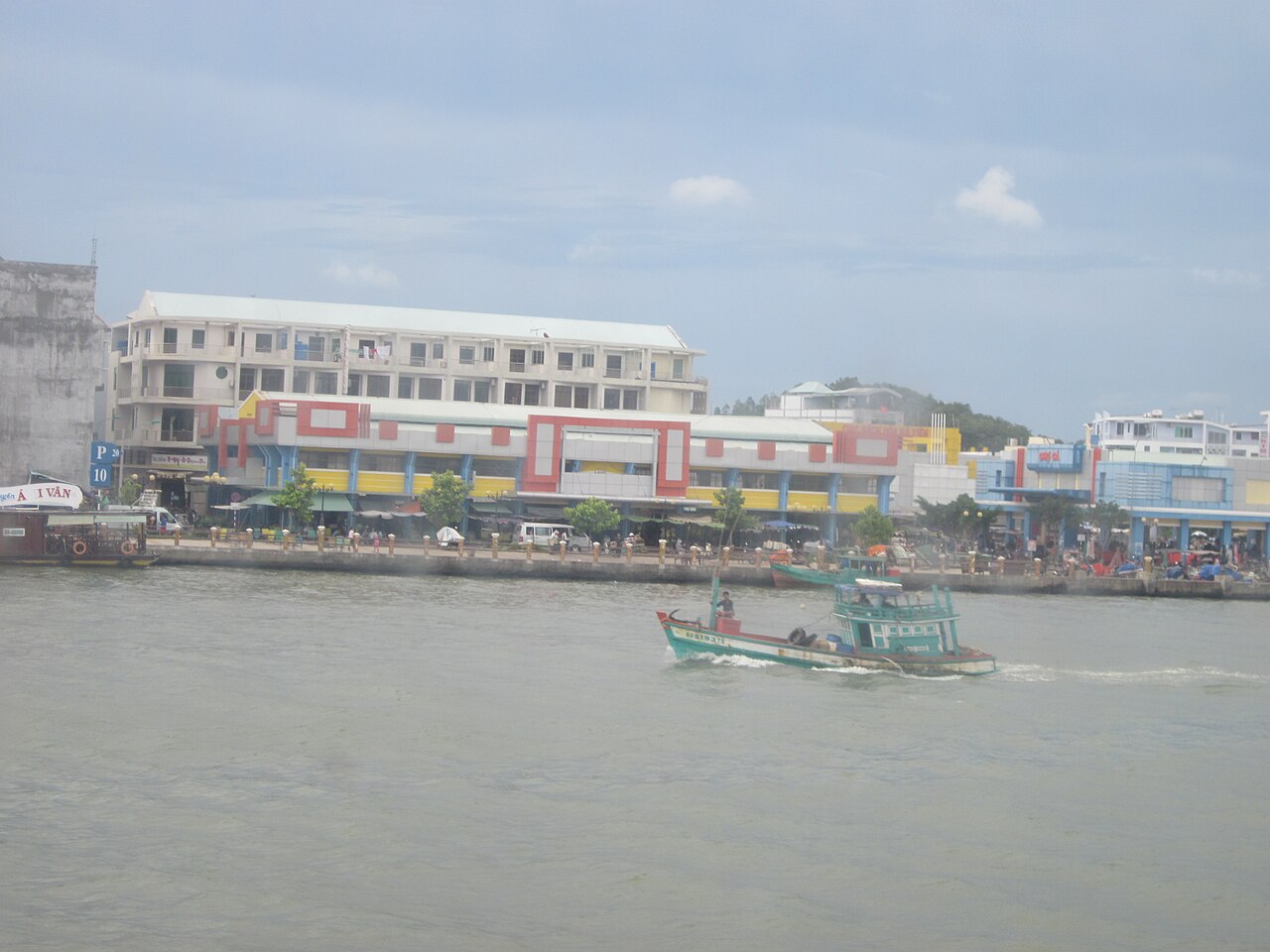
The place itself has not changed, and this page continues to cover it.
National Assembly Resolution 202/2025/QH15 on the rearrangement of provincial-level administrative units
Administrative status
Kien Giang existed as a provincial-level administrative unit until 30 June 2025, when Vietnam reorganised its 63 provinces into 34 as part of a nationwide reform that also abolished the district tier. The former Kien Giang territory was merged into An Giang, which now governs the area under a two-tier province/commune system.
This administrative change affects governance, official addresses and public-service delivery, but it does not move, rename or alter any of the physical places within the former province. Phu Quoc island, Ha Tien, the Nam Du islands, the U Minh Thuong forest and every commune and village remain where they have always been. Travellers using older maps or guidebooks that show Kien Giang as a current province should be aware the name no longer refers to an active administrative unit.
Geography and setting
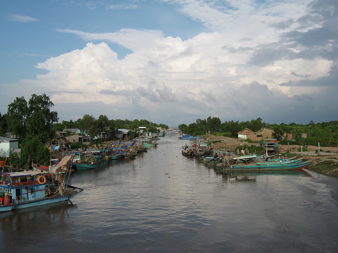
The former province occupied Vietnam's southwestern corner, with a long Gulf of Thailand coastline, a land border with Cambodia to the north, and connections to the rest of the Mekong Delta to the east. The mainland portion sits at near sea level on the delta plain, threaded by canals and seasonally flooded fields. Offshore, the territory included more than 140 islands, the largest of which is Phu Quoc.
- Ha Tien is a small coastal town close to the Cambodian border, known for its limestone karst outcrops, old trading-quarter architecture and relatively quiet beaches.
- Phu Quoc is Vietnam's largest island, with a mountainous interior covered by national-park forest and a coastline that ranges from busy resort areas to quieter fishing settlements.
- Nam Du archipelago lies about 90 km offshore, a cluster of small islands with fishing communities and minimal tourist infrastructure relative to Phu Quoc.
- U Minh Thuong National Park on the mainland preserves a remnant of the peat-swamp forest that once covered much of the western delta.
Climate and when to visit
The former province has a tropical monsoon climate with two well-defined seasons. Temperatures are warm throughout the year with little variation, but rainfall follows a pronounced annual cycle.
The dry season runs roughly from November through April. Conditions are sunniest and seas calmest from December to March, making this the most popular period for island travel. March and April bring the hottest temperatures before the rains arrive.
The wet season begins in May and intensifies through the middle of the year. Rainfall peaks around September and October, when monthly totals are substantially higher than the dry-season months. Seas around Phu Quoc and the Nam Du islands can become rough, and ferry services may be disrupted or suspended. The mainland benefits from the rains agriculturally, and U Minh Thuong's canals fill during this period.
Ha Tien, being close to the Cambodian hills, can experience slightly different local weather patterns to the open coast, and the Nam Du islands, lying further offshore, are more exposed to swell during the monsoon.
What there is to see and do
The range of activities across the former province is wide, reflecting the contrast between busy island resorts, a quiet border town and protected mainland wetlands.
- Phu Quoc National Park covers the northern part of the island and contains hiking trails through relatively intact tropical forest. The park boundaries are contested in places as resort development has expanded.
- Ha Tien's old quarter retains some of the Sino-Vietnamese merchant architecture associated with the Mac family, who controlled the area in the 18th century before Vietnamese imperial authority was extended over it. The Tam Bao Pagoda and the Mac Cuu family tombs are the most visited historical sites.
- Mui Nai beach near Ha Tien is a long, flat stretch used mainly by domestic visitors. The limestone formations of Thach Dong cave temple and Hon Chong promontory are accessible by road.
- Nam Du attracts visitors interested in snorkelling and diving in waters that are generally clearer than those closer to the delta's river outflows, though infrastructure remains limited and the journey by fast boat is lengthy.
- U Minh Thuong offers boat trips through flooded melaleuca forest, birdwatching and the chance to observe the ecology of a peat-swamp ecosystem that has largely disappeared from the rest of the delta.
Getting there and moving around
Access to the former Kien Giang area depends heavily on which part of it is the destination.
Phu Quoc has an international airport at Duong To that receives direct flights from several Vietnamese cities and some regional international routes. High-speed ferries run from Rach Gia (the former provincial capital on the mainland) and from Ha Tien; crossing times and frequency vary by season, and services may be cancelled during rough weather in the wet season.
Rach Gia on the mainland is reached by road from Can Tho and Ho Chi Minh City, or by air via its domestic airport. It serves primarily as a transit point for ferries rather than a destination in its own right.
Ha Tien is connected by highway to Rach Gia and to the Cambodian border crossing at Xa Xia, which links to Kampot and Phnom Penh. Bus services from Ho Chi Minh City are available but the journey is long.
Nam Du is reached by boat from Rach Gia; the journey takes several hours and schedules are subject to weather. There is no airport.
Within the area, travel between points is largely by road on the mainland and by boat between islands. The former district tier no longer exists, so local administrative references should use commune names rather than district names.
Where people stay
Accommodation across the former province is concentrated in a small number of zones that reflect very different visitor profiles.
Phu Quoc's southern and western coasts, particularly around Duong Dong town and the Long Beach area, hold the densest concentration of hotels and resorts, ranging from large international-brand properties to small guesthouses. The northern and eastern parts of the island are less developed. Prices vary by season, with the dry season commanding higher rates.
Ha Tien has a small selection of mid-range and budget guesthouses clustered around the market and waterfront. It functions mainly as an overnight stop for travellers crossing between Vietnam and Cambodia, or as a base for day trips to nearby beaches and caves.
Nam Du has basic homestay and guesthouse accommodation in the main fishing settlement of Hon Lon island. Options are limited and facilities are simple; most visitors stay only a night or two.
Rach Gia has functional business hotels oriented towards domestic travellers and traders rather than tourists.
Common misunderstandings
Administrative confusion. As of 1 July 2025, Kien Giang no longer exists as an administrative unit. Official documents, postal addresses and government services now reference An Giang province. Older signage, maps and websites may still show Kien Giang as a province; this information is out of date.
Phu Quoc and the mainland are not interchangeable. Many visitors arrive at Phu Quoc airport and remain on the island without visiting Ha Tien or the mainland at all. The two areas have very different characters and are not easily combined in a short trip without planning around ferry schedules.
Wet-season ferry disruption is real. Travellers who book non-refundable accommodation on Phu Quoc or Nam Du without checking seasonal ferry reliability risk being stranded or forced to fly at short notice. The peak of the monsoon, particularly September and October, brings the highest probability of cancellations.
Phu Quoc's north is not the same as its south. The resort development and beach infrastructure concentrated in the south does not extend uniformly across the island. The national park and fishing villages in the north have limited services.
Ha Tien's border crossing. The Xa Xia crossing to Cambodia is open to foreign nationals but entry requirements, visa arrangements and transport connections on the Cambodian side change periodically. Conditions should be verified close to travel.
Climate by month
Long-run averages, not a forecast. Reference period: 2015–2024. Source: ERA5 reanalysis (Copernicus) via the Open-Meteo archive API.
Show the numbers
| Month | High °C | Low °C | Rain mm | Rain days | Humidity % |
|---|---|---|---|---|---|
| January | 30.3 | 22.6 | 42 | 8 | 75 |
| February | 31.9 | 22.8 | 21 | 4 | 70 |
| March | 33.7 | 24.0 | 29 | 6 | 69 |
| April | 33.7 | 25.2 | 96 | 15 | 73 |
| May | 32.1 | 26.0 | 208 | 26 | 81 |
| June | 30.0 | 25.9 | 245 | 27 | 84 |
| July | 29.4 | 25.4 | 352 | 28 | 86 |
| August | 29.4 | 25.5 | 285 | 28 | 85 |
| September | 29.4 | 25.1 | 365 | 28 | 85 |
| October | 30.2 | 24.4 | 383 | 28 | 86 |
| November | 30.8 | 23.9 | 196 | 22 | 83 |
| December | 30.1 | 23.1 | 90 | 12 | 77 |
Also known as / see also
Now part of
Referenced by
Sources
- ERA5 climate normals — Copernicus / Open-Meteo (CC BY 4.0) accessed 30 August 2026
Supports: monthly temperature and rainfall normals, and elevation - Kien Giang (Q36576) — Wikidata (CC0 1.0) accessed 30 August 2026
Supports: coordinates, area, population - Kien Giang — Wikipedia (CC BY-SA 4.0) accessed 30 August 2026
Supports: background
Current Last verified: 31 August 2026. Rules, fares and prices change — check the official source before acting on anything here. Report a mistake.
Picture credits (4)
Cảng cá Hà Tiên - Kiên Giang, vi:User:Nhâm Tỵ, Public domain, Wikimedia Commons · Bến cá Hòn Quéo, Bùi Thụy Đào Nguyên, Public domain, Wikimedia Commons · Gốm Hòn Đất, Bùi Thụy Đào Nguyên, Public domain, Wikimedia Commons · Pháo 105 mm, Bùi Thụy Đào Nguyên, Public domain, Wikimedia Commons