The place itself has not changed, and this page continues to cover it.
National Assembly Resolution 202/2025/QH15 on the rearrangement of provincial-level administrative units
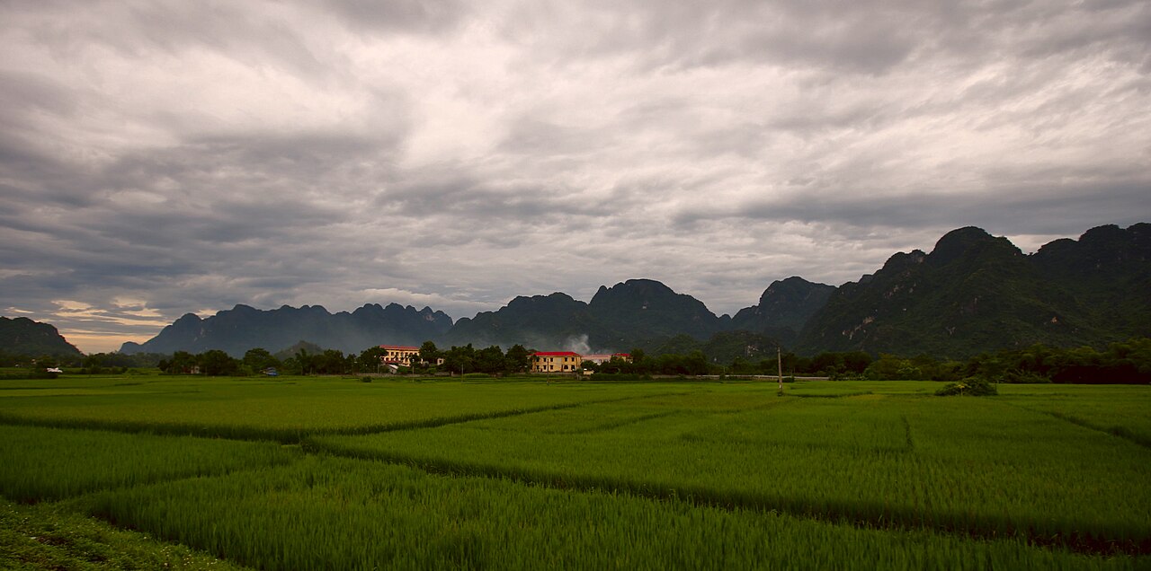
Hoa Binh province occupied the transitional zone between the Red River Delta and the northwest highlands, where the forested limestone ranges of the Truong Son system begin to assert themselves. For decades it drew visitors seeking minority culture, river scenery and valley trekking within easy reach of Hanoi. It ceased to exist as a separate administrative unit on 1 July 2025, when it was absorbed into Phu Tho under Vietnam's nationwide provincial consolidation.
Administrative note
Hoa Binh province was dissolved on 1 July 2025 under a National Assembly resolution rearranging Vietnam's provincial-level administrative units. Its territory now forms part of Phu Tho province. The district tier was simultaneously abolished across the whole country, so references to Hoa Binh's former districts — Mai Chau, Kim Boi, Lac Son and others — describe historical units only. The places themselves remain: towns, valleys and villages have not moved or been renamed, but their governing framework has changed. Visitors should consult current local and national sources for up-to-date administrative arrangements, since services, signage and addresses may still be in transition.
What the area is known for
The territory of the former province is associated with three distinct draws.
- Mai Chau valley: A wide, flat-bottomed valley surrounded by karst hills, populated largely by White Thai communities who have long hosted visitors in traditional stilt-house guesthouses. Rice paddies dominate the valley floor, and the landscape is most dramatic when the crops are green or at harvest. It is the most visited part of the former province.
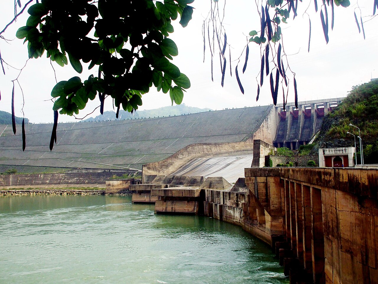
- Hoa Binh reservoir and the Da River: The reservoir formed by the Hoa Binh hydroelectric dam — one of Southeast Asia's largest when completed in the 1990s — stretches deep into the hills. Boat travel on the reservoir passes flooded forest margins and minority villages along the banks.
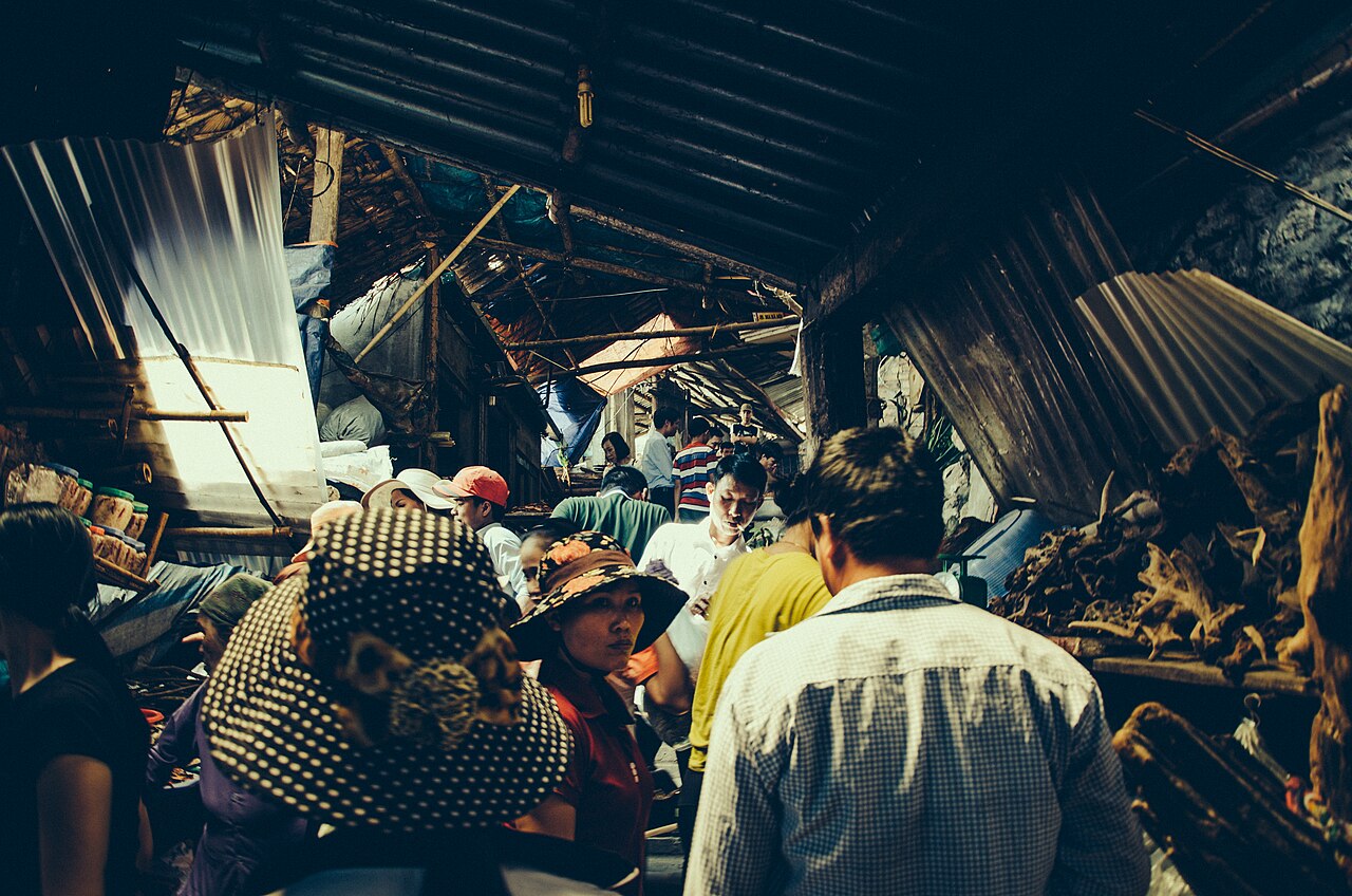
- Muong culture: The Muong are the majority minority group across much of the former province's upland interior. Their weaving, gong music and longhouse architecture differ from the Thai communities of Mai Chau and are less widely documented in tourism material, but are present throughout the hills.
When to go
The former province sits in a transitional climate zone. The wet season runs roughly from May to October, bringing heavy rainfall that can make mountain tracks difficult and cause localised flooding. Leeches are common on forest paths during wet months. The cool, dry season from November to March is generally preferred for valley walking and outdoor activity; temperatures at higher elevations can drop noticeably at night, occasionally near zero in January. April and late October represent shoulder periods with reasonable weather and fewer visitors than the peak dry months.
The Mai Chau valley is photogenic when rice is being planted (May to June) and at harvest (September to October), though both periods fall partly within the wet season. Visitors should weigh landscape interest against travel conditions accordingly.
Getting there and away
The town of Hoa Binh, which served as the provincial capital, lies roughly 70 kilometres southwest of Hanoi along Highway 6. The journey by road typically takes between one and two hours depending on traffic leaving Hanoi. Mai Chau valley is a further 60 kilometres or so southwest of the town, pushing the total road journey from Hanoi to around three to four hours. Highway 6 is the main artery; it is a winding two-lane mountain road through much of its length past the capital.
Buses from Hanoi's My Dinh and Giap Bat terminals serve both Hoa Binh town and Mai Chau. Motorbike travel is common among independent travellers familiar with Vietnamese roads. There is no rail connection to the area. The nearest significant rail hub remains Hanoi.
What there is to see and do
In Mai Chau valley, walking between Thai villages on flat valley paths is the central activity. The distances are modest and the terrain is easy; it is one of the more accessible village-walking areas in the northern highlands. Bicycle rental is widely available. Cultural performances — gong music, textile weaving demonstrations — are offered at several stilt-house guesthouses, though the degree to which these reflect daily life rather than tourism performance varies.
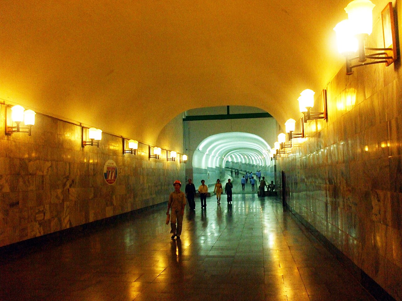
On the Hoa Binh reservoir, boat trips can be arranged to visit Muong villages on the reservoir's arms, including areas of the flooded Da River valley. The scale of the reservoir and its setting in forested hills make it a distinctive landscape. The hydroelectric dam itself is a significant piece of mid-twentieth-century infrastructure and can be viewed from designated points.
Kim Boi, in the former province's eastern hills, has natural hot springs that have been developed to varying degrees for bathing facilities. Cuc Phuong National Park borders the former province's southeast, though the park entrance and facilities are administered from the Ninh Binh side.
Where to stay
Accommodation divides broadly by location. In Mai Chau valley, stilt-house guesthouses operated by Thai families are the characteristic option; they range from basic communal sleeping arrangements to more structured rooms with private facilities. The valley has a small cluster of more formal hotels and resorts aimed at weekend visitors from Hanoi. Hoa Binh town had standard Vietnamese town hotels suited to a transit stop or a base for reservoir trips. Accommodation is thin elsewhere in the former province, and travellers planning to explore the interior hills should confirm options in advance rather than relying on facilities being available.
Common misunderstandings
The administrative change does not affect travel logistics. The merger into Phu Tho is a governing reorganisation. Roads, villages, guesthouses and landscapes are unchanged. Itineraries built around Mai Chau or the Hoa Binh reservoir remain valid.
Mai Chau is not remote. Its accessibility from Hanoi makes it one of the busiest minority-community destinations in the north, particularly at weekends and Vietnamese public holidays. Visitors expecting an isolated experience may find it crowded at peak times.
Muong and Thai are distinct peoples. Much tourism material conflates minority groups in the former province. The White Thai of Mai Chau and the Muong communities of the interior have different languages, dress, architecture and customs. The distinction is relevant when seeking out specific cultural experiences.
Highway 6 requires care. The road is heavily used by trucks serving the northwest and has a poor accident record on certain sections. Motorbike travellers unfamiliar with Vietnamese mountain roads should assess their experience honestly before setting out.
Iklim per bulan
Rata-rata jangka panjang, bukan prakiraan. Periode referensi: 2015–2024. Nguồn: ERA5 reanalysis (Copernicus) via the Open-Meteo archive API.
Show the numbers
| Bulan | Suhu tertinggi °C | Rendah °C | Curah hujan (mm) | Hari hujan | Humidity % |
|---|---|---|---|---|---|
| January | 19.9 | 13.8 | 70 | 12 | 83 |
| February | 21.4 | 14.8 | 46 | 9 | 83 |
| March | 25.1 | 18.5 | 64 | 12 | 86 |
| April | 28.6 | 21.1 | 122 | 13 | 85 |
| May | 31.1 | 23.7 | 236 | 20 | 85 |
| June | 32.4 | 25.2 | 201 | 19 | 84 |
| July | 31.5 | 24.9 | 326 | 22 | 86 |
| August | 30.7 | 24.6 | 393 | 26 | 89 |
| September | 29.4 | 23.5 | 323 | 23 | 89 |
| October | 26.6 | 20.7 | 212 | 15 | 84 |
| November | 24.6 | 18.2 | 69 | 10 | 83 |
| December | 20.1 | 13.8 | 45 | 8 | 79 |
Also known as / see also
Kini bagian dari
Dirujuk oleh
Các nguồn
- ERA5 climate normals — Copernicus / Open-Meteo (CC BY 4.0) đã truy cập 30 August 2026
Supports: monthly temperature and rainfall normals, and elevation - Hoa Binh (Q36015) — Wikidata (CC0 1.0) đã truy cập 30 August 2026
Supports: coordinates, area, population - Hoa Binh — Wikipedia (CC BY-SA 4.0) đã truy cập 30 August 2026
Supports: background
Current Terakhir diverifikasi: 29 August 2026. Rules, fares and prices change — check the official source before acting on anything here. Report a mistake.
Picture credits (4)
Hòa Bình Province, Kim Bôi District, [Tycho], CC BY-SA 3.0, Wikimedia Commons · Busy street market (Unsplash), Anh Nguyen pwign, CC0, Wikimedia Commons · Cửa xả nước, Bùi Thụy Đào Nguyên, CC BY-SA 3.0, Wikimedia Commons · Hầm đường bộ nhà máy thủy điện Hòa Bình, Bùi Thụy Đào Nguyên, CC BY-SA 3.0, Wikimedia Commons