The place itself has not changed, and this page continues to cover it.
National Assembly Resolution 202/2025/QH15 on the rearrangement of provincial-level administrative units
Administrative status
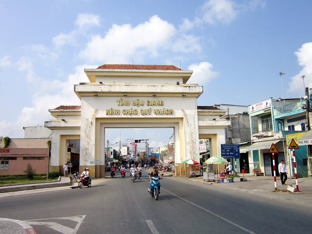
Hau Giang existed as a province from some point in the twentieth century until 30 June 2025, when Vietnam's national administrative reorganisation dissolved it along with dozens of other provincial-level units. From 1 July 2025, the area that was Hau Giang is governed as part of Can Tho province. The district tier has also been abolished nationally, so former district names no longer describe current administrative units.
The merger affects paperwork, official addresses and government services. It does not alter the geography, the settlements, the road network or the character of any part of the area. Visitors and residents will find the same canals, the same market towns and the same agricultural landscape they would have encountered before the change.
Geography and landscape
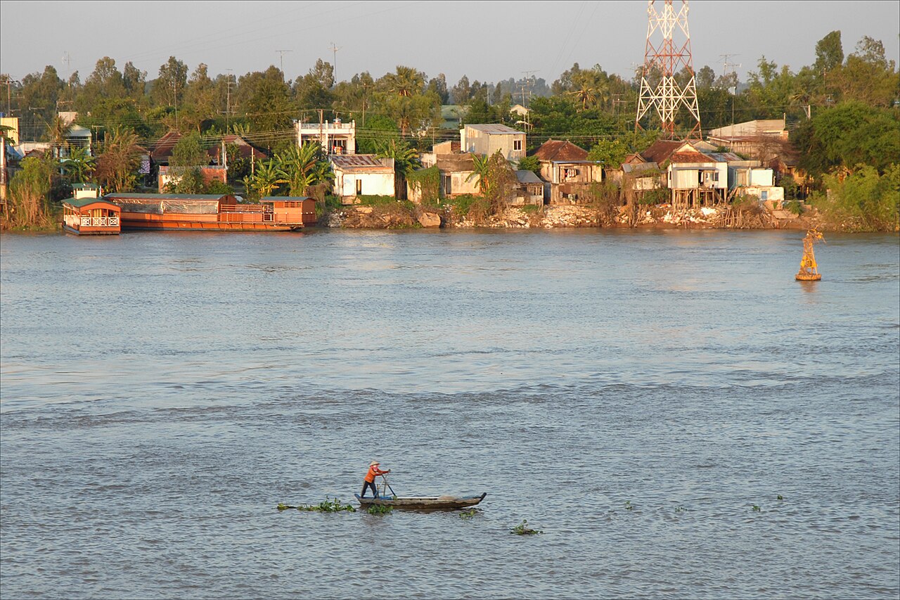
Hau Giang sits in the heart of the Mekong Delta, occupying flat alluvial land that averages around three metres above sea level. The terrain is shaped almost entirely by water: a dense grid of rivers, canals and irrigation channels cuts across rice paddies and orchards. The Hau River (one of the main branches of the lower Mekong) defines part of the northern boundary, and numerous smaller waterways thread through the interior.
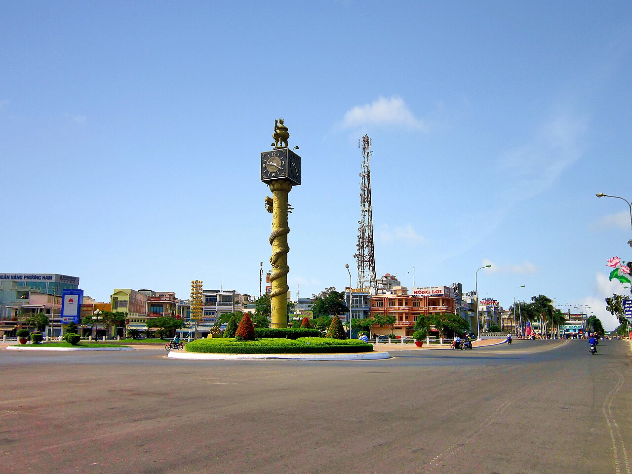
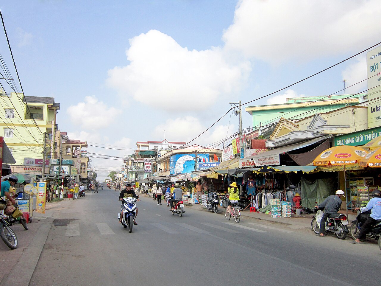
The area is dominated by wet-rice agriculture, with large tracts under paddy for most of the year. Between and around the paddy fields, smallholders grow pomelo, durian, longan and other tropical fruits that the Mekong Delta is known for. Market towns such as Vi Thanh (the former provincial capital) and Nga Bay sit along canal banks and serve as commercial hubs for the surrounding farming communities.
Climate and when to visit
Hau Giang has a classic southern Vietnamese tropical climate with two clearly defined seasons. Temperatures are warmest in the early dry season — peaking in March and April — and remain consistently warm and humid throughout the year, with little variation in daily minimums across months.
The dry season runs roughly from December through April. Rainfall is low, canal levels drop, and road access to farming areas is straightforward. This period is generally considered easier for travel, particularly for those wanting to explore orchards and rural waterways by boat.
The wet season runs from May through November, with the heaviest rainfall concentrated in September and October. Monthly totals during this period are substantial, and parts of the low-lying interior experience seasonal flooding. River and canal travel is more dynamic in this period, but road access to some areas can be disrupted. November marks a gradual transition as rainfall eases.
Fruit harvests vary by crop: pomelo and longan typically peak in the dry season months, while other tropical fruits follow their own schedules tied to local cultivation practices.
What the area is known for
The economy and identity of Hau Giang have long centred on rice production. The province was consistently among the Mekong Delta's significant rice-growing areas, with multiple harvests per year made possible by the canal irrigation system. Rice milling and trading infrastructure is visible in most market towns.
Beyond rice, the area has a reputation for freshwater fish and the dishes built around them. Canh chua (sour soup made with tamarind, tomato and river fish), cá kho tộ (fish braised in clay pot with caramel and pepper) and grilled snakehead fish are staples of local cooking.
The former province also contained Lung Ngoc Hoang Nature Reserve, a protected wetland area of seasonally flooded melaleuca forest that supports water birds and other wildlife characteristic of the Mekong Delta. The reserve retains this ecological character regardless of the administrative changes above it.
Getting there and getting around
The former provincial capital, Vi Thanh, is connected to Can Tho city by National Highway 61, a journey of roughly 60–70 kilometres. Can Tho city functions as the main regional hub for flights, long-distance buses and onward connections across the delta and to Ho Chi Minh City.
Within the area, motorbikes are the most common way to reach villages and canal-side settlements. Roads are generally flat but some rural tracks narrow considerably. Boat hire is available along major canals for access to orchards, floating markets and wetland areas; arrangements are typically made through guesthouses or at canal-side landings.
Bus services connect Vi Thanh and Nga Bay with Can Tho and other delta towns. Journey times and frequencies change seasonally and should be verified locally on arrival. Ride-hailing apps with motorbike options operate in larger towns but coverage is sparse in rural areas.
Accommodation and base towns
Vi Thanh has the widest range of accommodation in the former province, from small family-run guesthouses to mid-range hotels. It is a functional, unshowy town and a practical base for exploring the canal network and surrounding orchards.
Nga Bay, historically significant as the meeting point of seven canals, is smaller but has guesthouses and is closer to some agricultural and wetland areas. The town's name — literally "seven-way junction" — refers directly to its distinctive canal layout, which remains a point of local interest.
Rural homestays operate in some orchard and farming communities, offering proximity to daily agricultural life. These are typically arranged informally or through word of mouth rather than through formal booking platforms, and standards vary considerably.
Common misunderstandings
The province no longer exists administratively, but the place does. Travellers searching for Hau Giang by name will find that official maps and government systems now show the area as part of Can Tho. The towns, canals, nature reserve and road network are unchanged. Using the place name to describe the area and its character remains accurate.
Nga Bay's floating market is sometimes described in older sources as comparable to the large floating markets near Can Tho city. It operates at a much smaller scale and is primarily a local trading point rather than a destination in its own right. The larger and better-known floating markets — Cai Rang and Phong Dien — are located in the Can Tho city area.
Seasonal flooding is a feature, not a malfunction. In the wet season, water covers fields and enters low-lying village lanes by design; this is how the agricultural system has operated for generations. Visitors arriving in October expecting dry-season conditions will find a different, waterlogged landscape.
各月气候
长期平均值,非预测数据。 参考周期: 2015–2024. 来源: ERA5 reanalysis (Copernicus) via the Open-Meteo archive API.
Show the numbers
| 月份 | 最高气温 °C | 最低气温 °C | 降雨量(毫米) | 降雨天数 | Humidity % |
|---|---|---|---|---|---|
| January | 30.2 | 22.5 | 36 | 7 | 77 |
| February | 31.9 | 22.7 | 15 | 3 | 70 |
| March | 33.9 | 23.9 | 31 | 5 | 69 |
| April | 34.3 | 25.0 | 86 | 13 | 73 |
| May | 32.7 | 25.4 | 219 | 27 | 81 |
| June | 30.8 | 24.8 | 265 | 28 | 86 |
| July | 30.0 | 24.5 | 335 | 30 | 88 |
| August | 30.2 | 24.6 | 282 | 30 | 87 |
| September | 30.1 | 24.3 | 342 | 29 | 87 |
| October | 30.4 | 23.9 | 357 | 28 | 87 |
| November | 30.5 | 23.7 | 182 | 23 | 84 |
| December | 29.8 | 23.0 | 93 | 13 | 80 |
Also known as / see also
现为……的一部分
被以下页面引用
来源
- ERA5 climate normals — Copernicus / Open-Meteo (CC BY 4.0) 访问于 30 August 2026
Supports: monthly temperature and rainfall normals, and elevation - Hau Giang (Q36320) — Wikidata (CC0 1.0) 访问于 30 August 2026
Supports: coordinates, area, population - Hau Giang — Wikipedia (CC BY-SA 4.0) 访问于 30 August 2026
Supports: background
Current 最后核实: 31 August 2026. Rules, fares and prices change — check the official source before acting on anything here. Report a mistake.
Picture credits (4)
Hau Giang VN, Jean-Pierre Dalbéra, CC BY 2.0, Wikimedia Commons · Tháp Đồng Hồ ở Vị Thanh, Bùi Thụy Đào Nguyên, CC BY-SA 3.0, Wikimedia Commons · Chợ Cái Tắc, Bùi Thụy Đào Nguyên, CC BY-SA 3.0, Wikimedia Commons · Cổng chào Hậu Giang, Bùi Thụy Đào Nguyên, CC BY-SA 3.0, Wikimedia Commons