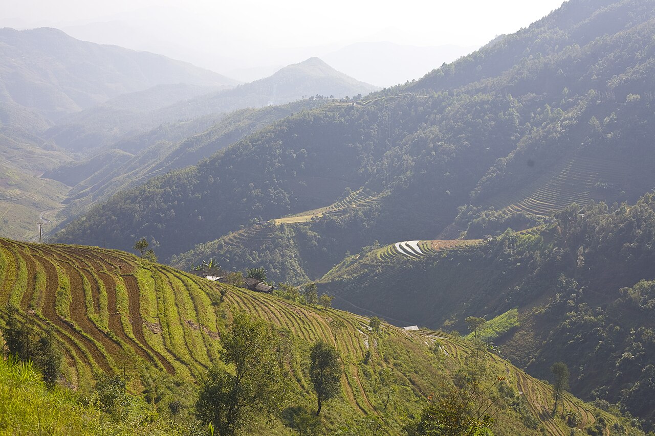
The Ha Giang Loop is widely considered the most popular motorbike route in Vietnam, tracing a rough circuit through the Dong Van karst plateau in what is now Tuyen Quang province following the July 2025 administrative merger. The area borders China to the north and passes through landscapes of limestone peaks, deep river gorges and villages belonging to H'Mong, Tay and Lo Lo communities.
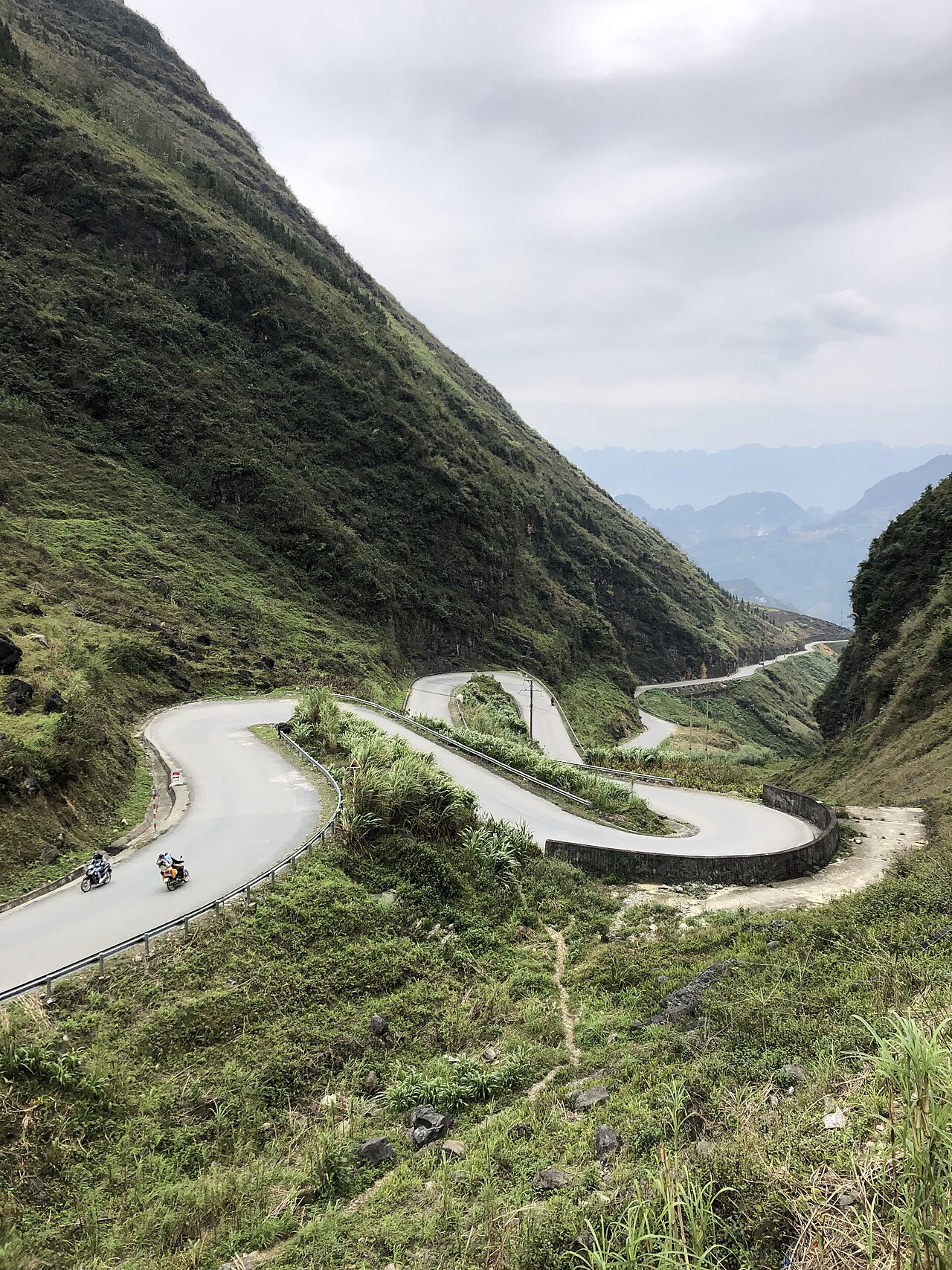
The route
The loop begins and ends in Ha Giang city. The standard three-day route runs north through Quan Ba and Yen Minh to Dong Van, crosses to Meo Vac via the Ma Pi Leng pass, then returns south to Ha Giang along the Nho Que river valley. The four-day version adds a spur north to the Lung Cu flag tower at Vietnam's northernmost point before doubling back to Dong Van, or extends the southern return leg through Mau Due and Du Gia to take in additional valley scenery. Neither route is a strict single road: riders commonly adjust the order of stops depending on accommodation availability and weather. A small number of operators offer extensions westward toward Bac Ha or Lao Cai, though these require additional planning. The full circuit covers roughly 350 kilometres on the three-day version.
Key places along the loop
Quan Ba (Heaven's Gate) is the first significant pass north of Ha Giang city, where the plateau opens up and the karst landscape becomes dominant. Yen Minh is the main overnight stop on the first night for many riders. Dong Van is the largest town on the plateau, with a preserved old quarter of stone-walled Cantonese merchant houses and a weekly market. It holds UNESCO Global Geopark status as part of the broader Dong Van Karst Plateau Geopark. Ma Pi Leng pass, between Dong Van and Meo Vac, is the most technically demanding section of road on the loop and crosses above the Nho Que river gorge at considerable height. Meo Vac is a market town with a significant H'Mong population and hosts a Sunday market. Lung Cu, roughly 24 kilometres north of Dong Van, is the location of a large flag tower that marks the northernmost point of Vietnam.
Self-riding versus guided (easy-rider)
Riders have two broad options: self-drive on a rented motorbike, or hiring a local guide who drives while the visitor rides pillion — a format known in Vietnam as the easy-rider style. Each has trade-offs.
- Self-drive gives full control over pace and stops, but the roads involve steep gradients, tight bends and patches of poor surface. Experience on a manual motorbike in mountain conditions is genuinely relevant; the route is not suitable for complete beginners.
- Guided pillion riding removes the riding burden and provides local knowledge of routes, accommodation and communities, at the cost of flexibility.
The licence question is unsettled. Vietnamese law requires a Vietnamese driving licence or an International Driving Permit endorsed for the appropriate motorbike category. In practice, enforcement has historically been inconsistent on this route, but the legal position is not ambiguous and is subject to change. This page does not advise on whether to ride without a valid licence; travellers should consult current official sources and consider the insurance implications. See also Safety and common scams.
See Riding the Ha Giang Loop for detailed practical information on rental, road conditions and logistics.
Permits and entry
Ha Giang province — now administered within Tuyen Quang — has historically required travellers to obtain a permit to enter the border areas of the Dong Van plateau, including Dong Van and Meo Vac districts. This permit has typically been issued quickly and at low cost at the Ha Giang city police station or through accommodation, but the requirement and procedure are subject to change by administrative decision. Travellers should verify the current requirement before departure. The area is a sensitive border zone and regulations can shift. Entry to Vietnam itself requires a valid visa; see Vietnam e-visa for current visa information, noting that visa policy changes by government decree and official sources are the authority.
When to go
September to November is the most widely recommended window. Buckwheat flowers bloom across the plateau from approximately mid-October, turning hillside fields pink and red. Skies are more reliably clear than in the monsoon months, and the passes are less likely to be obscured by cloud. March and April bring plum and peach blossom and are considered a secondary good period, though haze can limit visibility. June to August is the rainy season: roads become slippery, landslides are a genuine risk on the steep sections, and passes can close. December and January are cold at altitude — temperatures on the plateau can drop close to freezing at night — and some sections may be affected by fog. For regional weather context, see When to go: weather by region.
Getting to Ha Giang city
Ha Giang city is the starting point for the loop. It is connected to Hanoi by overnight sleeper bus, a journey of roughly seven to eight hours. Some travellers hire a private car from Hanoi. There is no railway to Ha Giang. Domestic flights do not serve the city. The bus station in Ha Giang has services to and from Hanoi and to provincial towns; timetables and frequencies change seasonally. ATM coverage in Ha Giang city is adequate but becomes sparse on the plateau itself — see Money, ATMs and cards. Mobile signal is intermittent on much of the loop; a local SIM helps where coverage exists — see SIM cards and eSIMs. Nearby destinations of interest in the broader region include Cao Bang and Ba Be National Park.
Aya göre iklim
Uzun vadeli ortalamalar; tahmin değildir. Referans dönemi: 2015–2024. Kaynak: ERA5 reanalysis (Copernicus) via the Open-Meteo archive API.
Show the numbers
| Ay | En yüksek °C | En düşük °C | Yağış miktarı (mm) | Yağışlı gün sayısı | Humidity % |
|---|---|---|---|---|---|
| January | 13.2 | 7.8 | 102 | 18 | 87 |
| February | 14.8 | 9.0 | 59 | 13 | 86 |
| March | 18.6 | 12.6 | 103 | 19 | 87 |
| April | 21.9 | 15.4 | 123 | 19 | 85 |
| May | 24.1 | 17.8 | 265 | 25 | 86 |
| June | 25.3 | 19.3 | 398 | 28 | 88 |
| July | 25.5 | 19.3 | 349 | 27 | 88 |
| August | 25.4 | 19.0 | 386 | 26 | 88 |
| September | 24.4 | 18.0 | 271 | 22 | 85 |
| October | 21.5 | 15.2 | 145 | 17 | 82 |
| November | 18.6 | 12.3 | 93 | 15 | 84 |
| December | 13.9 | 7.9 | 68 | 14 | 83 |
Practical notes
Where it is
Also known as / see also
Yakın çevrede
Referans veren sayfalar
Kaynaklar
- ERA5 climate normals — Copernicus / Open-Meteo (CC BY 4.0) erişildi 30 August 2026
Supports: monthly temperature and rainfall normals, and elevation - Ha Giang Loop — Wikipedia (CC BY-SA 4.0) erişildi 29 August 2026
Supports: carried over from the first build
Current Son doğrulama: 29 August 2026. Rules, fares and prices change — check the official source before acting on anything here. Report a mistake.
Picture credits (2)
Ha Giang Loop, Northern Vietnam, miketnorton, CC BY 2.0, Wikimedia Commons · Ha Giang Loop, Sabourock, CC BY-SA 4.0, Wikimedia Commons