The place itself has not changed, and this page continues to cover it.
2025 constitutional amendment and Law on Organisation of Local Government establishing a two-tier local government
Character and setting
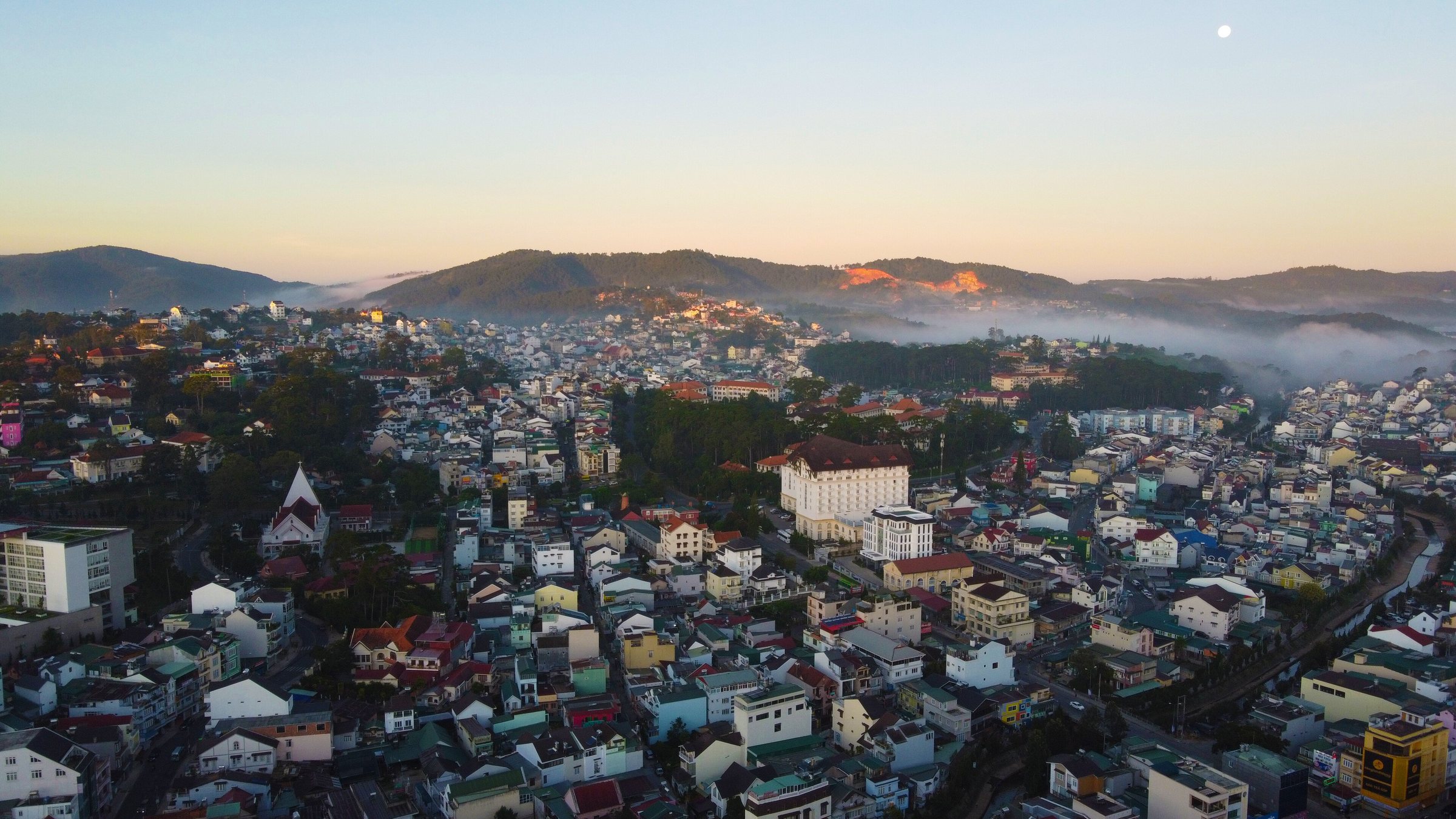
Da Lat sits at 1,507 metres on the Langbian Plateau in what is now Lam Dong province, formed under Vietnam's July 2025 administrative reorganisation. The elevation keeps temperatures moderate year-round in a country where most cities are tropical, and the surrounding landscape is a mixture of pine forest, vegetable plots, flower greenhouses and volcanic lakes. The French colonial administration developed Da Lat from the late 1890s as a hill station and sanatorium, drawing on the recommendations of physician Alexandre Yersin, who identified the plateau as climatically suitable. The legacy of that period survives in several hundred villas, a cathedral, and a railway station built in a style influenced by Deauville in Normandy. The city's Vietnamese identity runs alongside this colonial layer: a dense market district, a night market along Nguyen Thi Minh Khai street, and a food culture built around produce that cannot easily be grown in the lowlands.
Climate and when to visit
Da Lat's climate follows a pattern distinct from the coast. The dry season runs roughly from December through March, when days are bright, nights can drop to the low to mid-teens Celsius, and rainfall is light. Temperatures peak in March and April before the wet season establishes itself in May. Rainfall builds steadily through the middle of the year, reaching its heaviest in September and October, when several hundred millimetres can fall in a single month. The wet season does not bring constant rain — mornings are often clear — but afternoon downpours are frequent and sometimes intense. November sees rainfall taper off and is associated with the Dalat Flower Festival, held every two years (even years), when mimosa, hydrangeas and other highland flowers are displayed across the city. For visitors sensitive to cold, note that December and January nights can feel sharp by Vietnamese standards, and the city is sometimes covered in mist for days at a stretch. See When to go: weather by region for broader seasonal context.
Landmarks and attractions
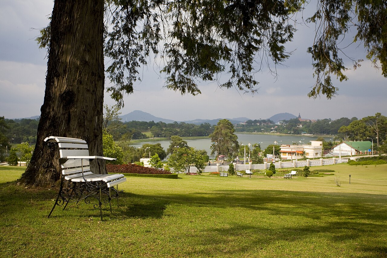
Xuan Huong Lake sits at the centre of the city, formed by a dam on the Cam Ly River. The promenade around it is the social spine of the city centre, lined with flower beds and frequented by both locals and visitors at dusk. Da Lat Central Market (Cho Da Lat) rises in tiers above the lake's southern end and is the main hub for local produce including strawberries, artichokes, avocados and cut flowers — most of which are grown in the surrounding farmland.
Crazy House (Hang Nga Guesthouse) on Huynh Thuc Khang street is a privately built structure designed by architect Dang Viet Nga, daughter of a former Vietnamese general secretary. Construction began in 1990 and continued in phases; the organic, Gaudí-influenced forms include caves, giant mushrooms and interconnected tree-like towers. It functions as a working guesthouse as well as a visitor attraction.
Lang Biang Mountain, roughly 12 kilometres north of the city centre, is the highest point of the Langbian Plateau, with twin peaks reaching around 2,167 metres. The ascent can be made on foot or by jeep to a lower platform. The mountain is associated with a K'Ho legend about two lovers, Lang and Biang, whose names form the basis for the plateau's name.
Several waterfalls lie within day-trip distance, including Datanla, Elephant (Voi) and Pongour. Datanla is the closest to the city and accessible via a roller-coaster alpine slide, which is operated commercially and carries variable safety standards across operators.
The old railway and Trai Mat
Da Lat once sat at the end of a metre-gauge rack railway that connected the plateau to the coast at Thap Cham (near Phan Rang). Completed in 1938 after decades of construction through difficult terrain, the line was largely dismantled after 1975, with track and rolling stock reportedly sold. A short section — roughly eight kilometres — survives between Da Lat station and the village of Trai Mat, and a heritage train operates on this segment. The station building itself, constructed in the 1930s with its distinctive coloured roof panels evoking the Alps, is considered one of the finest surviving examples of French colonial railway architecture in Vietnam. Trai Mat is known for Linh Phuoc Pagoda, a large structure decorated with mosaics made from broken ceramic and glass. Train departures on the heritage line are infrequent and subject to minimum passenger numbers; independent confirmation of the current schedule before travel is advisable.
Canyoning and outdoor activities
Da Lat has become a significant centre for canyoning in Southeast Asia, using the waterfalls and river gorges of the surrounding valleys. The activity involves abseiling down active waterfalls, swimming through canyons and cliff jumping. Several operators run guided canyoning trips of varying difficulty, ranging from beginner routes at Datanla to more committing descents in the Ankroet or other gorges.
Safety standards vary significantly between operators. The sector has experienced fatal accidents; deaths among both Vietnamese and foreign participants have been reported on multiple occasions, most recently drawing renewed attention to equipment inspection and guide certification practices. Lam Dong authorities have at different times suspended operators and introduced licensing requirements, though enforcement has been inconsistent and the regulatory situation continues to evolve. Prospective participants are advised to ask operators directly about guide qualifications, equipment age and inspection records, emergency protocols, and whether the route has been formally assessed. Operator reputation and peer reviews from recent participants carry more weight than marketing material. See Safety and common scams for general guidance.
Other outdoor activities available in the area include mountain biking on trails around the plateau, trekking on Lang Biang, and horse riding on the open grassland near the mountain base.
Coffee, farms and local produce
Da Lat's altitude and cooler temperatures support crops that cannot be grown in the Vietnamese lowlands. The city and its surrounding communes produce a large share of Vietnam's cut flowers for domestic consumption, with roses, gerbera, chrysanthemums and hydrangeas grown in plastic-covered greenhouses that cover considerable tracts of the hillsides. Strawberry farms, many operating on a pick-your-own basis for visitors, are clustered particularly around the Cu Lan and Trai Mat areas. Artichokes, a legacy of French introduction, are used locally in teas and soups and appear widely on restaurant menus.
Coffee cultivation in the highlands surrounding Da Lat tends toward Arabica varieties, which suit the altitude, in contrast to the Robusta-dominant lowland and Central Highlands production centred further north around Buon Ma Thuot. A cluster of specialty coffee roasters and cafés has developed in Da Lat over the past decade, with some operating their own small farms or sourcing directly from nearby growers. The egg coffee (cà phê trứng) associated with Hanoi also appears on many Da Lat menus, though the city's own version uses condensed milk beaten with egg yolk in slightly differing proportions depending on the establishment.
Getting there and onward connections
Da Lat is served by Lien Khuong Airport, located approximately 28 kilometres south of the city centre on the plateau's lower edge. Domestic flights connect Da Lat to Hanoi, Ho Chi Minh City and a small number of other Vietnamese cities; flight times from both major hubs are under two hours. The road from the airport to the city passes through farmland and greenhouse zones.
Overland, Da Lat sits at the top of several winding mountain roads. The route south-east toward Mui Ne descends dramatically from the plateau through a series of switchbacks before reaching the coastal plain — a journey of roughly four hours by road in normal conditions, passing through significant changes in vegetation and temperature. The road to Nha Trang on the coast to the east is similarly winding and takes three to four hours. Sleeper buses run overnight to Ho Chi Minh City and are the most common budget option for that route. Open-tour buses also connect to Mui Ne and Nha Trang. For those driving or riding by motorbike, the descents from the plateau require particular care: steep gradients, tight curves and heavy goods vehicle traffic are consistent features of all approach roads. Visitors arriving from abroad will need to review entry requirements at Vietnam e-visa, and those planning to use local SIM cards should consult SIM cards and eSIMs. Currency and payment information is available at Money, ATMs and cards.
월별 기후
장기 평균값이며 예보가 아닙니다. 기준 기간: 2015–2024. 출처: ERA5 reanalysis (Copernicus) via the Open-Meteo archive API.
Show the numbers
| 월 | 최고 기온 °C | 최저 기온(°C) | 강수량(mm) | 강수일수 | Humidity % |
|---|---|---|---|---|---|
| January | 22.2 | 13.7 | 30 | 7 | 78 |
| February | 23.5 | 13.5 | 21 | 4 | 73 |
| March | 25.7 | 14.5 | 39 | 8 | 71 |
| April | 25.9 | 15.8 | 87 | 15 | 77 |
| May | 24.9 | 16.9 | 198 | 25 | 85 |
| June | 23.6 | 16.8 | 191 | 27 | 88 |
| July | 22.8 | 16.9 | 231 | 29 | 90 |
| August | 23.2 | 16.9 | 207 | 27 | 89 |
| September | 23.0 | 16.4 | 290 | 28 | 90 |
| October | 22.6 | 16.0 | 269 | 25 | 89 |
| November | 22.3 | 15.8 | 154 | 15 | 86 |
| December | 21.5 | 14.8 | 65 | 9 | 83 |
Practical notes
Where it is
Also known as / see also
주변
참조 페이지
출처 목록
- ERA5 climate normals — Copernicus / Open-Meteo (CC BY 4.0) 접근됨 30 August 2026
Supports: monthly temperature and rainfall normals, and elevation - Đà Lạt (Q25281) — Wikidata (CC0 1.0) 접근됨 30 August 2026
Supports: coordinates, area, population - Đà Lạt — Wikipedia (CC BY-SA 4.0) 접근됨 30 August 2026
Supports: background
Current 마지막 확인: 31 August 2026. Rules, fares and prices change — check the official source before acting on anything here. Report a mistake.
Picture credits (7)
Da Lat - Viet Nam, Tuong Lam Photos, CC BY-SA 4.0, Wikimedia Commons · Đà Lạt năm 2013, bầu trời trong xanh khi nhìn qua cửa khách sạn (1), Phương Huy, CC BY-SA 4.0, Wikimedia Commons · Đà Lạt năm 2013, sáng sớm nhìn qua cửa khách sạn (3), Phương Huy, CC BY-SA 4.0, Wikimedia Commons · Đà Lạt năm 2013, sáng sớm nhìn qua cửa khách sạn (4), Phương Huy, CC BY-SA 4.0, Wikimedia Commons · Đà Lạt 2008, Jane Jean, CC BY 2.0, Wikimedia Commons · Lam Dong Library 02, Diane Selwyn ( talk ), Public domain, Wikimedia Commons · Da Lat Nuclear Research Institute 01, Diane Selwyn ( talk ), Public domain, Wikimedia Commons