The place itself has not changed, and this page continues to cover it.
2025 constitutional amendment and Law on Organisation of Local Government establishing a two-tier local government
Orientation
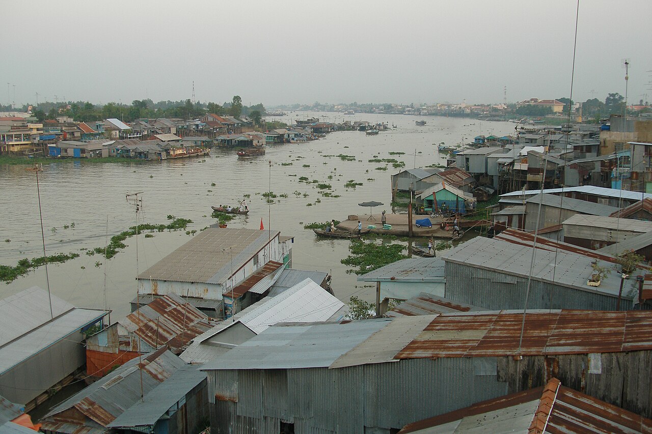
Chau Doc lies in the far northwest of the An Giang province, on the west bank of the Hau River (one of the Mekong's two main distributaries as they enter Vietnam). Cambodia is a short distance upstream; the official border crossing at Tinh Bien and the river crossing at Vinh Xuong are both easily reachable from town. The flat delta landscape is interrupted by a cluster of hills, most prominently Sam Mountain, which rises abruptly to around 284 metres. The town functions as a transit hub for travellers heading between the southern delta and Phnom Penh, and as a base for exploring the broader wetland region, including Tram Chim National Park to the southeast and the cajuput forests of Tra Su to the south.
Sam Mountain and Ba Chua Xu Temple
Sam Mountain (Nui Sam) is the most distinctive landmark in the area, a granite outcrop that dominates the surrounding paddy fields. Roads and paths lead to summits with views across the delta into Cambodia. The mountain is dotted with pagodas, tombs, and shrines at various elevations, making it as much a religious landscape as a natural one.
At the mountain's western base stands Ba Chua Xu Temple, dedicated to the Lady of the Realm, a deity venerated across the southern delta and among Vietnamese communities in Cambodia. The temple draws very large numbers of pilgrims, particularly during the Vía Bà Chúa Xứ festival, held from the 23rd to the 27th of the fourth lunar month (typically May or June). During this period accommodation in and around Chau Doc is under considerable pressure. The nearby tomb of Thoai Ngoc Hau, the Nguyen-era mandarin who oversaw construction of the Vinh Te Canal in the early nineteenth century, is also located at the mountain's base.
Floating Fish Farms and the Hau River
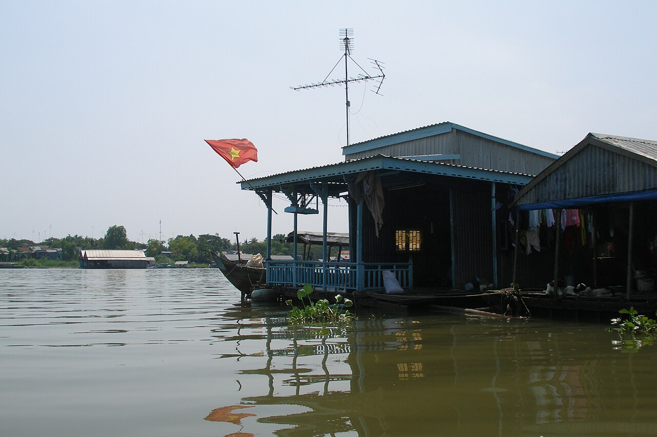
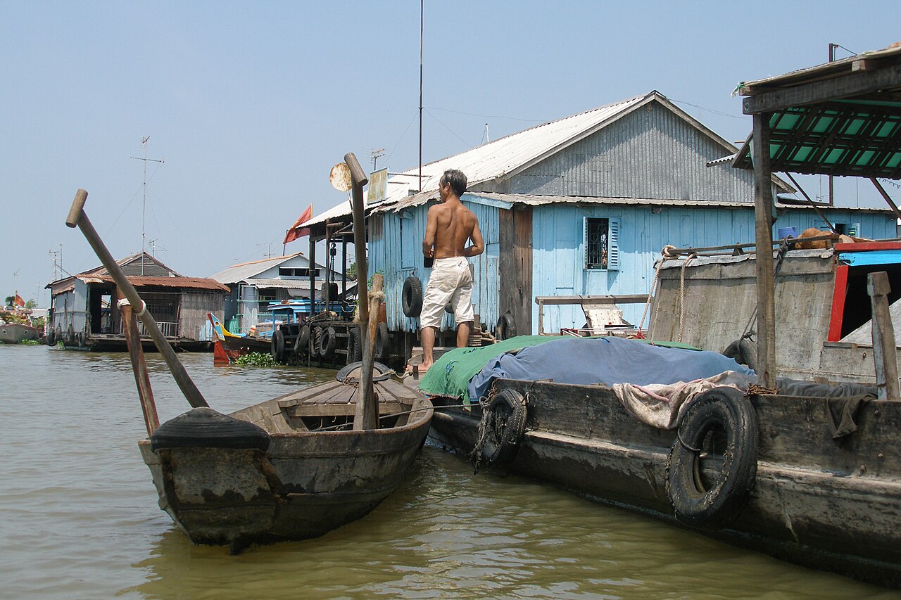
The Hau River around Chau Doc supports one of the densest concentrations of floating fish cages in Vietnam. Households and commercial operators keep catfish (cá tra and cá ba sa) in large submerged net enclosures suspended beneath wooden or metal pontoons, on which families also live. The farms are most easily seen by hiring a small boat from the town's riverside, and are particularly atmospheric in early morning when activity is highest.
Cá tra from this region is processed and exported globally, making the Chau Doc floating-farm system commercially significant well beyond the local market. The density of floating structures changes with the season; the flooded months of September and October bring the highest water levels and alter the visual character of the river considerably. Visitors should be aware that some boat operators approaching the waterfront may be operating informal or unlicensed tours; the safety and common scams page has relevant guidance.
Cham Villages and Muslim Community
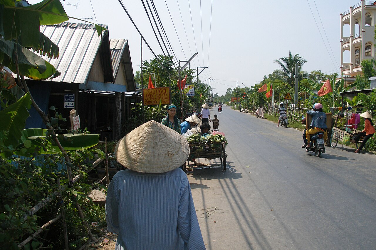
Several Cham villages occupy the islands and riverbanks across the Hau River from Chau Doc town, most notably Chau Giang and Da Phuoc. The Cham of this region are predominantly Sunni Muslim, a community with roots in the Champa kingdom that once ruled much of central Vietnam. Their presence here reflects centuries of migration southward and across the Cambodian border region.
The villages have mosques, traditional weaving workshops producing silk and cotton cloth, and distinct residential architecture. Reaching the main Cham settlements requires a short ferry crossing from the town's boat landings. Community members operate small weaving businesses, and handwoven fabric is available directly from producers. Visitors are expected to dress modestly, particularly when entering mosques or during prayer times.
Tra Su Cajuput Forest
Tra Su cajuput forest lies roughly 30 kilometres south of Chau Doc, within the Plain of Reeds ecosystem. It covers several thousand hectares of flooded cajuput (Melaleuca cajuputi) woodland, wetland grass, and lotus fields. The forest is managed as a protected area and is navigable by flat-bottomed rowing boat along narrow channels between the trees.
Tra Su is an important habitat for waterbirds, including large breeding colonies of herons and cormorants. Observation towers within the forest allow elevated views across the canopy. The site is most visited during the flood season between September and November, when water levels are high enough to paddle beneath the tree canopy; outside this window water recedes significantly and the character of the landscape changes. Tra Su is typically reached by motorbike or hired vehicle from Chau Doc, followed by a boat transfer from the forest's entrance point.
Border Crossing and the Route to Phnom Penh
Chau Doc is the principal departure point for fast-boat services between the Mekong Delta and Phnom Penh, Cambodia. Boats travel up the Hau River, crossing the border at Vinh Xuong on the Vietnamese side and Kaam Samnor on the Cambodian side, then continuing along the Tonle Sap and Tonle Bassac rivers to the Cambodian capital. Journey times vary with water levels and vessel type; the route passes through rural riverscapes on both sides of the border.
Vietnamese citizens and most foreign nationals require valid documentation for this crossing. Foreign visitors to Vietnam typically need a Vietnamese e-visa or another valid entry permit; details are at Vietnam e-visa. Entry into Cambodia requires a separate Cambodian visa, available on arrival at this crossing for most nationalities, though conditions can change. Overland crossings at Tinh Bien and Xa Xia to the south of An Giang are also options for those travelling by road. Confirm current border operating hours and documentation requirements before travel, as these are subject to change.
Climate and When to Visit
Chau Doc has a tropical climate with a pronounced wet and dry season. Temperatures remain warm throughout the year, with the hottest period in March and April before the rains arrive. From May onward, rainfall increases steadily, peaking in September and October when monthly totals are at their highest and the surrounding delta is at maximum flood. The dry season runs from December through March, with January and February receiving relatively little rain.
The flood season (roughly September to November) is when the Mekong's annual inundation reaches its height in this part of the delta. Floodwaters bring fish, sediment, and a transformed landscape of submerged fields and elevated villages; it is the period when Tra Su forest is most navigable and the floating-farm scenery most dramatic. The dry-season months from December to March offer easier road travel and lower humidity, though the landscape is considerably less distinctive. See when to go: weather by region for broader context. Prices vary by season.
月別気候
長期平均値であり、予報ではありません。 参照期間: 2015–2024. 出典: ERA5 reanalysis (Copernicus) via the Open-Meteo archive API.
Show the numbers
| 月 | 最高気温 °C | 最低気温 °C | 降水量(mm) | 雨天日数 | Humidity % |
|---|---|---|---|---|---|
| January | 30.8 | 22.6 | 33 | 5 | 73 |
| February | 32.2 | 22.6 | 15 | 4 | 69 |
| March | 34.1 | 24.1 | 27 | 5 | 67 |
| April | 34.2 | 25.3 | 126 | 13 | 72 |
| May | 32.8 | 25.8 | 214 | 25 | 81 |
| June | 31.3 | 25.4 | 229 | 26 | 84 |
| July | 31.0 | 25.1 | 257 | 27 | 84 |
| August | 31.2 | 25.1 | 247 | 29 | 83 |
| September | 30.9 | 24.7 | 330 | 29 | 86 |
| October | 30.7 | 24.1 | 369 | 28 | 87 |
| November | 31.0 | 23.8 | 172 | 20 | 83 |
| December | 30.5 | 23.1 | 69 | 9 | 75 |
Practical notes
Where it is
Also known as / see also
近隣
参照元
出典
- ERA5 climate normals — Copernicus / Open-Meteo (CC BY 4.0) アクセス日 30 August 2026
Supports: monthly temperature and rainfall normals, and elevation - Châu Đốc (Q373214) — Wikidata (CC0 1.0) アクセス日 30 August 2026
Supports: coordinates, area, population - Châu Đốc — Wikipedia (CC BY-SA 4.0) アクセス日 30 August 2026
Supports: background
Current 最終確認: 31 August 2026. Rules, fares and prices change — check the official source before acting on anything here. Report a mistake.
Picture credits (6)
Vietnam, Panorama of Chau Doc, Vyacheslav Argenberg, CC BY 4.0, Wikimedia Commons · Vietnam, Bassac River, Chau Doc, Mekong Delta, Vyacheslav Argenberg, CC BY 4.0, Wikimedia Commons · Vietnam, Chau Doc, City streets, Vyacheslav Argenberg, CC BY 4.0, Wikimedia Commons · Vietnam, Chau Doc, Houses on Bassac River, Vyacheslav Argenberg, CC BY 4.0, Wikimedia Commons · Vietnam, Chau Doc, Life on the streets, Vyacheslav Argenberg, CC BY 4.0, Wikimedia Commons · Vietnam, Chau Doc, Street market, Vyacheslav Argenberg, CC BY 4.0, Wikimedia Commons