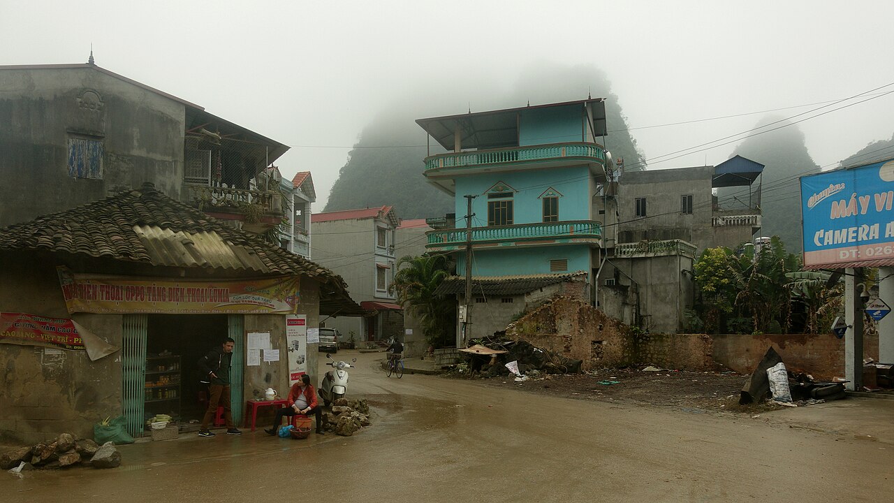
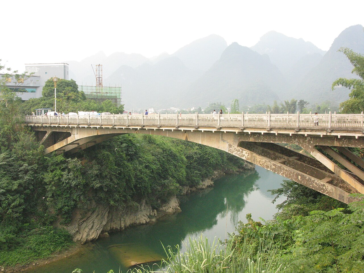
Cao Bang province sits in the northeastern corner of Vietnam, sharing a long border with China's Guangxi region. The terrain is dominated by limestone karst, forested peaks and deep river valleys carved by the Bang Giang and Quay Son rivers. The province remained unchanged in Vietnam's July 2025 administrative reorganisation and continues to function as a single province with its capital, Cao Bang city, as the administrative centre.
What Cao Bang is known for
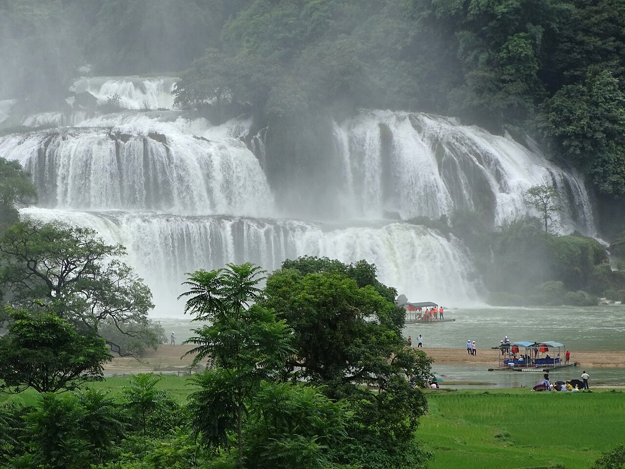
The province's defining attraction is Ban Gioc Waterfall, a tiered cascade on the Quay Son River that straddles the Vietnamese–Chinese border. At its most powerful during and just after the rainy season, Ban Gioc is wide rather than tall, spreading across a series of limestone shelves into a broad turquoise pool below. The surrounding Truc Lam Ban Gioc pagoda and boat trips on the river form part of the usual visit.
Beyond Ban Gioc, Cao Bang is notable for the Nguom Ngao cave system, one of Vietnam's longer accessible limestone caves, located close to the waterfall. Phja Oac–Phja Den National Park in the south of the province offers cloud forest, endemic flora and a history as a former French hill station. The province also holds significant revolutionary history: Pac Bo cave, close to the Chinese border, was where Ho Chi Minh returned to Vietnam in 1941 after decades abroad, and the site remains a place of considerable symbolic importance.
When to go
Cao Bang has a subtropical highland climate with distinct wet and dry seasons. The rainy season runs roughly from May through September, bringing heavy rainfall, lush vegetation and the highest water volumes at Ban Gioc — the waterfall is at its most dramatic in August and September, though roads can flood and minor landslides occasionally close mountain routes. The dry season, October through April, offers clearer skies and easier travel, with cooler temperatures from November to February that can drop close to freezing at higher elevations.
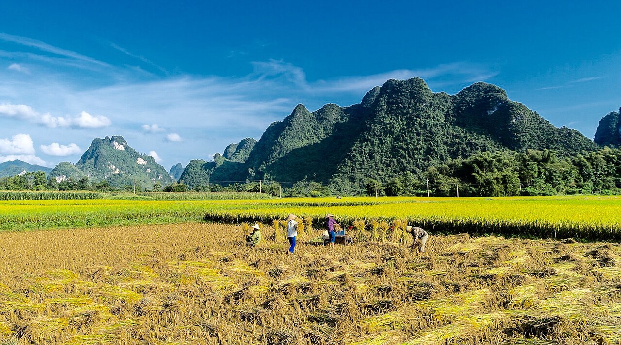
October and November are widely considered the most comfortable months: the rains have eased, rice terraces are golden before harvest, and temperatures remain mild in the valleys. February and March can bring mist and drizzle in the uplands — the so-called mưa phùn or drizzling fog — which reduces visibility but gives the karst landscape an atmospheric quality. Detailed weather patterns by region are covered separately.
Getting there and away
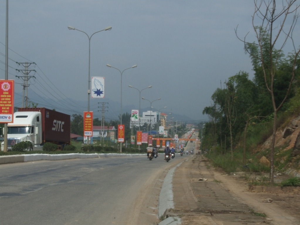
Cao Bang city is connected to Hanoi by National Route 3, a journey of roughly 270 kilometres. The road winds considerably through the mountainous terrain and the drive typically takes five to six hours, sometimes more. Sleeper buses and daytime coach services run from Hanoi's My Dinh and Gia Lam bus stations; the bus is the most common way for independent travellers to arrive. There is no passenger railway to Cao Bang.
Motorbike travel is popular among those combining Cao Bang with the broader northeast circuit, which might include Ha Giang to the west, Lang Son to the southeast, or Thai Nguyen further south. Roads within the province, particularly those leading to Ban Gioc (around 90 kilometres from Cao Bang city) and Pac Bo, are sealed but narrow and demand careful driving. Hired cars with drivers are available in Cao Bang city and are a practical option for reaching multiple sites in a limited time.
The nearest international airport with regular service is Hanoi's Noi Bai. There is a small airstrip at Cao Bang but scheduled commercial flights have historically been limited; check current schedules through Vietnamese carriers directly.
What there is to see and do
Ban Gioc Waterfall and Nguom Ngao Cave: These two sites are usually visited together on a day trip from Cao Bang city or from accommodation in the Trung Khanh area nearby. The cave is large enough to walk through for roughly a kilometre; a guide is required for entry. The waterfall page covers the visit in more detail.
Pac Bo Historic Site: The cave and surrounding area near the Chinese border where Ho Chi Minh established his revolutionary base. The site includes the cave itself, the Lenin Stream — named by Ho Chi Minh — and a small museum. It is a quiet, forested valley with clear political and historical significance to Vietnamese visitors.
Phja Oac–Phja Den National Park: Located in the southern part of the province, accessible from the direction of Tuyen Quang. The park protects montane forest at elevations up to around 1,930 metres and has trekking trails, though facilities remain limited compared to more developed parks.
Cao Bang city: The provincial capital is a small, unhurried town on the Bang Giang River. It functions mainly as a base and supply point rather than a destination in itself, though the morning market near the river offers a practical glimpse of local commerce and ethnic minority trade.
Accommodation and staying in the province
Accommodation in Cao Bang province is concentrated in Cao Bang city and, to a lesser extent, in the Trung Khanh area near Ban Gioc. Cao Bang city has a range of small hotels suited to both budget and mid-range travellers; larger or more comfortable options are limited but present. Staying near Trung Khanh reduces travel time to Ban Gioc and allows an early-morning visit before tour groups arrive from the city, though the choice of accommodation there is narrower.
Homestays are available in several villages across the province and are often the only option in more remote areas. Standards vary considerably. Facilities at popular sites such as Ban Gioc have expanded in recent years with resort-style accommodation appearing, though this remains limited in scale compared to more established tourist regions.
Common misunderstandings and practical notes
Distances are deceptive. On a map, Ban Gioc appears close to Cao Bang city, but the winding mountain road means a journey of at least two hours each way. Travellers who plan to see Ban Gioc, Nguom Ngao and Pac Bo in a single day from Cao Bang city often find the schedule too tight.
The border crossing at Ban Gioc is not a regular tourist crossing. Vietnamese and Chinese nationals may cross at certain designated points, but the Ban Gioc area is not a standard international land crossing for third-country travellers. Do not assume a Vietnamese visa allows onward entry into China, or that crossing is straightforward here. Check current regulations with official sources. Vietnam e-visa information is covered separately.
Ethnic diversity: Cao Bang is home to Tay, Nung, H'Mong, Dao and other ethnic groups who make up a large share of the provincial population. Markets such as the one at Trung Khanh draw traders from multiple communities and are a more authentic scene than tourist-oriented craft markets elsewhere in Vietnam.
Cash and connectivity: ATMs are available in Cao Bang city but sparse elsewhere. Mobile data coverage drops off on mountain roads. See Money, ATMs and cards and SIM cards and eSIMs for practical guidance.
월별 기후
장기 평균값이며 예보가 아닙니다. 기준 기간: 2015–2024. 출처: ERA5 reanalysis (Copernicus) via the Open-Meteo archive API.
Show the numbers
| 월 | 최고 기온 °C | 최저 기온(°C) | 강수량(mm) | 강수일수 | Humidity % |
|---|---|---|---|---|---|
| January | 18.3 | 11.4 | 108 | 15 | 81 |
| February | 20.0 | 12.5 | 89 | 13 | 80 |
| March | 24.0 | 16.6 | 98 | 16 | 82 |
| April | 27.5 | 19.5 | 132 | 16 | 81 |
| May | 29.9 | 22.3 | 273 | 22 | 83 |
| June | 31.0 | 23.9 | 327 | 24 | 86 |
| July | 31.3 | 24.0 | 286 | 24 | 85 |
| August | 30.8 | 23.8 | 331 | 26 | 87 |
| September | 29.8 | 22.7 | 247 | 20 | 84 |
| October | 26.9 | 19.4 | 161 | 12 | 79 |
| November | 23.9 | 16.2 | 78 | 11 | 79 |
| December | 19.0 | 11.3 | 57 | 10 | 76 |
Places within Cao Bang
Where it is
Also known as / see also
주변
참조 페이지
출처 목록
- ERA5 climate normals — Copernicus / Open-Meteo (CC BY 4.0) 접근됨 30 August 2026
Supports: monthly temperature and rainfall normals, and elevation - Map data from OpenStreetMap contributors, ODbL 1.0 — OpenStreetMap (ODbL 1.0) 접근됨 29 August 2026
Supports: carried over from the first build - Cao Bang (Q36865) — Wikidata (CC0 1.0) 접근됨 30 August 2026
Supports: coordinates, area, population - Cao Bang — Wikipedia (CC BY-SA 4.0) 접근됨 30 August 2026
Supports: background
Current 마지막 확인: 29 August 2026. Rules, fares and prices change — check the official source before acting on anything here. Report a mistake.
Picture credits (6)
Quảng Uyên, [Tycho] talk , http://shansov.net, CC BY-SA 3.0, Wikimedia Commons · Cảnh Tiên - Cao Bằng, minhphuc_99kdd, Public domain, Wikimedia Commons · Khu Trung Tâm Hành Chính Mới Tỉnh Cao Bằng, Kem thoi, CC BY-SA 4.0, Wikimedia Commons · Bang River at Ta Lung - Suikou border gates in Vietnam - China border, Phó Nháy ( talk ) 19:23, 19 October 2013 (UTC), CC BY 3.0, Wikimedia Commons · Mộ Kim Đồng, Cao Bằng, Leminhel, CC BY-SA 3.0, Wikimedia Commons · Ban Gioc Waterfall - Trung Kanh District - Cao Bang Province - Vietnam - 02 (48119872597), Adam Jones from Kelowna, BC, Canada, CC BY-SA 2.0, Wikimedia Commons