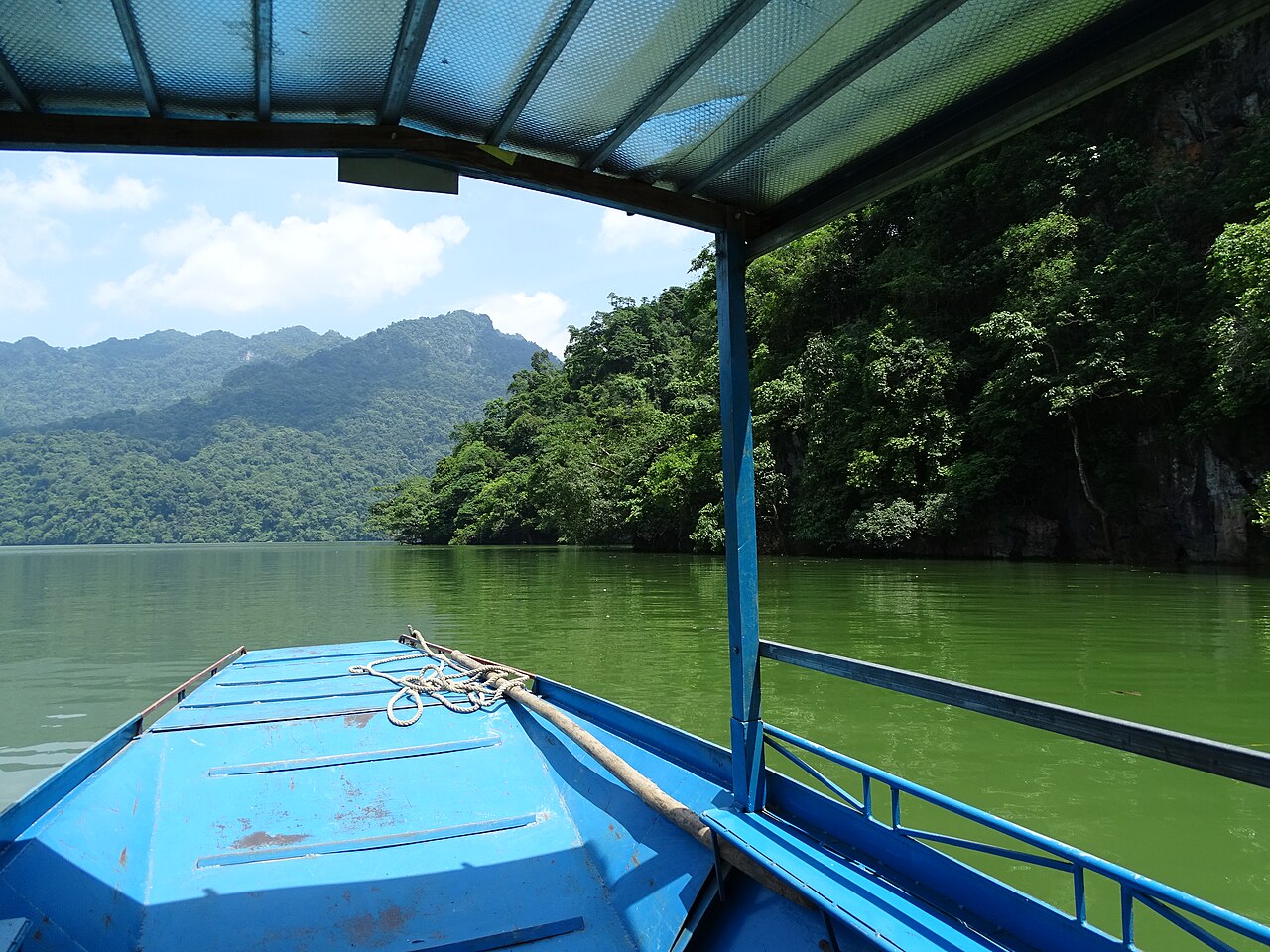
Ba Be National Park lies in what was formerly Bắc Kạn province, now part of the merged Thái Nguyên province following Vietnam's 2025 administrative reorganisation. The park covers roughly 10,000 hectares of karst limestone forest, river valleys and the three interconnected lakes — Ba Bể, meaning "three lakes" — that give it its name. It holds national park status and has been recognised as a Ramsar wetland site.
The lake and what defines the park
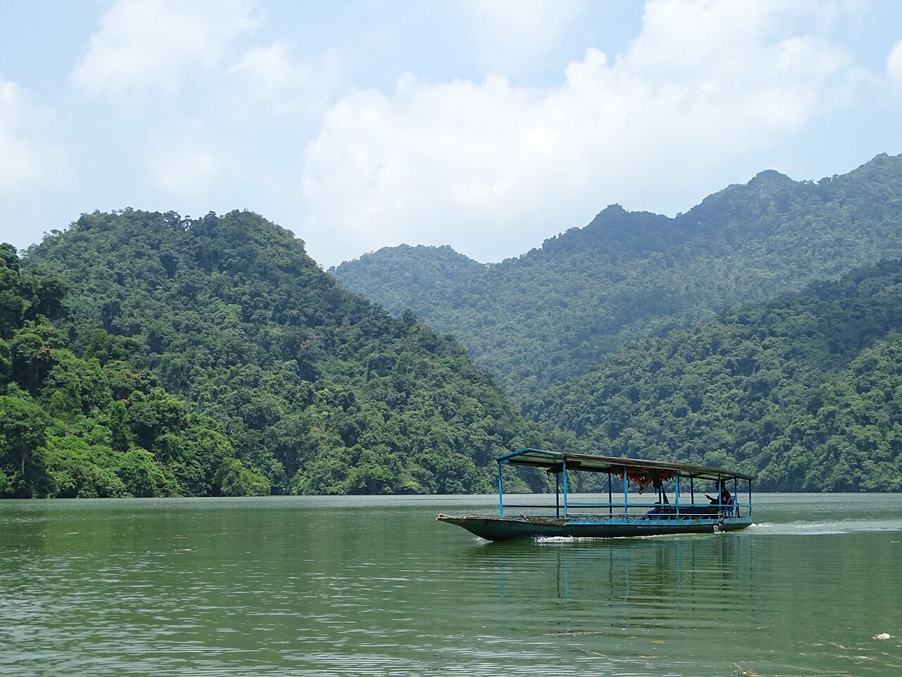
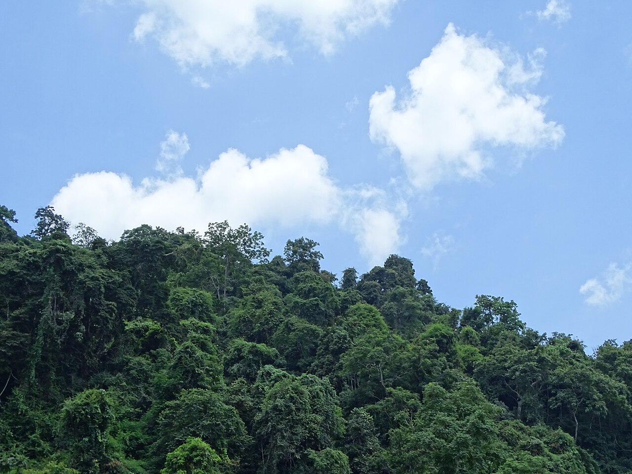
The Ba Bể lake system is the largest natural freshwater lake in Vietnam, formed by three connected bodies of water enclosed by forested karst cliffs. The surface sits at relatively low elevation compared with the peaks surrounding it, which creates a sense of enclosure: the lake feels less like an open expanse and more like a flooded valley. The water is generally calm and clear, and the limestone walls that rise from the shore are densely forested.
The ecosystem supports a range of fish species, several primate species including langurs, and a notable bird population. Because the park is genuinely remote and receives far fewer visitors than better-known sites in northern Vietnam, wildlife encounters are more likely here than in more trafficked parks.
Whether Ba Be meets the criteria for UNESCO World Heritage listing has been a matter of ongoing discussion; that question remains unsettled. The park's ecological significance is not in dispute.
Boat circuit, Puong Cave and Dau Dang Waterfall
The standard way to see the park is by wooden motorboat, typically arranged through a homestay or the park visitor centre. The classic circuit takes in the full length of the lake, the Năng River, Puong Cave and Đầu Đẳng Waterfall.
Puong Cave is a river cave through which the Năng River passes. Boats travel inside the cave, navigating by headlamp or torch through a passage of several hundred metres. The cave ceiling hosts a large colony of bats and the interior walls show stalactite and stalagmite formations. It is one of the more unusual river-cave passages accessible by small boat in northern Vietnam.
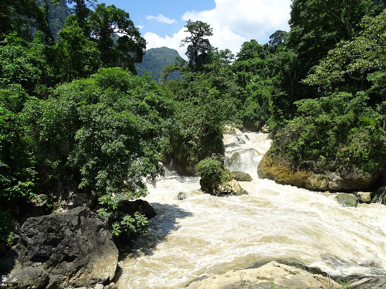
Đầu Đẳng Waterfall sits at the downstream end of the lake system, where the Năng River drops in a series of stepped rapids and falls through boulders. Boats cannot pass it; visitors walk to a viewpoint. The volume of water varies considerably by season — it is most dramatic after the summer rains.
There is an entry fee for the park and boat hire is arranged separately. Rates are not listed here as they change; confirm current costs on arrival or with accommodation in advance.
Pac Ngoi village and Tay homestays
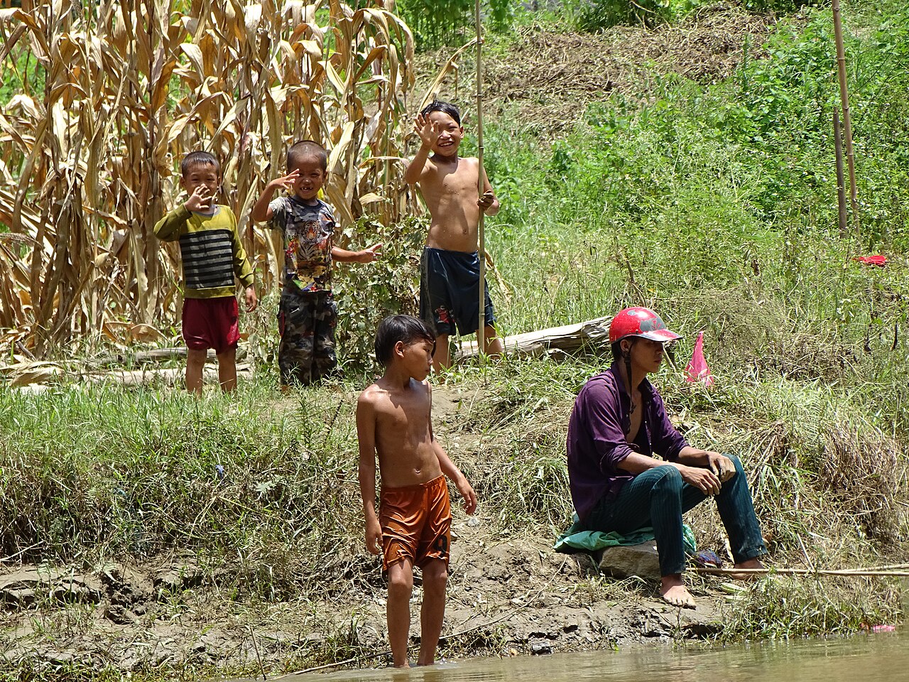
Pắc Ngòi is the principal Tày ethnic minority village associated with Ba Be tourism, situated on the lakeshore. Several families here offer homestay accommodation in traditional stilt houses. The format is typically a shared sleeping platform, communal meals prepared by the host family, and the use of the family's boat or connections to boat hire.
The Tày are the largest ethnic minority group in Vietnam's northeast and have a long-established agricultural and fishing culture around the lake. Staying in Pắc Ngòi rather than in a guesthouse nearer the park gate places visitors directly on the water and within walking distance of smaller surrounding villages.
Facilities are simple. Hot water and reliable electricity are available in most homestays but should not be assumed without checking. Mobile signal is present in the village but variable. SIM card guidance is relevant here as data coverage in the karst valleys can drop unexpectedly. Cash is essential; there are no ATMs inside the park.
Trekking in the park
Marked trails exist within the park, ranging from short walks along the lakeshore to longer routes through the karst forest to viewpoints above the lake. The terrain is steep in places; limestone paths become slippery when wet. The longer trekking routes benefit from a local guide, both for navigation and because the forest is dense enough that the trails are not always obvious.
Guides can be arranged through the park headquarters or through homestay hosts. Some routes pass through additional Tày and Dao villages, which adds an element of cultural interest beyond the landscape itself.
The park is small enough that day trekking covers most of the accessible route network. Those wanting to combine trekking with boat time typically spend at least two nights, splitting activities across days.
Getting there
Ba Be National Park is approximately 240 kilometres north of Hanoi. The most common access point is the town of Chợ Rã, from which the park entrance is a short distance by road. There is no direct train or bus service to the park gate itself.
From Hanoi, options include rented motorbike, private car, or a combination of bus to a nearby town followed by a local taxi or xe ôm (motorbike taxi). Several tour operators in Hanoi offer two- or three-day organised trips that include transport, accommodation and boat hire in a single package, which is the most straightforward option for first-time visitors unfamiliar with the road network.
The park can also be reached as part of a longer northeast circuit combining it with Cao Bằng to the north or looping back via Tuyên Quang to the south. Road conditions in the region are generally acceptable on main routes but can deteriorate on minor roads after heavy rain. The journey from Hanoi takes the better part of a day by road.
When to go
The recommended visiting periods are March to May and September to November. During these windows, rainfall is lower, humidity is manageable and the forest is green without the risk of flooding that comes with the summer monsoon peak.
The summer months — June through August — bring the heaviest rain. Water levels on the lake and river rise significantly and Đầu Đẳng Waterfall is at its most powerful, but boat trips can be disrupted by fast currents on the river sections, and trails become very muddy. Flash flooding is a risk in the surrounding valleys.
Winter (December to February) is cool and sometimes misty in the karst valleys. The forest is quieter and the light can be atmospheric, but mornings on the water are cold and some visitors find the grey conditions less rewarding. See when to go: weather by region for broader seasonal context across the northeast.
Practical notes
Visas: Most international visitors require a visa for Vietnam. The e-visa is the standard route for travellers from most Western countries, though policy can change by decree — always verify at the official source. Details are covered on the Vietnam e-visa page.
Money: Bring sufficient cash before entering the park. The nearest reliable ATMs are in Bắc Kạn town or in larger towns along the route from Hanoi. See money, ATMs and cards.
Safety: Ba Be is considered a low-risk destination. Common sense precautions apply on boats — life jackets should be available and used. Leeches are present on forest trails in wet conditions; long trousers and appropriate footwear reduce the nuisance. See safety and common scams for general guidance applicable across Vietnam.
Nearby destinations: Travellers combining the northeast region often pair Ba Be with Cao Bằng (Ban Giốc Falls) or continue west toward Hà Giang.
Klimaat per maand
Langjarige gemiddelden, geen voorspelling. Referentieperiode: 2015–2024. Bron: ERA5 reanalysis (Copernicus) via the Open-Meteo archive API.
Show the numbers
| Maand | Hoog °C | Laag °C | Neerslag mm | Regendagen | Humidity % |
|---|---|---|---|---|---|
| January | 19.9 | 13.4 | 92 | 14 | 83 |
| February | 21.5 | 14.5 | 78 | 12 | 81 |
| March | 25.3 | 18.3 | 112 | 17 | 84 |
| April | 28.7 | 21.0 | 142 | 16 | 83 |
| May | 30.9 | 23.6 | 296 | 22 | 85 |
| June | 32.0 | 25.0 | 369 | 25 | 88 |
| July | 32.1 | 25.1 | 311 | 26 | 88 |
| August | 31.7 | 24.8 | 373 | 28 | 90 |
| September | 30.6 | 23.8 | 249 | 22 | 88 |
| October | 28.1 | 20.6 | 136 | 14 | 82 |
| November | 25.1 | 17.8 | 92 | 12 | 82 |
| December | 20.5 | 13.1 | 44 | 9 | 79 |
Practical notes
Where it is
Also known as / see also
In de buurt
Verwezen door
Bronnen
- ERA5 climate normals — Copernicus / Open-Meteo (CC BY 4.0) geraadpleegd 30 August 2026
Supports: monthly temperature and rainfall normals, and elevation - Vietnam Administration of Forestry — MARD geraadpleegd 29 August 2026
Supports: carried over from the first build - Ba Bể National Park — Wikipedia (CC BY-SA 4.0) geraadpleegd 29 August 2026
Supports: carried over from the first build
Current Laatst geverifieerd: 29 August 2026. Rules, fares and prices change — check the official source before acting on anything here. Report a mistake.
Picture credits (5)
Aboard the Boat on Ba Be Lake - Ba Be National Park - Vietnam (48102408917), Adam Jones from Kelowna, BC, Canada, CC BY-SA 2.0, Wikimedia Commons · Dau Dang Waterfall - Near Ba Be Lake - Ba Be National Park - Vietnam (48102296396), Adam Jones from Kelowna, BC, Canada, CC BY-SA 2.0, Wikimedia Commons · Group of Boys and Man - Shore of Ba Be Lake - Ba Be National Park - Vietnam (48102345273), Adam Jones from Kelowna, BC, Canada, CC BY-SA 2.0, Wikimedia Commons · Scenery at Ba Be Lake - Ba Be National Park - Vietnam - 01 (48102368637), Adam Jones from Kelowna, BC, Canada, CC BY-SA 2.0, Wikimedia Commons · Scenery at Ba Be Lake - Ba Be National Park - Vietnam - 02 (48102255951), Adam Jones from Kelowna, BC, Canada, CC BY-SA 2.0, Wikimedia Commons